Bxstormwatcher360
-
Posts
484 -
Joined
-
Last visited
Content Type
Profiles
Blogs
Forums
American Weather
Media Demo
Store
Gallery
Everything posted by Bxstormwatcher360
-
OBS-Nowcast Noon Saturday 2/15-Noon Monday 2/17
Bxstormwatcher360 replied to wdrag's topic in New York City Metro
Superstorm dropped the hammer when it changed to ice. I remember the winds pelting everything in sight,it was like buckshot being shotgunned from the sky. -
OBS-Nowcast Noon Saturday 2/15-Noon Monday 2/17
Bxstormwatcher360 replied to wdrag's topic in New York City Metro
Well it is also a known fact that the waters around our area are cooler this year as compared to the last few. If the water is in the 30s then yeah it mitigates faster warming. Its like blowing a fan over a ice sheet. -
OBS-Nowcast Noon Saturday 2/15-Noon Monday 2/17
Bxstormwatcher360 replied to wdrag's topic in New York City Metro
Yeah average sst's were also cooler back then, that actually contributed to the ice storms in the 90's. Now any fetch off the water,its rain. -
OBS-Nowcast Noon Saturday 2/15-Noon Monday 2/17
Bxstormwatcher360 replied to wdrag's topic in New York City Metro
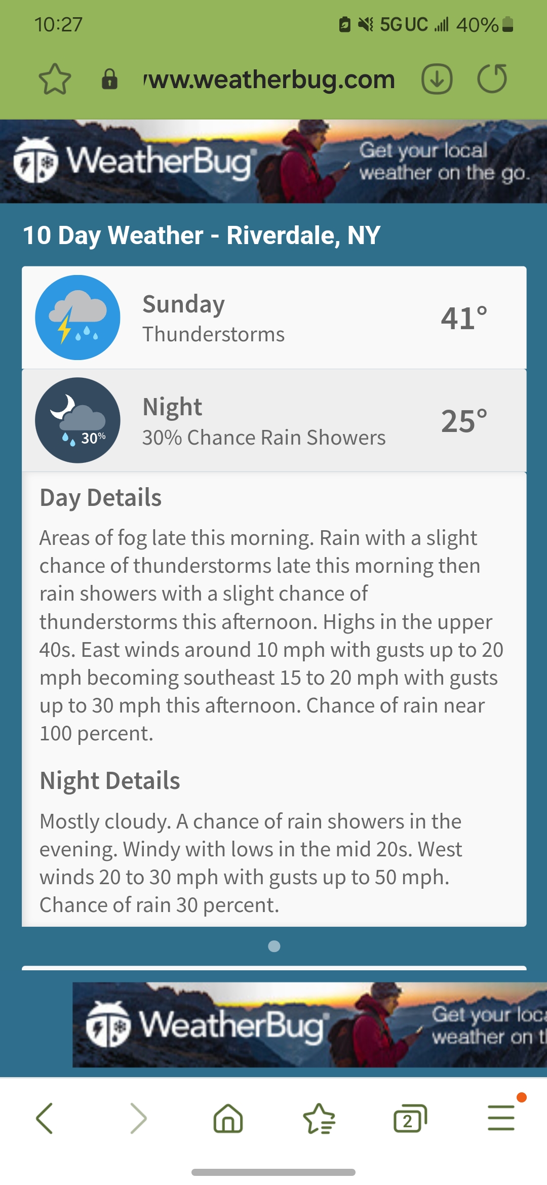
Dropped the forecast temps yet again. 56 max projected to 41 max projected,jeesh. Talk about bust.
-
OBS-Nowcast Noon Saturday 2/15-Noon Monday 2/17
Bxstormwatcher360 replied to wdrag's topic in New York City Metro
I got about an inch and a half outta the little event up here. It actually snowed more then what was predicted,not by much though. -
OBS-Nowcast Noon Saturday 2/15-Noon Monday 2/17
Bxstormwatcher360 replied to wdrag's topic in New York City Metro
Nailed it. I remember those storms,always left everything opague white everywhere measured in inches -
OBS-Nowcast Noon Saturday 2/15-Noon Monday 2/17
Bxstormwatcher360 replied to wdrag's topic in New York City Metro
Just had a pop up heavy rain/pinger shower,interesting,there is def still cold air up top. -
OBS-Nowcast Noon Saturday 2/15-Noon Monday 2/17
Bxstormwatcher360 replied to wdrag's topic in New York City Metro
Im in the bx and its wet and wild out there..there are patches of ice that most people dont see when walking and slip they go. -
OBS-Nowcast Noon Saturday 2/15-Noon Monday 2/17
Bxstormwatcher360 replied to wdrag's topic in New York City Metro
6 hours ago ..modeled for mid 50's ..recent trend is cooler..we might barely get in to the lower 40s now. The northerly winds continue and temps havent budged much currently. -
OBS-Nowcast Noon Saturday 2/15-Noon Monday 2/17
Bxstormwatcher360 replied to wdrag's topic in New York City Metro
That warm sector better be a true southerly wind to achieve mid 50's here. If it does its gonna be brief anyway but imo ,it doesnt hit 50's here. -
OBS-Nowcast Noon Saturday 2/15-Noon Monday 2/17
Bxstormwatcher360 replied to wdrag's topic in New York City Metro
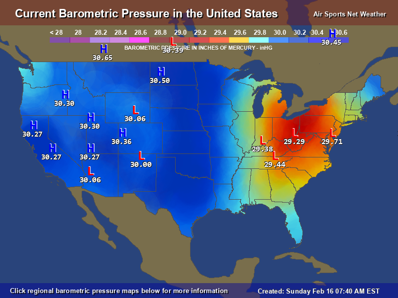
Real reasons why nobody gets above 50. Everything to the coast,south of all guidance. The trail energy in tenn/va is gonna bomb somewhere off the coast south of us,current movement is ene??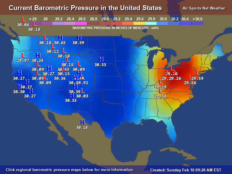
-
OBS-Nowcast Noon Saturday 2/15-Noon Monday 2/17
Bxstormwatcher360 replied to wdrag's topic in New York City Metro
Keep it going,my location sez 42°f..so the trend is real . -
OBS-Nowcast Noon Saturday 2/15-Noon Monday 2/17
Bxstormwatcher360 replied to wdrag's topic in New York City Metro
Yeah ill be waiting,still sitting at 32-33f here in the no bronx. -
OBS-Nowcast Noon Saturday 2/15-Noon Monday 2/17
Bxstormwatcher360 replied to wdrag's topic in New York City Metro
Yeah,its just not warming up fast enough for you northern folk unfortunately. Stay safe up there. -
OBS-Nowcast Noon Saturday 2/15-Noon Monday 2/17
Bxstormwatcher360 replied to wdrag's topic in New York City Metro
Yeah my new forecast high is 42 maybe 43 ..thats a big gap from 55 degrees. -
OBS-Nowcast Noon Saturday 2/15-Noon Monday 2/17
Bxstormwatcher360 replied to wdrag's topic in New York City Metro
They changed my forecast high to 42 degees,i just saw my point and click. Wow!!. Thats a major upset. 50's wont make it far only because no one figures that the northern primary low is dying and a new one has taken its place much further south. -
OBS-Nowcast Noon Saturday 2/15-Noon Monday 2/17
Bxstormwatcher360 replied to wdrag's topic in New York City Metro
For my location its still 32 at 9am..i dont think the guidance suggested still frz at this time. But its gonna be close. -
OBS-Nowcast Noon Saturday 2/15-Noon Monday 2/17
Bxstormwatcher360 replied to wdrag's topic in New York City Metro
Man its gonna close but 60 in southern jerz sounds like a pipe dream rn. The modeling in reguards to thermals are pretty much off by as much as 9 degrees,also no southerly winds rn,means a veryy slow go lol -
OBS-Nowcast Noon Saturday 2/15-Noon Monday 2/17
Bxstormwatcher360 replied to wdrag's topic in New York City Metro
Im on that anomaly,something is off or a unforeseen transfer to the coast later is possible. Colder air is rushing behind the primary low which i believe might be dying in eastern ohio/western pa and the trailing energy down in tenn now moving in to va is the new primary. Watch out if the low exits the southern jersey coast,alas northerly winds keep it colder. Cle to buff back to snow currently. -
OBS-Nowcast Noon Saturday 2/15-Noon Monday 2/17
Bxstormwatcher360 replied to wdrag's topic in New York City Metro
We shall see if 50 verifies, as of right now the cold wont budge fast enough. -
OBS-Nowcast Noon Saturday 2/15-Noon Monday 2/17
Bxstormwatcher360 replied to wdrag's topic in New York City Metro
Wow, the cold air is putting up some fight. Most of us at 8 am at or below frz away from the coastline. -
OBS-Nowcast Noon Saturday 2/15-Noon Monday 2/17
Bxstormwatcher360 replied to wdrag's topic in New York City Metro
Yeah my temps here in the bx have been dropping ..from 35 to 32/30f. -
OBS-Nowcast Noon Saturday 2/15-Noon Monday 2/17
Bxstormwatcher360 replied to wdrag's topic in New York City Metro
Thats my thinking as well,this is not going much further north. -
OBS-Nowcast Noon Saturday 2/15-Noon Monday 2/17
Bxstormwatcher360 replied to wdrag's topic in New York City Metro
Its gonna warm but its looking more and more brief and then a flash freeze tonight. Not good either way with blk ice tonight all over. -
OBS-Nowcast Noon Saturday 2/15-Noon Monday 2/17
Bxstormwatcher360 replied to wdrag's topic in New York City Metro
Dunno if it transfers .. if it does those 50 degree temps aint happenin. Just odd to see temps drop with dp now below freezing too.