.jpg.93eb8afe5d1df4d67bc0eeb78d645380.jpg)
.jpg.7cbeb4b469bd18d447fac5868c43a091.jpg)
Yardstickgozinya
-
Posts
1,681 -
Joined
Content Type
Profiles
Blogs
Forums
American Weather
Media Demo
Store
Gallery
Everything posted by Yardstickgozinya
-
.thumb.jpg.6a4895b2a43f87359e4e7d04a6fa0d14.jpg)
Central PA Summer 2026 Discussion/Obs Thread
Yardstickgozinya replied to Voyager's topic in Upstate New York/Pennsylvania
I know brother. I don't just base what I say off phone calls from family, internet stories, or just the view out my window. I actually go out and put in my own work and see for myself. It's definitely a unprecedented scale. -
Central PA Summer 2026 Discussion/Obs Thread
Yardstickgozinya replied to Voyager's topic in Upstate New York/Pennsylvania
Reevaluating, my thought, I guess it would depend on how you look at , if you're just talking about the few streets in Harrisburg that got hit by a tornado in 2009 then, sure. -
Central PA Summer 2026 Discussion/Obs Thread
Yardstickgozinya replied to Voyager's topic in Upstate New York/Pennsylvania
The tree damage in the area blows 2009 away. There's not even any comparison to be had. -
Central PA Summer 2026 Discussion/Obs Thread
Yardstickgozinya replied to Voyager's topic in Upstate New York/Pennsylvania
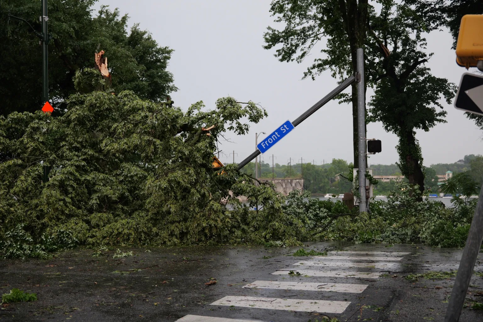
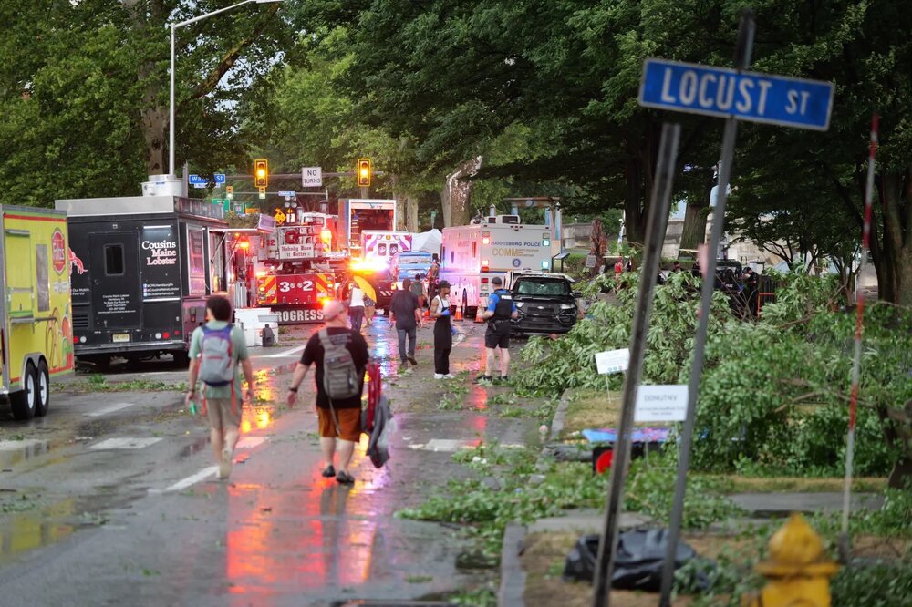
Pictures from Harrisburg that my son sent me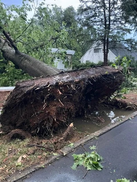

-
Central PA Summer 2026 Discussion/Obs Thread
Yardstickgozinya replied to Voyager's topic in Upstate New York/Pennsylvania
It could have been a hell of a lot worse for our area had the soil been saturated. -
Central PA Summer 2026 Discussion/Obs Thread
Yardstickgozinya replied to Voyager's topic in Upstate New York/Pennsylvania
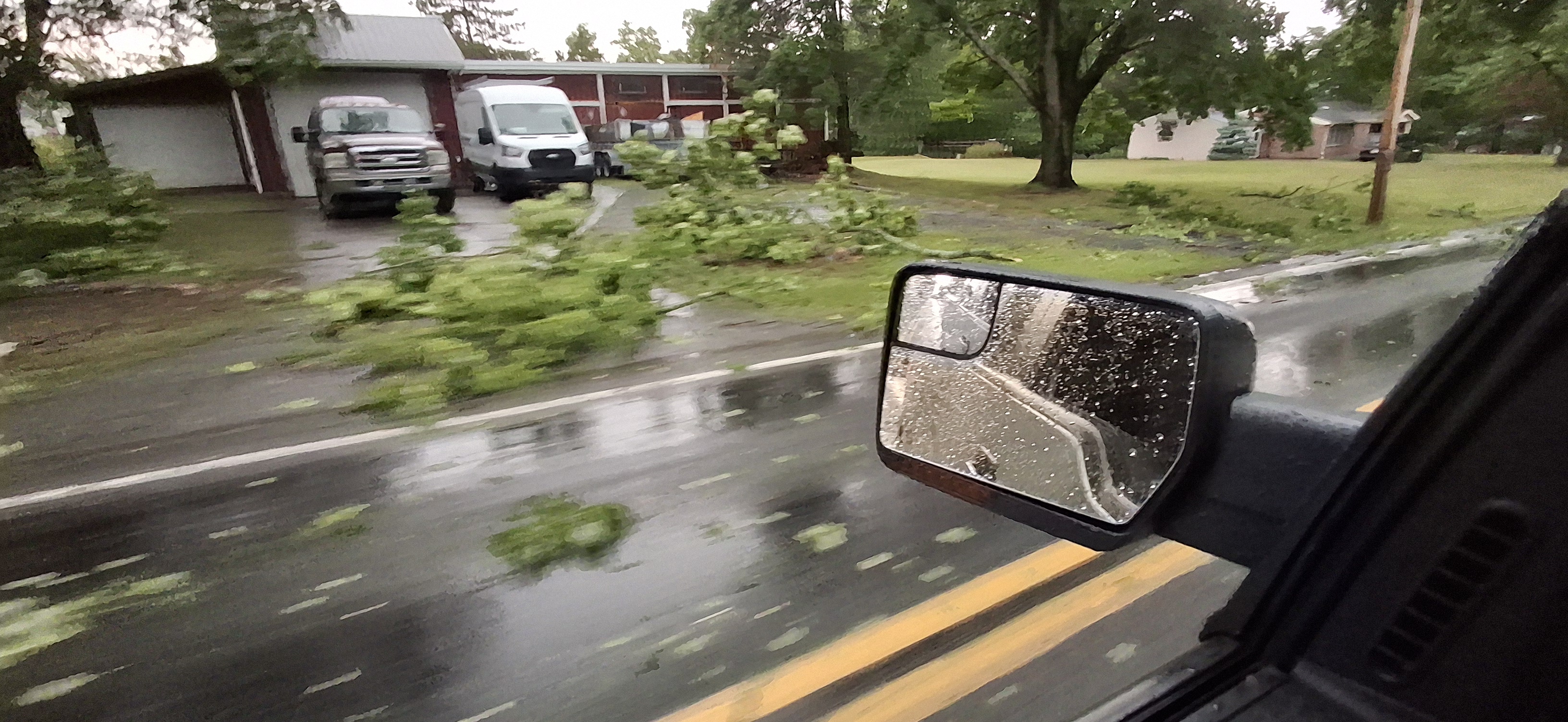
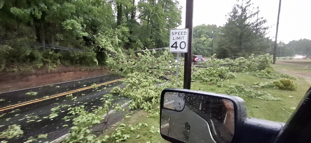
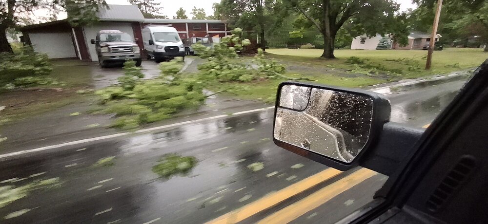
The one thing I noticed every place had in common along my drives last night, and this morning was the smell of freshly cut timber. I think a lot of people are going to be surprised about how widespread and damaging ithis wind event actually was as pictures and stories roll in. Some of the hardest hit places along my drives were the Heritage golf course in Lisburn, neighborhoods surrounding the I81 and Carlisle pike Interchange, areas around Cedar, Cliff high school, including the Cliffs, and the north end of Greenlane farms. My son also sent me pictures from front street in Harrisburg and I can also confirm that that area seems particularly hard hit. Unfortunately, driving last night required extra attention so I got very few pictures and videos ,but seeing the damage fresh leves, no doubt in my mind that this was the worst windstorm in my hometown and many surrounding areas in my lifetime. The picture below is what it looks like outside my sliding door and looking directly back at it from my woods. I lost four large connifer trees just in that view. I also lost 2 large poplar trees and small dogwood and had several deadfalls. -
Central PA Summer 2026 Discussion/Obs Thread
Yardstickgozinya replied to Voyager's topic in Upstate New York/Pennsylvania
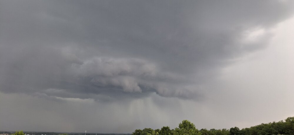
No morning update from the Spc yet but the national weather service seems pretty confident we are going to see more severe weather in cpa today. Highlight Changed Discussion -- 998 FXUS61 KCTP 050843 AFDCTP Area Forecast Discussion National Weather Service State College PA 443 AM EDT Sun Jul 5 2026 .WHAT HAS CHANGED... * Dense Fog Advisory issued early this morning for the western and central Alleghenies * Targeted Moderate Risk Excessive Rainfall Outlook (level 3/4) for east-central Pennsylvania through tonight * Flood Watch issued this afternoon through Monday for east- central Pennsylvania && .KEY MESSAGES... 1) Breakdown of heat wave pattern gives rise to severe storms and torrential downpours today and Monday && .DISCUSSION... KEY MESSAGE 1: Breakdown of heat wave pattern gives rise to severe storms and torrential downpours today and Monday 40 severe thunderstorm warnings issued in the past 2 days. The days following a transition from an extreme heat pattern are often marked by severe/active weather, and that trend continues through at least Monday. As the heat dome shifts to the west and troughing develops over the Great Lakes/Ohio Valley/Northeast, the upcoming week will feature relatively cooler (more seasonal) temperatures with a bullish signal for almost daily rain chances particularly early and late in the week. In the very near term, clearing sky and nearly calm wind following last evenings widespread rainfall has resulted in areas of dense fog over the western and central Alleghenies. IR sat shows the fog expanding as higher clouds peel away. We issued a DFA through 13Z/9AM with several ASOS and RWIS sites already reporting 1/4 mile visibility. Another active wx day ahead with dual severe T-storm and flash flood risks to manage. We anticipate another diurnal uptick in convective development within a very warm, moist and increasingly unstable environment indicative of steep low-mid level lapse rates. Pockets of stronger deep layer shear 30+ kt may exist in the upper OH Valley and eastern PA, but the general expectation is for pulse to multicell storms to once again merge/form into line segments with some cold pool organization to promote damaging wind potential from mid afternoon into the evening. SPC placed the highest damaging wind probs near/southeast of I81/78 where max temps should reach 90F. Focus will should evolve from severe to flash flood/hydro ops by later this evening and continue into Monday as a robust +RA signal continues to manifest over east-central PA. Atmos conditions will be quite favorable for heavy rainfall and flash flooding potential with 2+ inch pwats correlating to intense rain rates >2 in/hr and repeating/back-building storms along q-stnry/wavy frontal zone. Latest HREF/REFS mean QPF guidance is signaling 1-3" in the 24hr period ending 00Z Tue with PMM/LPMM max values exceeding 5 inches. WPC coordinated a targeted and relatively small moderate excessive rainfall outlook (level 3/4) within a broader level 2/4 or SLGT risk area. We issued a relatively large/broad flood watch along with WFO PHI as there remains some spatial uncertainty to exactly where the greatest rainfall will occur. The setup (multiple rounds of slow moving/torrential downpours) favors locally significant flash flooding particularly in terrain areas and highly urbanized corridors. One limiting factor is obviously the drought conditions and corresponding elevated FFG values that may offset the overall risk to some extent https://forecast.weather.gov/product.php?site=CTP&issuedby=CTP&product=AFD&format=CI&version=1&glossary=1&highlight=off -
Central PA Summer 2026 Discussion/Obs Thread
Yardstickgozinya replied to Voyager's topic in Upstate New York/Pennsylvania
@Jns2183 1:43AM I'm driving through Camp Hill right now checking out all the damage throughout your town. This is locally historic, without a doubt. There's at least 6 trees down on my property. I'm going to take a walk in the woods tonight and assess. Heading out the Carlisle pike, next then driving back through Mechanicsburg, and checking out some of the areas where where I posted some of my first pictures from today.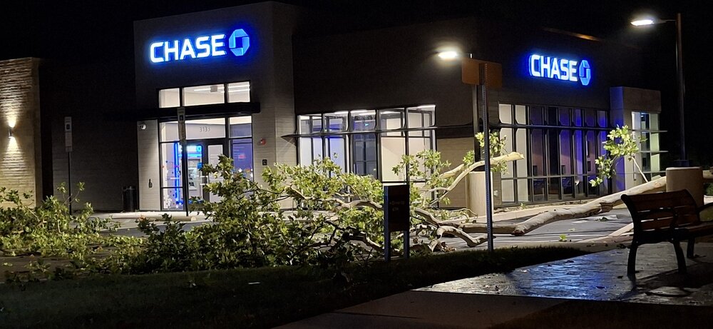
-
Central PA Summer 2026 Discussion/Obs Thread
Yardstickgozinya replied to Voyager's topic in Upstate New York/Pennsylvania
No shortage of crews and people still out here clearing debris out of roads and off of homes. Fireworks and generators glore out here tonight. -
Central PA Summer 2026 Discussion/Obs Thread
Yardstickgozinya replied to Voyager's topic in Upstate New York/Pennsylvania
My mistake 11:00 pm tuesday, for some of the residents out this way. That's probably mostly b*******, though.I'd imagine it's going to be long before that for most people if not everyone. -
Central PA Summer 2026 Discussion/Obs Thread
Yardstickgozinya replied to Voyager's topic in Upstate New York/Pennsylvania
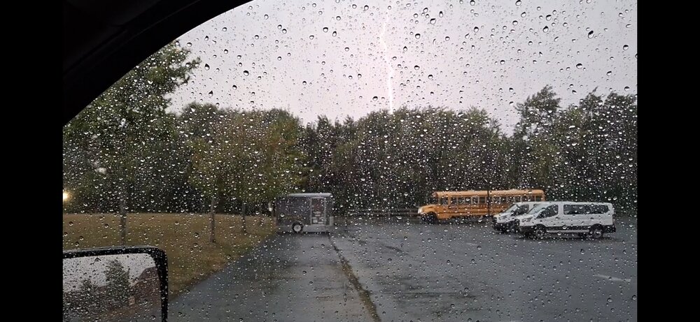
Never have I had wind rock my ford around. I wish we could post videos here. I was actually getting pretty nervous while sitting at the mechanicsburg middle school. I'm going to sleep on it, but today's storme most likely makes it into my top five, and certainly the best I think i've experienced since 2011. -
Central PA Summer 2026 Discussion/Obs Thread
Yardstickgozinya replied to Voyager's topic in Upstate New York/Pennsylvania
Power company sent out a notification to everybody in our area that power may not be restored until 6pm Tuesday for some customers. -
Central PA Summer 2026 Discussion/Obs Thread
Yardstickgozinya replied to Voyager's topic in Upstate New York/Pennsylvania
Yes, indeed. It took me quite a while to clear my way home with some of the locals. Just through my chainsaw on my truck and i'm heading out to help clear some stuff up around my area. -
Central PA Summer 2026 Discussion/Obs Thread
Yardstickgozinya replied to Voyager's topic in Upstate New York/Pennsylvania
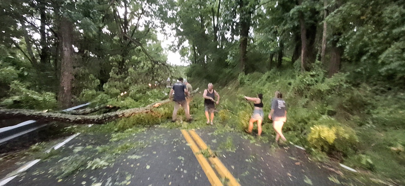
Absolutely pummeled out here in lisberne and fairview township area.We're not getting home without clearing the roads ourselves out here. I passed a couple homes with damage also at this point.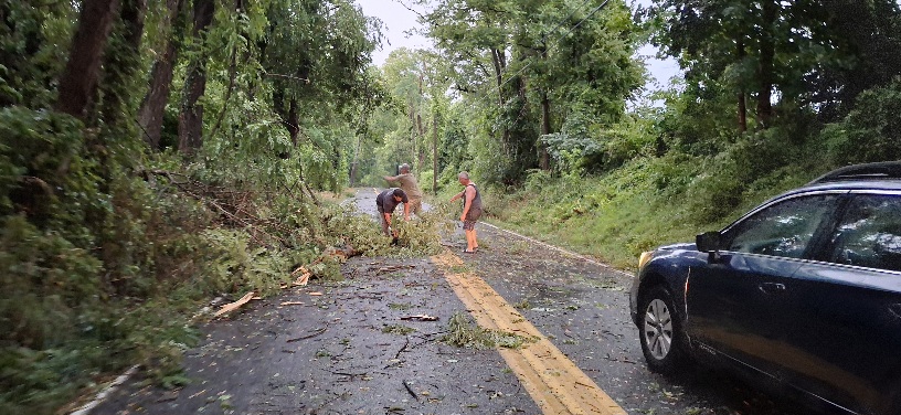

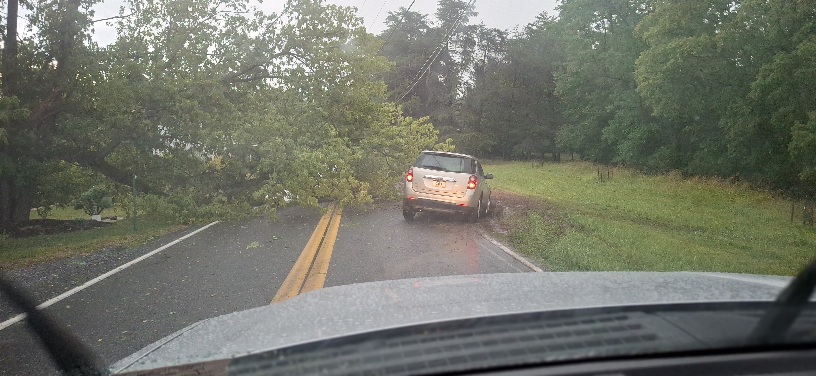
-
Central PA Summer 2026 Discussion/Obs Thread
Yardstickgozinya replied to Voyager's topic in Upstate New York/Pennsylvania
This is the third time i've encountered.We've had to clear the roads more picks coming boys, we're stuck at this one.I'm not getting home absolutely pummeled out here as I get towards fairview township -
Central PA Summer 2026 Discussion/Obs Thread
Yardstickgozinya replied to Voyager's topic in Upstate New York/Pennsylvania

-
Central PA Summer 2026 Discussion/Obs Thread
Yardstickgozinya replied to Voyager's topic in Upstate New York/Pennsylvania
Debris all along the way, but so far, Lisburn seems to got the worst of what i've driven through.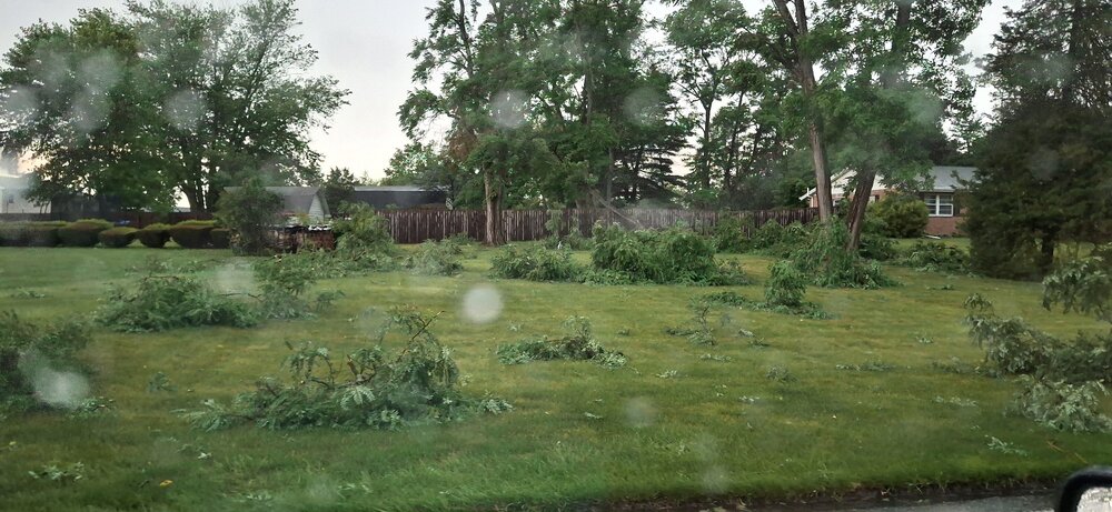
-
Central PA Summer 2026 Discussion/Obs Thread
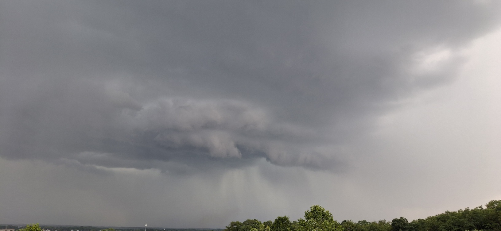
Yardstickgozinya replied to Voyager's topic in Upstate New York/Pennsylvania
Lisburn got pummeled pictures in a minute, still driving around the area -
Central PA Summer 2026 Discussion/Obs Thread
Yardstickgozinya replied to Voyager's topic in Upstate New York/Pennsylvania
-
Central PA Summer 2026 Discussion/Obs Thread
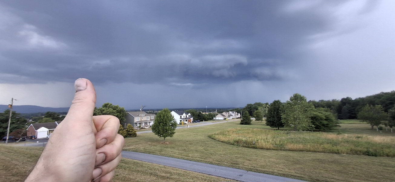
Yardstickgozinya replied to Voyager's topic in Upstate New York/Pennsylvania
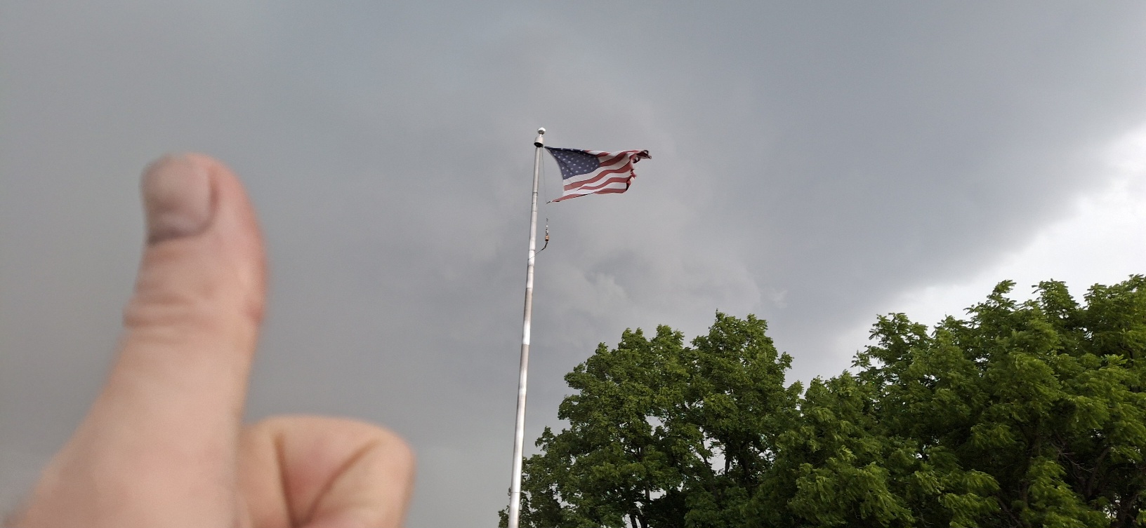
Hell yeah!!! Happy independence day boys. couldn't help myself. I had to stop from one last picture. The trucks a rocking boys place myself good for this one.
-
Central PA Summer 2026 Discussion/Obs Thread
Yardstickgozinya replied to Voyager's topic in Upstate New York/Pennsylvania
-
Central PA Summer 2026 Discussion/Obs Thread
Yardstickgozinya replied to Voyager's topic in Upstate New York/Pennsylvania
Last time I checked. We didn't quite have the cape values of yesterday, but there was still more than enough to do some business.
-
Central PA Summer 2026 Discussion/Obs Thread
Yardstickgozinya replied to Voyager's topic in Upstate New York/Pennsylvania
Excessive Rainfall Discussion NWS Weather Prediction Center College Park MD 417 AM EDT Sat Jul 4 2026 Day 2 Valid 12Z Sun Jul 05 2026 - 12Z Mon Jul 06 2026 ...THERE IS A SLIGHT RISK OF EXCESSIVE RAINFALL ACROSS PORTIONS OF THE MID-ATLANTIC... An east-west orientated front boundary will be sprawled across the Northeast/northern Mid-Atlantic region during this period. Moderate instability combined with PW values of 2+ inches are expected to overlap near the frontal boundary to produce periods of heavy rainfall. This area historically is more prone to flash flooding due to terrain influences and more sensitive hydrologic schemes thus maintaining the Slight Risk for excessive rainfall for this part of the region. Backbuilding and training of thunderstorms may be possible. Scattered flash flood concerns exist over the central Mid- Atlantic with an increasing risk of heavy convection over portions of Pennsylvania down through the Washington DC- Baltimore- Philadelphia corridor. A broad Marginal Risk area spans from eastern Oklahoma/Kansas eastward to the Mid- Atlantic/southern portions of the Northeast. -
Central PA Summer 2026 Discussion/Obs Thread
Yardstickgozinya replied to Voyager's topic in Upstate New York/Pennsylvania
NWS verbatim SPC on today's severe potential. -- Highlight Changed Discussion -- 237 FXUS61 KCTP 040916 AFDCTP Area Forecast Discussion National Weather Service State College PA 516 AM EDT Sat Jul 4 2026 .WHAT HAS CHANGED... * Extreme Heat Warning upgrade for Fulton, Franklin, Perry, and Cumberland Counties && .KEY MESSAGES... 1) Breakdown of early July heat wave promotes an increased risk of damaging thunderstorm wind gusts and potential flash flooding through Independence Day weekend && .DISCUSSION... KEY MESSAGE 1: Breakdown of early July heat wave promotes an increased risk of damaging thunderstorm wind gusts and potential flash flooding through Independence Day weekend Final day of heat headlines with max heat indices reaching 100-110 degrees to the east of the Allegheny Plateau. The breakdown or ending process of heat waves is often marked by bouts of severe weather - and that will likely hold true through the July 4th holiday weekend. Clusters of storms are projected to develop through the weekend in a very moist, unstable, modestly sheared environment and will have the potential to produce localized to perhaps widespread damaging wind gusts - especially of they can grow upscale and sustain strong cold pools. A threat for heavy to excessive rainfall will also be in play given high pwats and efficient rainfall/hourly rates. SPC and WPC outlooks were largely unchanged for this cycle. https://forecast.weather.gov/product.php?site=CTP&issuedby=CTP&product=AFD&format=CI&version=1&glossary=1&highlight=off