AtlanticWx
-
Posts
643 -
Joined
-
Last visited
Content Type
Profiles
Blogs
Forums
American Weather
Media Demo
Store
Gallery
Everything posted by AtlanticWx
-
nevermind, the whole thing is just slower. looks held back
-
HRDPS looks less amplified at first glance tbh
-
RGEM is more - but still pretty bad around NW of DC bc even tho it's cold enough it's still "raining", says around <1" for NW of DC
-
honestly gonna be fun to see these rates tho, haven't seen these type of rates modeled in a while
-
yeah it's really elevation dependent this run, it rains IMBY at hr 37 while 5 miles north of me gets puking snow. and that makes sense given im like 50' lower. super cool to see
-
still puking at hr 41.
-
-
yea this is ab to puke snow for those NW of DC
-
hrrr looks a lot better so far, more - tilt and more held back. looks similar to nam3k at h32
-
i was wondering this too but after looking into it further, that event was just synoptically different as a whole. we had a GL low that brought a cold front down here followed by some gusty flurries. I think that event was farfetched to begin with and we were j desperate because there was no trailing low or trough digging in the south. this event, meanwhile, is caused by a trough digging in the south and turning negative rapidly bringing cold for the last few hours of precipitation. definitely a more promising event where we see a coastal low spawn and bring back moisture into our area for a few hours of flakes or even accumulating snow. def a more promising setup compared to most anafrontals.
-
it's honestly a bonus event too, i wasn't expecting anything till new years
-
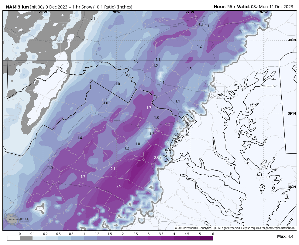
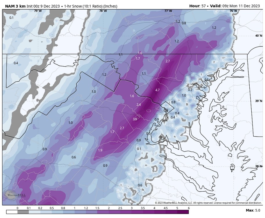
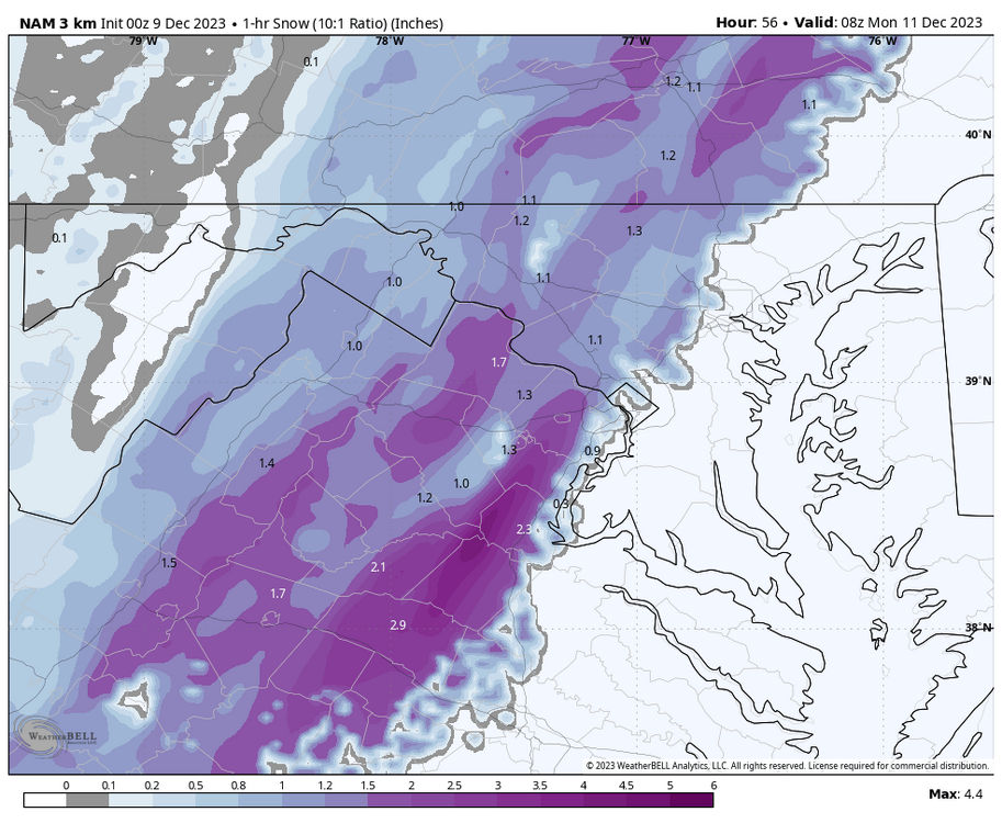
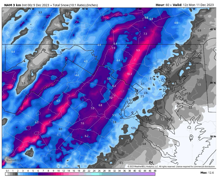
the deformation band is back on nam3k, some lucky ppl in moco could see a few sloppy inches w nam3k's depiction verbatim, stalling band for like 3-4 hours
-
uptick again (10:1 is 2-3" area wide)
-
don't wanna jinx it but encouraging 0z suite so far. euro was already bullish so i wanna see how much more bullish it can get and if the NAM holds tmr
-
so far all the 0z models have shifted towards a more negative tilt. hrrr looked like nam3k but colder and slightly less precip (would've been pretty snowy probably). gonna have to wait and see what gfs does, but positive trends continuing into 0z so far.
-
if none of it is gonna stick, i'd rather look at the raw output of how much would be falling rates wise rather than caring about snow depth
-
oh my god
-
oh?
-
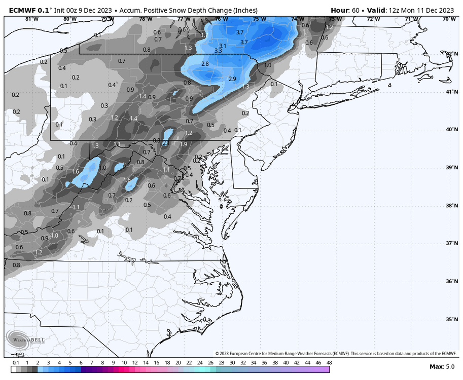
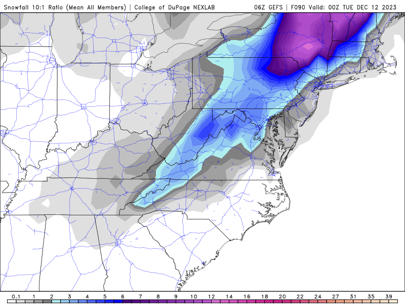
surprisingly, euro has .5"-1" of snow depth in NW areas.
-
70% chance of >1" btw
-
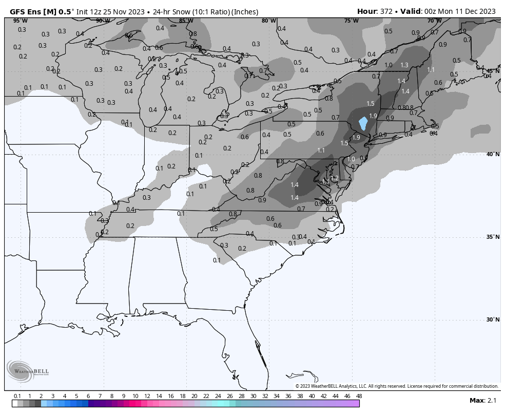
what's the mean? pivotal weather says it's 2" in moco
-
it's nice knowing there's a shot. just a few runs ago, GFS had a storm near that same time which was about to slam us but it didn't go far out enough
-
1962, 1961 & 2009 all had >6" of snow fall in december at BWI