AtlanticWx
-
Posts
643 -
Joined
-
Last visited
Content Type
Profiles
Blogs
Forums
American Weather
Media Demo
Store
Gallery
Everything posted by AtlanticWx
-
That Dec 12-13 piece of energy is key. The airmass associated with it comes all the way from Siberia/N AK and it being stronger means it gets trapped under the block and amplified, leading to colder and possibly snowier weather here.
-
Doug's forecast is 100% verifying!!
-
This. Out of the 11 Decembers with an -NAO <-1.2 sd, 10/11 Januaries and 7/11 Februaries had a -NAO too (see this tweet). Blocking won't break down that easily, and we could get another +SCAND going on soon that could retrogade and enforce the -NAO.
-
EPS Control coming in hot with cold pressing more compared to 12z.
-
The long-range pattern looks fine — piece of energy by energy breaks down the SER and further amplifies the Atlantic troughing. We'll be fine lmao, we want the interior NE to win right now so the airmass won't be as modified by the time it reaches us.
-
Hoping that threat around the 10th works out for us
-
00z GFS with a nice hit here! 00z CMC on the other hand gives us rain and snow for SNE, will see how this evolves. The TPV placement matters and I imagine given how volatile models have been with it this storm will flip flop a lot.
-
The trends regarding the TPV lobe getting pulled further west are well within D10, occuring around ~D6
-
18z GFS is a dumpster fire, literally.
-
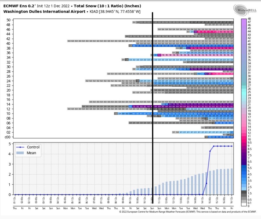
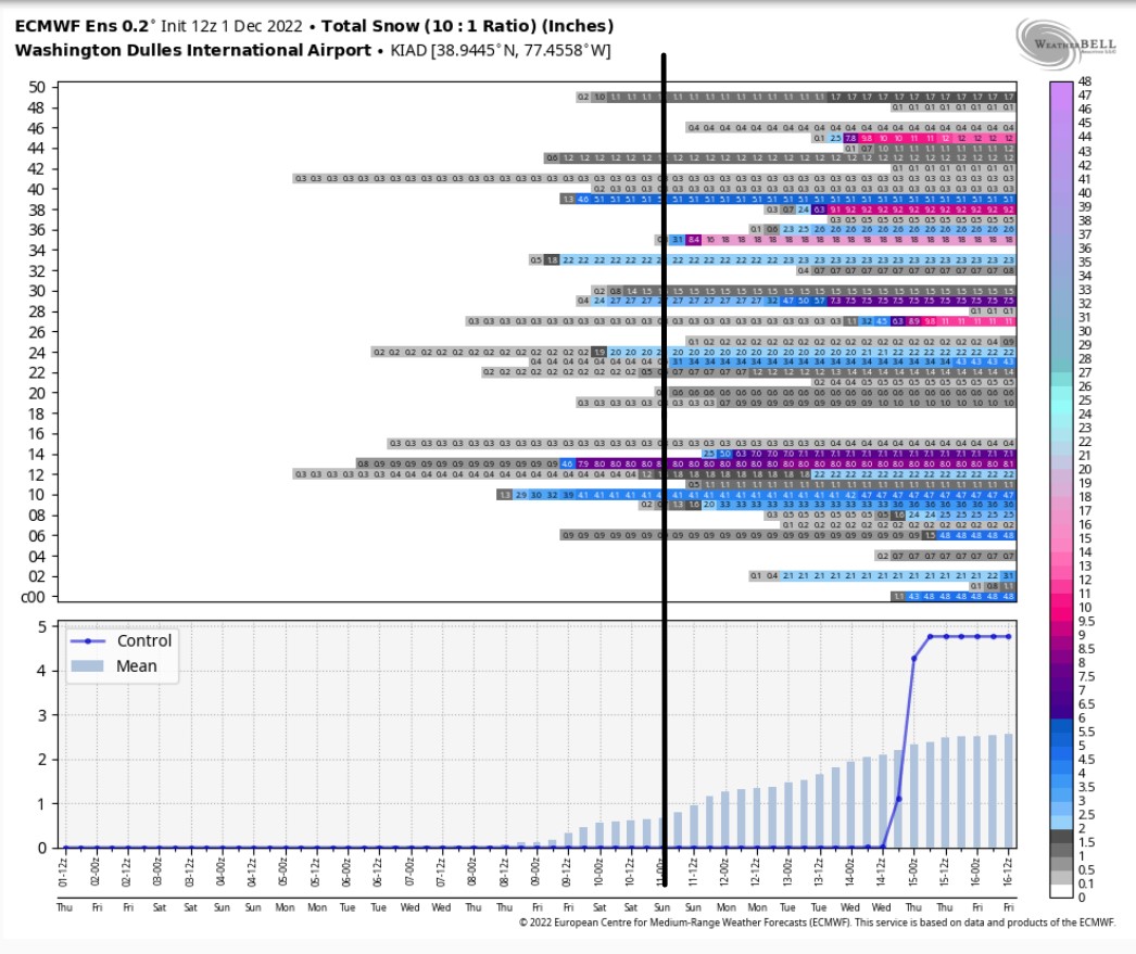
Not sure if you all have noticed but EPS has decent support for the December 10th threat (GEFS and GEPS too). Many members show a hit here or some even a miss to the north, I'm quite doubtful it misses that far to the south.