AtlanticWx
-
Posts
643 -
Joined
-
Last visited
Content Type
Profiles
Blogs
Forums
American Weather
Media Demo
Store
Gallery
Everything posted by AtlanticWx
-
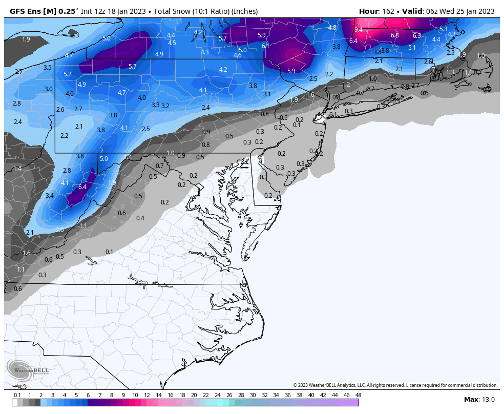
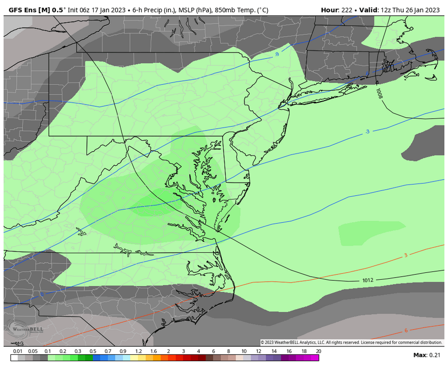
18z eps w/ some pretty major improvements for the storm on the 26th. less amped S/W & lower heights of the EC (555 line was in PA last run now it's south of DC)
-
yes because january 25th is definitely 10 days away!
-
complaining 24/7 is only gonna make u more sad
-
ensembles really ticked up today, 12z eps is really bullish
-
i think these se trends for the 23rd while they seem useless bc we prob wont get snow is rlly good for the 27th system as it shunts the boundary further SE & helps fight the amplification
-
tbh this is def just ensembles going crazy for one run
-
gefs improves the LR pattern too btw
-
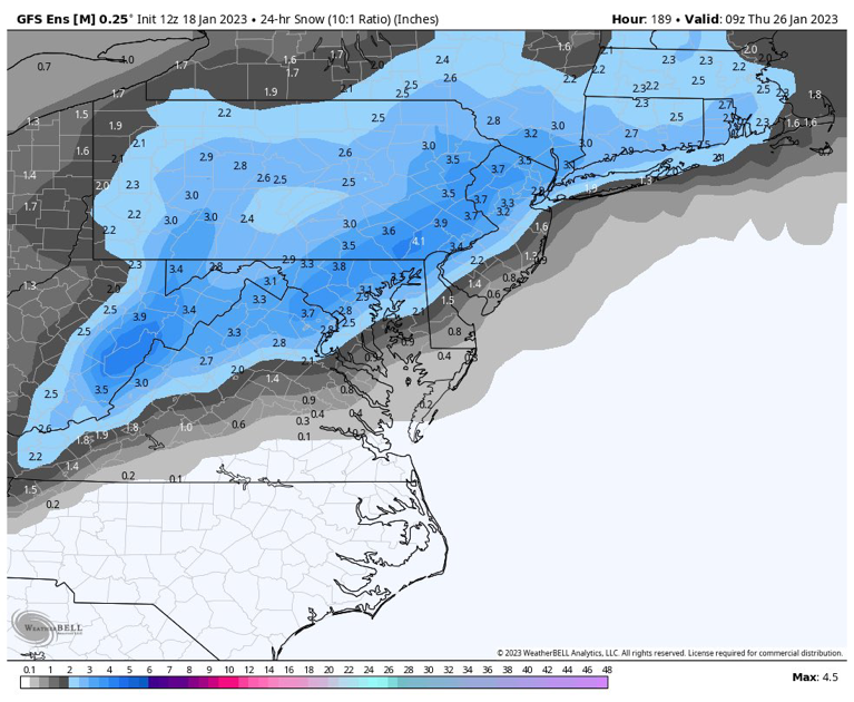
gefs is crazy for the 26th system - ~50% of >1" and a mean of 4" mostly from the 26th system (give or take 0.1")
-
it seems increasingly likely we'll probably get some decent cold and this pattern looks good for ski resorts in PA, hopefully the ski season redeems itself for places like whitetail n liberty
-
damn
-
i think the window of opportunity remains the same regardless if we pop an se ridge past the 28th like some ensembles are showing it's quite a weak ridge so idt it'll be able to flush out the really cold 850s from the previous airmass, we'll be fine
-
00z gem!
-
1-2" is meh? damn
-
on the bright side, ensembles have the probability of an inch being decent! we'll prob see an inch which is enough to make me happy atl
-
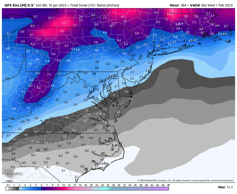
case in point, an impressive mean ~10 days out and for reference w/ out a smoothed mean, 18z gfs paints a good picture
-
this pattern is gonna be locked and loaded, lots of opportunities esp from the 27th onwards w/ an active STJ coupled w/ multiple waves passing thru. imo 27th is our pattern changer but we could score w/ it if all goes well, just gotta see how things progress. 18z gefs only continues to improve the pattern fwiw, i thought it'd come to an end soon like how the trends for a favorable pattern in december stopped abruptly but it seems like we're within the fantasy pattern range and w/ models only continuing to improve the pattern, perhaps it's time to start getting excited. my only worry is that we go from warm/wet to cold/dry, but multiple waves are passing through so we should be fine?
-
continued trends SE and immediate NW burgs should be on the right side of the gradient
-
6z gefs, the 26th/27th is our best chance the next few days
-
we can hope! imo we could end up w/ a 2008-09 type winter where we get one snow event late jan, an SSWE and a good storm in march
-
what's pd3?
-
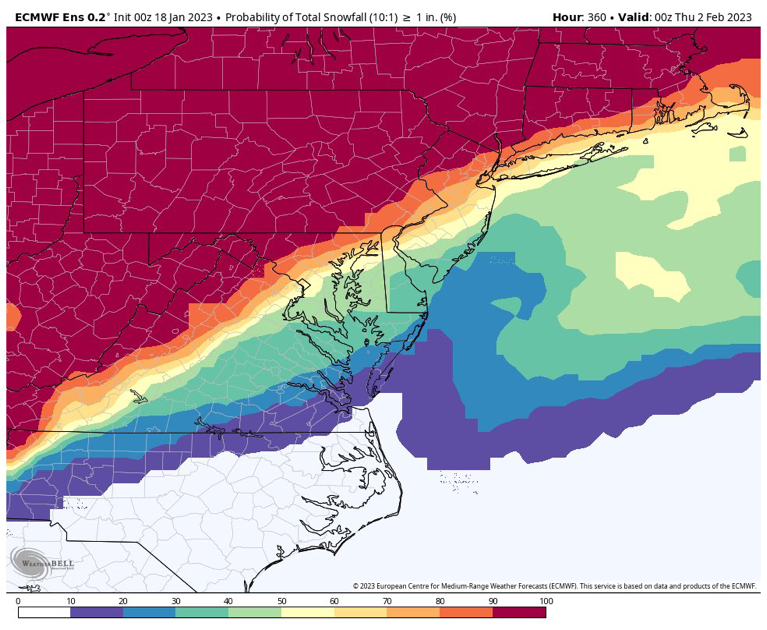
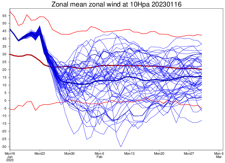
growing support for an SSWE per the weeklies
-
who's gonna win, strong TPV lobe(s) or a weak SE ridge? obviously the se ridge!
-
i do have a good feeling ab this pattern just gotta hope things continue to trend better
-
Warm? Temp anoms are consistently below 0C throughout the entire run past the 26th and best of all -