AtlanticWx
-
Posts
643 -
Joined
-
Last visited
Content Type
Profiles
Blogs
Forums
American Weather
Media Demo
Store
Gallery
Everything posted by AtlanticWx
-
January/February Mid/Long Range Disco IV: A New Hope
AtlanticWx replied to stormtracker's topic in Mid Atlantic
do we really want this trend this early? -
January/February Mid/Long Range Disco IV: A New Hope
AtlanticWx replied to stormtracker's topic in Mid Atlantic
fwiw canadian ensembles bullseye SOMD, so i wouldn't be worried ab canadian -
January/February Mid/Long Range Disco IV: A New Hope
AtlanticWx replied to stormtracker's topic in Mid Atlantic
12/9/18 on the GFS all over again! -
January/February Mid/Long Range Disco IV: A New Hope
AtlanticWx replied to stormtracker's topic in Mid Atlantic
love cancelling a threat 7 days out! -
January/February Mid/Long Range Disco IV: A New Hope
AtlanticWx replied to stormtracker's topic in Mid Atlantic
oops sorry for the spoiler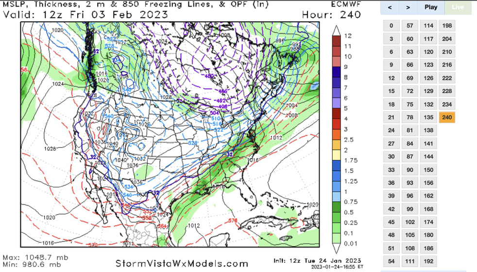
-
January/February Mid/Long Range Disco IV: A New Hope
AtlanticWx replied to stormtracker's topic in Mid Atlantic
Euro!!
-
January/February Mid/Long Range Disco IV: A New Hope
AtlanticWx replied to stormtracker's topic in Mid Atlantic
eric webb saying the flow is too fast for anything -
January/February Mid/Long Range Disco IV: A New Hope
AtlanticWx replied to stormtracker's topic in Mid Atlantic
-
January/February Mid/Long Range Disco IV: A New Hope
AtlanticWx replied to stormtracker's topic in Mid Atlantic
we've said that about 3 headfakes so far, 12/16, 12/22-23 and 1/16 all of which never happened. the big ones are sniffed out, just big rainstorms! -
January/February Mid/Long Range Disco IV: A New Hope
AtlanticWx replied to stormtracker's topic in Mid Atlantic
happening
-
January/February Mid/Long Range Disco IV: A New Hope
AtlanticWx replied to stormtracker's topic in Mid Atlantic
looking like gfs trying to cook up another snowstorm what's w 18z runs -
is this a CAD event?
-
where do we want it?
-
January/February Mid/Long Range Disco IV: A New Hope
AtlanticWx replied to stormtracker's topic in Mid Atlantic
literally all from that overrunning signal in this time frame, damn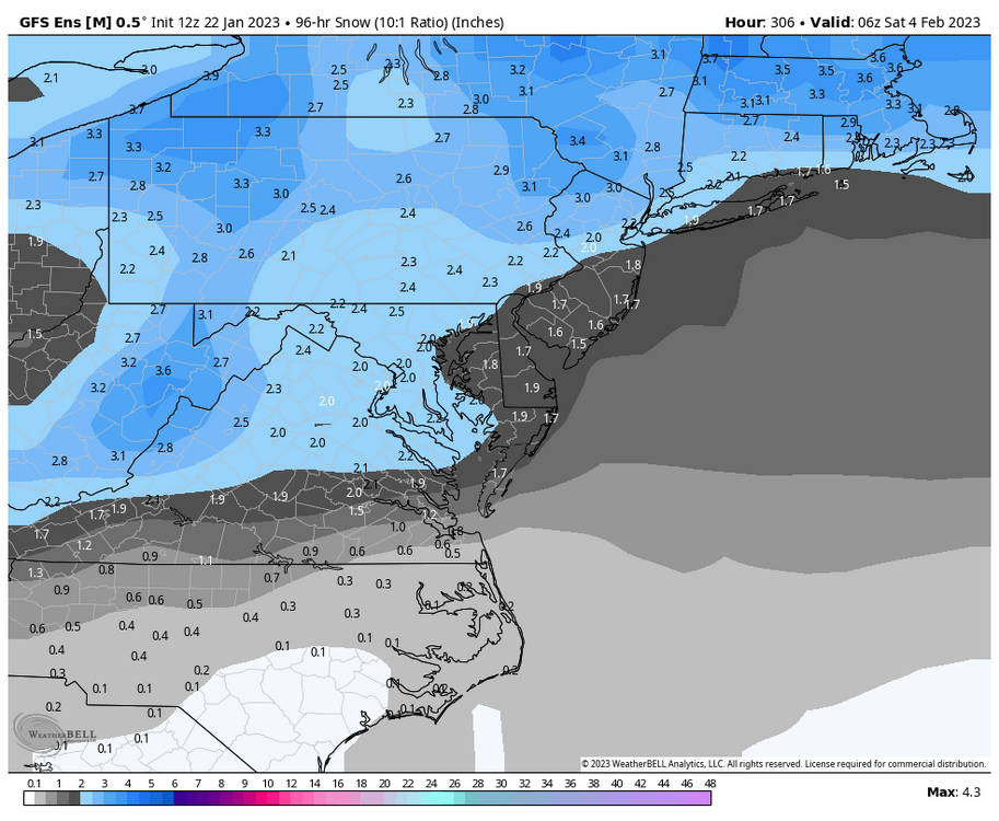
-
January/February Mid/Long Range Disco IV: A New Hope
AtlanticWx replied to stormtracker's topic in Mid Atlantic
actually, this pattern looks like a pattern that looks bad but could actually work. there's a very good cold source j north of us and even tho 500mb heights show a fairly weak SER 850mb temp anomalies and 2m temp anomalies are both BN being on the thermal gradient should help us w/ overrunning storms too, we'll see. not a bad pattern in the peak of climo -
we don't even need that much of a tick east for the good stuff
-
did it improve?
-
there's still hope, albeit not much — all ensembles agree on a cool down after the 27th storm before a transient warm up before the TPV dips down come feb 1st, and ensembles + ops have been consistent on some sort of threat the first few days of feb
-
it has rlly nice plots but using it on phone is a nightmare
-
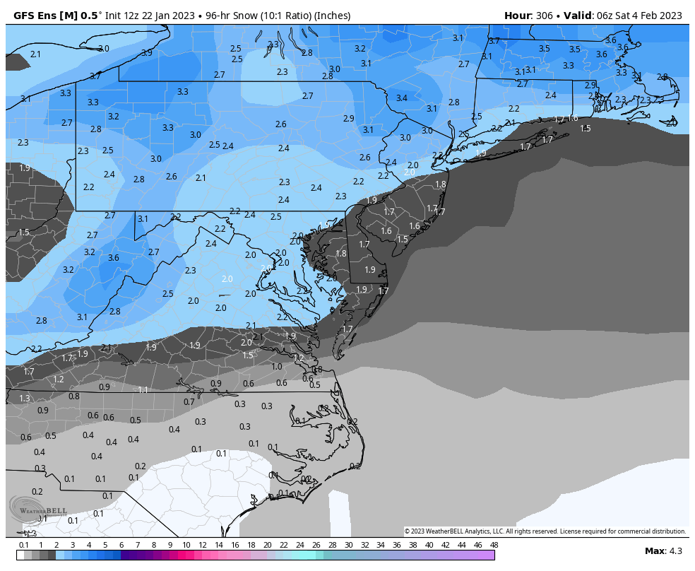
Way colder 850s this run
-
let's see what euro says, EPS made good steps
-
imo we're starting to see not horrible trends. seems like precip breaks off from the low and works its way upwards so if a high trends stronger perhaps we sneak our way into measurable snow
-
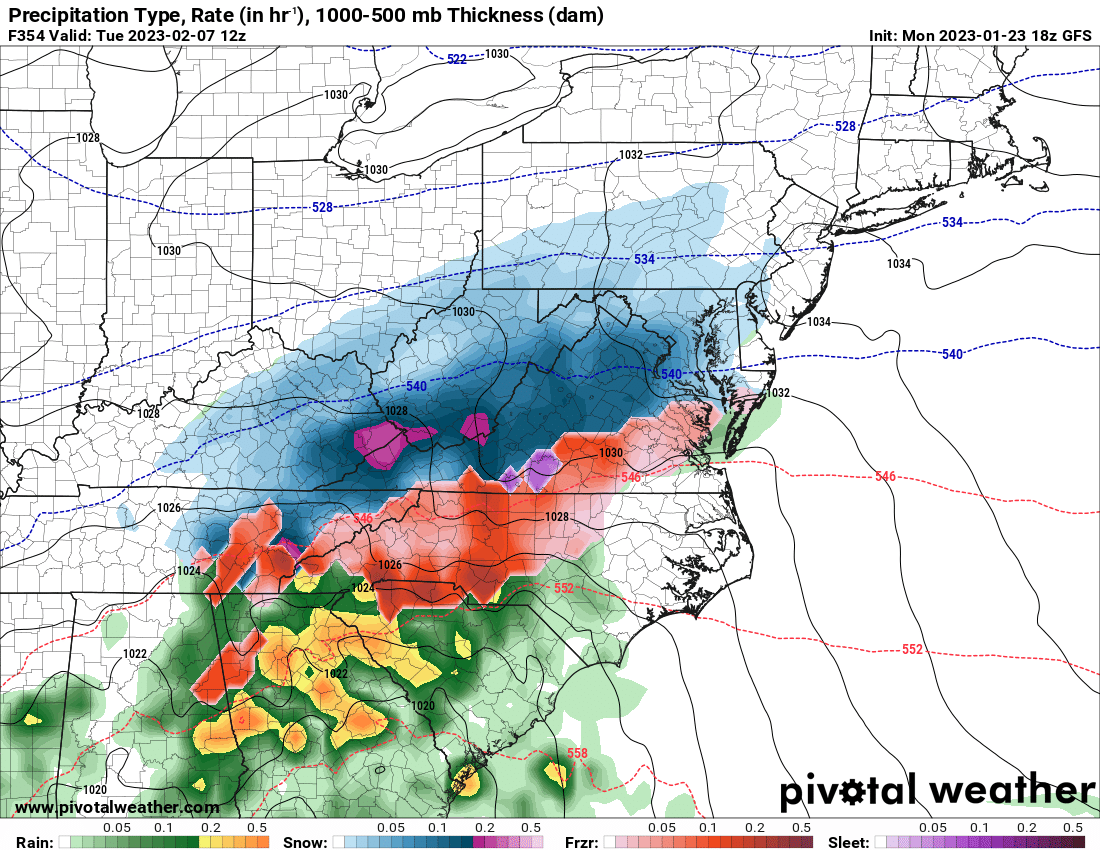
if the 540 line were over us it'd probably be crushing NC
-
yeah the advertised pattern is basically just a hyped up backside of a trough now since the ridge starts pumping as it leaves
-
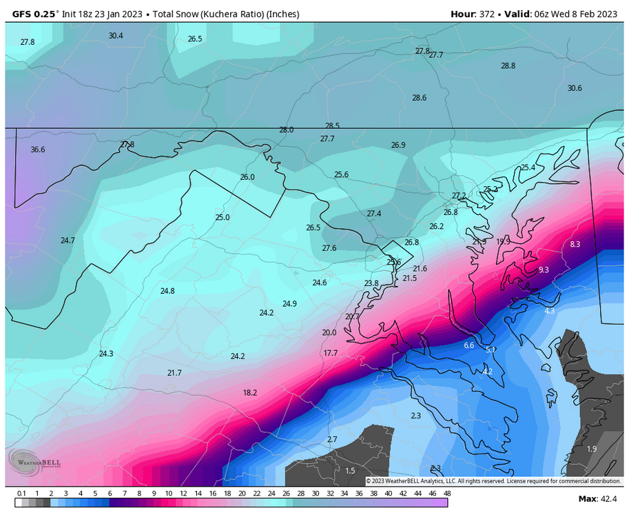
the 29th/30th has the highest potential out of all of them bc it could phase w a literal TPV as advertised by a few op runs