

DarkSharkWX
-
Posts
695 -
Joined
-
Last visited
Content Type
Profiles
Blogs
Forums
American Weather
Media Demo
Store
Gallery
Everything posted by DarkSharkWX
-
nah not yet
-
late feb-early march 2003 and feb 1989 are showing up on CPC analogs a lot as well as years in the late 50s/early 60s, earliest date for feb 2003 was feb 20
-
graphcast too!
-
EPS trending better in long range for the period psuhoffman and others have been highlighting, more +PNA/-NAO
-
not sure if its been posted yet but LWX has already maxed potential impact for the entire region
-
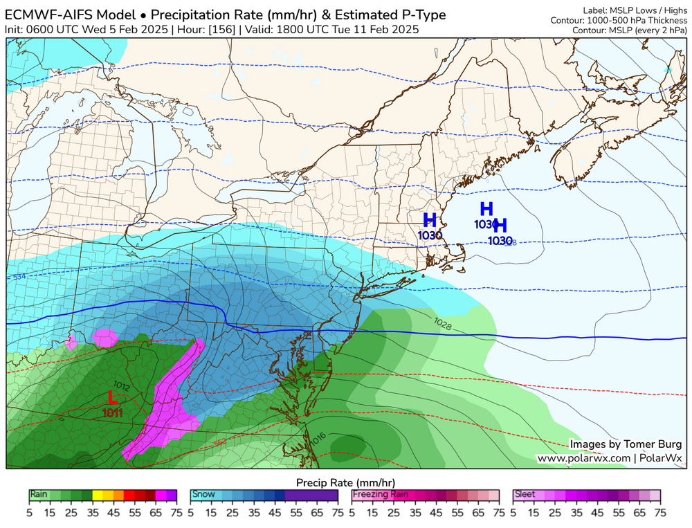
tomers website polarwx has AIFS ptype
-
euro op and eps shifted south anyways lmao
-
-
for perspective lol
-
nice
-
1' mean expanding SE
-
wtf?
-
10" mean!!
-
LOL
-
EPS snowier than last run FWIW, gonna end up with a very nice mean
-
crazy run lmao, I don't think anyone north of DC mixes
-
HOLDDDDD
-
euroooooo, waiting for mid Atlantic view to load but looks like a MECS
-
can't speak for other websites but ik on WB at least EPS does not
-
-
When's the last time we saw a mean like this? W/o a coherent threat
-
-
beautiful EPS run, 6" mean/median down to DC
-
cool
-
lmao wtf


