Stormchaserchuck1
-
Posts
3,260 -
Joined
-
Last visited
Content Type
Profiles
Blogs
Forums
American Weather
Media Demo
Store
Gallery
Everything posted by Stormchaserchuck1
-
I have these deep black bugs, like military aircraft(heavy-weight) projecting .exe's into my computer (blue ring around mouse)and I really don't have a choice, to use my computer, but to channel them to something like weather models (info gathering, at least). My computer screen is like a puddle. clear-water-puddle from 10,000s tiny bugs. Maybe someone can help? (non-visible) I don't want to be doing this all day. It also feels wrong. Seems to happen after I make weather predictions, etc, anything that could be economical. Not a big deal though after 12-18 hours of clearing .exe's.. imagine little bugs projecting red lasers from their top forehead.. lol Don't know what to do about the problem in masse, it's starting to create a wall that's independent of the computer, which is what I don't like
-
When -NAO wanes.. that's when we'll get our snow
-
And what do you know, this might be a real snow threat
-
That's not a -NAO on the 00z GFS MR
-
40% average snowfall every year for 20 years.
-
-PNA has to shake, sometimes the EC storm threat will take over and dominate N. Hemisphere pattern (usually it trends back to -PNA in the last few days).
-
The information in that thread may have gone Penn State Meteorology Department
-
little relevant science left
-
climate is running like an old record.. anti-global warming I guess, technology like this was 1920-40s.
-
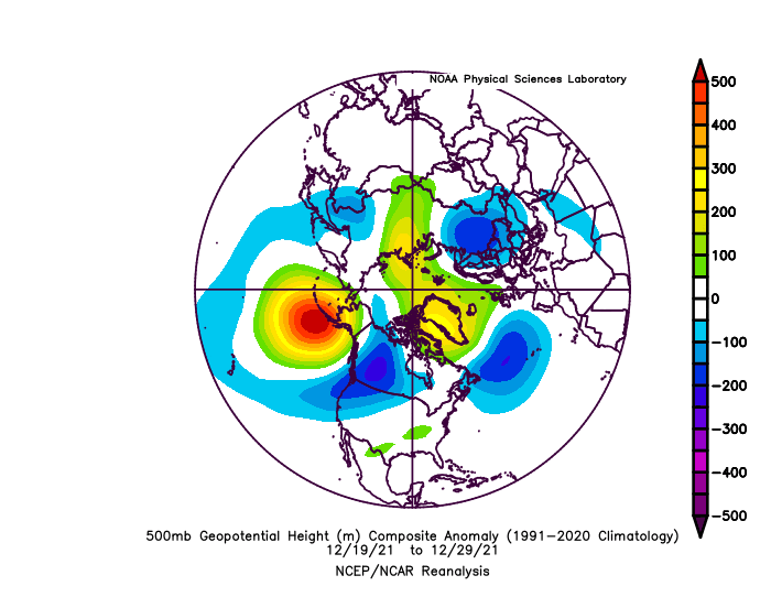
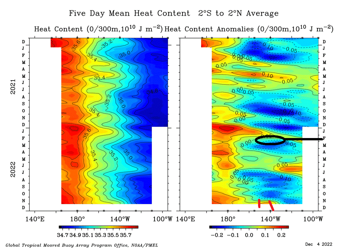
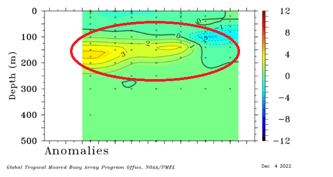
This is what happened last time we had a Kelvin Wave in La Nina in the Winter (Dec 20-Jan 5)


-

2021-2022 ENSO
Stormchaserchuck1 replied to StormchaserChuck!'s topic in Weather Forecasting and Discussion
This is what happened last time we had a Kelvin Wave


-
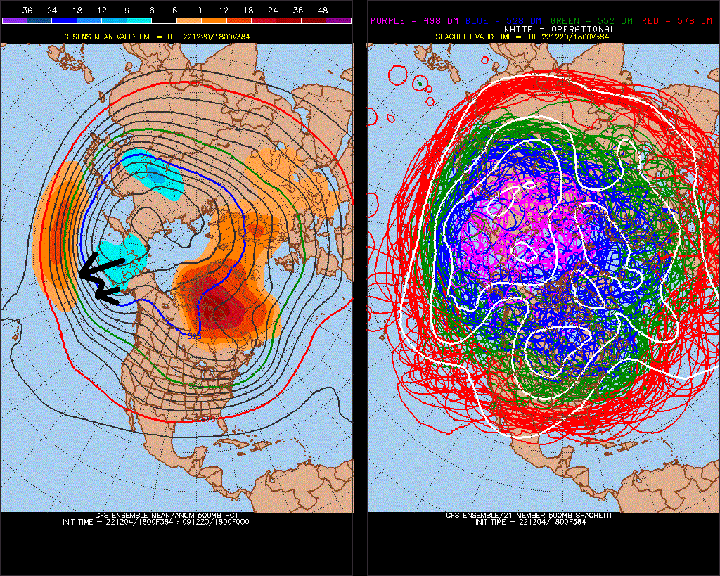
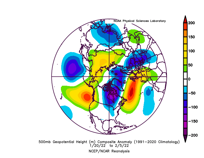
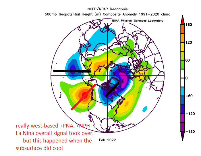
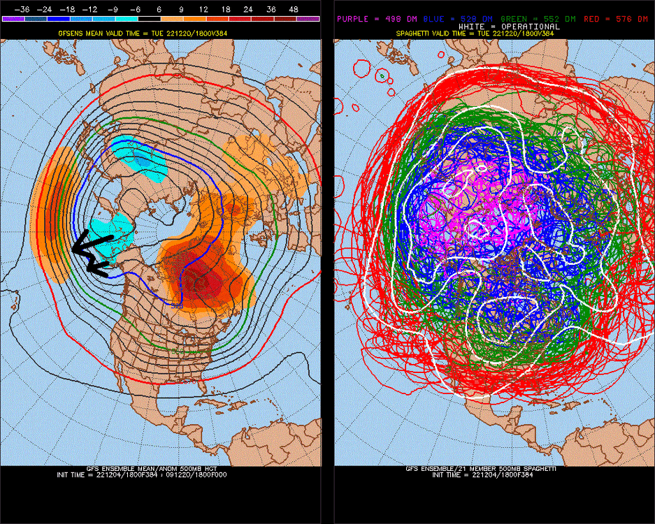
18z GFS had a 588dm ridge on the West coast. 12z GEFS had nothing at all. With this subsurface-ENSO configuration, we aren't going to see a west-based -PNA in Jan and Feb, like we are seeing now in Dec. Jan 500mb could be similar to last year.

-
2021-2022 ENSO
Stormchaserchuck1 replied to StormchaserChuck!'s topic in Weather Forecasting and Discussion
Yeah it seems like we are building up a lot of potential energy.. that's all maybe -
2021-2022 ENSO
Stormchaserchuck1 replied to StormchaserChuck!'s topic in Weather Forecasting and Discussion
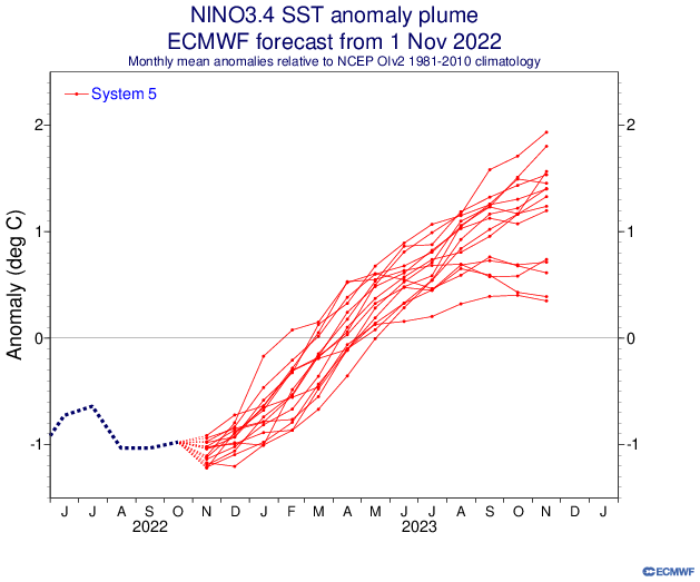
>+7f hitting 180W now.. they sometimes look like this before Strong Nino's but it's December.. 12/5. atmosphere seems to consider Jan-Mar in the subsurface historically. I think I found it was like 3-1-3 before then.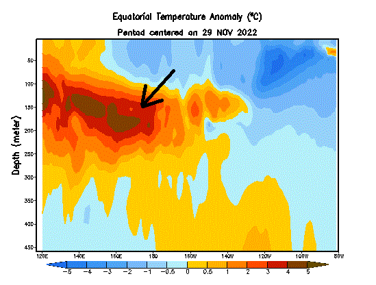
-
2021-2022 ENSO
Stormchaserchuck1 replied to StormchaserChuck!'s topic in Weather Forecasting and Discussion
^Same as last year though. (Subsurface)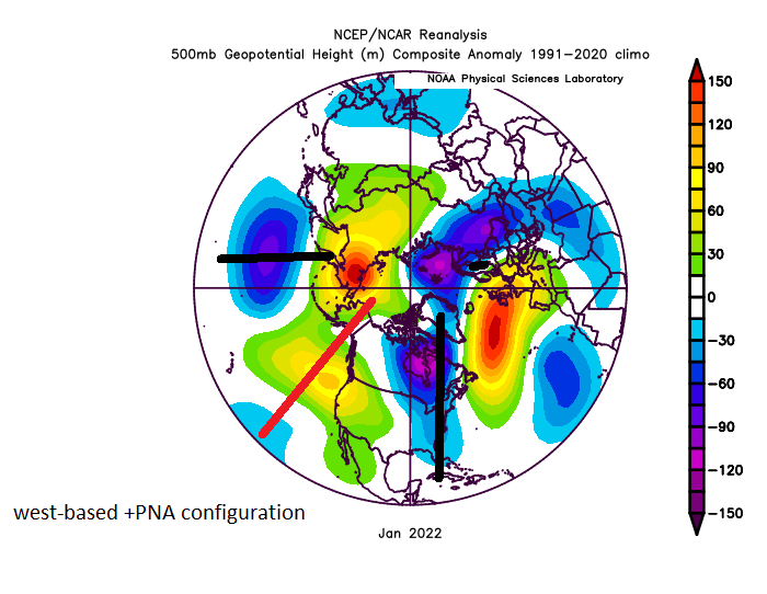

-
2021-2022 ENSO
Stormchaserchuck1 replied to StormchaserChuck!'s topic in Weather Forecasting and Discussion
^Same as last year though.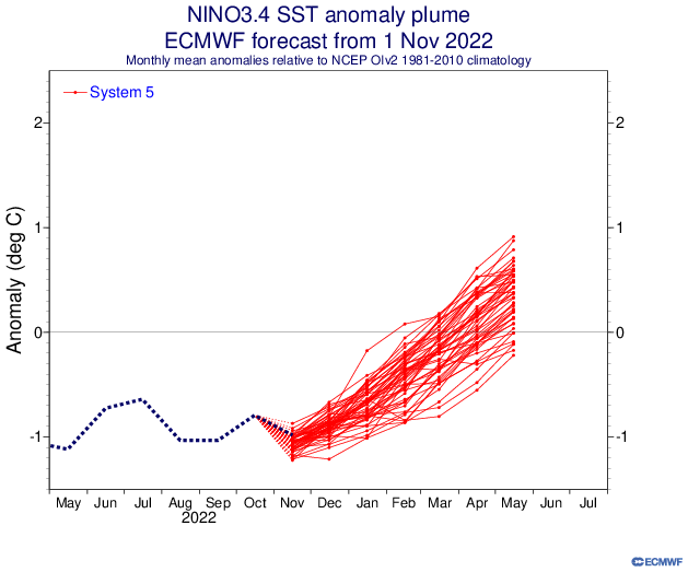
-
Analogs for Dec 21-29 +PNA (snow) are: 2005, 2002, 2001, 1995, 1975, 1973, 1963*, 1952, 1950.
-
Analogs I am coming up with for Dec 20-24 are: 2005, 2002, 2001, 1995, 1975, 1973, 1963*, 1952, 1950. (Dec 20-24 is rigid, make it Dec 16-29 those years). 1) Dec 21-29+PNA, 2) Dec 10-20-NAO
-
Poor DT. When the PNA is negative, and has been in that phase for >20 days in December, our odds for snowfall are significantly low. Especially since it's technically not Winter yet. Dec 20-24 is our window.
-
Does don or anyone know what NYC snowfall is like, coming out of a 4SD -NAO? Better yet, what happens, when that rise is associated with a positive PNA/or GOA low as I think we are going to reverse thisv. could make a window a few days before Christmas


-
Reversing last years conditions
Stormchaserchuck1 replied to Stormchaserchuck1's topic in Weather Forecasting and Discussion
-
Thanks. Here's the thread
-
Could be a white Christmas.. as lifting out of strong -NAO and +PNA is very happy historically. Could be a 10"+
-
-NAO rebuilds while strongly negative on models 3 times. v 384hr is +400dm still. Dec 21-24 looks like the window per 18z GFS ensembles. (PNA should be positive then too.. could be a big one)
-
Pretty nice +PNA coming up Dec 19-29.. don't expect snow before then imo 1-year reverse correlation has been running <-0.50, and this one is extreme..