-
Posts
3,173 -
Joined
-
Last visited
Content Type
Profiles
Blogs
Forums
American Weather
Media Demo
Store
Gallery
Everything posted by Stormchaserchuck1
-
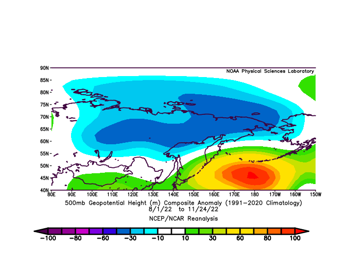
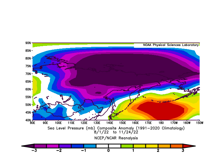
I like the -AO that's been building, especially over Russia, since August.
-
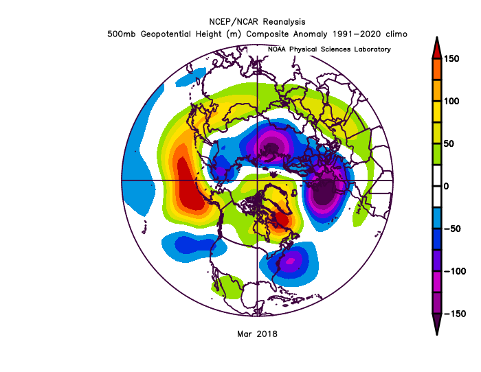
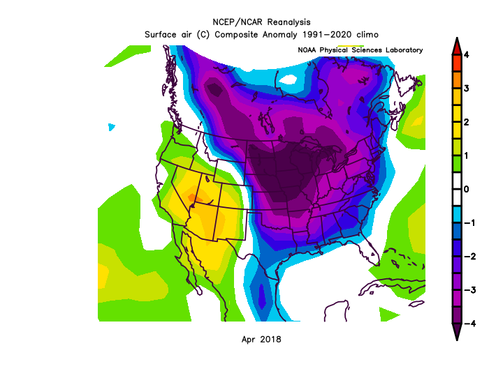
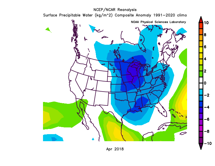
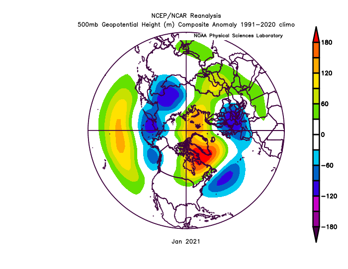
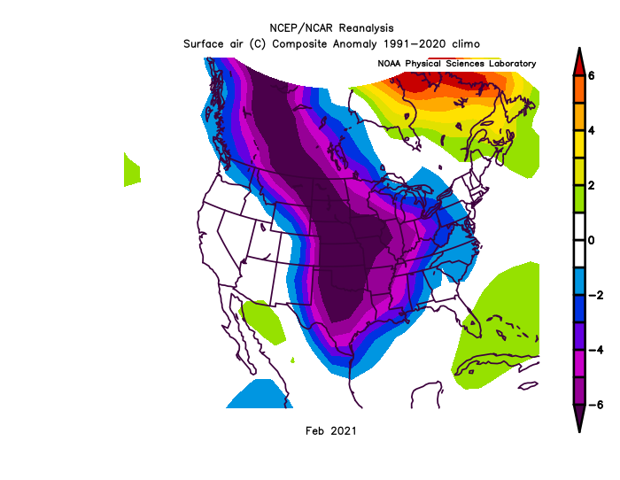
It doesn't snow when the PNA is moderate to strongly negative recently, that's our worse pattern, even with >2SD -NAO. MR/LR pattern reminds me a lot of March 2018: Good news is it was followed by a cooler April. Let's see what happens. Second recent case of -PNA, -NAO was Jan 2021 cold again followed that's it since 2013.. as far as analogs go.
-
-
Looks like it's turning positive. Reminds me of 09-10 actually.
-
-

Fall/Winter Banter - Football, Basketball, Snowball?
Stormchaserchuck1 replied to John1122's topic in Tennessee Valley
0 for Atlanta the whole year. -

Fall/Winter Banter - Football, Basketball, Snowball?
Stormchaserchuck1 replied to John1122's topic in Tennessee Valley
ACCESS TO PR/OT -

Fall/Winter Banter - Football, Basketball, Snowball?
Stormchaserchuck1 replied to John1122's topic in Tennessee Valley
Weak Went through a 4-5 year dark period here -
-
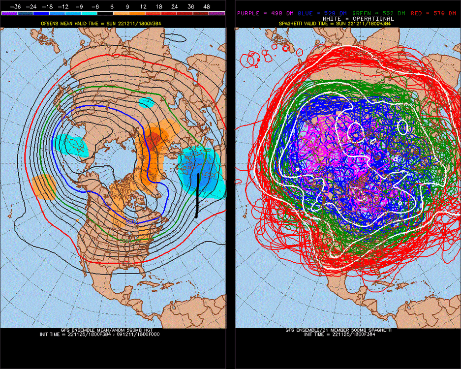
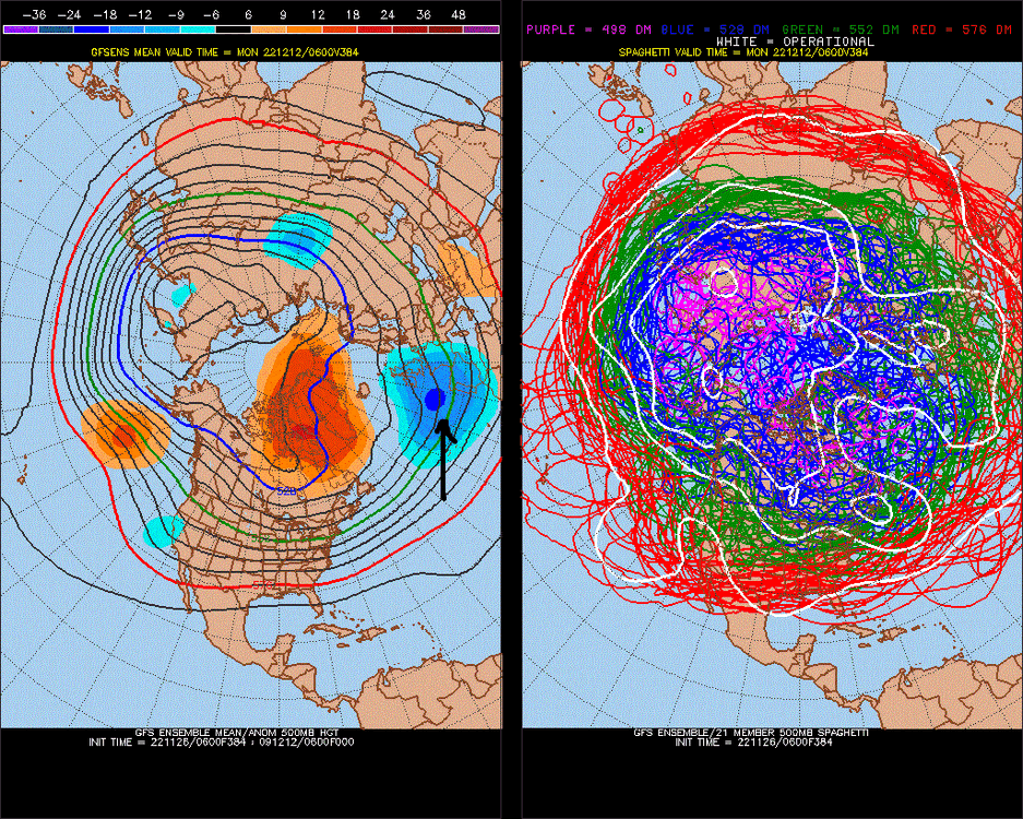
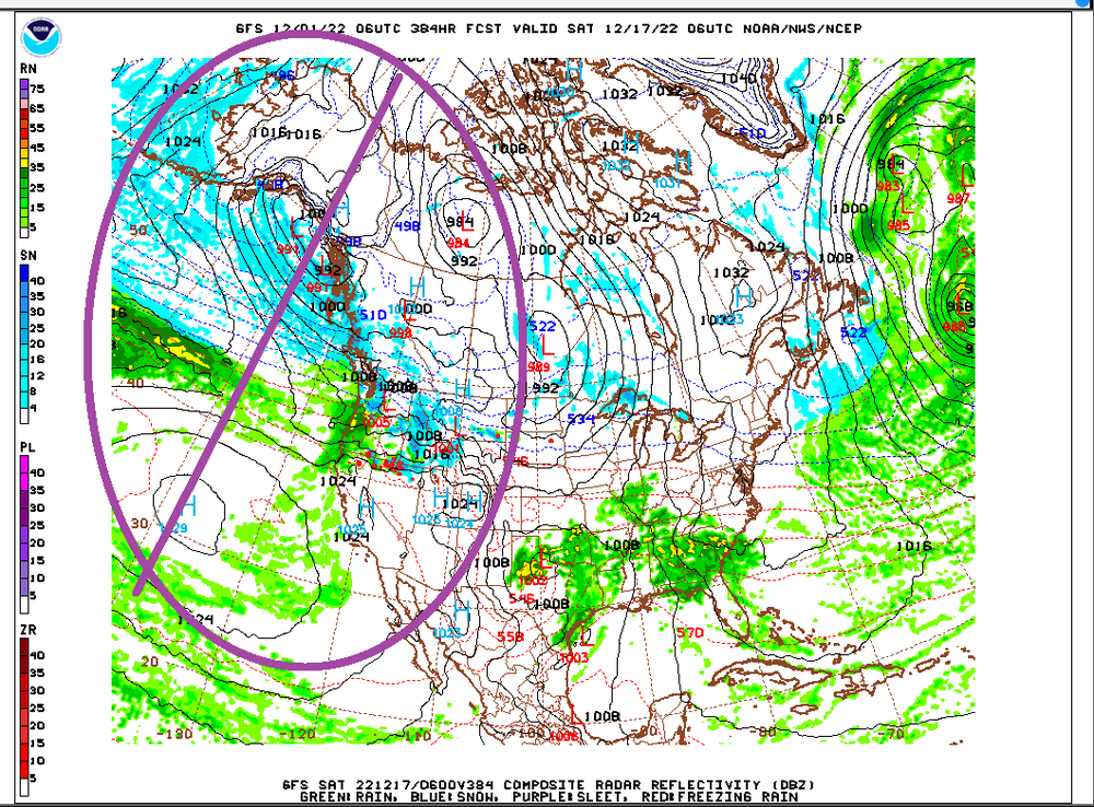
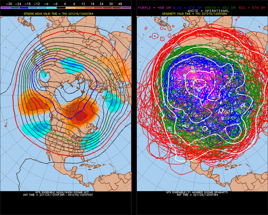
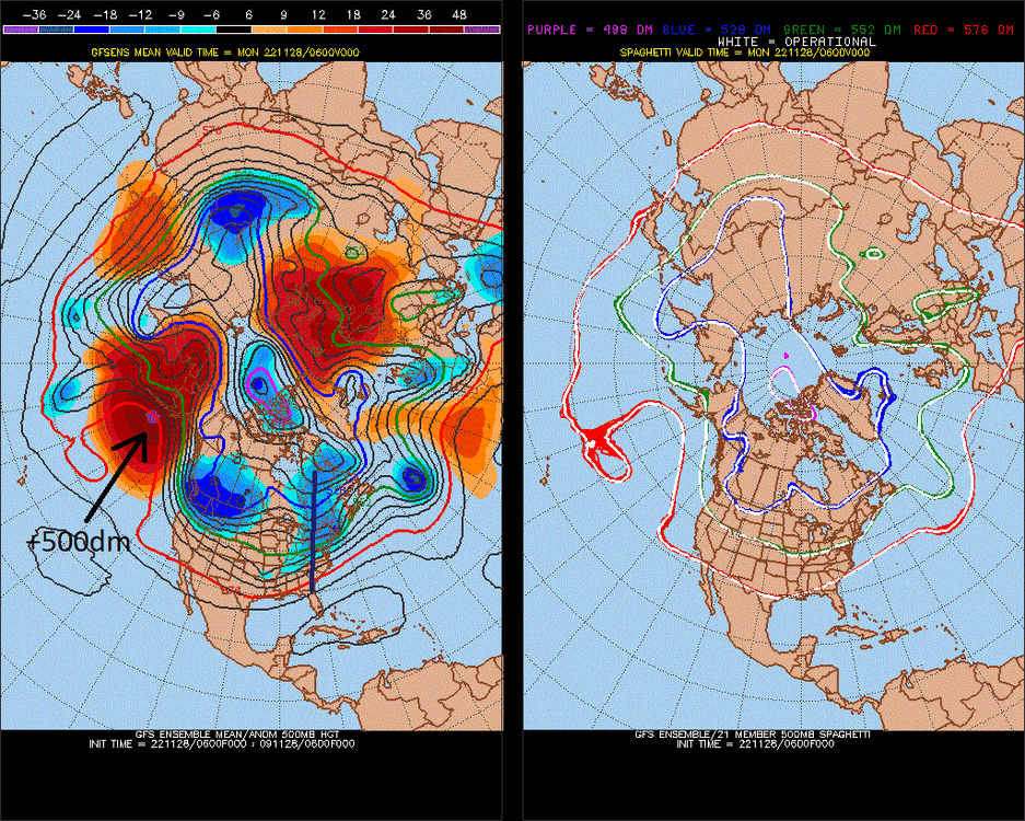
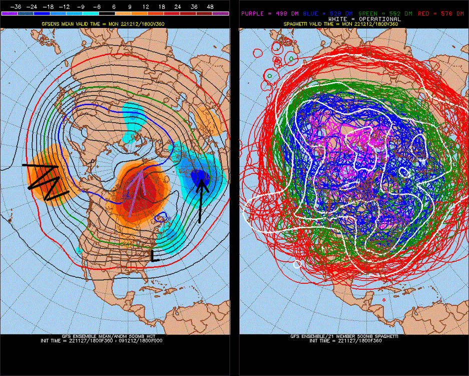
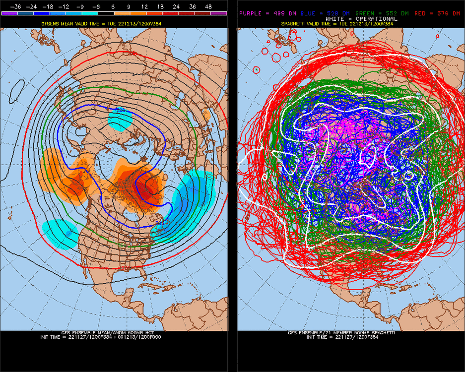
Coming out of west-based strong -NAO block. In real time, I have seen this go for 5/5 in the last 5 times, and it's ~80-90% in the longer term (after the fact/theorized) we get a big storm,or close to it, as the west-based -NAO block is lifting out. ^-NPH (east Pacific) developing on this 384hr model, and I have done research showing a 0.80-0.90 correlation jump with +/- anomalies at 40-45N recently(minus indexes) ,in unlikely areas, jumping to key regions (PNA). Our best pattern for snow on the east coast is a Gulf of Alaska low pressure. ^italics I think this favors a neutral or +PNA in that time. Could be a good mixture for a big snowstorm. That +400dm+ -NAO lifting out has been really strong correlation-indicator in real time.
-
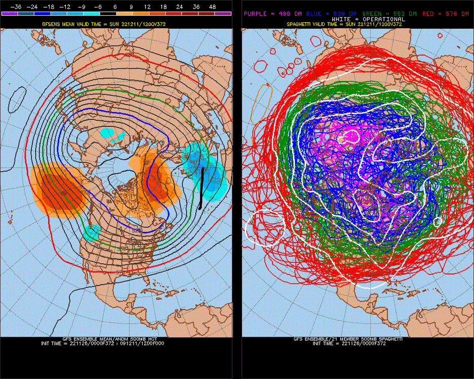
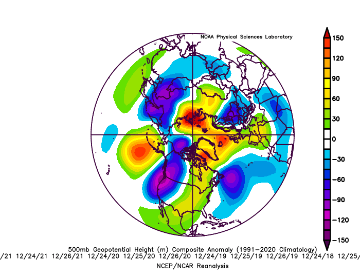
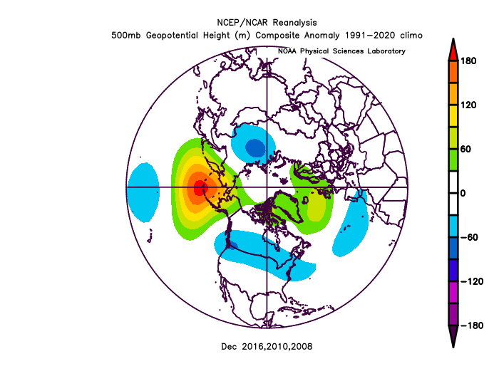
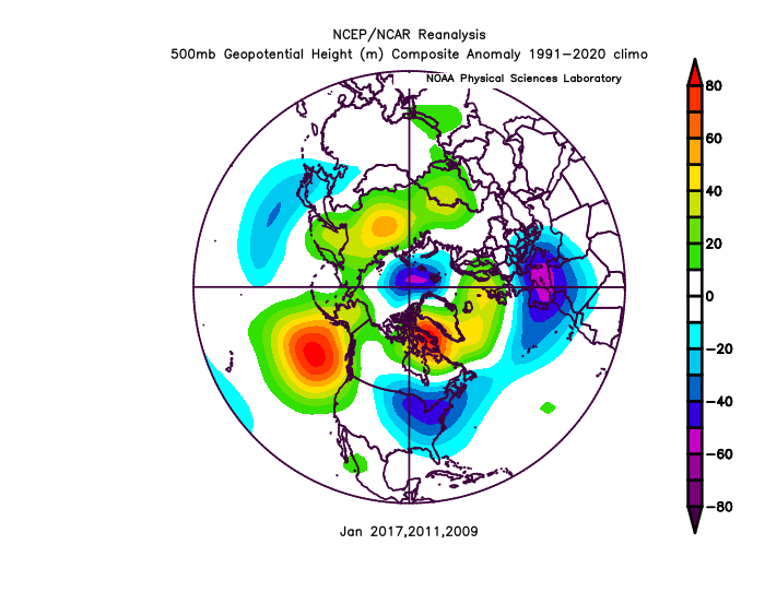
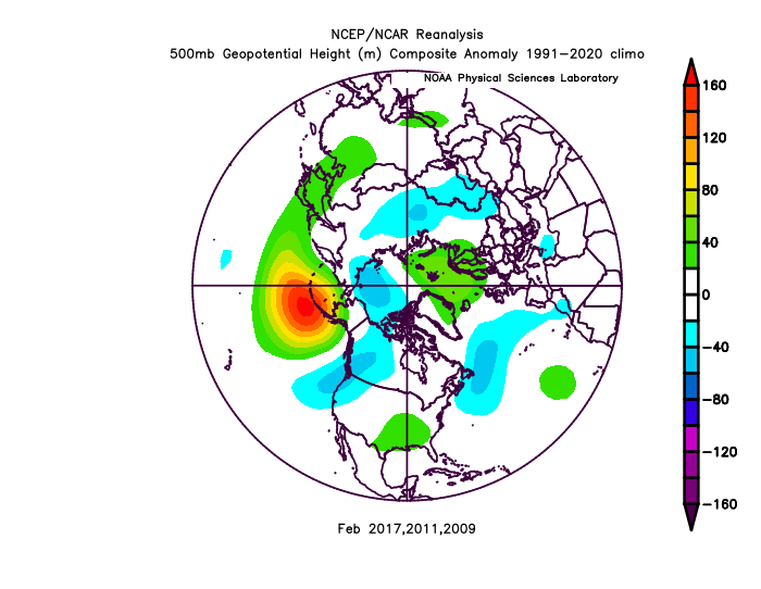
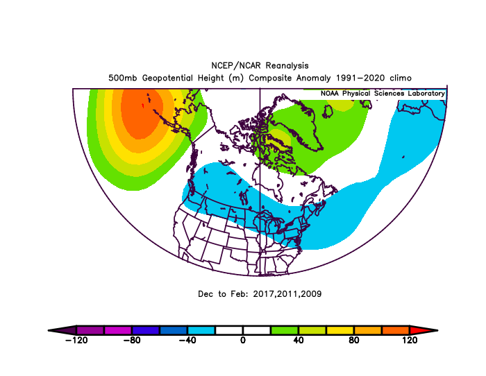
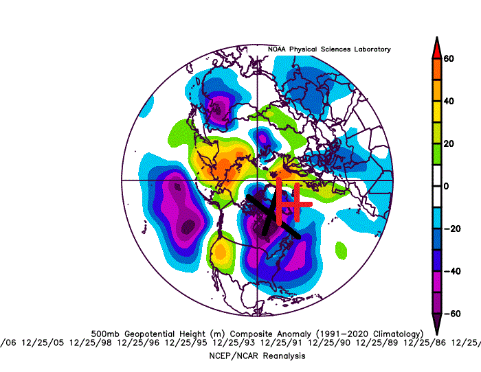
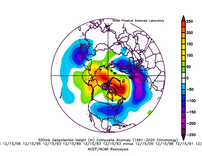
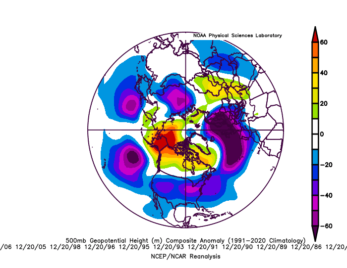
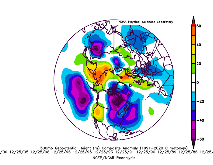
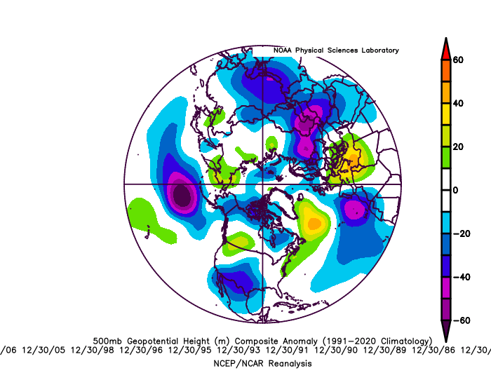
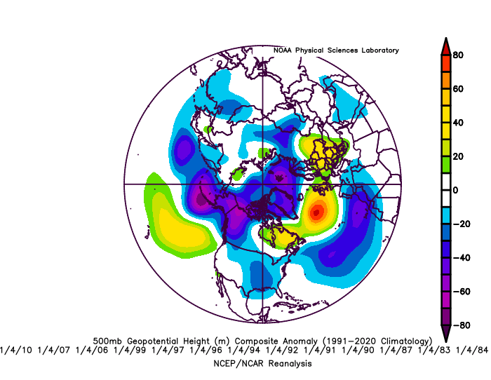
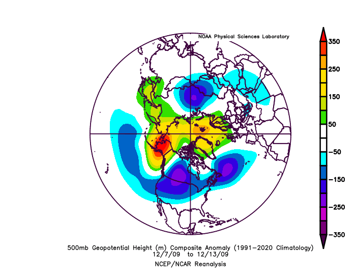
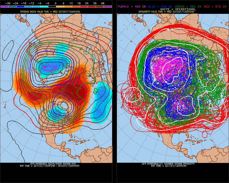
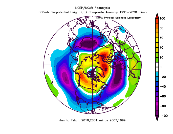
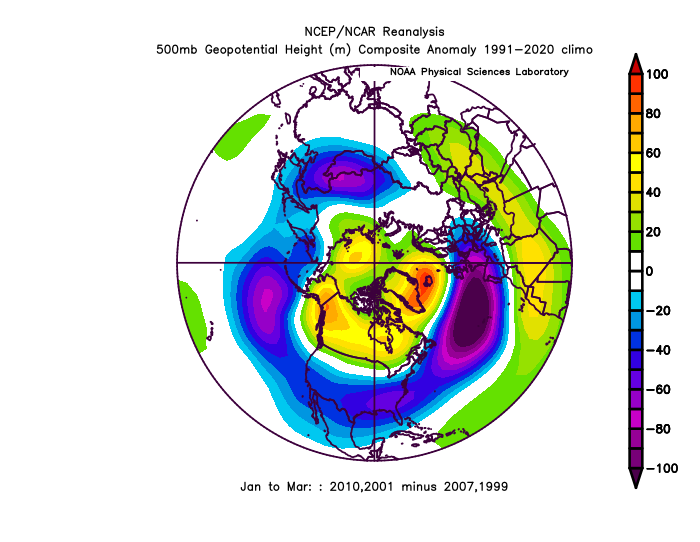
Locked. I was posting too much consecutively, thirsting for discussion. I just get excited. The last time we had a -AO like what's being advertised on models Dec 7-13 is 2009: Here are the broader analogs: My 45N theorum This is even before I hypothesize we transition into +PNA (or much less -pna) Dec 15 Anyway, then 1989 is the next best analog. That had a much different outcome thereafter, 35 years ago. (87, 85, 83, 81 -ao matches.. let's see what happens) 2016, 2017 were liter -AO matches Dec 7-13, and these went heavy -PNA Jan/Feb
-
It's been a long time since 45N has been consistently below normal. This has shown up several consecutive models runs now. (+4 more model runs, going back to yesterday) We have been, since 2019, reversing the Pacific and Atlantic at -0.70 correlation(record) I think the cold showing up in western Europe in +15-16D will translate to a favorable Pacific (+PNA(not -NAO)) in 20 days. We have had a -NAO on Christmas +4 days every year since 2017, and 7/8 years since 2014. This has been an anomaly in the midst of a very +NAO time. Laws of waves and averages gives us a 80% chance of having NAO negative Dec 21-28 this year. This means that with a favorable Pacific, the Atlantic will be at least not be against us. (I predict a 4-8" storm in the MA (average for Dec is 3") and a general snowy/cold time ~Dec 15-29/30.) [PNA may move more negative around Christmas when the NAO tendency dips negative]



.thumb.gif.c75f0c65c522d1066e3a79a21fdc0a73.gif)
.thumb.gif.18ca6de6c6a5b5ae030c96779294ce64.gif)

.thumb.gif.ef4b155694e9de65986583541243fd67.gif)
.thumb.gif.9068f0fe51d06d88672755230471152b.gif)
