-
Posts
3,183 -
Joined
-
Last visited
Content Type
Profiles
Blogs
Forums
American Weather
Media Demo
Store
Gallery
Everything posted by Stormchaserchuck1
-
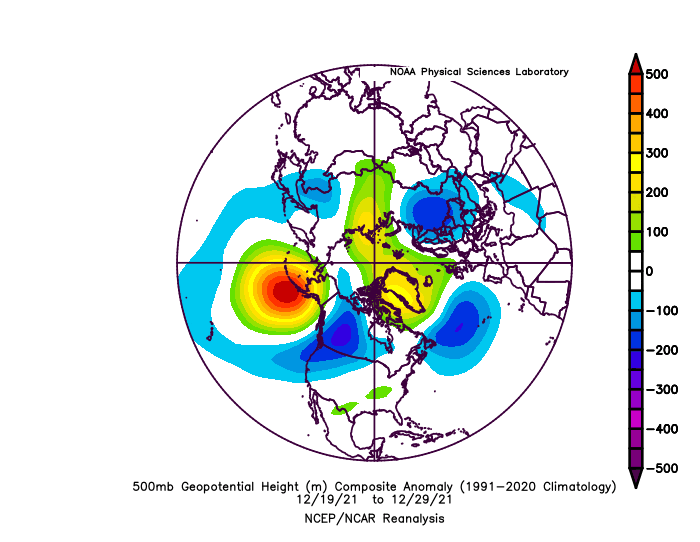
initial point actually fell apart somewhat.. as the -NAO (high pressure) dominates theory was >1.5x cold-sustained/-NAO condition in Europe/w. Atlantic was a difference maker 45N, but N. Atlantic high pressure completely filled in. I still think we will +PNA Dec19-29. Same idea pushed back a few days..
-
cramping my style
-
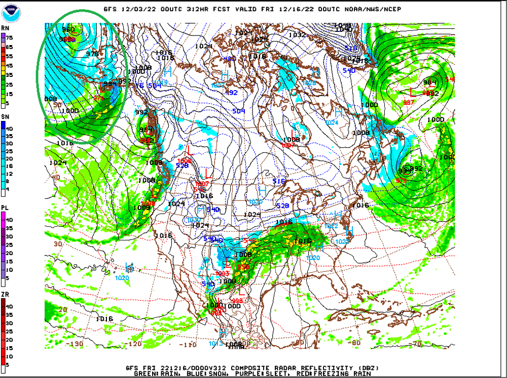
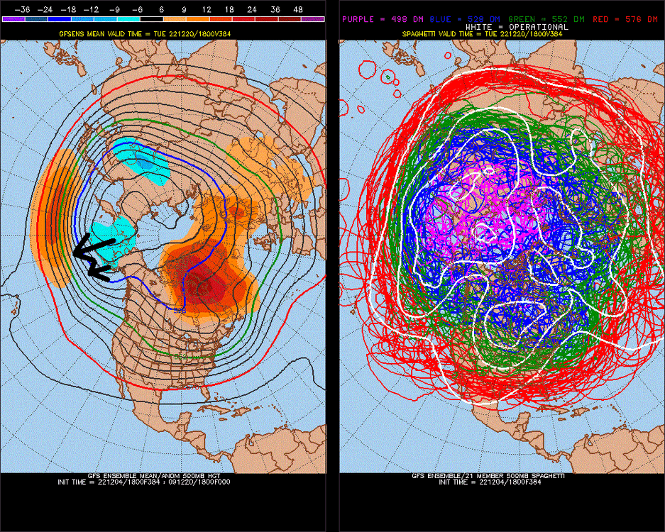
Future runs will trend warmer at 500mb in the MA/SE.. maybe even alot warmer. I've seen it 100 times before. (It's 100/100).. PNA region dominates. (days 5.75-10.75)
-
Someone is being stupid.. like to believe in an alternate reality- Space is thoughts. Why can't I bring them forward (because energy-weight isn't real?)
-
tick tock .. that's a greater signal pick-and-choose 1/every 10, in the roll forward +2 months. 00z GFS is running out to MR/LR now too.
-
Cliché I don't know that people see my research though, because you can probably make monetary gain from it , because it's simple work. It's a long time at this point for information blackout re: responses. (Can't do anything if you're saying STFU to my outside point from 30 minutes ago.) Not a big deal.. but it's weird. calculated and no science (the response times). it's about respect too.
-
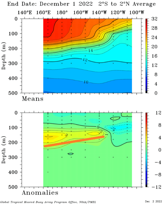
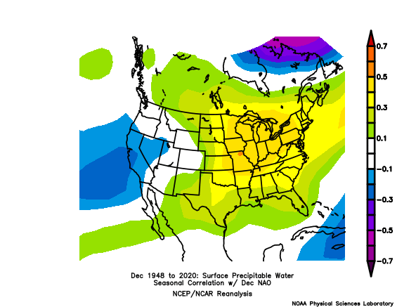
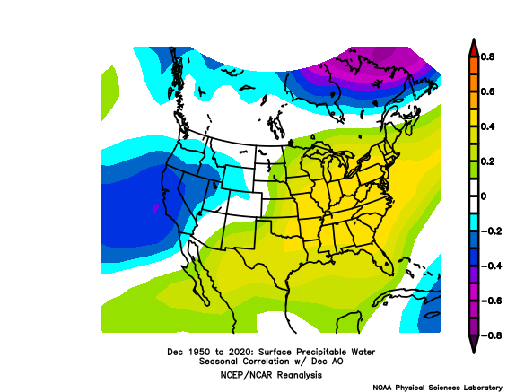
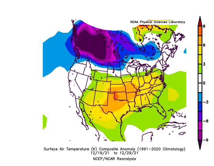
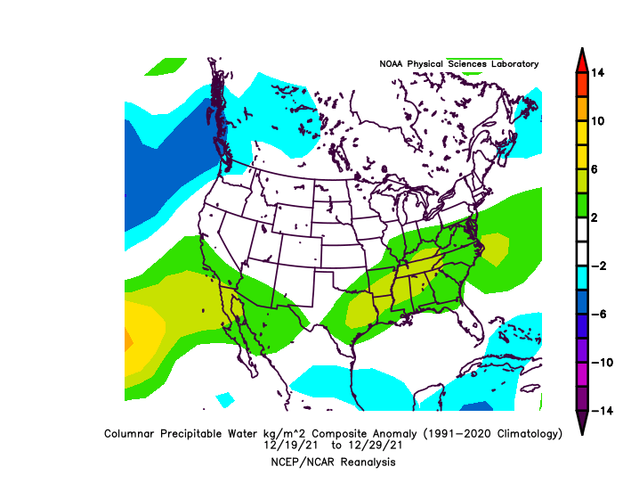
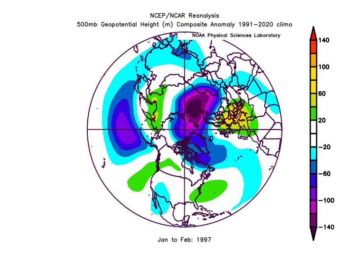
-NAO's in December have been historically dry. Not this one. 1996 was the only exception and the similarity is that there was warmth in the ENSO subsurface (before 1997 El Nino). do you see my other maps(before +time)? water, water everywhere but noone pays $1 for water Yeah I'm out bro
-
60 here.. nice High pressure-NAO, like always.
-
It seems like they are getting progressively "less uniform" (our last strong Nino 15-16 was followed by 6-7 years of -PNA )
-
I just think it's interesting.. watch it happen. I'd take a +NAO these days and in general. We are switching to a lower atmosphere pattern I think.
-
Yes.. maybe we will have -NAO all Winter.. could be the same to worse.. (I edited your post)
-
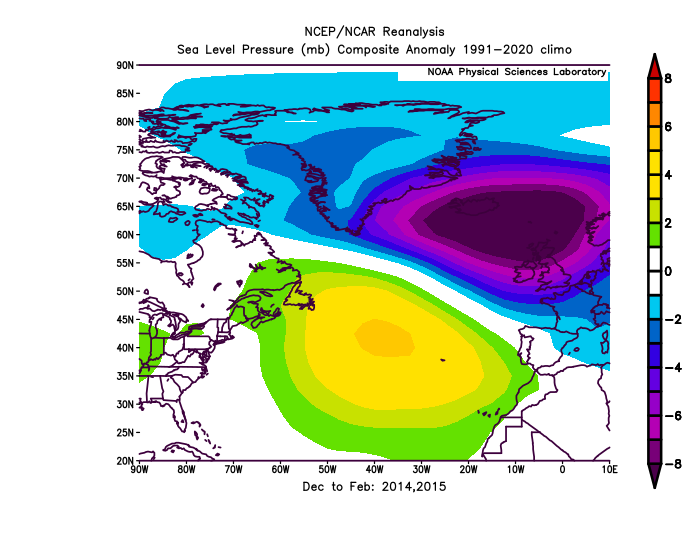
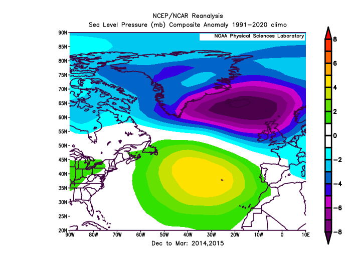
*If I can 1 more post this. It was Dec-Mar. A 0.40-0.50 correlation/above random for +NAO Jan-Mar, based on Dec -PNA, (since 1948, 75 analogs. top 20/75 analogs).
-
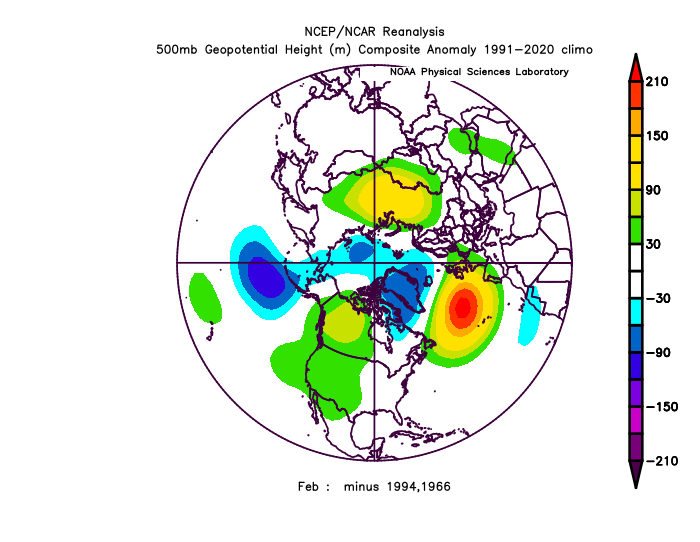
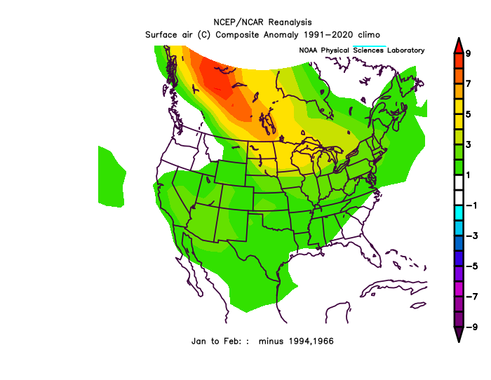
Check out my research from last Winter as to what a +PNA Dec means for the rest of the Winter. (last year was the #1 strongest PNA on record, per 500mb) 20 analogs, that came out at +100dm -PNA for, Jan and Feb! same 20 analogs came out ta a +70dm +NAO for Jan and Feb! The NAO is probably of more significance because same things correlate the same going forward, but the NAO is not so connected... so, if the PNA comes out like 18z GFS ensembles have, making it a top 5 Dec PNA on record, it's a strong +NAO, -PNA signal for Jan-Feb combined. That's just roll-forward, but I was surprised how well it worked out last year.. The +100/+70-2months dominated other things that were conflicting indicators in early January, like ENSO developments.
-
Notice how LR models skew reacts strongly to current conditions?
-
18z GFS ensembles looks really bad in the ER (extended range) day 15>beyond (trend)
-

2021-2022 ENSO
Stormchaserchuck1 replied to StormchaserChuck!'s topic in Weather Forecasting and Discussion
-
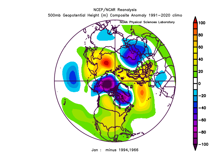
Yeah, the subsurface is really warm A lot of the analog roll forward I did gave us 50% chance of Nino next year, 25% Neutral, 25% Nina(it's like 10% because we are 0/7 in 4th year Nina's). We'll see, events have been getting depressed in general, defaulting to 1998- cold period (-PDO) base state. ^The mid-subsurface at -200m actually correlates directly with the 500mb N. Hemisphere pattern, and is a reason, I think why, we are so wet.
-
Importance of the PNA.. I keep harping on how big of a miss this is, because of how dry -NAO/-AO's typically are We are entering a very wet pattern at just the right time(NAO/AO), which is contrary to what's normal.
-
super positive.. #2 on record. 95-96 was after 6 straight +ENSO years 90-95 (record of this century +streak, also 89-90 and 96-97 were both -Neutral, but we didn't go La Nina 8/9 years (95-96 the exception) 89-98, which is also the longest streak of the last 200 years). After we were most negative ENSO 70-76, 76,77, 77-78, 78-79 were the coldest Winter's on record. 78-79 still ranks as #1.
-


.thumb.gif.3624aeba18b8ac0440762edb7d3e48bf.gif)



.thumb.gif.303acdfd256972cd0d4260c1d3c02746.gif)
