Stormchaserchuck1
-
Posts
3,114 -
Joined
-
Last visited
Content Type
Profiles
Blogs
Forums
American Weather
Media Demo
Store
Gallery
Everything posted by Stormchaserchuck1
-
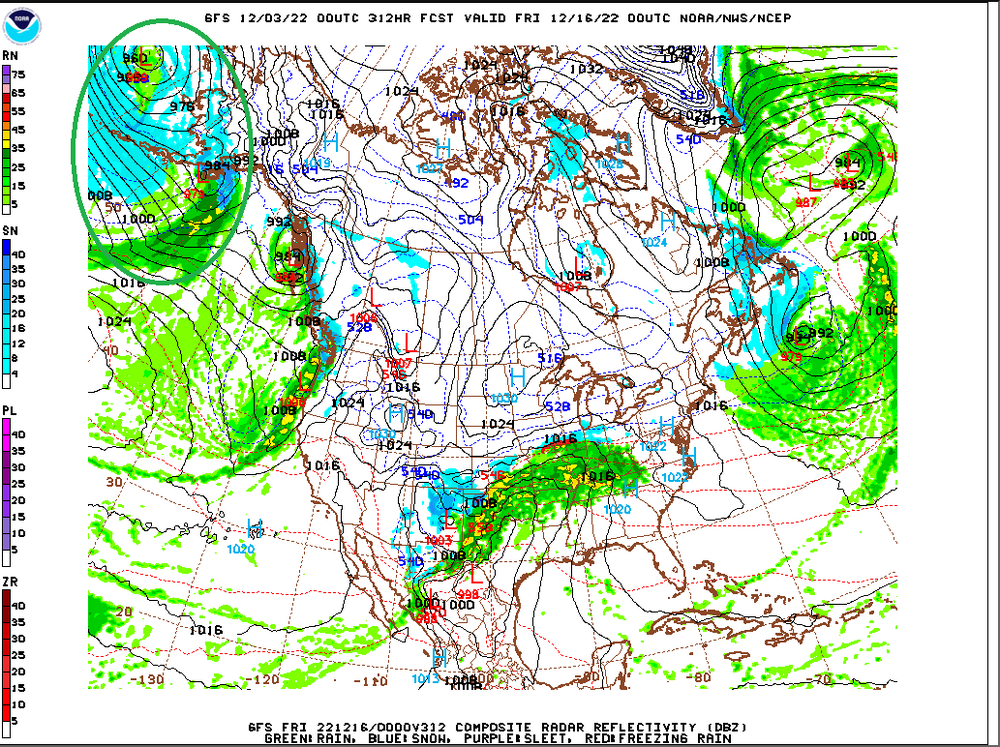
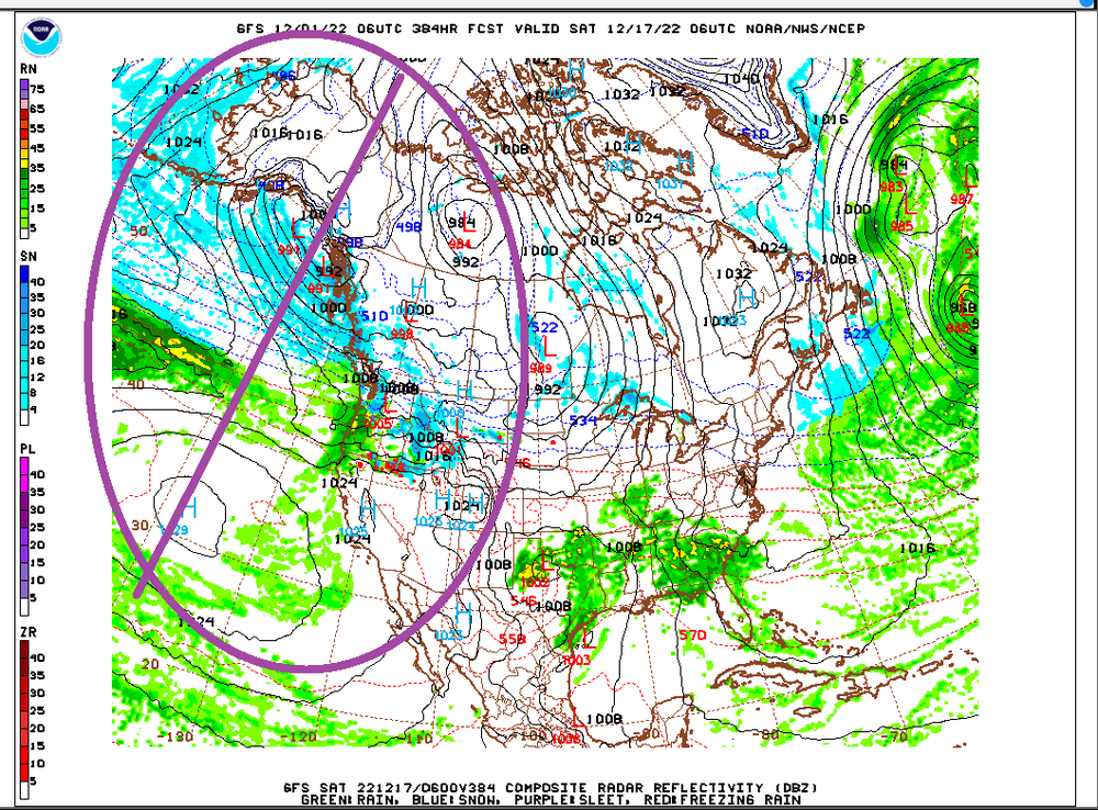
18z GFS ensembles looks really bad in the ER (extended range) day 15>beyond (trend)
-

2021-2022 ENSO
Stormchaserchuck1 replied to StormchaserChuck!'s topic in Weather Forecasting and Discussion
Wet pattern, El Nino STJ. ladada.thumb.gif.303acdfd256972cd0d4260c1d3c02746.gif)
-
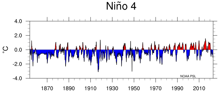
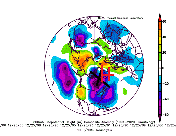
Yeah, the subsurface is really warm A lot of the analog roll forward I did gave us 50% chance of Nino next year, 25% Neutral, 25% Nina(it's like 10% because we are 0/7 in 4th year Nina's). We'll see, events have been getting depressed in general, defaulting to 1998- cold period (-PDO) base state. ^The mid-subsurface at -200m actually correlates directly with the 500mb N. Hemisphere pattern, and is a reason, I think why, we are so wet.

-
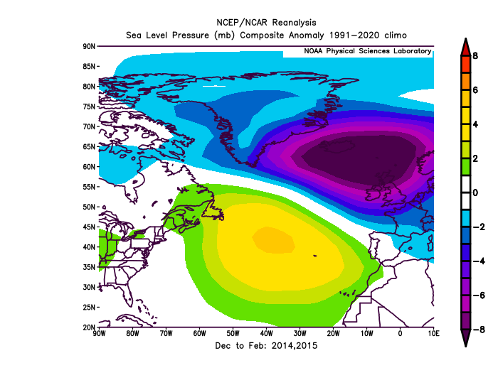
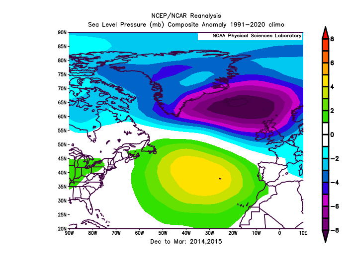
Importance of the PNA.. I keep harping on how big of a miss this is, because of how dry -NAO/-AO's typically are We are entering a very wet pattern at just the right time(NAO/AO), which is contrary to what's normal.
-
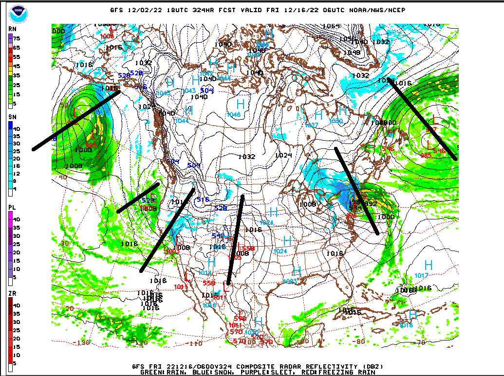
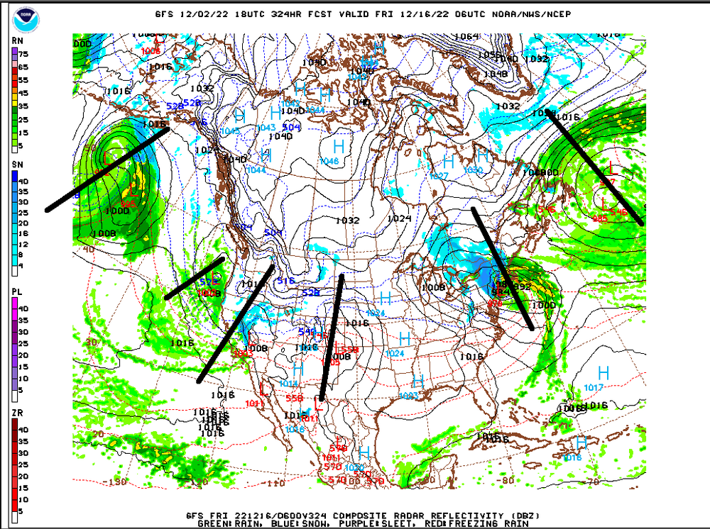
Here we go.. look at all this moisture
-
super positive.. #2 on record. 95-96 was after 6 straight +ENSO years 90-95 (record of this century +streak, also 89-90 and 96-97 were both -Neutral, but we didn't go La Nina 8/9 years (95-96 the exception) 89-98, which is also the longest streak of the last 200 years). After we were most negative ENSO 70-76, 76,77, 77-78, 78-79 were the coldest Winter's on record. 78-79 still ranks as #1.
-
Didn't you have 90" of snow those years? (I wasn't here)
-
2021-2022 ENSO
Stormchaserchuck1 replied to StormchaserChuck!'s topic in Weather Forecasting and Discussion
MacDonald and Case[24] reconstructed the PDO back to 993 using tree rings from California and Alberta. The index shows a 50–70 year periodicity but is a strong mode of variability only after 1800, a persistent negative phase occurring during medieval times (993–1300) which is consistent with La Niña conditions reconstructed in the tropical Pacific[25] and multi-century droughts in the South-West United States.[26] 0/7 I think 3rd year La Nina's going into the 4th year, since the 1800s.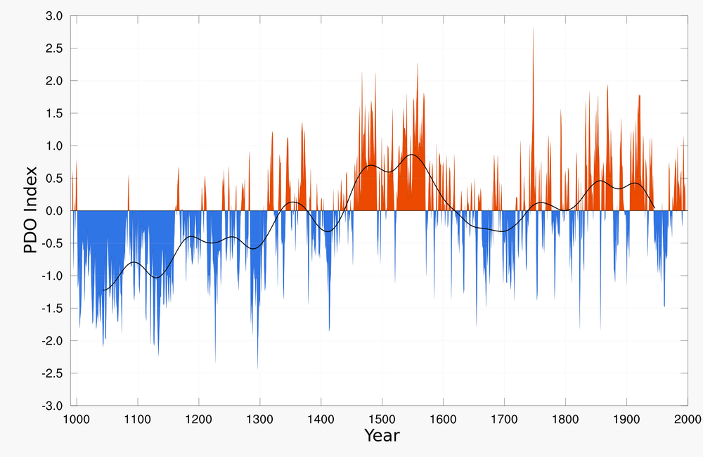
-
We can do it when ++NAO (13-14, 14-15, 92-93, 93-94). PNA is pretty untouchable.
-
-PNA is saturated now. http://www.meteo.psu.edu/fxg1/HEMI500/5dayloop.html Usually when it's switching from long term +PNA to -PNA, we can get colder, but not this time.. look forward to a rainy 15-20 days.
-
Look at this wave train Maybe someone could run stats on how it goes PNA negative/neutral, coming out of >4SD -NAO (rain/snow?). Because the moisture will be there.
-
STJ is really active for 10-12 days with retrograding NW Atlantic low.. probably all rain imo, pretty high confidence lock, but something we have not seen in a while(such a wet pattern).
-
2021-2022 ENSO
Stormchaserchuck1 replied to StormchaserChuck!'s topic in Weather Forecasting and Discussion
After our last two, only two, strong -PNA/-NAO's in long-wavelength season, since Jan 2013.. it gets cold (high pressure upper atmosphere lol)


-
2021-2022 ENSO
Stormchaserchuck1 replied to StormchaserChuck!'s topic in Weather Forecasting and Discussion
Can you believe this +5-7F subsurface cancels itself out in the global + wavepatterns? (little relevance)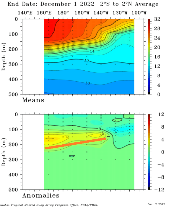
-
Pacific and Atlantic have been matching too, at -0.70 correlation. A 4-5SD -NAO is going to be 3SD -PNA (5-6SD -NAO is going to be a 4SD -PNA) (3SD -NAO is going to be a 2SD -PNA, 0time). No snow for us for a while, at least through 384hr.
-
STJ is actually really juicy
-
I'd go with no snow through 384hr.. Higher chances next December is +PNA, at least. lol
-
I like the -AO that's been building, especially over Russia, since August.
-
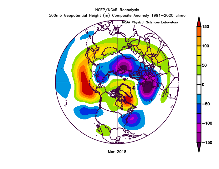
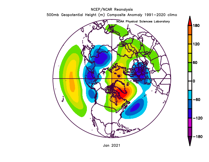
It doesn't snow when the PNA is moderate to strongly negative recently, that's our worse pattern, even with >2SD -NAO. MR/LR pattern reminds me a lot of March 2018: Good news is it was followed by a cooler April. Let's see what happens. Second recent case of -PNA, -NAO was Jan 2021 cold again followed that's it since 2013.. as far as analogs go.


-
The last 3 +QBO/La Nina Winter's have been -NAO December seems to be dominant/middle
-
Looks like it's turning positive. Reminds me of 09-10 actually.
-
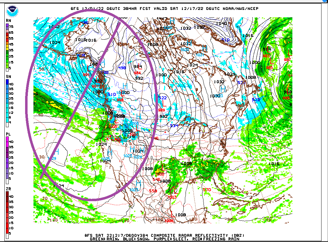
Look at how wet the Pacific got at hr384 6z
-
Look how wet the Pacific/STJ is at the end of this run.

-
Fall/Winter Banter - Football, Basketball, Snowball?
Stormchaserchuck1 replied to John1122's topic in Tennessee Valley
0 for Atlanta the whole year. -
NAO has been negative on Christmas last 7/8 years by +100dm> , while the Dec-Mar average NAO for the period is -60dm-median-average. (since 2013/4) You can throw out this +NAO signal
.gif.56b9ae1956e25b41068092b362587a8d.gif)