

Stormchaserchuck1
-
Posts
3,294 -
Joined
-
Last visited
Content Type
Profiles
Blogs
Forums
American Weather
Media Demo
Store
Gallery
Everything posted by Stormchaserchuck1
-
You guys aren't going to like the -PDO after the next 15 or so days.. last monthly reading was -2.54. There is a strong correlation Sept-Nov with the following Winter's conditions (more than random chance) so it could weaken after mid-July if we are going to see a good Winter, but it looks like re-strengthening -PDO should occur mid to late-July.
-

El Nino 2023-2024
Stormchaserchuck1 replied to George001's topic in Weather Forecasting and Discussion
-PDO should strengthen the next 15 or so days... -
QBO is almost negative already! 2023 12.50 9.80 10.93 12.89 9.26 0.72-999.90-999.90-999.90-999.90-999.90-999.90 https://www.cpc.ncep.noaa.gov/data/indices/qbo.u30.index Meaning it's probably going to be a solidly -QBO Winter.
-
2023 Mid-Atlantic Severe Wx Thread (General Discussion)
Stormchaserchuck1 replied to Kmlwx's topic in Mid Atlantic
Need to take a break from the rain, and build instability over several days if we are to see another good severe wx threat. -
I'll take that one. The way the pattern is flowing, I can envision tracking several storms that could be snow. Winter ridges are not supported by anything in the upper level pattern, and above average snowfall is favored, imo. -PNA's are getting sheared out on MR/LR models May-July. We just really missed it hardcore last year. The Nina was about as strong as it could get relative to global average rising temperature. It's a macro pattern though, favoring just one good track the whole Winter, i.e. smaller events are less likely. Everything seems to run as one unit globally, unlike times like 97-98, meaning a +PNA or GOA low should correlate to trough/storm. That's the pattern.
-
Raining again here. The 9th or 10th time in the last 2 weeks.
-
Mid to Long Range Discussion ~ 2023
Stormchaserchuck1 replied to buckeyefan1's topic in Southeastern States
-PNA may bring that SW ridge east through mid/late July. -
Models have been way below average lately, almost intentionally so: i.e: current conditions impact the long range at about a 0.75 correlation. Warmer or colder than forecasted day goes out to 11-15 day model at like 85-90%. Seems we are in a "sleeping phase" as a whole system.
-
Winter 2023-2024
Stormchaserchuck1 replied to Stormchaserchuck1's topic in Weather Forecasting and Discussion
Here is what I came up with.. https://ibb.co/qpJFFdh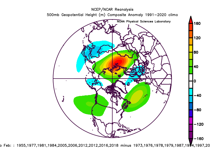
-
2023 Mid-Atlantic Severe Wx Thread (General Discussion)
Stormchaserchuck1 replied to Kmlwx's topic in Mid Atlantic
It kind of irks me that they always have predictability too low on Days 4-8 forecast. See a trough, and forecast out ahead of it.. They bust like crazy. Low risk is 15%, which rarely happens. -
Summer's have been relatively cool since year 2000.
-
How crazy! When I was a kid... the correlation only intensified.
-
2023 Atlantic Hurricane season
Stormchaserchuck1 replied to Stormchaserchuck1's topic in Tropical Headquarters
Our last El Nino Atlantic Hurricane season.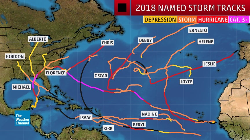
-
I always get hit in the Winter (north of Baltimore).
-
How about those -NAO extended ridges! We can't get an organic high pressure full rotation counter-clockwise over Greenland these days.
-
I've seen maybe 6-7" in the last 2 weeks.. El Nino is delivering here.
-
20 days till the hottest day of the year.. enjoy it.
-
I've noticed this, this year. There is a symmetry to the two atlantic storms- two east pacific storms, and that Cat 5. It seems the pattern is smoothing north, where 35N is the old 30N, as a macro pattern.
-
Winter 2023-2024
Stormchaserchuck1 replied to Stormchaserchuck1's topic in Weather Forecasting and Discussion
Natural Gas now down to 2.5 after rising from 2.1 to 2.7. It's price action similar to what it was '96-00. Russia remains colder than average.. through July on LR models. So Apr 2022- July 2023 (15 months): Research shows that the next 12+ months features to even out (warmer than average Russia). So DJF would be a composite of warmer than average Russia at like 0.25-30 correlation (I'll run the map when I have time). -
Pretty significant pattern change coming up in 4-5 days..
-
I don't see why not. The NAO is negatively correlating, that's the only difference (-nao is correlating with +EPO/-PNA, +nao is better overall for snowfall). This started in the -PNA extremes after Dec 2010.
-
Can someone clarify, did Boston see 2" of snowfall Dec-Feb 18-19, or 17-18? I think that and last years snowfall along the coast are two strong plot points for current movement, on the "less" side of possibilities. (I feel Boston has some kind of block around legit extreme snowfall, re: global warming trend at this time. It could snow, but then be followed by warm days.)
-
I don't know about that.. maybe people are biased to their personal experiences. Everything about the society seems to "even out".
-
Spring/Summer Mid-Long Term Discussion
Stormchaserchuck1 replied to John1122's topic in Tennessee Valley
-PNA looks to be a constant around Day 5-15+. I have noticed tremendous low model skill vs course correcting a lot in current conditions. When that SE ridge potentially pops in 5 days, and if we get warmer, watch for a trend warmer in the LR. -
We've seen 4 straight days of 90s across the area, with not much agreement in upper latitude pattern. -NAO now looks to persist next 10 days, this has correlated with extended ridge down the EC lately. The problem I have with 65-66 analog is the -NAO really dug into -PNA SE ridge, forcing trough. The NAO is not even in the same ballpark of pattern these days: we need pacific-forced cold, but a -nao may give us bigger storms to work with. Either way I think the STJ will be pretty juicy as the pattern is macro, Hard to imagine we get a lot of rainstorms if there is a Moderate+ Nino this Winter.


