

RU848789
-
Posts
4,002 -
Joined
-
Last visited
Content Type
Profiles
Blogs
Forums
American Weather
Media Demo
Store
Gallery
Everything posted by RU848789
-
Thanks, although wouldn't "all other cases" for Feb from 1975 to 2023 be about 1342 (28 days/Feb x 48 Feb's)?
-
Fantastic - you're the best! That's roughly a 60-80% enhancement for having those conditions in place. One last question: can you share how many cases there were in total (although I guess that's 10% of 28 days/yr x 48 yrs or 10% of 1344 or 134 days of 2" in total for example, but I can't tell the number of cases for the specific conditions) and for the specific conditions and is this for NYC?
-
The details don't really matter here, as those will change hugely in coming days - it's just cool to see a significant threat possibly (we all know this may disappear or fizzle) on the table to kick off the pattern change.
-
Climo is only about 10-11" from the 2nd half of Feb onwards, so ~13" more isn't a ridiculous amount if this pattern ends up being as productive as many think it will be - not talking historic amounts, but certainly a few to several inches above climo doesn't seem crazy. We'll see soon, of course...
-
Thanks for confirming those were temps in those regimes and that it was a typo on the PNA. Too bad there's not snow data for those regimes, since 95% of the poster on these boards are snow hounds and the $64K question for all of them is, what level of confidence do we have that the coming pattern will actually deliver at least normal snowfall, if not well above average snowfall and maybe even a KU storm. In their backyards. Will be interesting to watch it all unfold...
-
Nick never said 15-23" more snow is coming. 15-23" was his winter forecast for NYC Metro (and the 95 corridor from Philly to CT, as per his map) and he's saying there's the potential for another ~15" of snow this winter and since most of that area has seen 2-8" of snow that would bring that area into his 15-23" seasonal forecast. https://www.fox5ny.com/news/nyc-2024-mid-winter-forecast
-
Don - thanks, although I'm not 100% sure what your table is showing. Is that monthly average temp for both cities under the teleconnection/MJO conditions specified? If so, clearly those conditions lead to significantly colder temps (typically a >2F departure from the overall mean puts one into "colder than normal"). Also, is that supposed to be PNA+, not PNA-? And lastly, any data on snowfall under these conditions relative to normal? I would guess snowier than normal or else people wouldn't get so excited when patterns featuring these conditions develop, as it looks like they will soon. Thanks again. Also, it's amazing what data you're able to find and put together - it's like you have access to a database for all weather data from every city in a way that allows easy data extraction from queries - does that actually exist (and is it available to all)?
-
But I want it now! Just kidding, that was my Veruca Salt imitation from Wonka. Don't sweat it too much, was hoping that might be something you wouldn't have to work too hard to get - but thanks, in advance, for anything you can find.
-
Does there exist, anywhere, data on what a pattern like what is being forecast (generally, i.e., at least -AO/-NAO/-EPO/+PNA and MJO in 8/1) might typically produce in winter in, say, the NE or maybe at least NYC Metro, especially in January and February? I know not all patterns are the same (ENSO state being a big variable), but just looking for whether anyone has done the work to determine this. Personally, I've tracked about 8 fairly similar patterns since 2016 and saw that all 8 verified for colder than normal temps and 5 verified for snowier than normal outcomes (one would expect random guessing to verify 2-3 out of 8) for the 2-3 week periods I was following (did this for New Brunswick and vs. above/normal/below for those two parameters vs. all seasons for the period in question), but that's a fairly small sample size and I didn't rigorously track the teleconnections beyond what was forecast about 8-10 days out. Would be cool to have a much larger, more accurate dataset to have some idea of the confidence of a pattern like this actually producing snow, in particular. @donsutherland1- any chance something like that exists? If anyone would know, I think it would be you...
-
Not sure - at least on Pivotal, the weeklies are still only showing the twice a week runs - I thought maybe the rollout was delayed...
-
Stumbled across this, from ECMWF, which I think people will like. Sounds like the increase in horizontal resolution of the ensemble forecast to the same resolution used in the operational model means there is no lower resolution "control" any more (meaning the "control" will now be the op), which has always been a bit of an issue. But the coolest part was seeing that the extended range ensemble will now run daily out to day 46 with 100 ensemble members; no more "weeklies." The fact that it'll run at 0Z will affect the sleep patterns of millions of weenies worldwide. In 2023 we will see a major upgrade to our forecasting system. The key change will be a significant increase in the horizontal resolution of our medium-range ensemble forecasts from 18 km to 9 km, bringing the 50‑member ensemble to the same level as our current high-resolution forecast. Cycle 48r1 will also bring a major upgrade to the configuration of the extended-range ensemble. Rather than being an extension of the medium-range forecasts starting twice a week at day 15, it will be a completely separate system, running daily from 00 UTC out to day 46 with 100 members. Cycle 48r1 will be the first ECMWF forecast upgrade to be produced in our new data centre in Bologna, Italy. https://www.ecmwf.int/en/about/media-centre/focus/2022/global-numerical-modelling-heart-ecmwfs-forecasts#:~:text=For example%2C ECMWF's high-resolution,the first operational weather forecasts.
-
Hence my comment that it's probably a fantasy...
-
And the GFS remains alone...
-
This may wake a few folks up - probably a fantasy (and ratios would likely be bad for part one during the day on Sunday), but it's why we track, lol...
-
Yeah, they slammed the door pretty hard on the hopes raised by the NAM and a bit by the GFS, although at this point, we can't know the outcome yet - but it sure would've been nice if we saw at least some consensus on a colder solution.
-
Don - do you (or Walt or anyone else) know if the NBM continuously updates its maps (like snowfall, precip, etc.) as each model output is received, since the outputs come out for a suite over 3+ hours? I haven't notice it change much, though, during that time for past events and I can't imagine they have an "advance copy" of the output hours before we do.
-
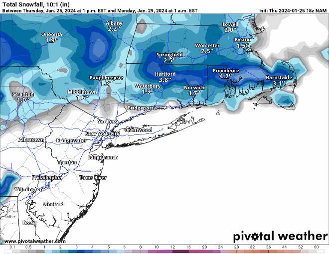
It's the NAM just about past the end of its useful range, but still an impressive shift SE in snowfall shield, so maybe a ray of hope for 95/coast... And here's the graphic through the end of the run.
-
CMC is pretty good too and it's nice that, as modeled by both the Euro and CMC, most of the precip falls Sunday evening/overnight into early Monday, so at least indirect sunlight wouldn't be an issue.
-
Given that this is the NYC Metro forum, I wonder if a better question is where is the best place to live within reasonable driving/train distance from NYC and I'll go with 35 miles from Central Park as a somewhat arbitrary cutoff, since that distance generally means you're probably within a 1-hour commute (on a good day and not from all locations within 35 miles). If that were the criterion, I might have to go with West Milford in NW Passaic County, the NW part of which is at about 1000 feet in elevation and about 34 miles NW of CPK, so it'll get elevation-driven snows as well as still not being too far NW to miss on most coastals (unlike the Poconos which can miss on those). I live about 27 miles SW of CPK, right on the 95 corridor and generally get very similar snowfall as CPK, except in very borderline events like the past few, where the UHI can really hurt CPK or latitude can hurt like the last one (we have 7.3" to 2.3" for CPK, which still sounds a bit low to me). As much as I'd love more snow, this is where friends and family are, so moving is doubtful.
-
Thought I posted this hours ago, but somehow I didn't post it here but did elsewhere (I post too many places during storms, lol). After shoveling then relaxing some, I went back outside to go run some errands and we had about 0.1" of new snow on the board, cars, etc., which must've fallen after dark, so my total is now up to 2.9" and our season total is up to 7.3". Every tenth helps, lol. Temp down to 27F. I also calculated my snow:liquid ratio for the first time ever (used a roughly 11x11" square section I melted down) got 17.6" of snow per 1" of liquid. I was guessing it was around 15-17, so 17.6 is believable. That means I only had 0.16" of liquid equivalent per 2.9" of snow depth. Just imagine if we had gotten the 0.3-0.4" of precipitation we were looking at on some models 2 days ago and had those ratios - would've been at least 6" of snow on the ground. Damn.
-
I also calculated my snow:liquid ratio for the first time ever (used a roughly 11x11" square section I melted down) got 17.6" of snow per 1" of liquid. I was guessing it was around 15-17, so 17.6 is believable. That means I only had 0.16" of liquid equivalent per 2.9" of snow depth. Just imagine if we had gotten the 0.3-0.4" of precipitation we were looking at on some models 2 days ago and had those ratios - would've been at least 6" of snow on the ground. Damn.
-
Forgot to post this. After shoveling then relaxing some, I went back outside to go run some errands and we had about 0.1" of new snow on the board, cars, etc., which must've fallen after dark, so my total is now up to 2.9" and our season total is up to 7.3". Every tenth helps, lol. Driving around Metuchen, Edison and South Plainfield, all of the county roads seemed to be in good shape, but some of the lightly traveled residential streets were icy in spots, so be careful out there. Temp down to 27F.
-
As of about 3:15 pm, the snow was definitely over and my final measurement was 2.8", which turns out to not be that far below my 3.3" prediction around noon yesterday, when the forecast was for 3-6", which I never really bought into since the models were generally showing 2-4" for us, so i went well below what was being forecast at that time. Still a bit on the high side relative to what we got, but then again, my guess is that 5-10 miles north of us most are likely under 2", just based on the radar loop. Very nice, pretty storm and not too much inconvenience for most, I imagine, at least for shoveling, given how light and fluffy it was - was able to use a wide broom for 90% of it. There were definitely some impacts locally with snow covered local streets and even county roads for an hour or two - numerous fender benders reported, but nothing outrageous. Brings us to 7.2" on the season, which shouldn't be too far below normal, which is likely about 11" at this point in the season.
-
As of 2:30 pm we hit 2.7", but the snow has gone to light intensity since about 2:25 pm, so not sure if we can squeeze out another 0.3" to get to 3". Still 29F.


