RU848789
Members-
Posts
4,002 -
Joined
-
Last visited
Content Type
Profiles
Blogs
Forums
American Weather
Media Demo
Store
Gallery
Everything posted by RU848789
-
Similar to 18Z for inland areas, but a lot more snow for SENJ and far ELI. Just need the ULL to connect more to the low via an IVT to get those 1-2" amounts in NEPA to make it through NJ/NYC. I would guess we'll see a lot of movement in those ULL blobs/bands of snow NW of the NJ coast and ELI. Congratulations Cape May and Montauk, lol.
-
18Z RGEM almost identical to 12Z and presents a much more believable general area-wide snowfall from the ULL of 0.5-1.5" of pure powder, with a bullseye on NYC and is fairly similar to the 18Z NAM with the ULL snows - and both show hints of an inverted trough reaching westward from the coastal low to the ULL. I could see someone getting a few inches wherever the best bands set up.
-
Is there any better summary of how this winter has gone for most of us in this forum than the GFS graphic of snowfall for the next 16 days? It's not that we've been shutout, but that everywhere else around us, even areas that usually get much less, has gotten more and is projected to get even more. Ouch.
-
The 6Z NAM and the 03Z SREFs are the only models showing any snow over 1" anywhere north of coastal DE, although several models have ~1/2" amounts throughout the inland regions north of there due to the ULL, while several others show nada. I can understand why the NWS cut snowfall back again. We're close to miracle territory for getting even minor snowfall north of DE, although their 1 in 10 chance high end map does show some surprisingly high snowfall amounts for the area, indicating that there's still some potential for more snow (and reflecting that we're still 42+ hours away from the "event" starting time)...and their 1 in 10 chance low end map shows 0.0" for everyone.
-
This is the 19Z BOM I'm sure he was referring to at 7 pm...I would kill for that, lol, but I'm sure it's heavily weighted towards the NAM and SREFs, which are also bullish. The NWS often follows the BOM at least early on, but clearly they are not right now, with less snow forecast, which is understandable with nada from the GFS, UK, CMC, etc (other than the 1/2" or so now showing up on some of the models for nearly everyone, presumably due to the upper level low).
-
My cutoff time has been 0Z tonight, so I'll wait a little a little longer before declaring the patient dead, plus I take seriously Walt's input here, as he's been rock solid on not going big early when many did, but also sticking with his few inches forecast, still, so while I'm pretty certain anything beyond 2-4" is dead for the 95 corridor I still think it's possible we could have a 1-2" event (and an outside shot at 2-4") instead of a complete whiff (which is also obviously possible given the models). So, I'm still following everything, but at a distance...
-
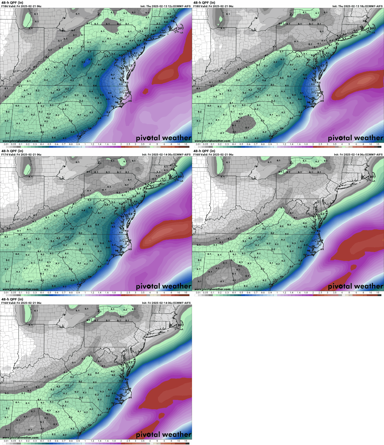
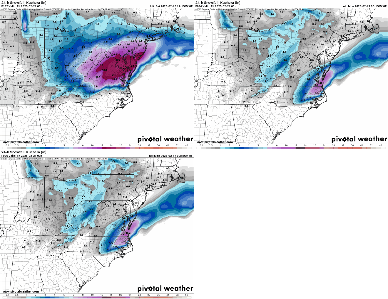
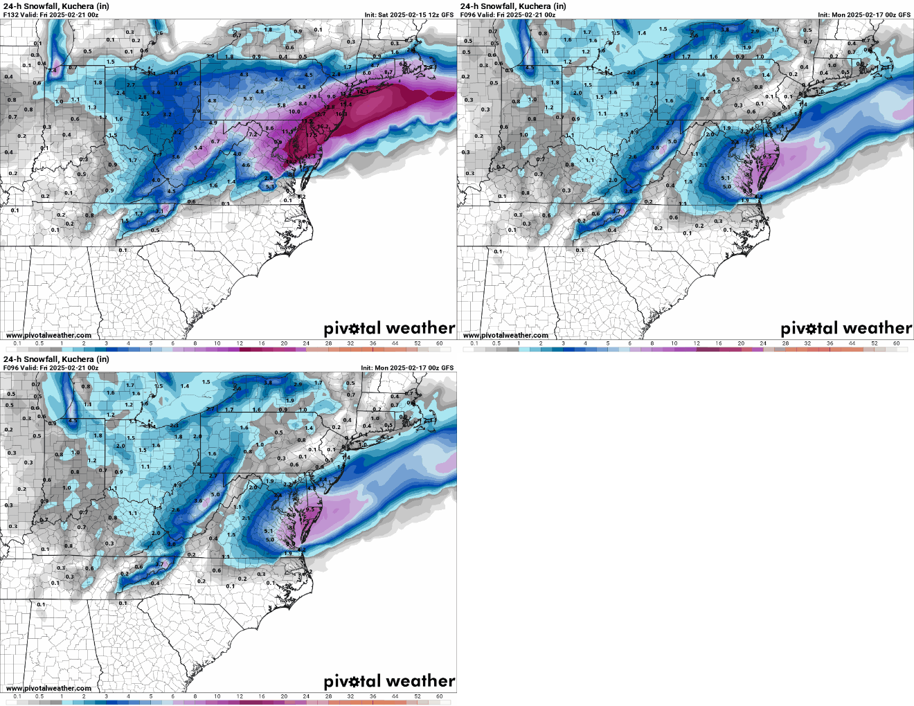
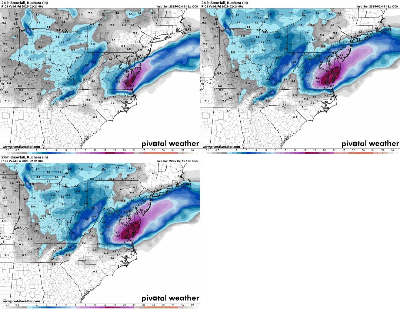
In hindsight, it looks like the Euro-AI model scored a significant modeling coup, as it never showed a major (8" or more - my definition) snowstorm for our area, unlike almost every other global model all of which showed at least a few runs with major snowfall. The Euro-AI had most runs in days 4-7 showing a minor to moderate hit with one run on Sat 12Z with significant (4-8", again, my definition) snowfall, but not major. Out of the rest of the models, the GFS was close to the Euro-AI, only showing one major snowfall run, also on 12Z Sat. The Euro, UK and CMC all had multiple major snowfall runs for our region in that timeframe (including some historic runs). So still a significant failure for the AIFS/GFS but an epic failure for the Euro/UK/CMC. IMO.
-
Here's the 2.5 day trend of the NBM since Saturday at 12Z (every 12 hours), showing how the NBM can be very misleading in trending situations, due to its time-lagged nature. I think everyone here knew this storm was mostly toast by yesterday at 12Z, but the NBM was still showing 6"+ for the 95 corridor with a bit less NW and up to 9" at the NJ coast. And it just showed <3" for the 95 corridor at 12z today. I think it's a useful tool when models aren't trending one way or another, significantly, but has been useless for this event.
-
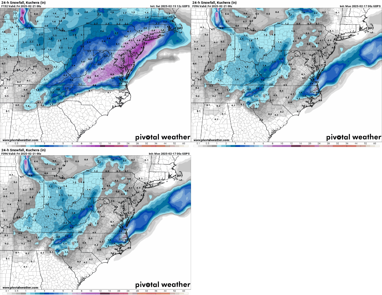
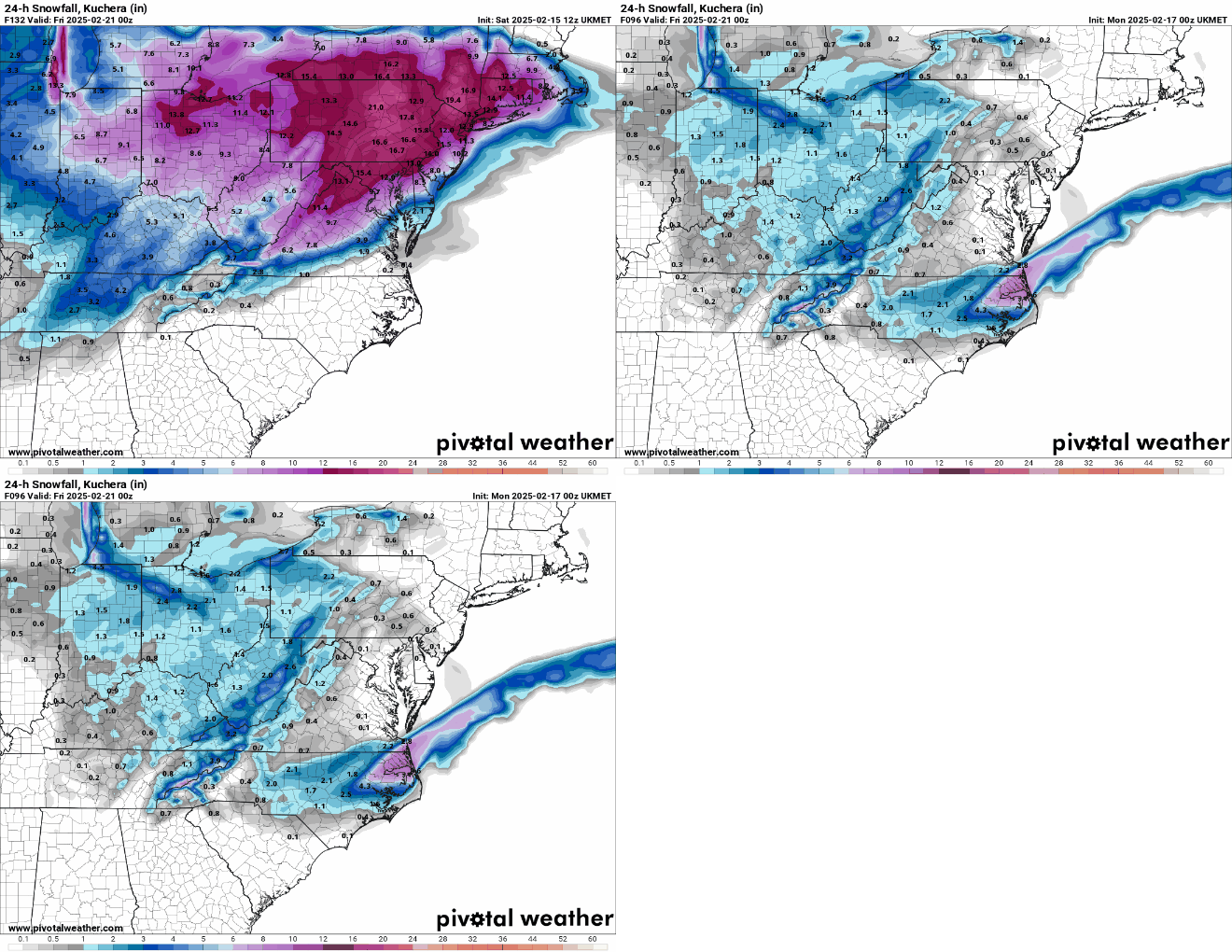
Just wanted to memorialize the complete modeling failure for the Euro, GFS, CMC and UK models from 12Z Saturday to 0Z Monday, from major/historic snowstorm to essentially nada (need 2 posts for this due to size issues). I don't recall a faster implosion in the last 15-20 years, as the axis of heaviest snowfall shifted 150-250 miles over 36 hours in this case. Even Jan-2015 went from a forecast of 18-24" for most in NJ (and there was not model consensus on the high snowfall forecasts 12-24 hours before that event) to several inches for most of NJ, which is at least not a complete miss (and yes I know this one isn't 100% over yet, but it's close). March 2001 might be worse at least for me, as we had a forecast of 1-2 feet and got maybe 1" in CNJ. The only saving grace, kind of, is that it happened between 4 and 3 days out, which is a little less painful to me than having an actual forecast for a big storm and getting shut out.
-
I can only imagine what the weather boards would've looked like in the 70s and 80s, lol. NYC gets a 12" snowstorm about every 4.2 years (37 in 155 years at CPK), but had 13 such storms in the last 30 years, which is one every 2.3 years, so we've been spoiled in the age of the internet. Welcome to climo, as it's barely been 4 years since the last one in 2021. There were 4 in the 70s/80s or 1 every 5 years, which is probably why it seemed they were so rare when I was growing up.
-
Walt et al - wondering what you think of the latest WPC map on likelihood of achieving warning level snowfall in the next 4 days (30-50% for CNJ/NYC/LI). I wouldn't think this would be so high, but iirc, WPC goes off the NBM and the NBM at 13Z is way more bullish than I would imagine, even considering it's time lagged (but I can't imagine it's still including very snowy outcomes from 12Z yesterday, can you?).
-
Interesting points. Wouldn't that be where hindcast analysis for some past storms comparing the "old" models to the "new and improved" ones would be helpful and possibly indicate that for major storms, where stability is pretty damn important, perhaps some work needs to be done to improve the models? Who gives a crap about predicting the heights at 500 mbar and SLP on sunny days (which is what most of the verification scores are based on, iirc; although I do know more detailed storm verification scores are kept on hurricanes)? I don't care if it's 73F vs. 80F for a high, but I do care about whether I'm going to get 1" or 6" of snow in 2-3 days. I do also wonder how much the AI models have been "trained" on datasets like what we've seen over the past few days (although there probably aren't too many of them).


