SnoSki14
-
Posts
16,212 -
Joined
-
Last visited
Content Type
Profiles
Blogs
Forums
American Weather
Media Demo
Store
Gallery
Everything posted by SnoSki14
-
Ok this will deliver for everyone. Nice pocket of rain now and we still have the strong pocket associated with the surface low
-
Why do you assume it'll be an east based Nino? Warming typically starts east and propagates westward. Monthlies show this happening by the fall. Strong eastern warming can collapse very quickly.
-
Models sort of all over the place with rain amounts today. I do wonder if we'll be dry slotted with low going right over us with heavy rains west & east of us. Very chilly first few days of May. GFS has highs in the 40s on Wednesday with graupel likely
-
The flowers have been out for a couple weeks already Very early leafout & bloom this year
-
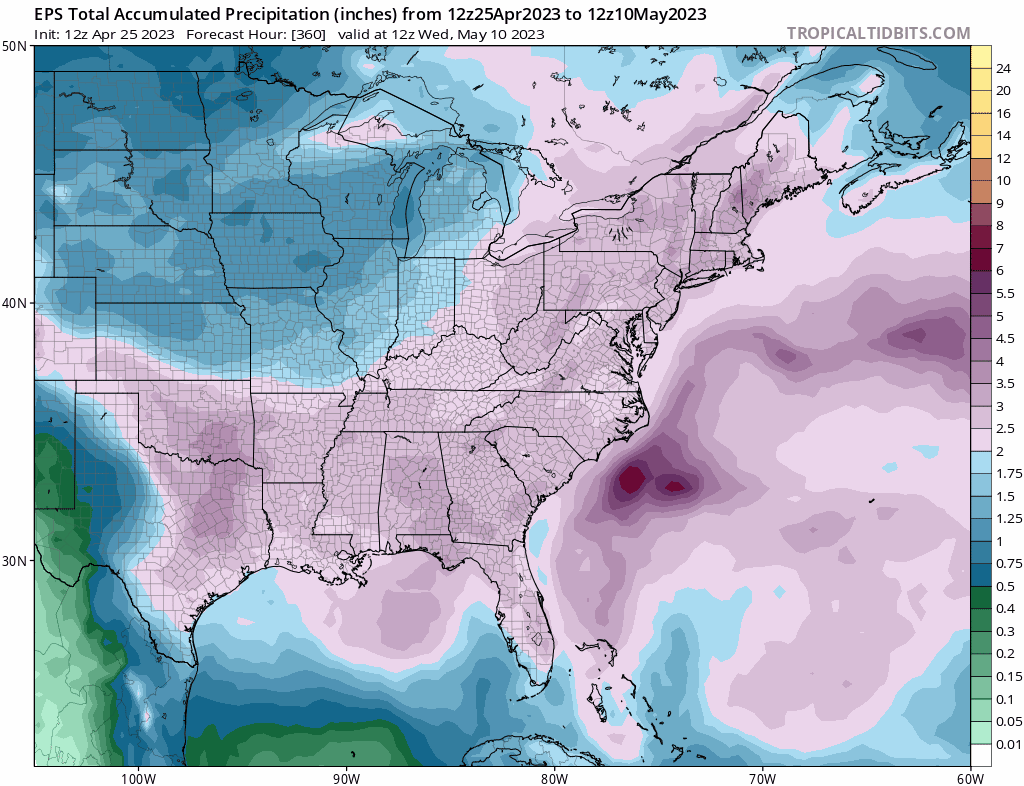
We need this during hurricane season A few more inches and our yearly deficits will be gone.
-
I love it and the prolonged wet weather is much needed without the flooding risks.
-
Yeah if we were having sustained 90s throughout April then that would be an extreme problem. The weather has been perfectly fine and mostly seasonable. We'll even avoid those chilly late April to early May rainy 40s to low 50s type days.
-
You get different outcomes by late April/May. Closed low with blocking to the NE will cause a lot of rain. Fully anticipate models to ramp up totals Big signal from EPS

-
I wonder what that means for late week into the weekend.
-
Nice rain event. Hopefully GFS is right with the rains next 7-10 days as we're running a bit of a deficit this year.
-
But it is theoretically possible then. This April is averaging 59 and we've had Mays average below 60. We would need a May 2005 though which is highly unlikely
-
Looks like weeklies/monthlies actually shows a BN May after a record warm April. Has May ever had a lower average temperature than April?
-
There's no indication of a super nino. I doubt it goes beyond moderate
-
We're having the warmest April ever so it's fine. I also don't think it'll be that bad, we'll probably still have an above normal May.
-
I think we're running behind some of the strongest Ninos. Although it's not out of the question I would go with moderate to moderate-high for now
-
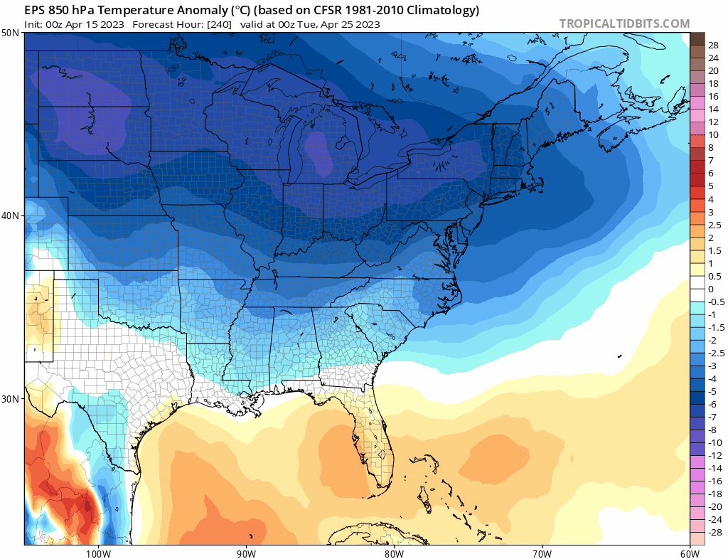
It'll be late March before you know it. Our warm records have really been accelerating. We might have also shot our warm load early. EPS has a substantial cool down for late April into May

-
I'll pass on mid summer weather in April. The humidity makes it tolerable but it's still way too warm. 70s are perfectly fine right now
-
Not necessarily. Models have a quick deep trough after the near record warmth this week.
-
Next weekend looks really warm
-
I love how the best match is 1972-1973 aka the least snowiest season on record prior to this one for NYC. The snow gods hate us lol.
-
90F a lock later this week. Ridiculously warm
-
How is 90s in April a blessing? That's a bad sign though not always. Sometimes really warm weather early leads to cooler weather later in the summer however we haven't had a cool summer in a decade plus so I doubt that.
-
Models might be jumping the gun a bit but at the same time it wouldn't take much to push temps towards 90F. It's probably easier to do now with the lack of vegetation than later in spring.
-
It's just one day. Mid 80s by Thursday and then more 80s next week. Spring looks like an inferno this year as troughs keep dumping west and pump the SE ridge. I think we could even see 90+ readings this month and definitely in May unless there's a big pattern change.
-
With the rapidly warming Atlantic waters that should theoretically enhance Tstorm activity