SnoSki14
-
Posts
16,200 -
Joined
-
Last visited
Content Type
Profiles
Blogs
Forums
American Weather
Media Demo
Store
Gallery
Everything posted by SnoSki14
-
Tasty look and in a reasonable window Very stormy as well with an endless supply of disturbances likely coming in. It feels like models did a 360 turn to what they showed a several days ago but just slightly delayed
-
I'll have to read it then. Even if those systems don't work out the pattern looks good post 15th for more attempts. I don't think many were expecting much before mid month anyway
-
AO now forecast to dip to an impressive -4 around that time too. I think the stronger block has merit. Best case scenario is the trends continue and there's a double whammy of winter weather as 12th system acts like a 50/50 low for the next one.
-
I don't think it's done trending either GEFS with the rare coast to coast troughiness in the long range
-
That's why I'm just gonna stick to the 5 day on op and no more than 7 on ensembles The evolution of the system on the 12th will play a role in the following systems.
-
I'm starting to like the 12th more. Really nice trends on the GEFS for the 5 day. It keeps pushing the ridge axis west and increasing troughiness on the coast. Not sure if it'll be enough but the blocking clearly slowing things down. You can actually see the modeling playing catch-up to the strong blocking.
-
Very significant. GFS going apeshit with the blocking
-
South is more likely than north given blocking Could also end up being a shredder
-
I'm hoping the SW trough continues to trend SW and pinch off from main jet.
-
Last night's runs and ensembles were pretty decent and a continued improvement over what we've seen. Some even gave us some snow
-
This is why.
-
Pacific improves on Euro too. Let's hope that continues
-
It depends on how the 12th system evolves. Still a little too make any determinations
-
I'm glad we're seeing it in the 8-10 day rather than 11-15+ That's a good sign for now
-
Ensembles finally bringing a more favorable pattern out west inside the 10 day. If that continues then things should improve after mid December.
-
Nice to see improvements out west on the ensembles as we get closer.
-
We're shielded from the more severe AGW impacts as well. We also haven't had our Pac NW crazy summer ridge yet That would def raise a lot of eyebrows
-
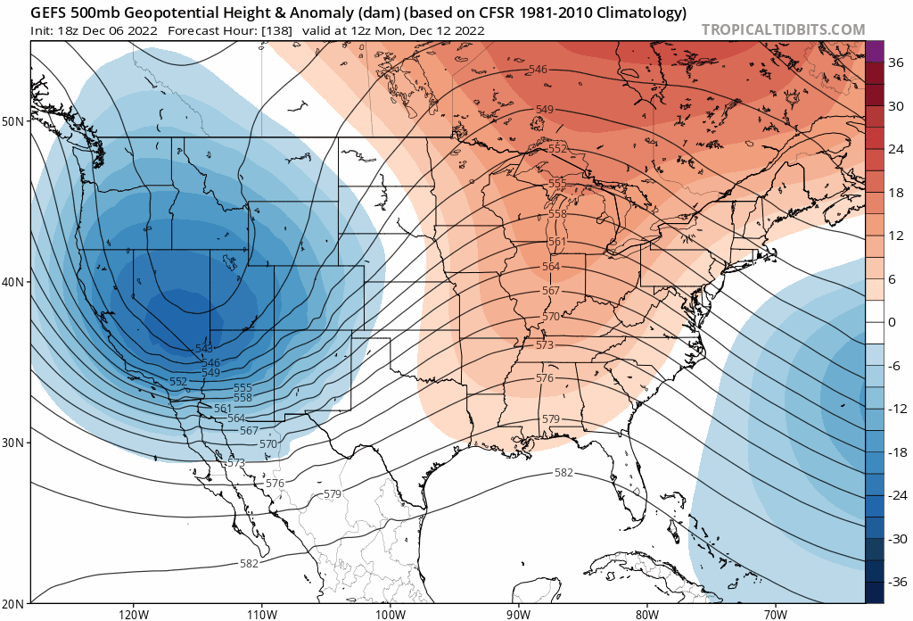
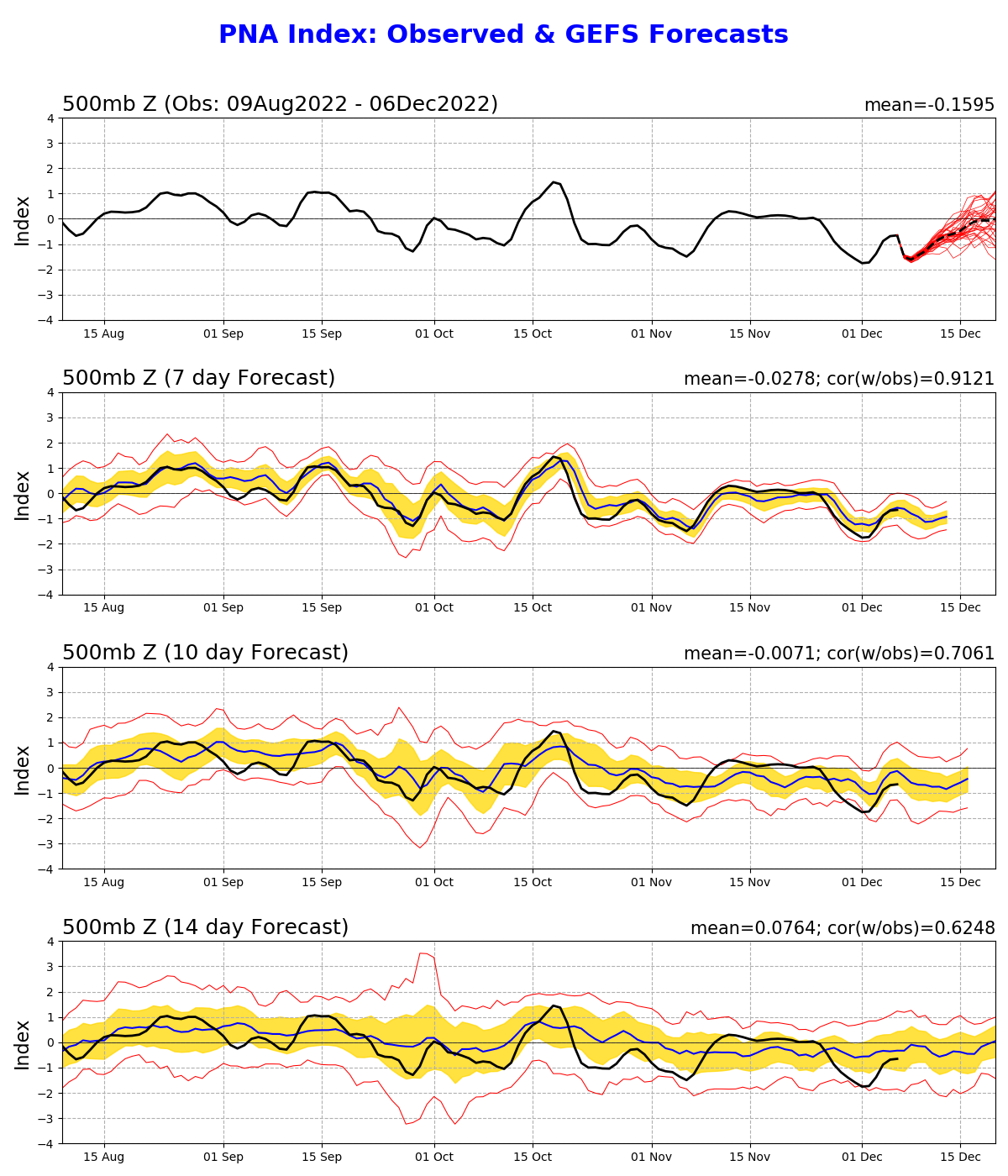
The PNA is forecast to trend towards neutral near mid month so theoretically the pattern shouldn't be as hostile. It'll prob be temporary but there's a window for something wintrier in the Dec 15-25th timeframe. However the PNA could just as easily end up more negative like we've seen and then we're prob toast til Jan. January imo will be our best opportunity. Another 2-3 week winter is probable
-
Another busted December. More of the same pacific garbage. Wake me up when the Nina crap finally ends
-
Garbage pacific, garbage pattern I'm getting 01/02 vibes tbh. All the cold will be in Europe as bad pacific circumvents Atlantic blocking.
-
I disagree but anything is possible In the era of AGW a torch is more likely than even an average month
-
Looks different again in the 8-10 day
-
I do think something will come out of this but it's a long waiting game. After mid month most likely. Climo gets a lot better too by then.
-
This is especially true if you live on the coast. Areas further north and inland in New England can get away with a suboptimal airmass but not us. If you're still struggling to hit freezing in the morning now then yeah you need the cold. I do think things will look better after mid month. Less of a -PNA will help