SnoSki14
-
Posts
16,208 -
Joined
-
Last visited
Content Type
Profiles
Blogs
Forums
American Weather
Media Demo
Store
Gallery
Everything posted by SnoSki14
-
GFS caved significantly to the other models
-
I need the mesos to come aboard for that one but it's possible the system is out of range for them.
-
If the models swapped places you would say the same thing though.
-
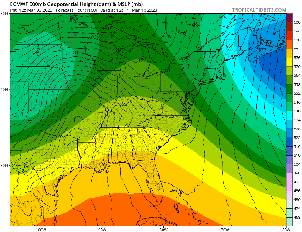
Sneaky clipper with a southern lean. Euro actually misses us to the south with it. Good overnight timing too
-
Very, very unlikely to happen but the EPS gives us some hope. That's probably the best Day 7 EPS I've seen all season
-
The Euro would be a historic storm for this region and one of the biggest March storms on record So yeah I'd say extremely unlikely though there is EPS support. Would need that to hold and for other models to come on board.
-
I'll take that lol
-
What a surprise
-
It feels like forever since we had a classic BM track.
-
I remember when miller Bs featured secondary transfers offshore NC/VA or the Delmarva that gave everyone a good hit not just NNE.
-
That's not really a miller B unless the definition completely changed. Miller Bs usually has secondary development off the NC/VA coast with a primarily no further north than southern Ohio.
-
We'd be fine as long as the western trough doesn't dig into Mexico
-
It's a fool's errand trying to hang onto something after mid March and nobody wants cold/snow by then. I would be a lot happier if the month just torched and it was definitively over.
-
GFS says game over for winter. The so called favorable period is gone. Why? The massive north of Hudson ridge links with southern ridge and creates a pseudo omega high pattern. The problem is the blocking north is so powerful that it overwhelms the pattern and it's placed too far south. We saw that in December too So yeah if the GFS is correct then better luck next season and we can wrap things up.
-
The next threat is turning to garbage real fast.
-
Cutter or not I would like to see a massive storm regardless because extreme weather is fascinating and I think we'll def get that.
-
Anything after mid March would be very anomalous. Our chances drop substantially after the 15th. Even if the pattern was still decent we would start having issues with getting enough surface cold for snow. We saw that in March 2018
-
The funny thing is if the Euro verified it would likely reinforce arctic blocking guaranteeing everyone a chilly early spring. The Nina forcing & the dreadful Pacific have been killer all season. Thank your lucky stars for every inch you received. On a positive note it is one op run past day 5 so a lot can change. Additionally your area could score on a little clipper before that.
-
How fitting for this winter to have two seemingly favorable months Dec & March only to both be bookended by a huge Midwest cutter Gotta just laugh at some point.

-
It does look like a December repeat per Euro. And wasn't he correct on the December storm
-
Additionally the Pacific actually looks decent for once. A neutral to slightly negative PNA is pretty ideal for March.
-
What I would give for a coastal track or at the very least a classic Miller B with an offshore NC/VA coastal transfer. Those tracks have been few & far between
-
Good calls with the last couple events. I hope you're wrong but this winter has shat the bed in every way possible so why wouldn't it do so again. Thank God spring is almost here
-
Midwest/Lakes cutter yes. Coastal tracks have been a rarity for a while. I think if one does happen under this pattern then it would be an extreme event.
-
I would keep expectations very low if you live south of C/NNE. Right now CMC/GFS/Euro all have inland runners for the next big storm.