tarheelwx
-
Posts
1,663 -
Joined
-
Last visited
Content Type
Profiles
Blogs
Forums
American Weather
Media Demo
Store
Gallery
Everything posted by tarheelwx
-
I think the idea of super cold is completely off the table. However, I think we're still looking pretty solid below normal for at least the next week or so. Still a far cry from what the ensembles were showing. TW
-
FWIW, both the 12Z NAM and RGEM have dewpoints in the single digits in CAD areas early Sunday afternoon with wet bulbs 25-30. Having said that, there's no wedge signature or HP in the northeast. I suspect the wet bulb will move up quickly as precip arrives. At this stage, it looks like even Snowshoe might be mainly ice. TW
-
I think one big problem we have now is the lack of moisture. Since Helene, we have been exceptionally dry. What moisture we have received has come through in large amounts - but only about twice a month. October had no significant precip events and October had just one. Many winters it is common to have a system every 3 to 4 days. Now we're at least running about once per week (system this past Sunday morning and the next system comes in late Sunday). So the dry pattern we're in now only exacerbates the problem. As for the cold air - I fully agree. TW
-
Icon followed the 18z Euro - way north for #1. TW
-
12z AI a classic.
-
I like your enthusiasm. Let’s just call it a decent ice storm. I’m seeing 1/4-1/3” in NC CAD areas. Look at KY…… that’s a crippling ice storm. Who knows how it will end up. TW
-
Whatever happened to the SSW? Did it ever occur? TW
-
Yes the models AND ENSEMBLES (for specifics) are pretty poor in the longer range…over 5 days. I think in reality, the models are just as good, if not better than they’ve ever been. When they miss a forecast or don’t show what we want, people say the models suck. So for the last 3 years, the perception is that the models suck since there was nothing ever to track. I know that last year we didn’t have a single storm show up for more than maybe a couple runs well out past 5 days - it would pop up one time and then it was gone. So there was never anything to track and whattaya know, we got nothing. So that’s not bad modeling, but good. As for the period coming up, some have built sky high expectations that will be hard to meet. I think if we were realistic, we wouldn’t put much, if any, weight on a model out past 120 hours. TW
-
Pulling this from my long term memory as we have t had this situation in quite a while. But often when there’s a strong negative NAO, we’ll see the models correct the storm track further south for quite a few runs in succession. Hopefully that will be the case for the early week storm. TW
-
Thanks Eyewall. Can you teach here? I see the radar imagery showing strong storms or even super cells. The Hodograph seems to be showing some sort of rotation, but the rotation appears to be clockwise instead of counter clockwise. I see the the cold pocket up at about 18,000'. Which of the above is indicative of the tornado risk? Thanks in advance. TW
-
Olafminesaw, Do you mind interpreting what you're seeing here? Big hail risk? Thanks, TW
-
95% of the clippers east of the mountains don’t produce any snow. Once in a while we pull a rabbit out of the hat and get usually an inch or less. TW
-
I’d take my chances with that right there.
-
2024-2025 Fall/Winter Mountain Thread
tarheelwx replied to Buckethead's topic in Southeastern States
You mountain folks may want to check out the 18z NAM. Major increase in ice - probably warning criteria. TW -
2024 Atlantic Hurricane Season
tarheelwx replied to Stormchaserchuck1's topic in Tropical Headquarters
Euro has had several runs with the system in the Caribbean coming north with a Helene like path. We’ve had about half an inch of rain here near GSO since Helene and really need some rain. I know the mountains don’t need a tropical system though. TW . -
I’m hopeful we save our small window of below normal temps for sometime during the last 10 days of December through the end of January. Below normal Novembers almost never turn out well TW .
-
If we get to 80 or so by 5pm and that is before any rapid intensification, what would be the top end potential? There's been some crazy intensification in the gulf when there's such warm water. TW
-
Mountain West Discussion- cool season '23-24
tarheelwx replied to mayjawintastawm's topic in Central/Western States
HRRR and RAP have backed off just a bit for areas around Thornton and Brighton. Probably mostly due to rain. TW -
Mountain West Discussion- cool season '23-24
tarheelwx replied to mayjawintastawm's topic in Central/Western States
Thanks for the response. My only blizzard warning was the Blizzard of '93. We're supposed to ski @ Winter Park on Friday. I think we take 25 south to 70 west to 40. Think we'll be able to make it. We have an F150 4WD. TW -
Mountain West Discussion- cool season '23-24
tarheelwx replied to mayjawintastawm's topic in Central/Western States
I’m flying into Denver as we speak. I’m from NC and have never experienced a storm on the front range. We’re staying with my son in Thornton just a few miles east of I-25 and just inside I-470. Models are showing anywhere from 6” to just over 20”. AFD mentioned some occasional blizzard conditions on the Palmer divide and foothills I believe. Can anyone tell me what the criteria for blizzard conditions is here? Where I am in NC we need 1/8 mile visibility and I think sustained winds of 20 (maybe 25) or gusts over 35 (maybe 35). In my 58 years, that’s only happened one. TW -
Hopefully the trends today will pause the massive bellyachin' we were hearing this morning. At least there still seems to be a fair amount of hope for us. TW
-
Just my opinion, but the pattern after next weekend is a total crap shoot. Next weekend is pretty much up in the air as well. TW
-
We certainly can and do get ice in NC and even further south in late winter. However, the sweet spot for ice is earlier in the season. Can it happen? Yes. But prime time for ice starts slipping (joke there) away as we move through February and into March. At the same time, prime time for snow runs a bit later. TW
-
I think we are going to need some legit cold air. Right now, I'm not seeing anything notable through about 2/10. Hope I'm wrong. I'd really like to see a storm (snow or ice, I really don't care) with temps in the 20's as opposed to a 32/33 degree slop fest. TW
-
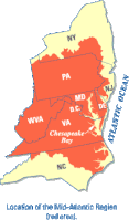
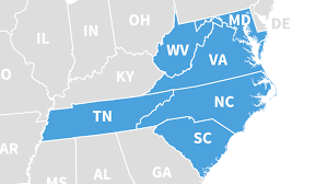
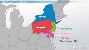
Easy to tell that the 00z and 06z runs were less then exciting. My recollection is that DT stated he considered N NC as part of the southern mid-atlantic region. I did a Google search for "mid atlantic region" and went to images. Most run from VA up to NY. However, there is certainly some variance - even TN made one map (from some doctor's group). The first image is from Wikipedia. So I'd say there's nothing set in stone as to where the borders for the mid atlantic region is. However, I beleive DT has clearly stated what he refers to as the southern extent of the mid atlantic. I'm not sure where he says the northern boundary is, but I don't really care as well.