Hurricane Agnes
-
Posts
8,877 -
Joined
Content Type
Profiles
Blogs
Forums
American Weather
Media Demo
Store
Gallery
Everything posted by Hurricane Agnes
-
The above from drop #3 -
-
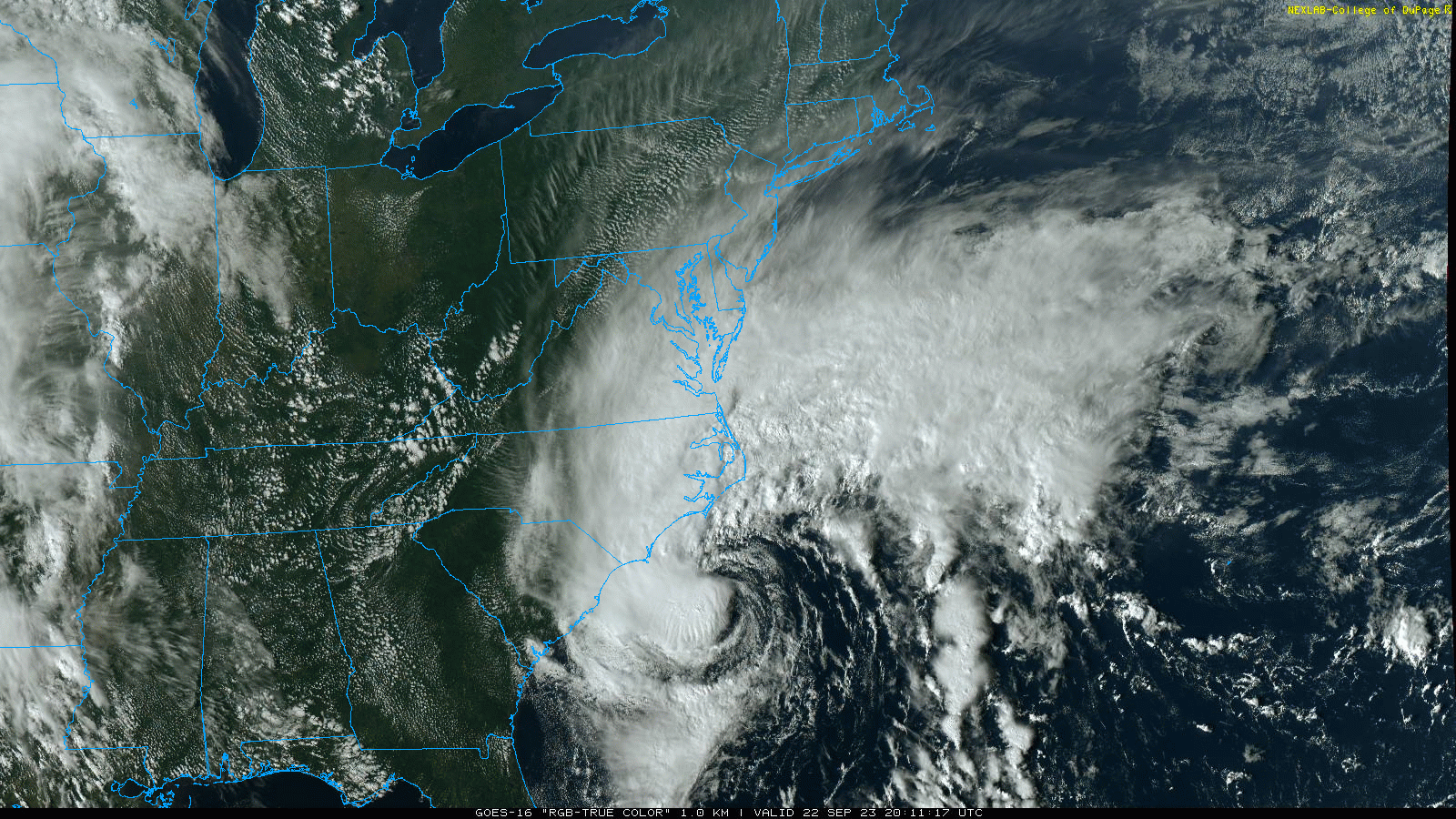
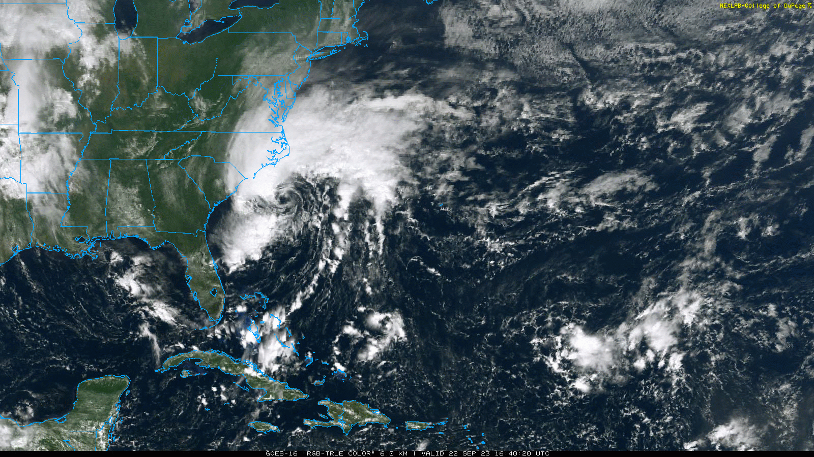
I know it has to be tearing up the Carolina coast and SC already had issues with flooding (especially Charleston) just the past week or so, let alone with Idalia.
-
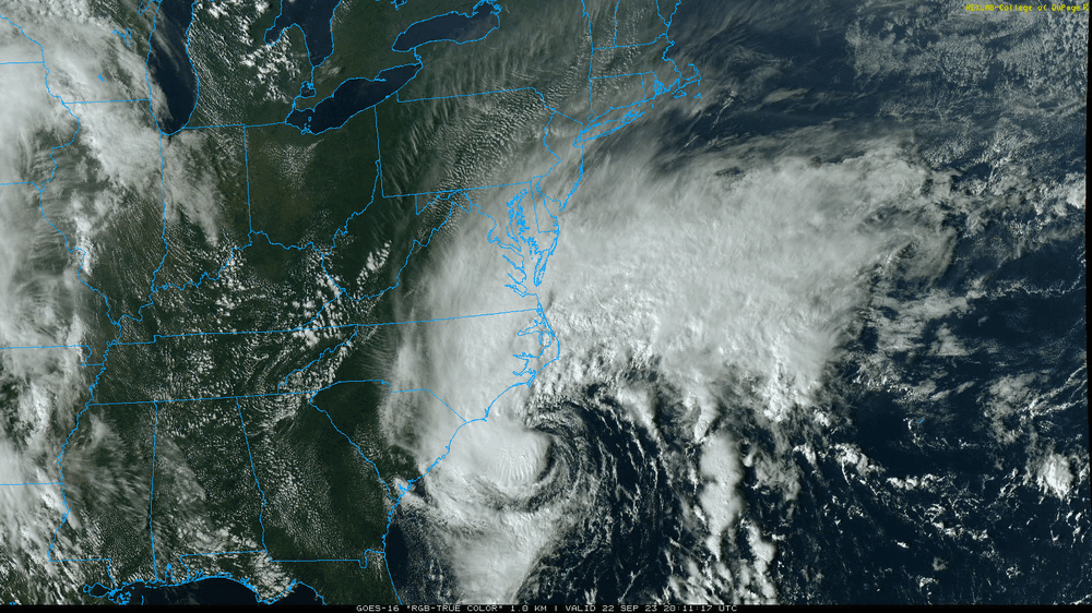
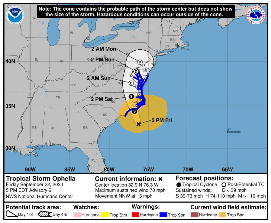
I was watching the satellite loops and saw the eye start filling in with convection so it seemed to be juicing up. It's one thing having a 50 mph thing landfall and a 70 mph one. Didn't expect that kind of almost-RI. It's just a few mph short of a hurricane but I don't think it has enough room to do that before landfall.
-
Wow. Ophelia hit that bathwater and exploded from 50 mph to 70 mph. Might not have time to become a hurricane before landfall but didn't expect that!
-
E PA/NJ/DE Fall 2023 OBS/Discussion Thread
Hurricane Agnes replied to Rtd208's topic in Philadelphia Region
Maxed out at 72 today with a gusty cool SE breeze. The dews haven't shot up IMBY yet as it is currently overcast and 68 with dp 55. -
OMG. Those cans usually have latches on the front for the lid but that is a huge can too. Am wondering about the Phils tonight because even if the rain doesn't start until later, the winds are going to do a number on where any hit balls end up.
-
When I saw the stuff down there I was wondering if you noticed it! It's definitely breezy out. Was tying up a couple of my potted tropical plants (I have a top heavy plumeria that definitely needed it).
-
Was just out and the winds are whipping and thar she blows!
-
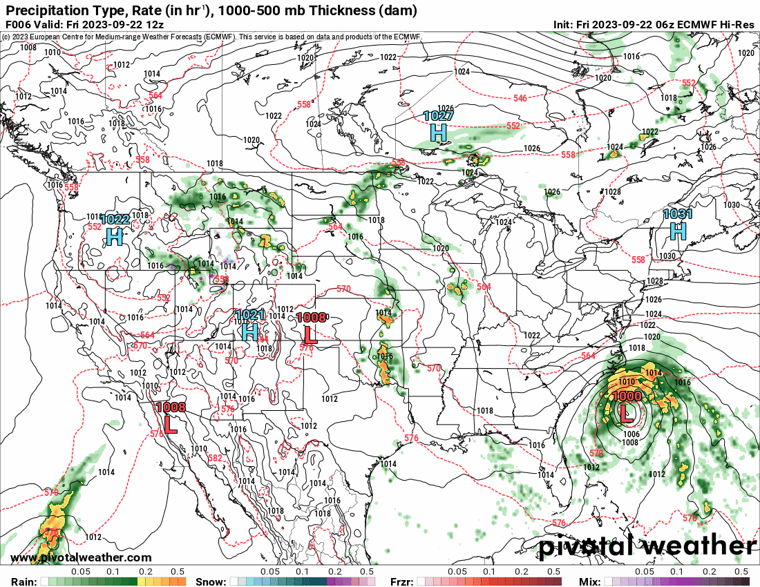
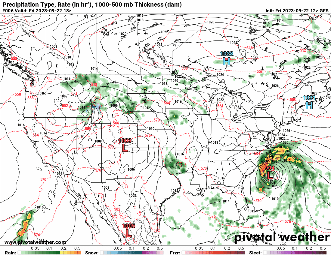
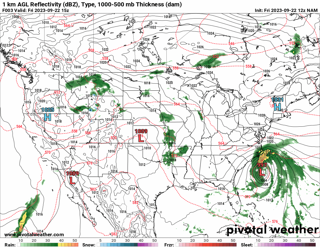
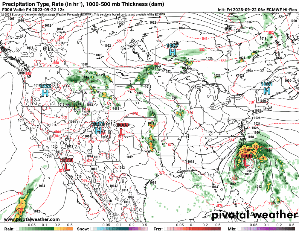
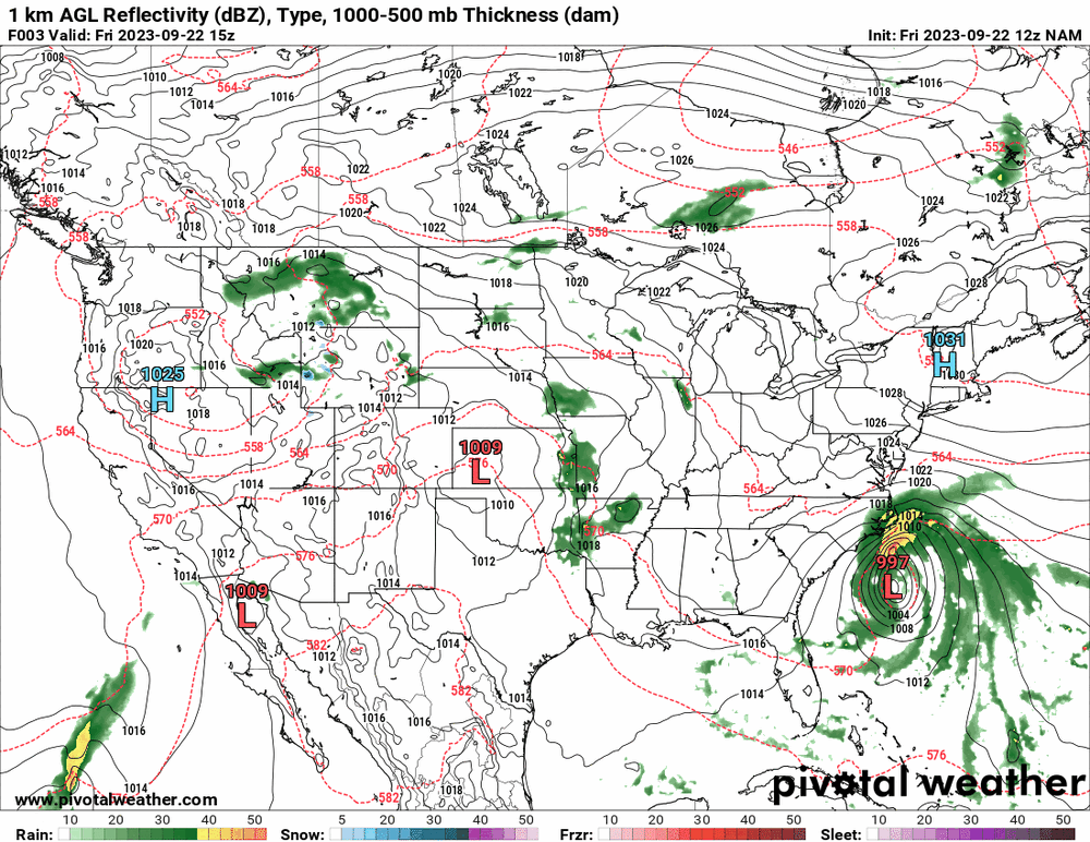
12z GFS is running now and after the 6z kept the scraping, the 12z ticked west with the rest. The Euro had caved to move further to the west too but not as far as the 12z 12k (and 3k) NAM the furthest west.

-
E PA/NJ/DE Fall 2023 OBS/Discussion Thread
Hurricane Agnes replied to Rtd208's topic in Philadelphia Region
Bottomed out at 54 this morning and the clouds have been rolling in since. Currently mostly cloudy and 69with dp 57. -
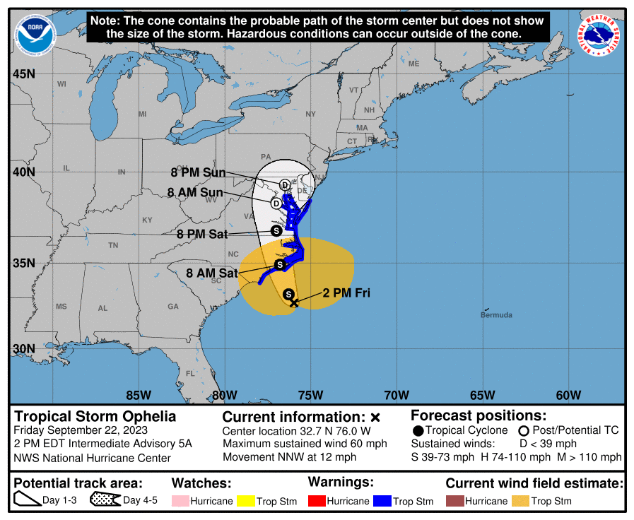
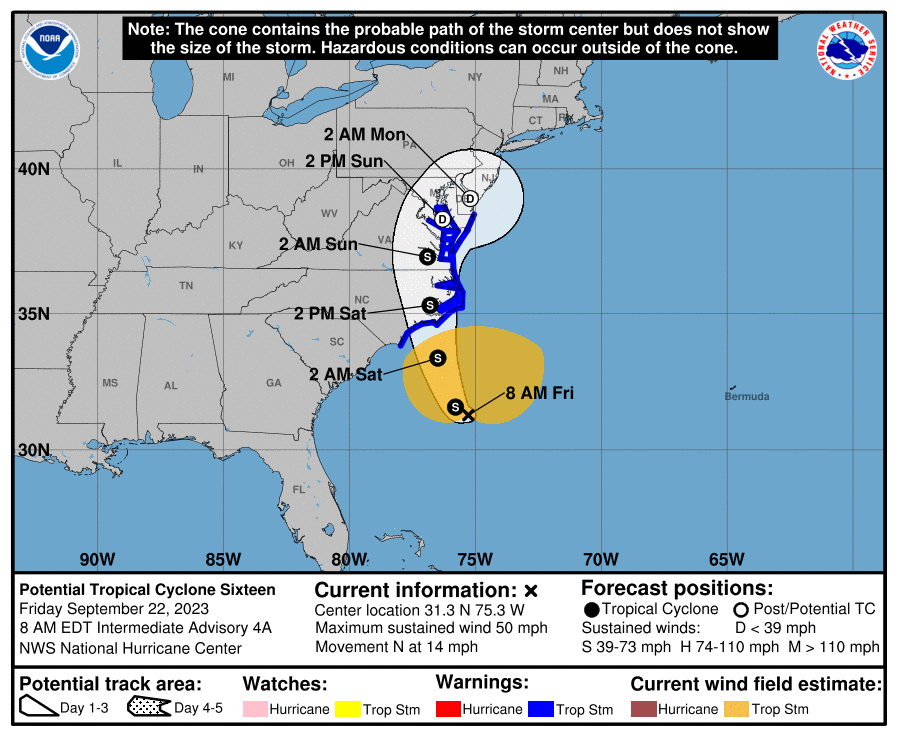
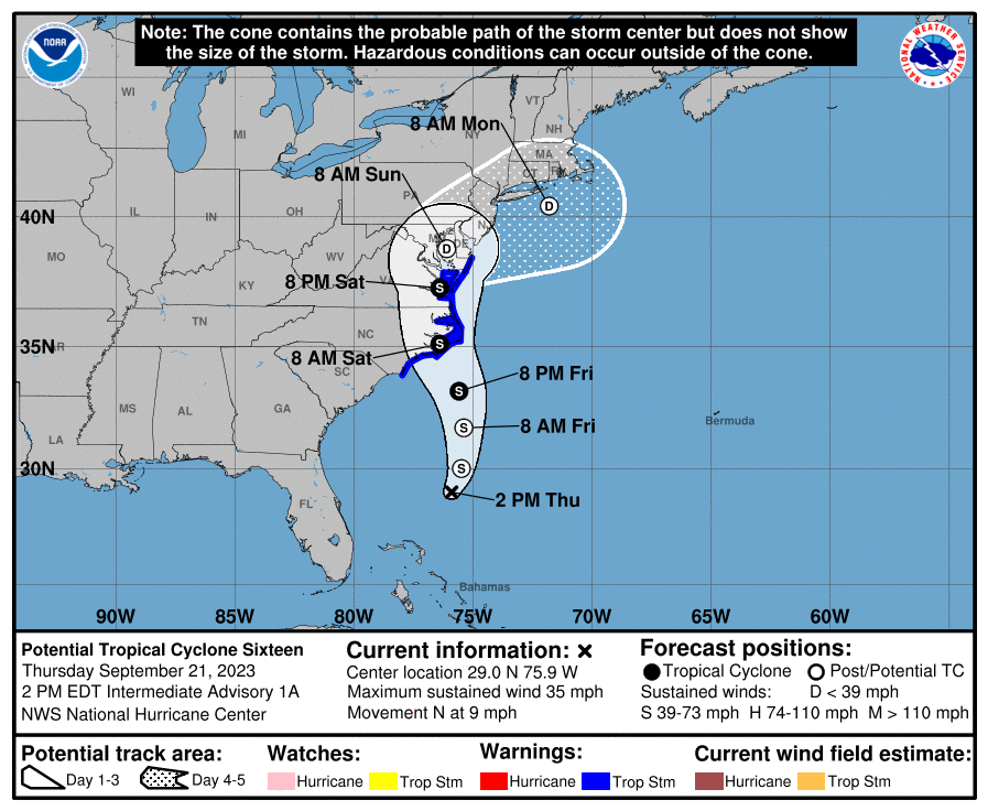
Latest cone @11 am looks like it took a western jog -

-
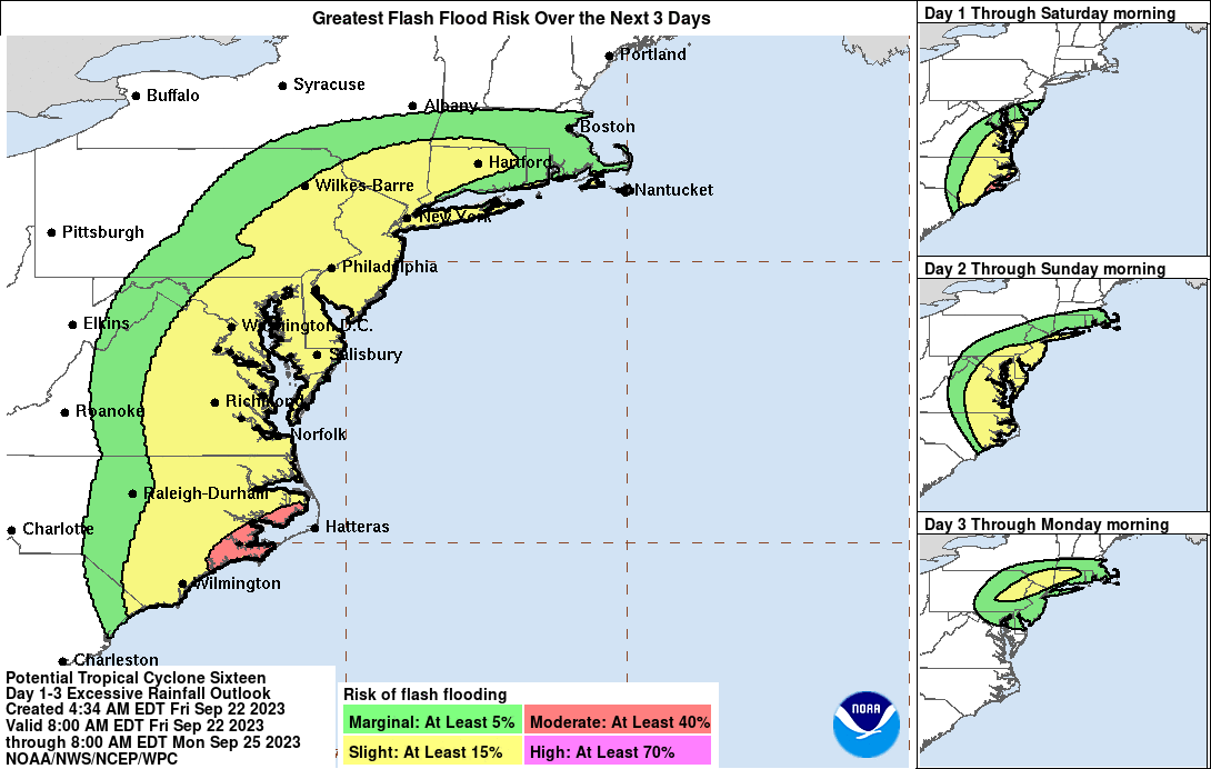
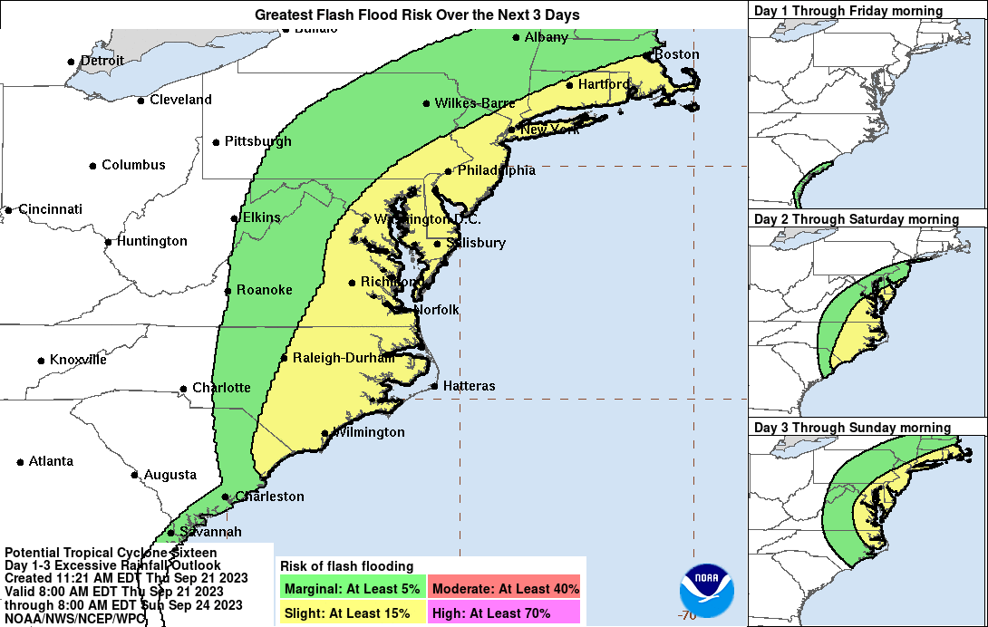
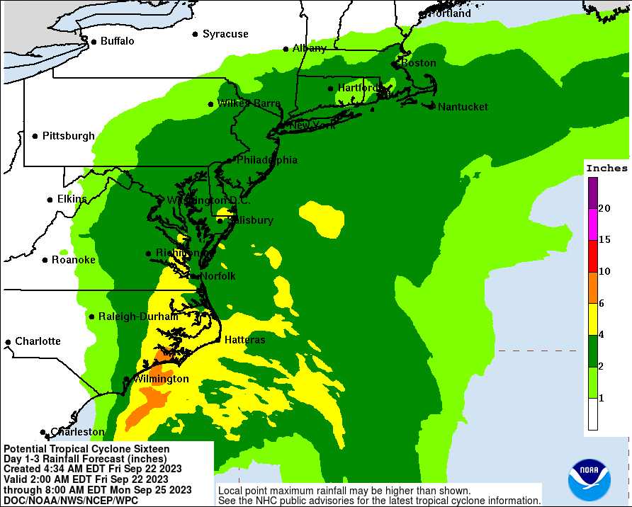
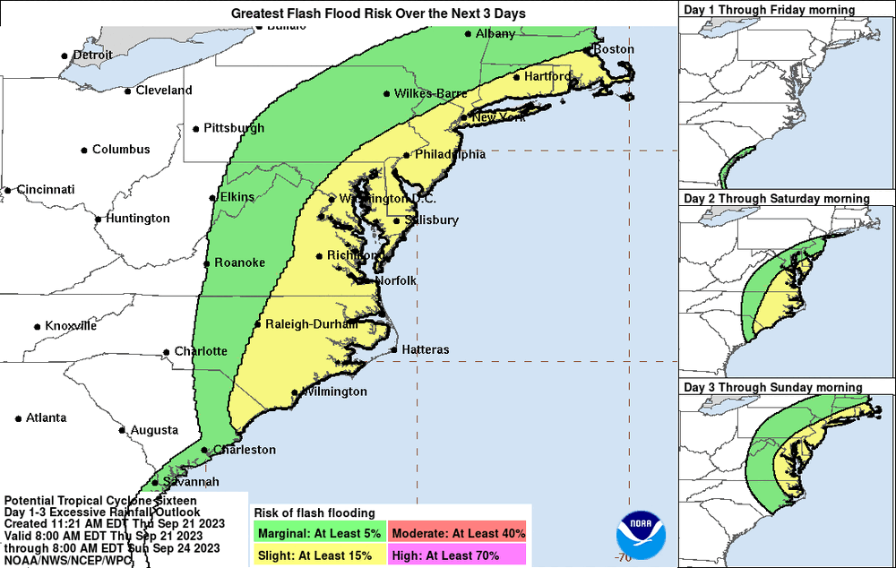
The track is going to make a big difference as well as whether it really does get cut off as being hinted at, and stalls for a bit. If a band sets up over the area, there could be some pretty significant flooding. Fortunately we are almost 1/2 way between a new and full moon so any normally higher tides won't be there to make it worse.
-
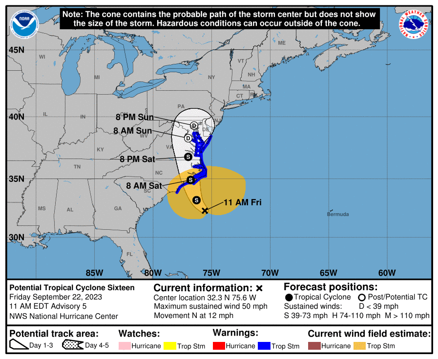
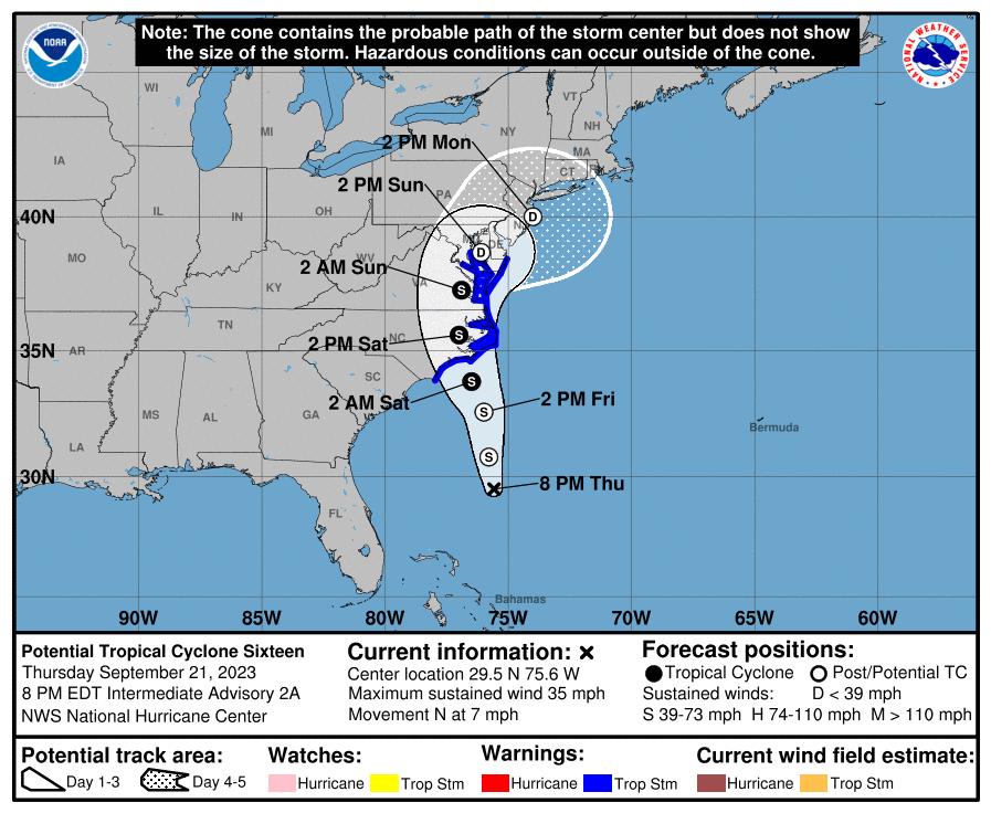
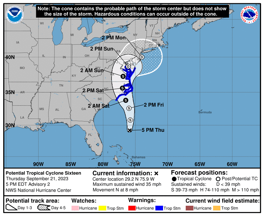
8 am update -
-
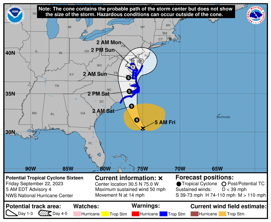
As of the 5 am update 9/22/23 - Still on the fence about whether it will be a full fledged tropical storm or subtropical storm but in any case, it has intensified so will need to continue to watch.
-
8 pm cone and discussion -
-
E PA/NJ/DE Fall 2023 OBS/Discussion Thread
Hurricane Agnes replied to Rtd208's topic in Philadelphia Region
I went on and made a PTC-16 (which may become TS Ophelia at some point) thread here - Impacts are expected to start some time late Friday afternoon and go all weekend depending on what happens with the northern high and any troughs swinging through. -
It's been a long time since tracking "an event" (winter or any other season) so might as well do that since the CWA is in the cross-hairs.
- 144 replies
-
- 4
-

-

-
- potential tropical cyclone
- floods
- (and 2 more)
-
E PA/NJ/DE Fall 2023 OBS/Discussion Thread
Hurricane Agnes replied to Rtd208's topic in Philadelphia Region
Bottomed out at 54 this morning and am currently at my high of 73 with dp 51. And LOL...
-
E PA/NJ/DE Fall 2023 OBS/Discussion Thread
Hurricane Agnes replied to Rtd208's topic in Philadelphia Region
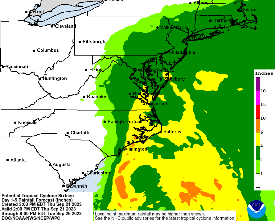
Yesterday I had a 55/73 low/high and this morning I bottomed out a little cooler at 53, but made it up to 75 for a high. Stellar day. Have had more clouds today than yesterday and they continue to funnel in. It's currently 72 and partly sunny with dp 55. Am watching the system due to come by here this weekend and the model tracks are still all over the place (18Z GFS coastal scraping, 18Z NAMs (both res.) more to the west including coming inland along the coast, 12Z EC to the east of them all, just beyond scraping and the Canadian a sortof average between the EC and GFS). If it really does scrape or even come inland, that might cut some of the totals in this area although that could increase them further west. But being a longer duration storm thanks to an anticipated temporary blocking high to the north, then it could still build up some totals. -
E PA/NJ/DE Fall 2023 OBS/Discussion Thread
Hurricane Agnes replied to Rtd208's topic in Philadelphia Region
Made it up to 70 as a high today and the 0.58" was it, with a 1.42" 2-day total and 3.19" for the month. The sun actually popped out earlier this afternoon as the front pushed the rain off the coast and to the northeast, and that helped to drop the dews a bit. Currently 62 with dp 60. -
E PA/NJ/DE Fall 2023 OBS/Discussion Thread
Hurricane Agnes replied to Rtd208's topic in Philadelphia Region
I eventually finished up with 0.84" yesterday and had 0.37" early this morning before the new batch of rain moved in. Have picked up an additional 0.21" since, for a total of 0.58" for the day so far, and a total of 1.42" for the 2-day event. Yay! Bottomed out at 60 this morning and am currently an overcast and misty 64 with dp 63. -
E PA/NJ/DE Fall 2023 OBS/Discussion Thread
Hurricane Agnes replied to Rtd208's topic in Philadelphia Region
Almost another 1/4" received from yet another negatively-tilted line giving me 0.84" in the bucket for the day so far at post time. Grateful! Currently misty and 65 with dp 65. -
E PA/NJ/DE Fall 2023 OBS/Discussion Thread
Hurricane Agnes replied to Rtd208's topic in Philadelphia Region
Got another thin bandlette of heavier rain move through from SW -> NE, this time positively tilted, giving me an additional 0.27" and am now getting some general light rain as the big blob moves in from the west. So far have 0.60" in the bucket at post time. Temp is 65 with dp 65. -
E PA/NJ/DE Fall 2023 OBS/Discussion Thread
Hurricane Agnes replied to Rtd208's topic in Philadelphia Region
Just had a negatively tilted thin band of showers pass through moving from SW -> NE giving me 0.32". Rates had reached upwards of 1.75"/hr briefly before it moved on. I was hoping I hadn't jinxed it since I had put my patio umbrella down. I did make it up to 80 before the rain hit and it's currently overcast and looks like a big break before another batch *might* come through from out west but we shall see. Currently 66 with dp a more humid 65.