Hurricane Agnes
-
Posts
8,877 -
Joined
Content Type
Profiles
Blogs
Forums
American Weather
Media Demo
Store
Gallery
Everything posted by Hurricane Agnes
-
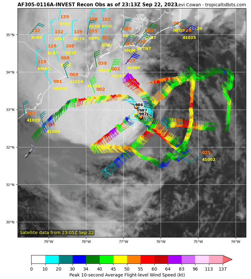
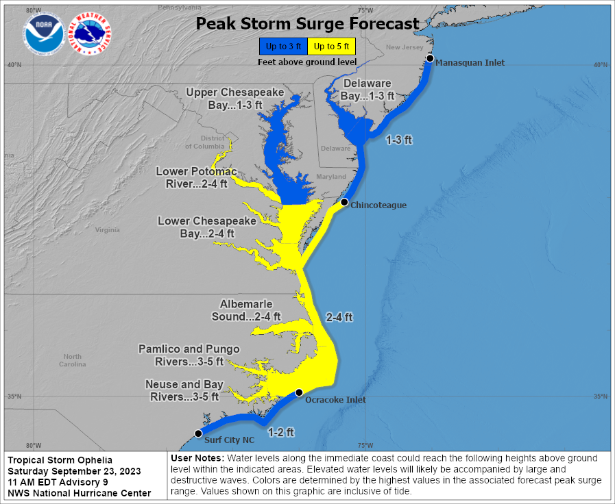
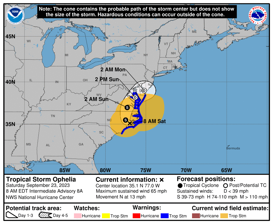
11 am surge map (not sure how intact the core will be by the time it gets up to S. Jersey but I would think it would push some water into the coastal towns) -
- 144 replies
-
- 1
-

-
- potential tropical cyclone
- floods
- (and 2 more)
-
Just have to watch for mixing and a warm nose.
- 144 replies
-
- 1
-

-
- potential tropical cyclone
- floods
- (and 2 more)
-
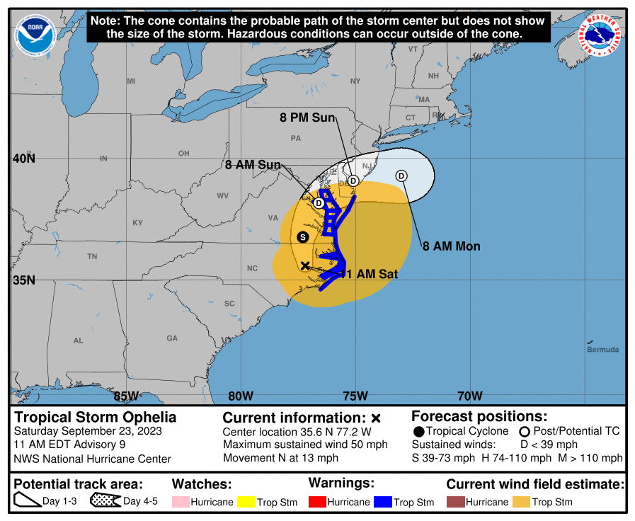
11 am update and weakening as progged (looks like the remnant might be heading for the 40/70 benchmark! ) -
- 144 replies
-
- 1
-
-
- potential tropical cyclone
- floods
- (and 2 more)
-
Finally notched above my low this morning and am at 58. Dewpoint has slowly crept up to 57 so the battle between moist and dry is underway. Winds have been pushing with from the SE. Currently in a dry slot between bands with 0.89" in the bucket.
-
8 am update -
-
Am now up to 0.77" in the bucket at post time, with temp still at the low for today - 56 - and dp 56. The current rain band is pushing up from the SSE and looks like there might be a break in it on the western side.
-
So far this morning, am getting a little steadier rain (currently around 1/4" - 1/3rd" per hr rates) and have 0.39" in the bucket at post time. Am currently at my low of 56 at the moment with dp 56 (so the drier conditions continue). Am guessing a "small" central core of that has the tropical conditions and the rest is (inland) nor'easter-like.
- 144 replies
-
- 1
-
-
- potential tropical cyclone
- floods
- (and 2 more)
-
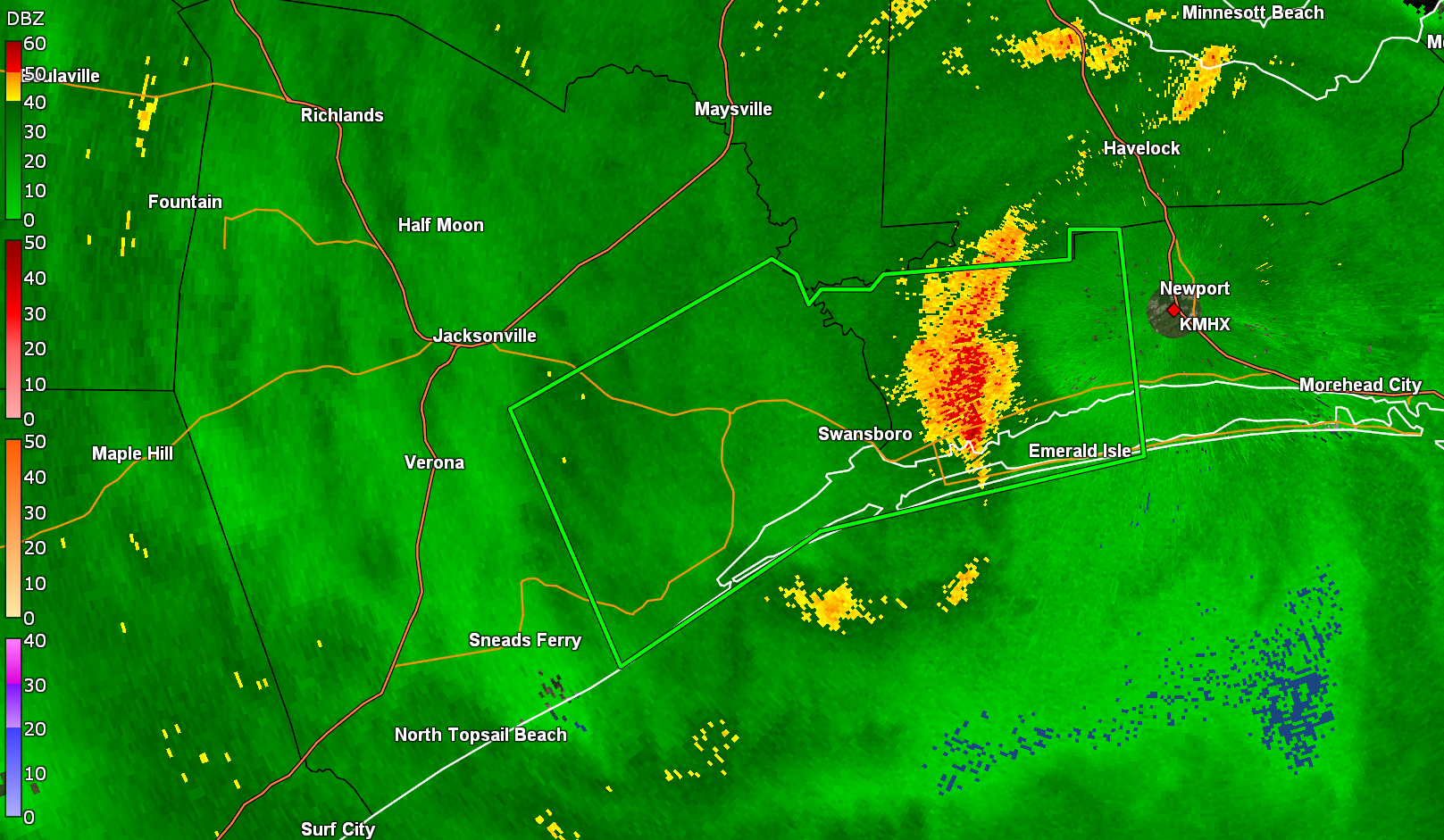
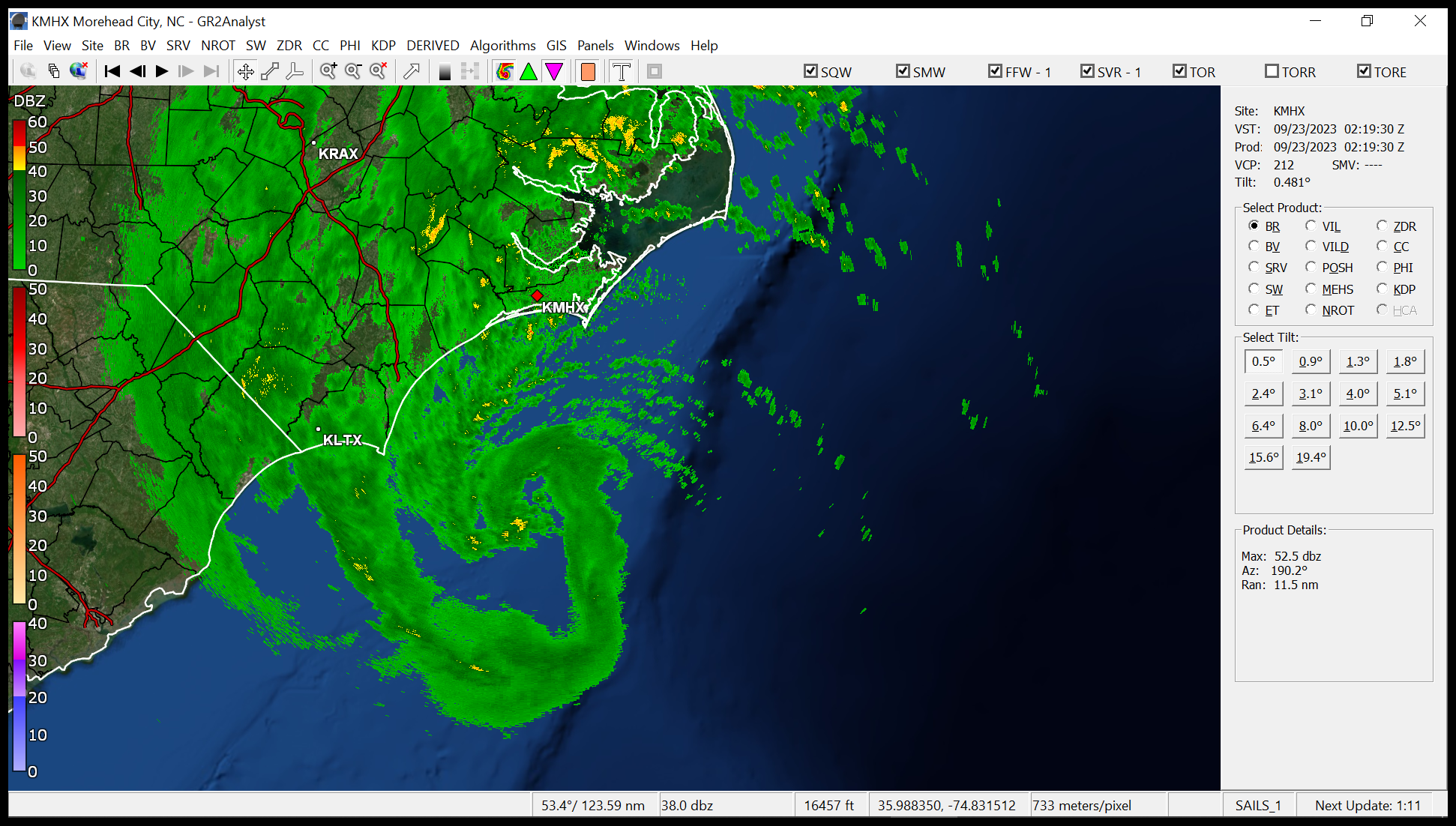
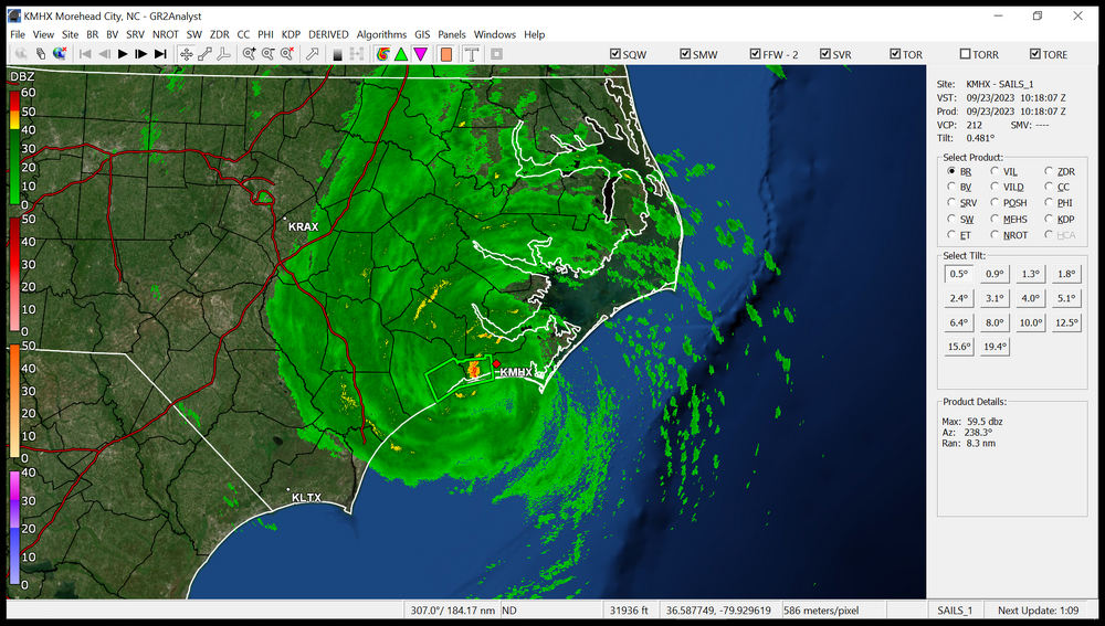
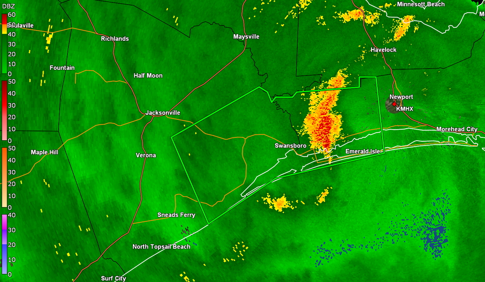
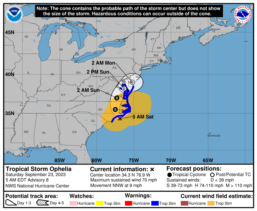
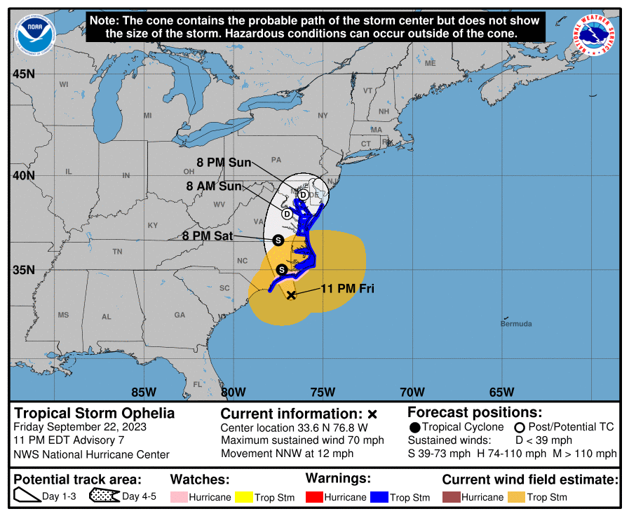
And NHC confirmed landfall @ 6:15 am.
-
Looks like some kind of landfall happened to the SW of Morehead City by Emerald Isle, sometime around 6:15 am give or take.

-
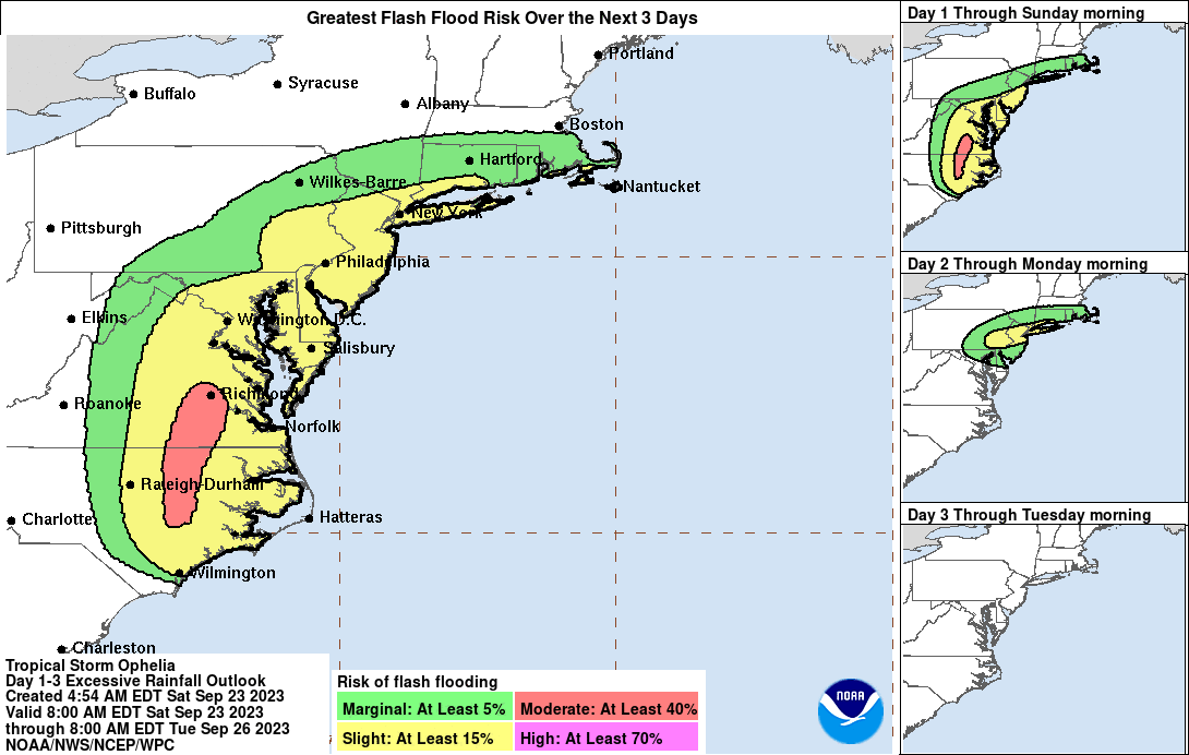
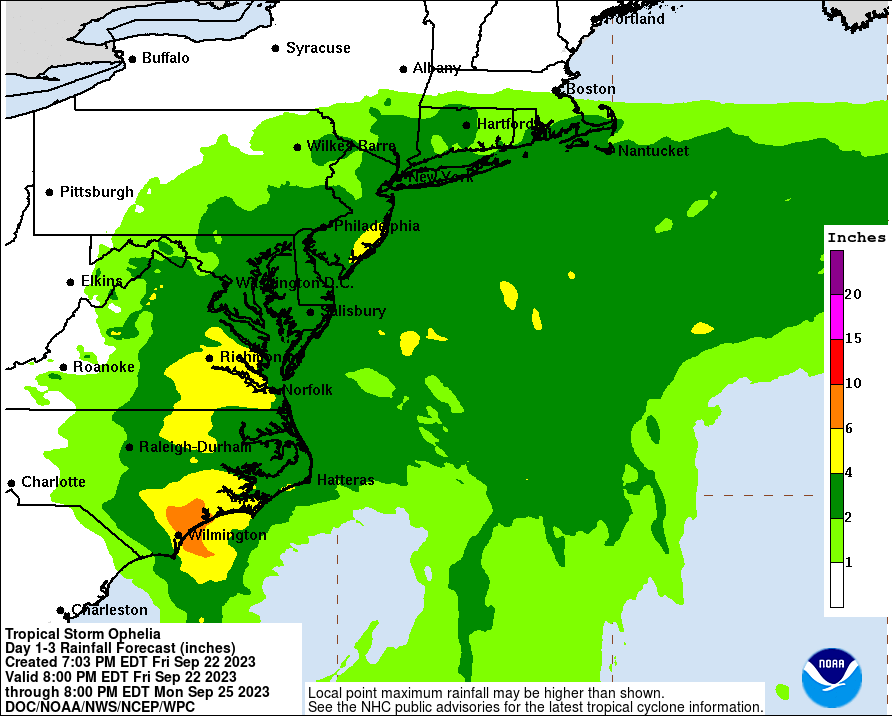
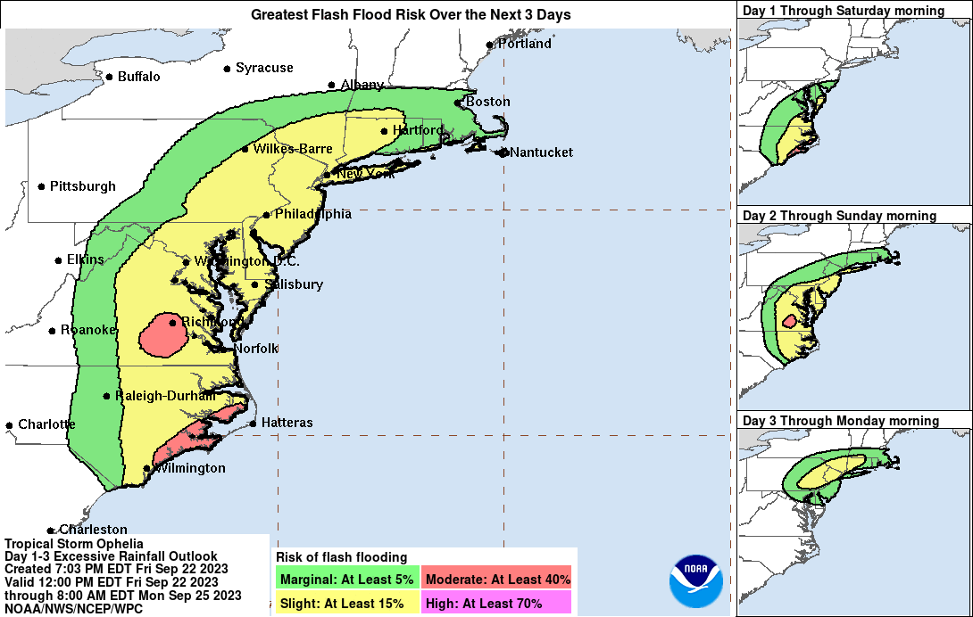
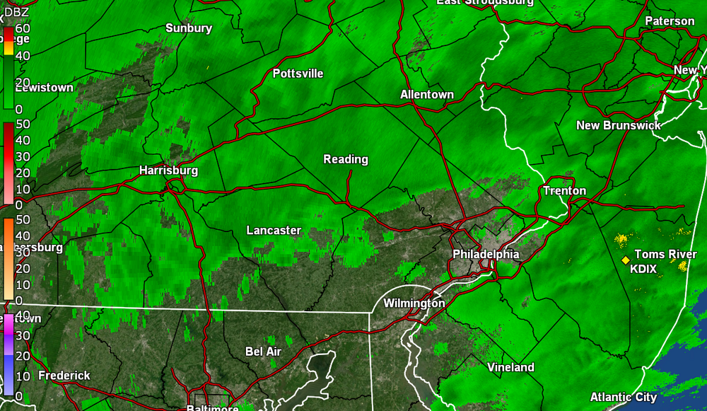
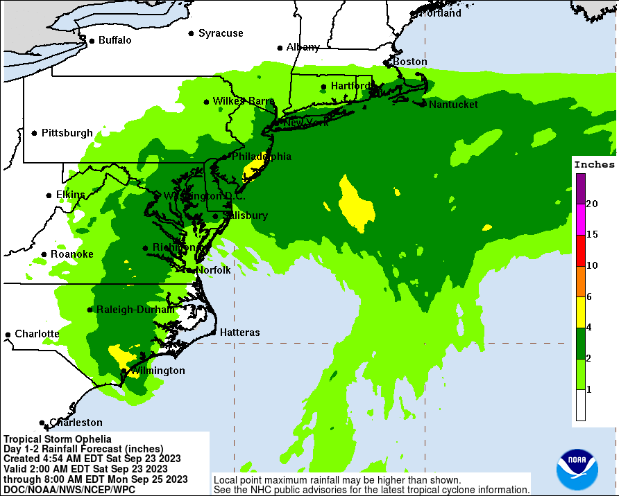
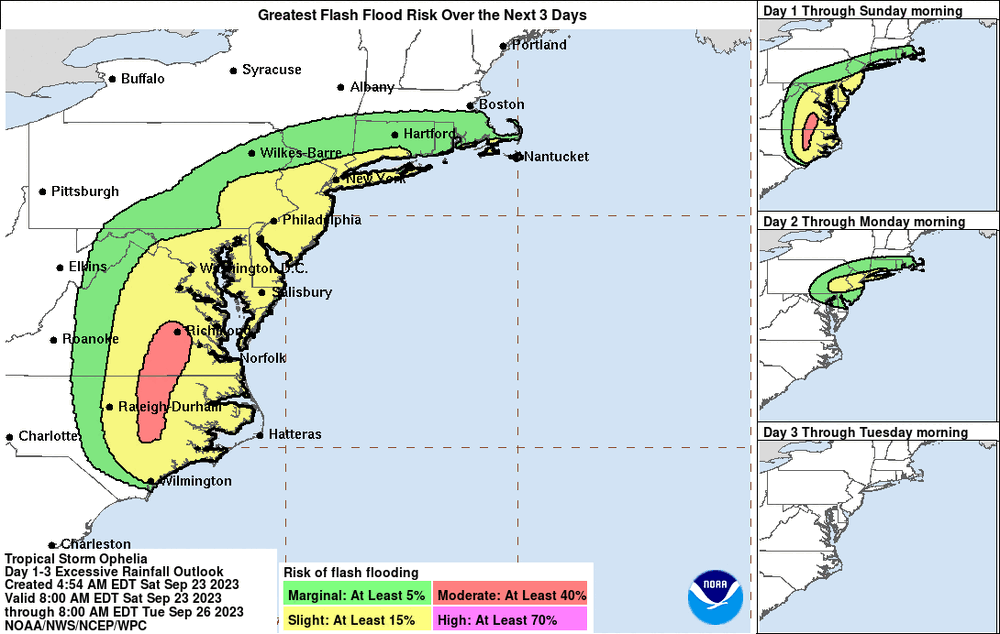
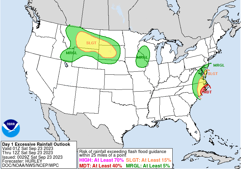
WPC rainfall forecast for the morning package, still on track for a general 1" - 6" rainfall across the CWA (with more to the S/E, particularly along the coast, and less to the N/W). CWA is in a general marginal to slight risk for flash flooding (although local conditions may depend on where bands set up given the storm has slowed and has a blocking high to the north).
-
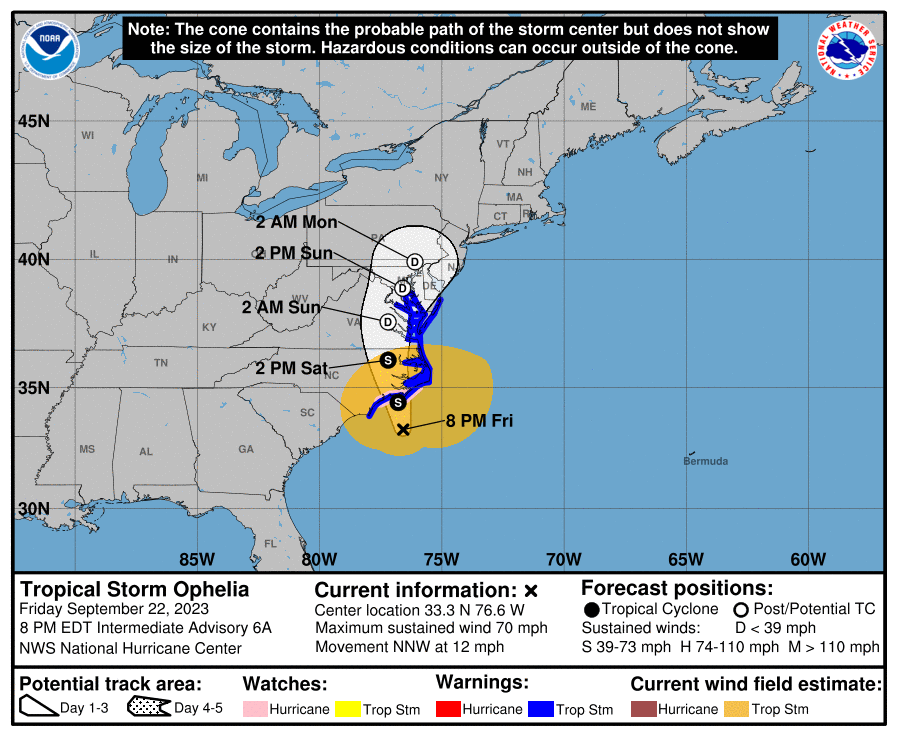
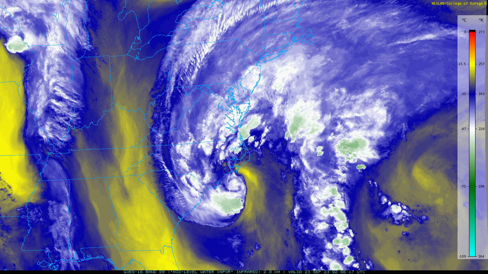
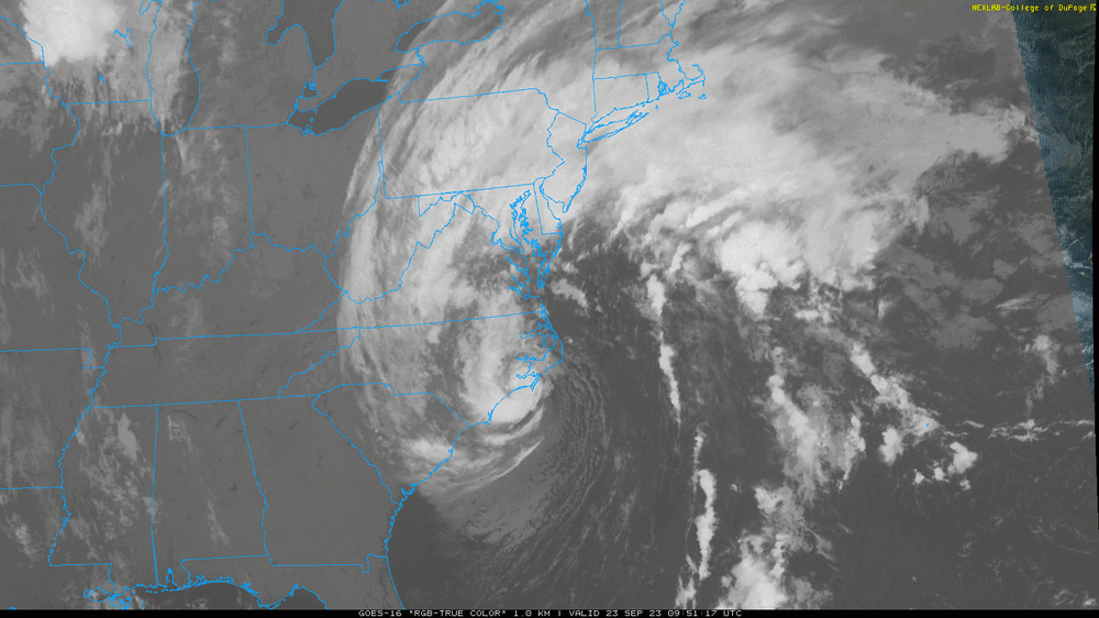
Ophelia continues to deepen and slow. Winds still holding at 70 mph. Heard some guy on KYW earlier this morning saying "Oh it's just a tropical storm". And my first reaction was - "Yeah, a HIGH END one". We're talking 70 mph sustained winds with who knows how high the gusts might be. Track ticked back to the east.
-
E PA/NJ/DE Fall 2023 OBS/Discussion Thread
Hurricane Agnes replied to Rtd208's topic in Philadelphia Region
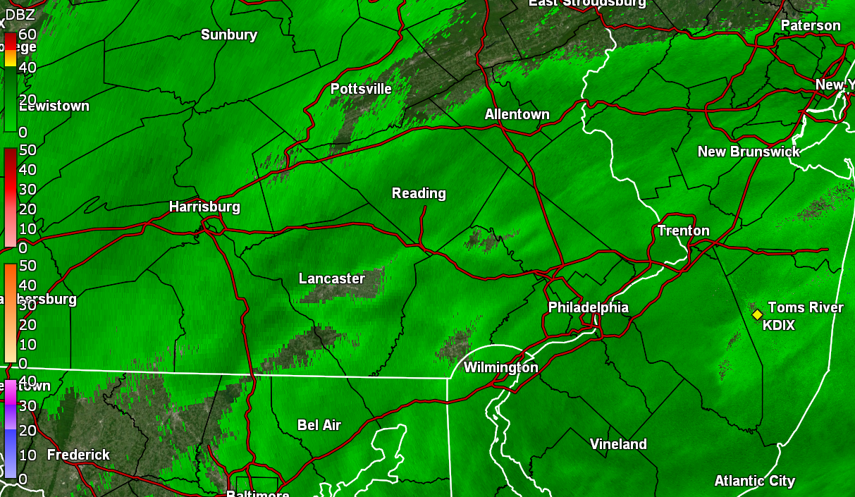
LOL And this is when Ralph is supposed to make an appearance. Am finally getting some light rain (apparently on and off) this morning and now up to 0.02". Temp 58 with dp 55. -
Finally starting to get some measurable here, with a first bucket tip for 0.01". Had expected to have woken up with it already accumulating but that was not to be. Currently damp and 58 with dp 55.

-
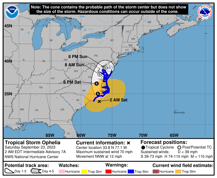
Steady as she goes at the 2 am update -
-
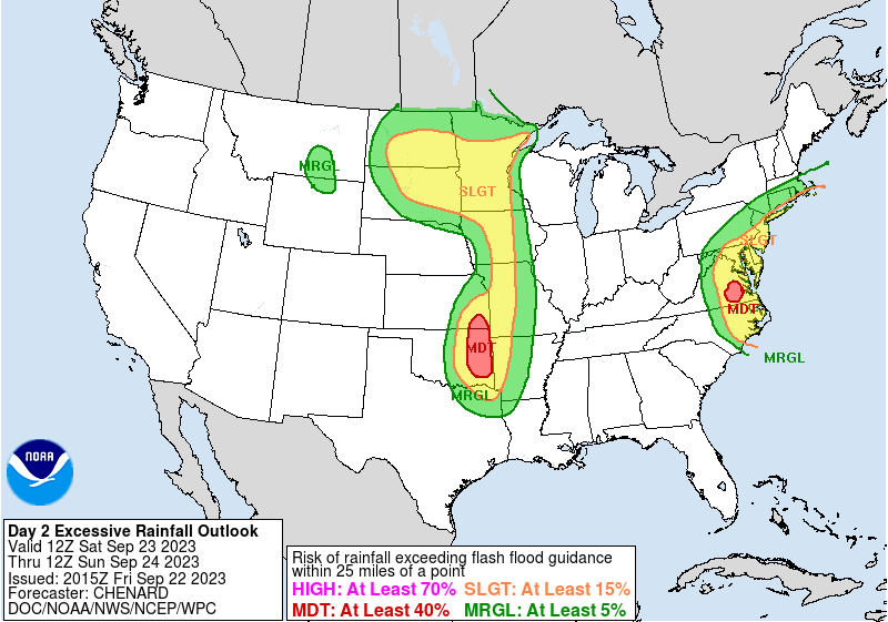
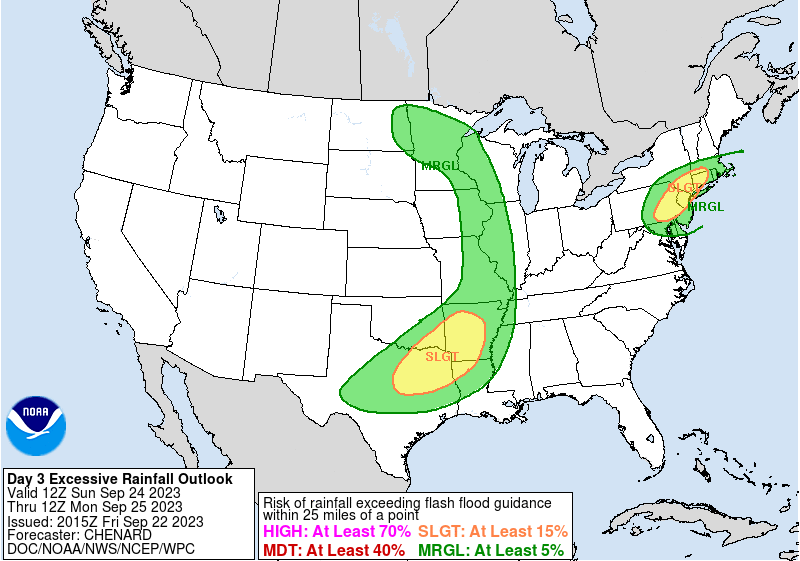
WPC flash flood/excessive rain - targeted as marginal in the southern part of the CWA for day 1, and a mix of marginal and slight for days 2 & 3. Cou;d be for some antecedent dryness.
-
Yup. Just refreshed it.
-
Looking for a couplet. Looks like a big version of this!

- 144 replies
-
- 1
-
-
- potential tropical cyclone
- floods
- (and 2 more)
-
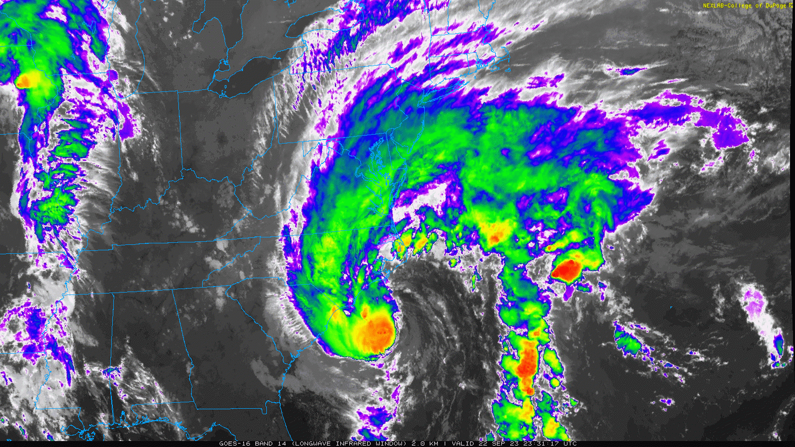
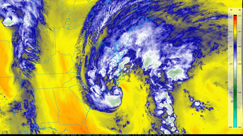
Mid- and lower-level...(Water Vapor). Yup. My dp is currently 55 (temp 62). Wasn't getting the typical "tropical feel" from it - at least yet. I guess as it moves further north, some of that might start mixing in.
-
8pm update and still deepening a bit but slowing down and still @70 mph -