Hurricane Agnes
-
Posts
9,355 -
Joined
Content Type
Profiles
Blogs
Forums
American Weather
Media Demo
Store
Gallery
Everything posted by Hurricane Agnes
-
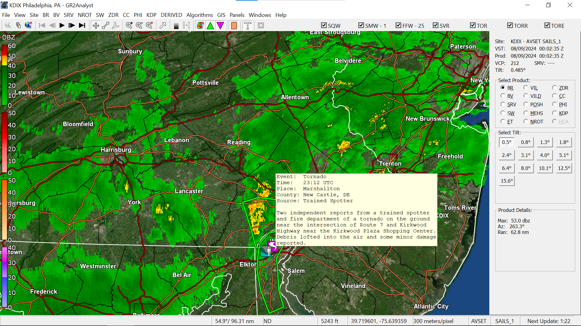
E PA/NJ/DE Summer 2024 Obs/Discussion
Hurricane Agnes replied to JTA66's topic in Philadelphia Region
Ended up with a high of only 72 today but it was so muggy that I needed to put the AC on anyway. I got a not-too-shabby round 3 of rain that pushed up from the SE that added 0.75" onto my 0.31" to give me 1.06" so far for today (3-day total of 2.88" and monthly total of 4.83"). Currently in a rain pause with temp of 72 and dp 72. I was up there about 10 years ago on a muggy overcast and threatening day and i can see why they might cancel given how much of it is "outside", although they do have much of it normally under tents. Could be they were concerned about some cell that might pop up and upend stuff. Yeah i saw that and I know the possibility was progged as Debby pushed north.
-
E PA/NJ/DE Summer 2024 Obs/Discussion
Hurricane Agnes replied to JTA66's topic in Philadelphia Region
After a low of 66 this morning, I managed to get a round 1 of rain between 5 - 6 am from a pre-Debby band that lifted up from the south, giving me 0.19". Have been under some more scattered rain now backing in and lifting up from the SE for an additional 0.12" for a round 2, giving me 0.31" total at post time. Currently misty with some intermittent light rain and 70, with dp 70. -
E PA/NJ/DE Summer 2024 Obs/Discussion
Hurricane Agnes replied to JTA66's topic in Philadelphia Region
Ended up with 1.48" overnight and 0.32" after midnight, for a 2-day event total of 1.80". Currently a misty 70 with dp 70. -
E PA/NJ/DE Summer 2024 Obs/Discussion
Hurricane Agnes replied to JTA66's topic in Philadelphia Region
Just passed the 1" mark and under a heavier blobette. Getting >1.75"/hr rates and up to 1.03" in the bucket. Plus now getting thunder/visble lightning. (ETA about 1" in just under 45 minutes) -
E PA/NJ/DE Summer 2024 Obs/Discussion
Hurricane Agnes replied to JTA66's topic in Philadelphia Region
Got an EAS for Flash Flood Warning. Currently getting >0.5"/hr rates. Have 0.75" in the bucket with temp 74 and dp 73 (+ steamy windows).
-
E PA/NJ/DE Summer 2024 Obs/Discussion
Hurricane Agnes replied to JTA66's topic in Philadelphia Region
>2.5"/hr rates. Currently have 0.46 at post time for my own round 1. Temp down to 75 with dp 73. -
E PA/NJ/DE Summer 2024 Obs/Discussion
Hurricane Agnes replied to JTA66's topic in Philadelphia Region
And as soon as I posted, here it comes!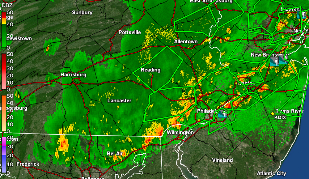
-
E PA/NJ/DE Summer 2024 Obs/Discussion
Hurricane Agnes replied to JTA66's topic in Philadelphia Region
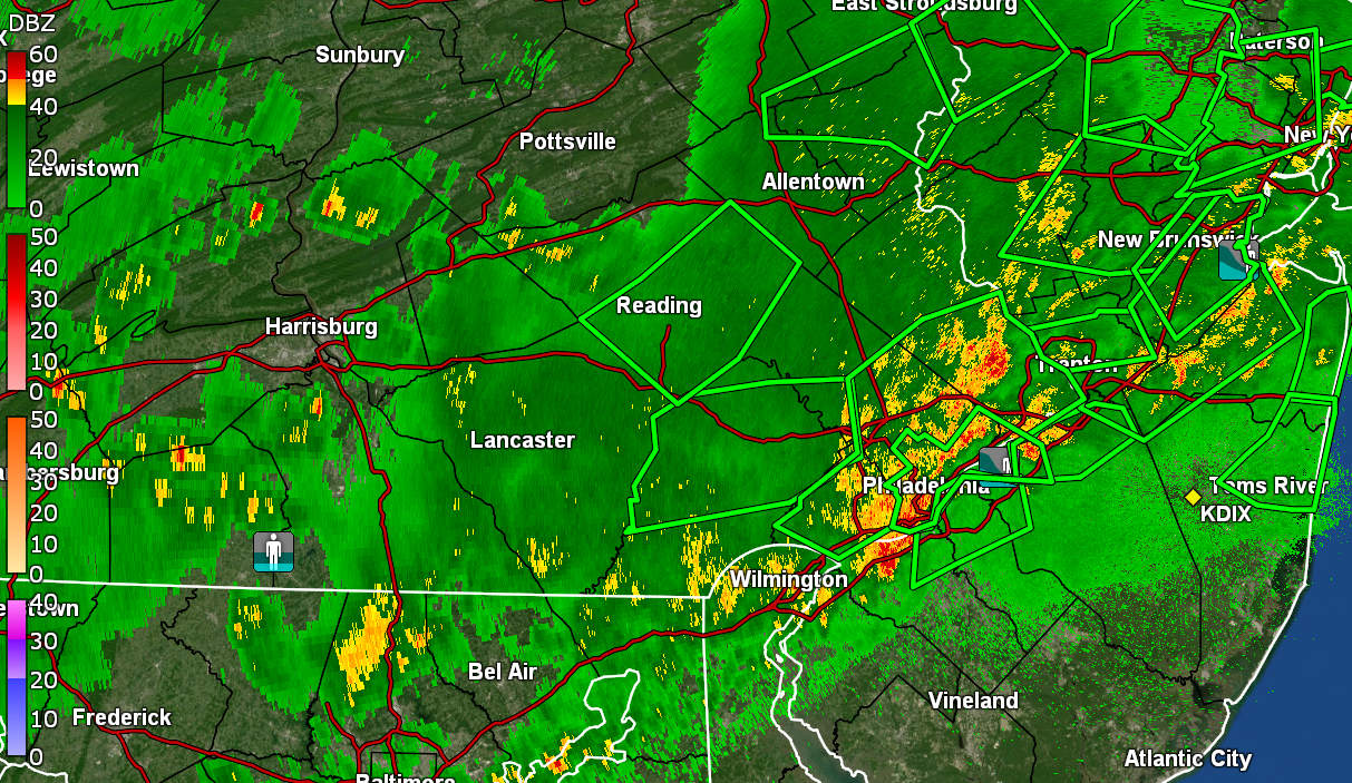
As solid as the radar looks, I still haven't gotten anything yet. There is a band approaching so might get something. Temp is down to 77 with dp 73 and have been picking up nearby convection (but no thunder). -
E PA/NJ/DE Summer 2024 Obs/Discussion
Hurricane Agnes replied to JTA66's topic in Philadelphia Region
Complete fizzle, miss, and formation of a precip. hole here. Temp had dropped some but is back up to 83 with dp 74. Am not whining yet since I did get some last Fri/Sat/Sun. i know there are plenty of chances the rest of the week from Debby. Seeing more sagging down. -
E PA/NJ/DE Summer 2024 Obs/Discussion
Hurricane Agnes replied to JTA66's topic in Philadelphia Region
92 and 80 dp. -
E PA/NJ/DE Summer 2024 Obs/Discussion
Hurricane Agnes replied to JTA66's topic in Philadelphia Region
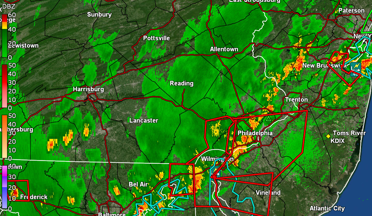
There's a bunch forming now including one that may be zooming north of you.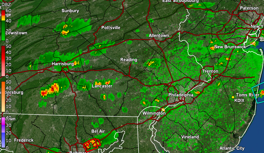
-
E PA/NJ/DE Summer 2024 Obs/Discussion
Hurricane Agnes replied to JTA66's topic in Philadelphia Region
ST Watches are up - Current temp here is 93 with dp 78. -
E PA/NJ/DE Summer 2024 Obs/Discussion
Hurricane Agnes replied to JTA66's topic in Philadelphia Region
Had a low of 77 this morning and it's currently 91 with dp 78, so something is definitely bound to pop up later this afternoon with that combo (particularly with the front). WPC has it juicy here... Once Debby drifts back out into the Hotlantic, it will refuel and just tear up the coast.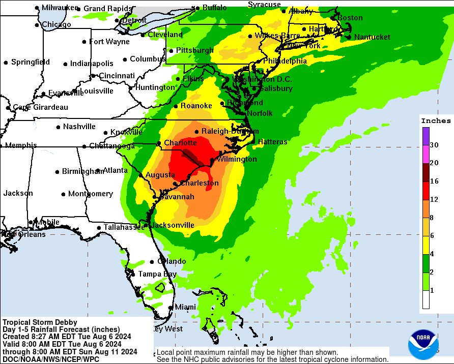
-
E PA/NJ/DE Summer 2024 Obs/Discussion
Hurricane Agnes replied to JTA66's topic in Philadelphia Region
Get ready! As an obs, I made it up to 92 as a high and it's currently 88 and partly cloudy with dp 73.
-
E PA/NJ/DE Summer 2024 Obs/Discussion
Hurricane Agnes replied to JTA66's topic in Philadelphia Region
After a low of of 73 this morning, am currently mostly sunny and 89 with dp 71. You're almost in the cone!
-
E PA/NJ/DE Summer 2024 Obs/Discussion
Hurricane Agnes replied to JTA66's topic in Philadelphia Region
Getting a round 2 shot - so far with an additional 0.05" along with some thunder. Currently have 0.43", temp 78, dp 77. Oh and "steamy windows alert". -
E PA/NJ/DE Summer 2024 Obs/Discussion
Hurricane Agnes replied to JTA66's topic in Philadelphia Region
That little line gave me 0.38" when all was said and done, giving me a 3-day total of 1.40". Before the rain, I hit a high of 83 (with a low of 72) and it's currently overcast, but clearing and misty, with a temp of 78 and dp of 77. -
E PA/NJ/DE Summer 2024 Obs/Discussion
Hurricane Agnes replied to JTA66's topic in Philadelphia Region
> 1"/hr rates for what will probably be a quick hitter. Have 0.19" in the bucket as post time. Temp 78 with dp 75. -
E PA/NJ/DE Summer 2024 Obs/Discussion
Hurricane Agnes replied to JTA66's topic in Philadelphia Region
There is a little line that formed that is incoming here in NW Philly. Will see if it holds together and gives me anything of note. Am just starting to get rain and am hearing thunder and it's coming down! I think the names are done by the international met organization. I was trying to check to see if there was a "Debbie" that might have been retired in the past.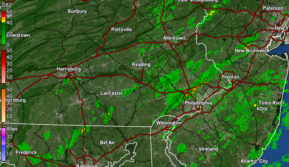
-
E PA/NJ/DE Summer 2024 Obs/Discussion
Hurricane Agnes replied to JTA66's topic in Philadelphia Region
Ended up with an additional 0.14" for a 3-round 0.65" for Saturday, and a 2-day total of 0.72". The high yesterday topped off at 91 before the rains dropped the temp significantly. Currently 72 with dp 71. -
E PA/NJ/DE Summer 2024 Obs/Discussion
Hurricane Agnes replied to JTA66's topic in Philadelphia Region
Getting another round of light rain now and picked up a couple hundreds so far from that (0.51" total for the day). Temp 72 and dp 71. -
E PA/NJ/DE Summer 2024 Obs/Discussion
Hurricane Agnes replied to JTA66's topic in Philadelphia Region
Doesn't look like much measurable in the immediate future so finished up wtih 0.41" on top of 0..07" from midnight for 0.48" so far today. Did have some thunder finally a couple minutes ago. Looks like there is some more stuff back around Harrisburg but I don't know how much of that will survive its way east. Currently 72 and misty with dp 71. -
E PA/NJ/DE Summer 2024 Obs/Discussion
Hurricane Agnes replied to JTA66's topic in Philadelphia Region
1.80"/hr rates with the back-build and 0.47" in the bucket (0.40" from round 2). Temp 74 and dp 72.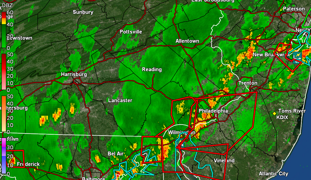
-
E PA/NJ/DE Summer 2024 Obs/Discussion
Hurricane Agnes replied to JTA66's topic in Philadelphia Region
Ooo... a blob just did a back-build over me. Getting some rain again.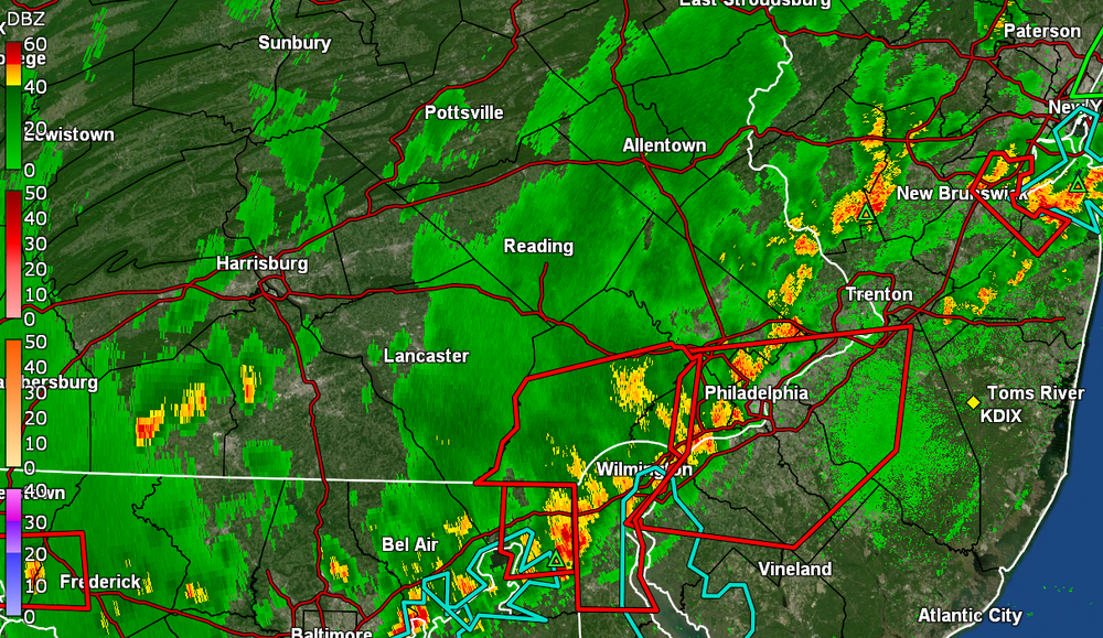
-
E PA/NJ/DE Summer 2024 Obs/Discussion
Hurricane Agnes replied to JTA66's topic in Philadelphia Region
It's fast moving and cools the air rapidly so the atmosphere seems to stabilize. Am down to 76 with dp 72 and still only 0.16" (total 2 rounds) in the bucket.