Hurricane Agnes
-
Posts
8,877 -
Joined
Content Type
Profiles
Blogs
Forums
American Weather
Media Demo
Store
Gallery
Everything posted by Hurricane Agnes
-
Temp now 33/dp 32 with light to moderate rain and lots of slush/melt. My rain gauge bucket is frozen at the moment so don't have a reading but do have a Stratus out there to get whatever the final total at some point.
-
Temp is creeping up now and am at 32 with light rain and dp 31. Sidewalks that did manage to cave are now wet.
-
And the changeover is in progress. Now getting light rain mixing in with some ip and flakes. Temp bobbing between 31 and 32 with dp 31.
-
My Upper Darby sis said she has had sleet for the past 1/2 now. For Haz...
-
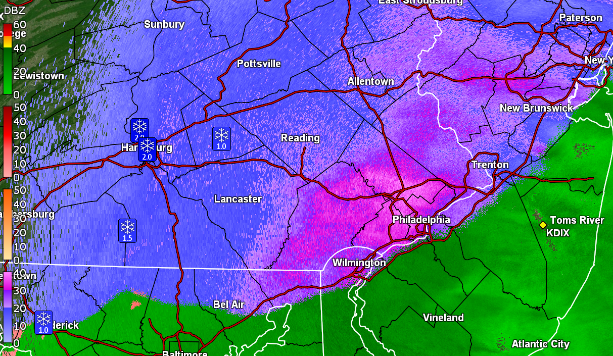
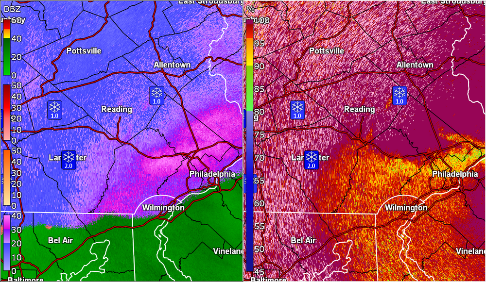
My SN with pancakes now has sleet mixing in. Temp down to 31 with dp 30. Measured 0.2" of a coating on cold/untreated surfaces. Classic sleet bright blob on the radar.
-
Thank you!
-
Still have light snow but now getting car topping of it as the flakes cool the surfaces. Temp now down to 32 with dp 30. Am seeing a heavier band to my west that some are under at the moment. Need some Jersey input for how accurate (if at all) that rain/snow line is.
-
Have been getting variable rates/flake sizes but it's now starting to stick to the grass and mulched surfaces. Still holding at 33 with dp now 29.
-
Have flakage going on. So far melting on surfaces. Temp is 33 with dp 28. Upper Darby and Wyndmoor sisters reporting flakes as well.
-
Overcast and 31 with dp 28 here in NW Philly.
-
First graupel sighting!

-
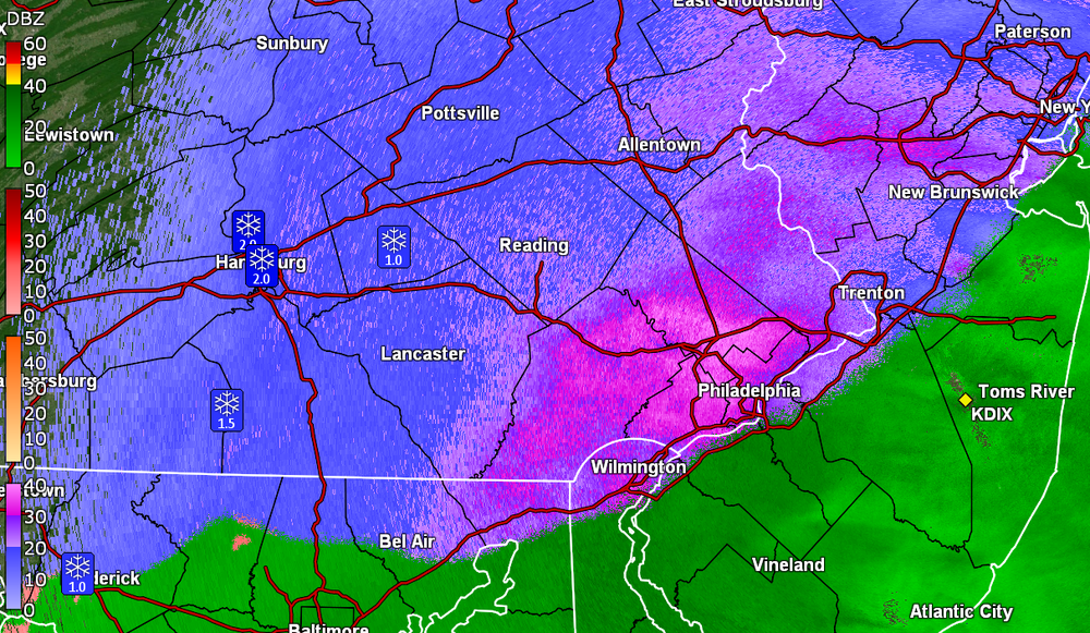
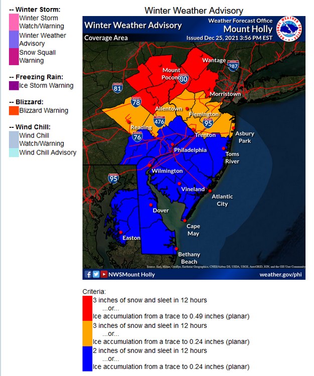
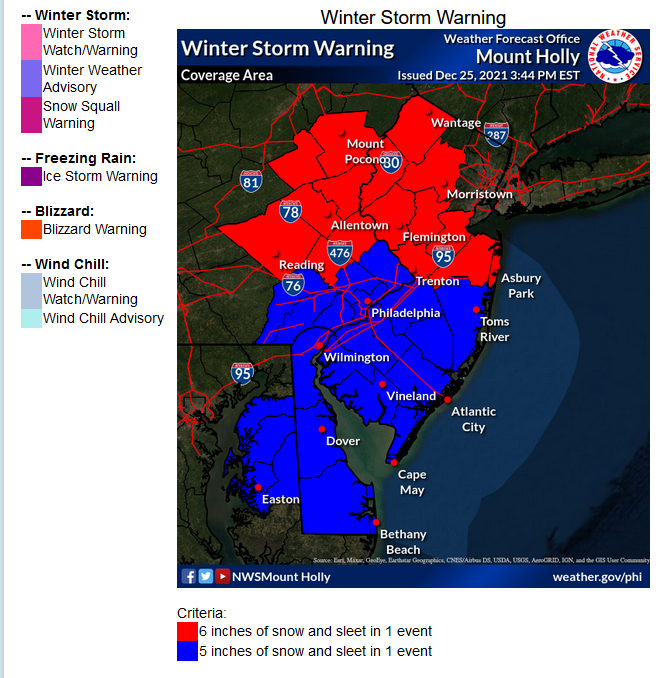
They have a graphic (with a mouse hover) that shows the criteria here - https://www.weather.gov/phi/criteria-winter
-
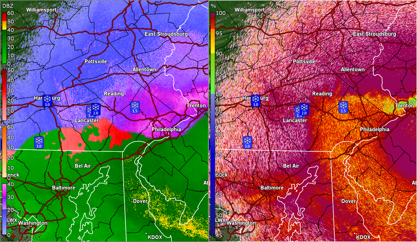
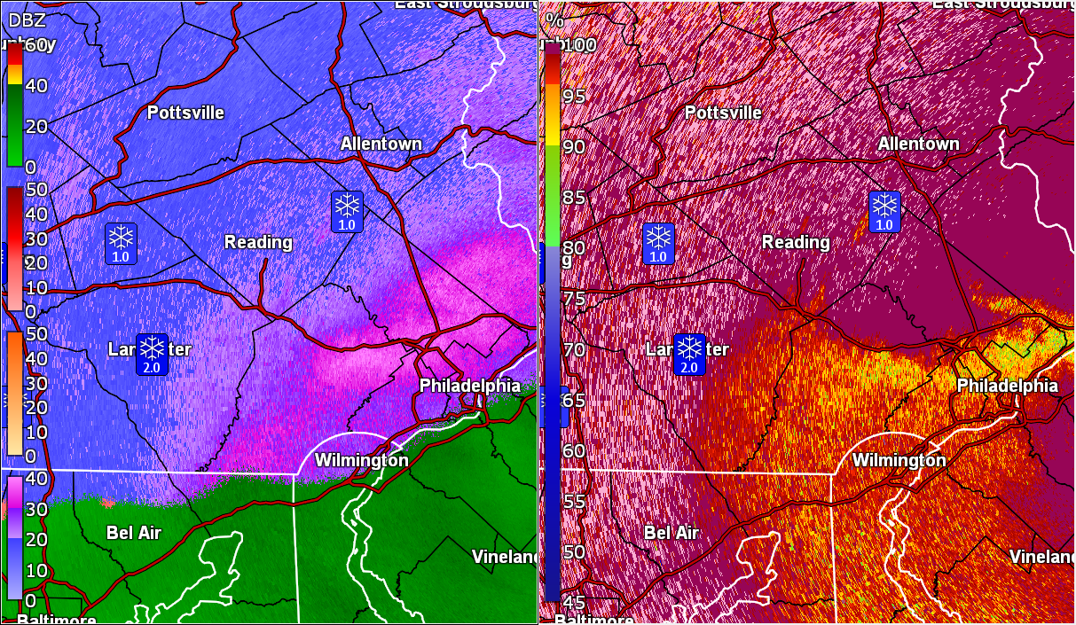
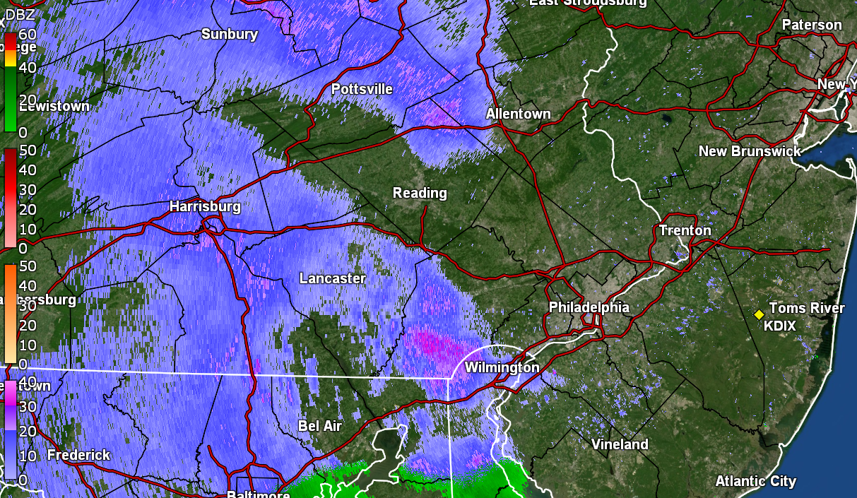
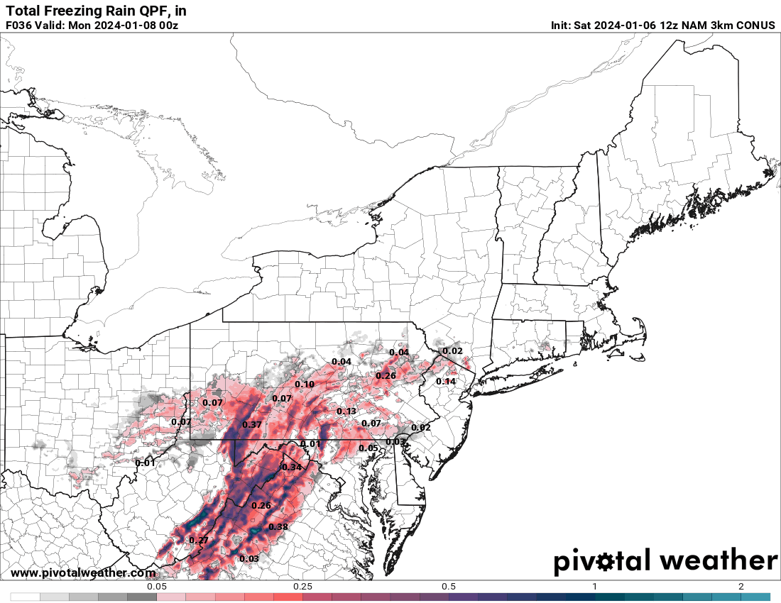
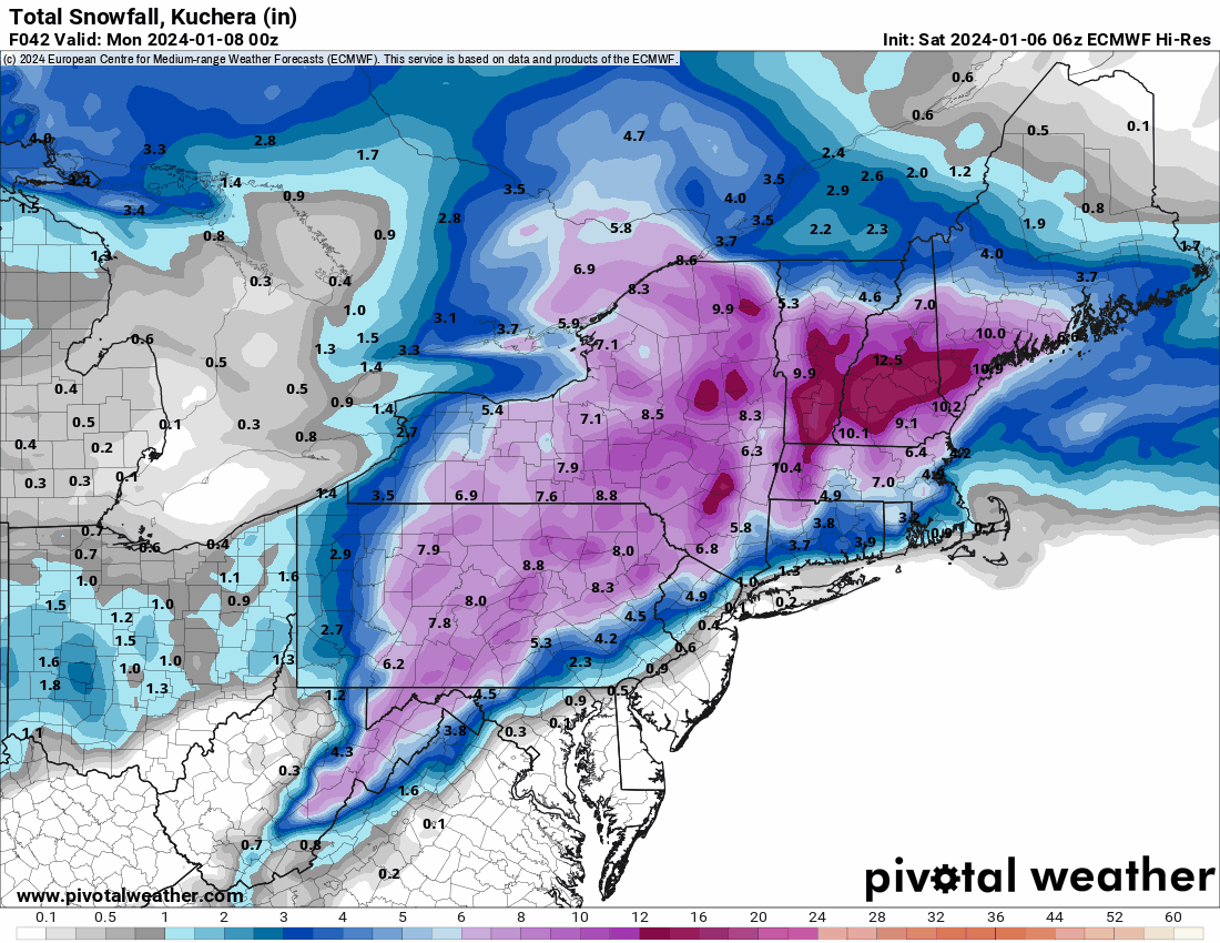
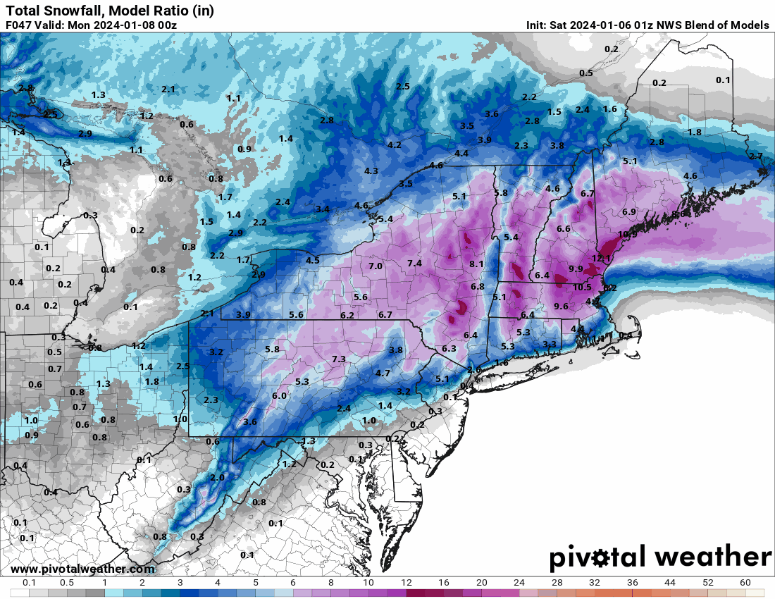
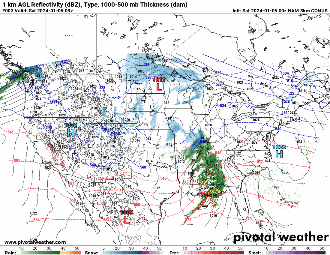
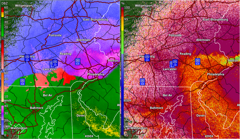
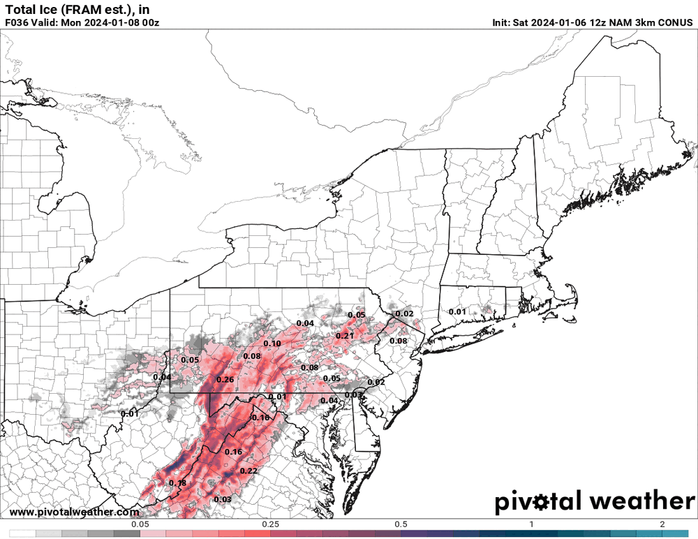
12z 3k NAM has some ugly ice progged.

-
E PA/NJ/DE Winter 2023-2024 OBS/Discussion
Hurricane Agnes replied to The Iceman's topic in Philadelphia Region
Made it up to 36 for a high yesterday and bottomed out at 23 this morning around 2:15 am and the temp has been creeping up since ahead of the storm. Currently overcast and 28 with dp 24. -
Yup. That's what made me pull up the radar to see what was going on as I'm so used to dry air hanging on for dear life before trying to saturate ahead of storms.
-
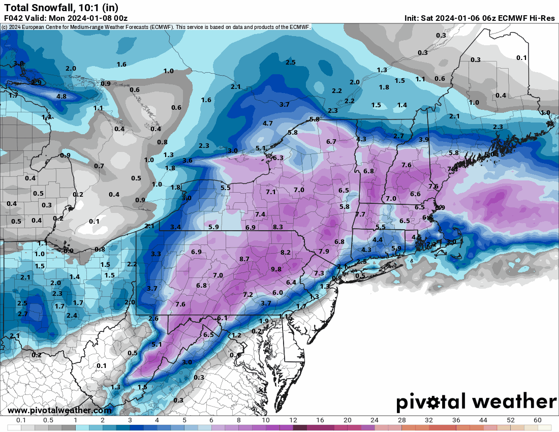
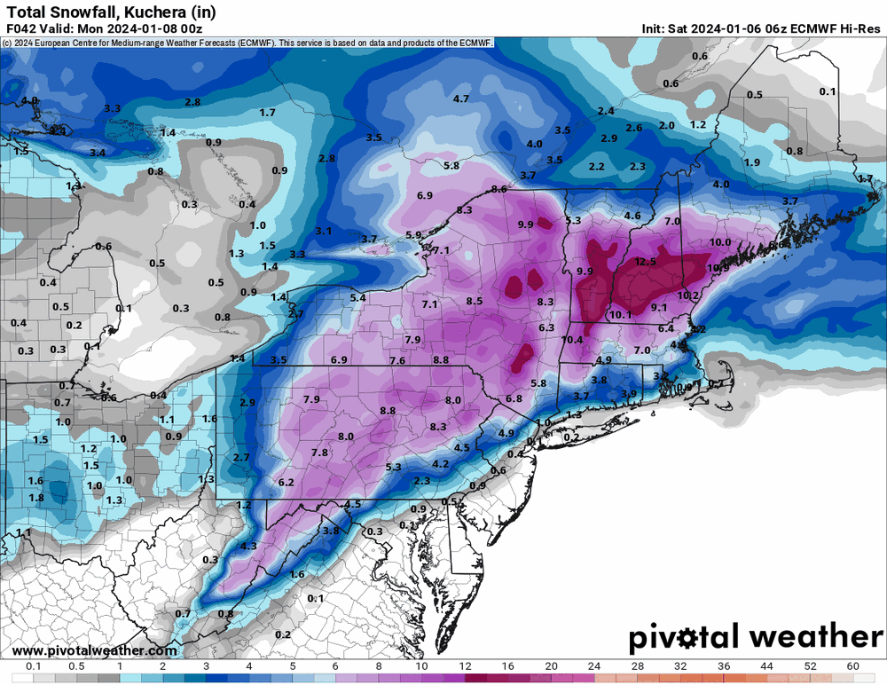
6z EC hires maintaining that death band potential up north.

-
There is junk and stuff rolling up the Appalachian spine.
-
I'm north of you and am at 28 with dp 24. I actually bottomed out at 23 at about 2:15 am this morning and the temp/dp has been creeping up ever since.
-
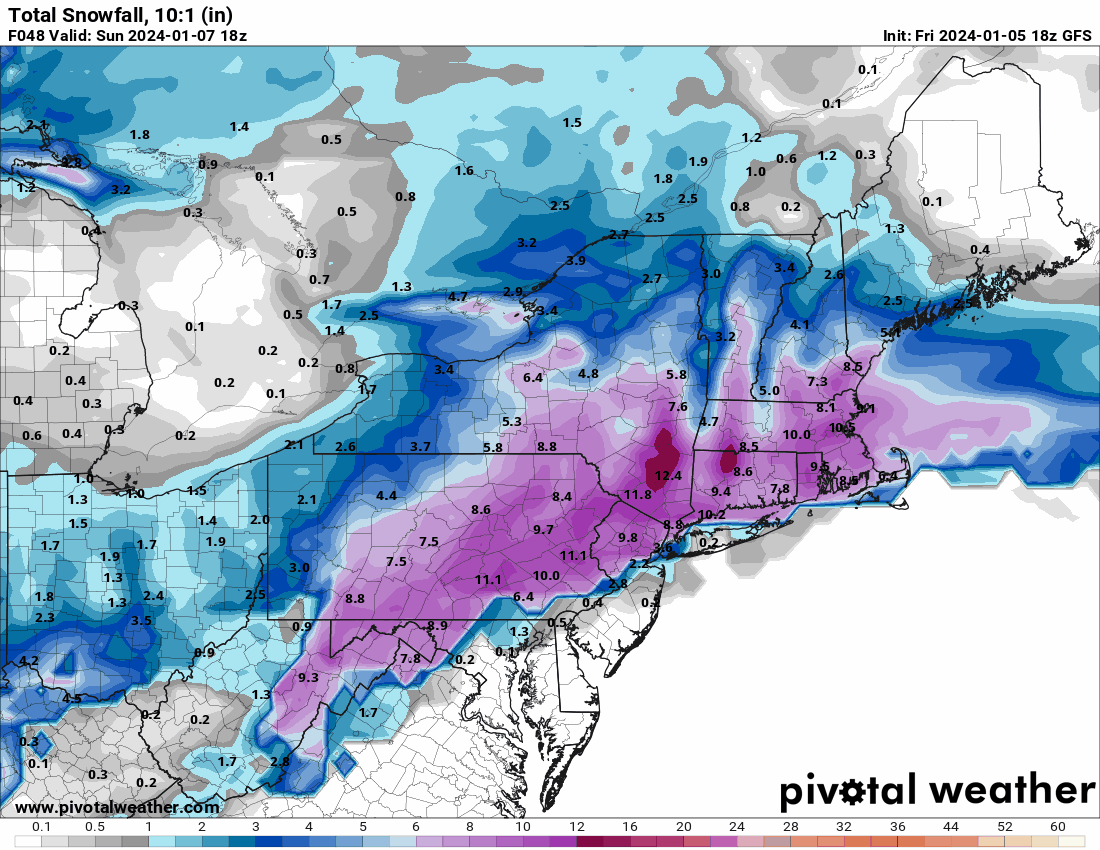
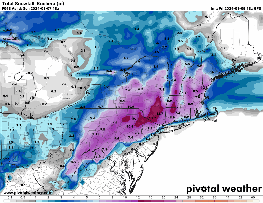
NBM holding with what it might be thinking will be a warm nose intrusion in the midst of this (cutting down on totals by the end of the storm).

-
Some nutty stuff going on!

-
Been awhile since we have seen one of these!
-
Yup it is. The models seem to have been sensing what amounts to 2 lows (or maybe one as a shortwave/disturbance that gets fired up with the low that is supposed to move up from the GOM). It's interesting to see how that manifests on a run though!
-
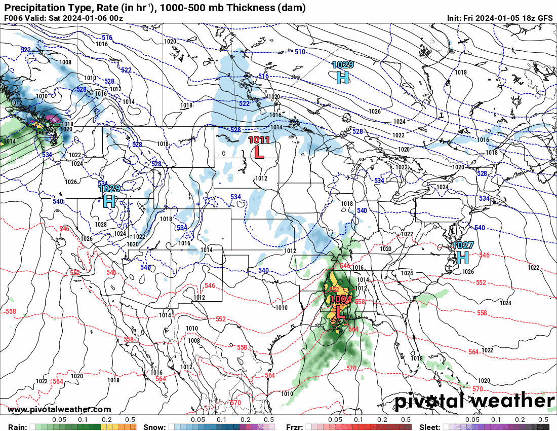
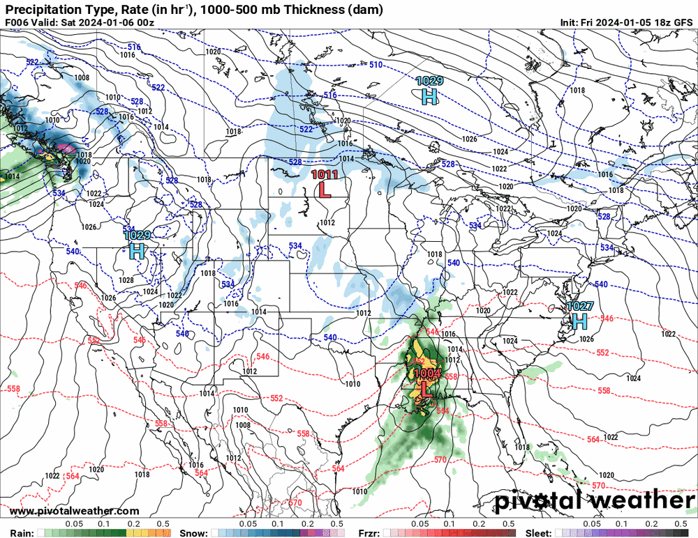
18z GFS with a low trying to act like an apps runner.


-
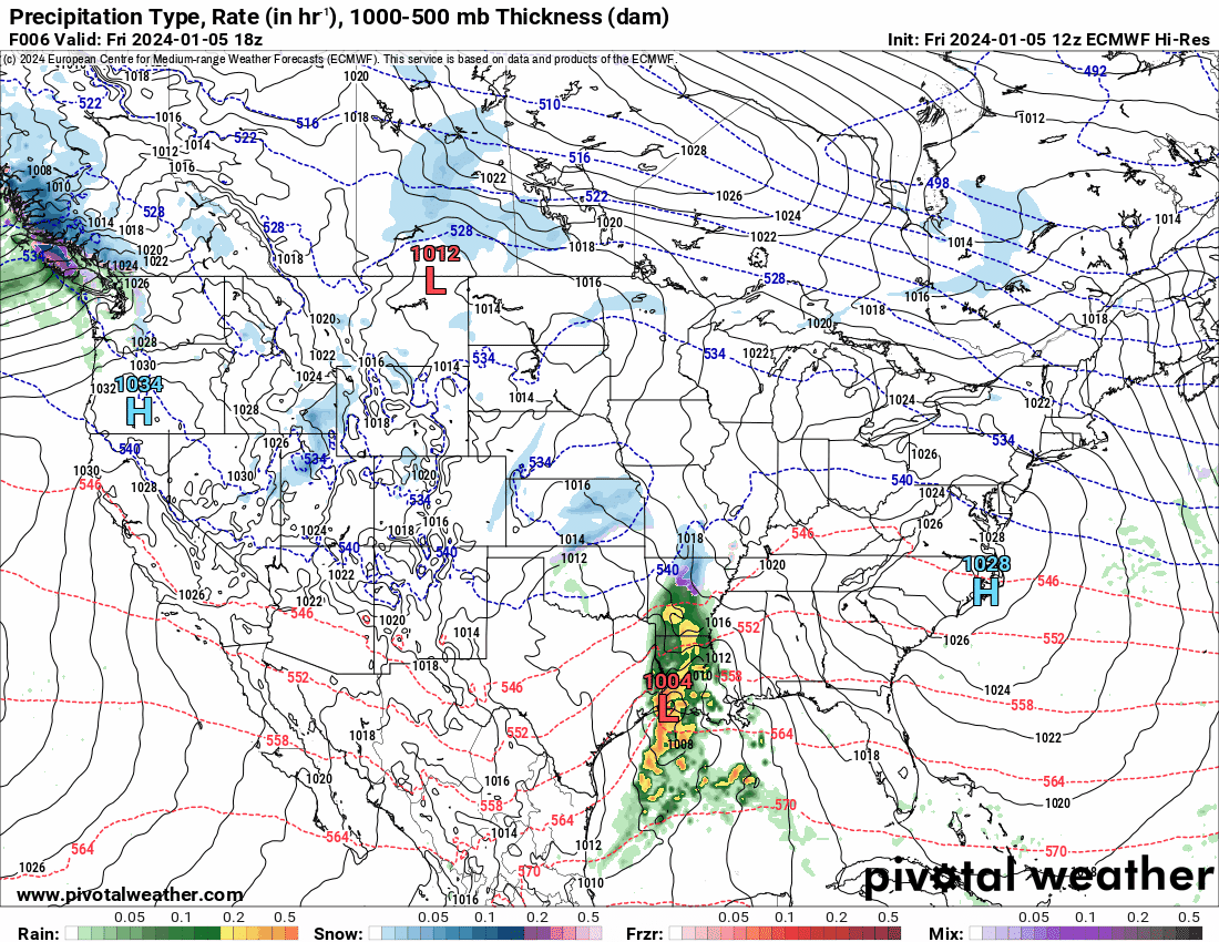
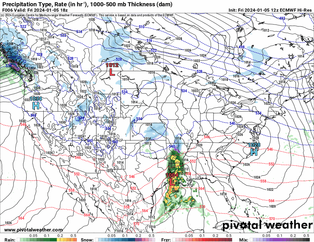
12z Euro decided to keep the low inland all the way up until it got close to here and then says - "oh yeah, better head on out over the water".
-
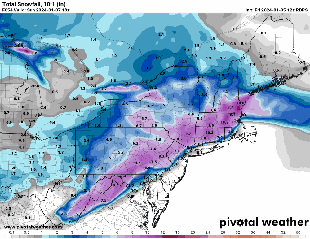
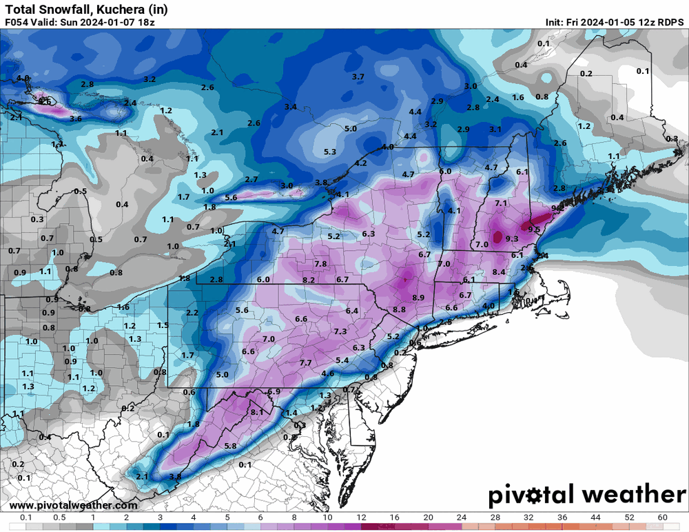
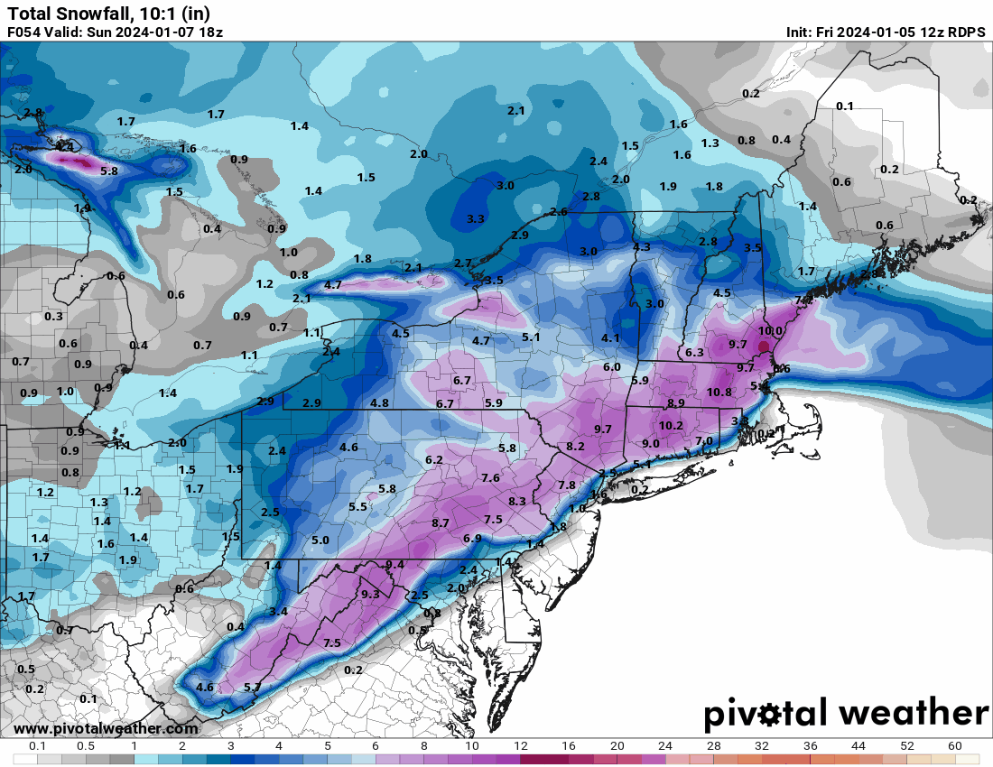
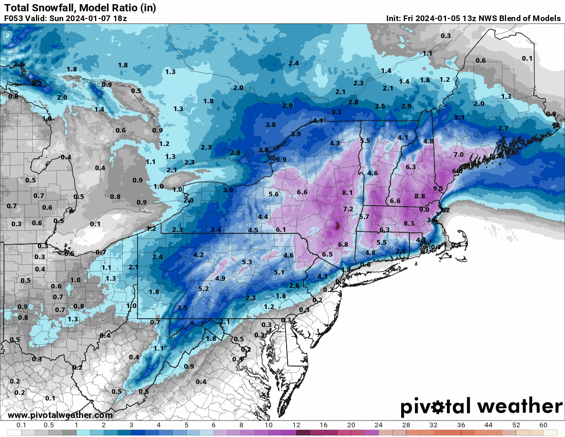
12z Canadian & 13z NBM. Same theme of I-78/I-80 north special.