Hurricane Agnes
-
Posts
8,877 -
Joined
Content Type
Profiles
Blogs
Forums
American Weather
Media Demo
Store
Gallery
Everything posted by Hurricane Agnes
-
Hit 90 here before noon. SPC just issued a Severe Thunderstorm Watch for the entire area - Currently 90 with dp 67 and mostly sunny.
-
Just hit 95 IMBY. But then the dp is 66. Lots of cumulus have rolled in too. Radar is showing scattered pop-ups forming along a line way up NW of here by Jim Thorpe and vicinity now.
-
Maxed out at 91 today (2nd 90+ so far), with a low of 73 this morning. The dews have remained in the upper 50s so not too bad. Currently 86 and mostly sunny.
-
Registered my first 90 of the year today around 3 pm. Dews have stayed in the upper 50s so a bit uncomfortable but not a steam bath. Currently 86 and mostly sunny.
-
Made it up to 88 today, which is the hottest so far this year. I was fringed by the storms this morning and basically got no measurable. After steamy dps near or at 70, the cold front thankfully came through and took it down about 10 degrees. Currently 79 and partly cloudy after a pretty sunset.
-
Had some dribs and drabs between 1:30 - 2:30 am and then had a heavy downpour around 3:30 am. Total this morning so far has been 0.18". It's currently 70 and overcast.
-
Sun just popped out and temp had dropped down to 72 during the rain but is on its way back up and currently 73 and partly cloudy (at least to the west and overhead). Ended up with an additional 0.40" of rain for a total of 1.31" for the day (so far). There appears to be another line of light returns to the west and am not sure if anything will come from that but will see.
-
Gully washer going on now. Getting some thunder but pretty big rain drops. Getting > 1"/hr rates. Temp down to 78.
-
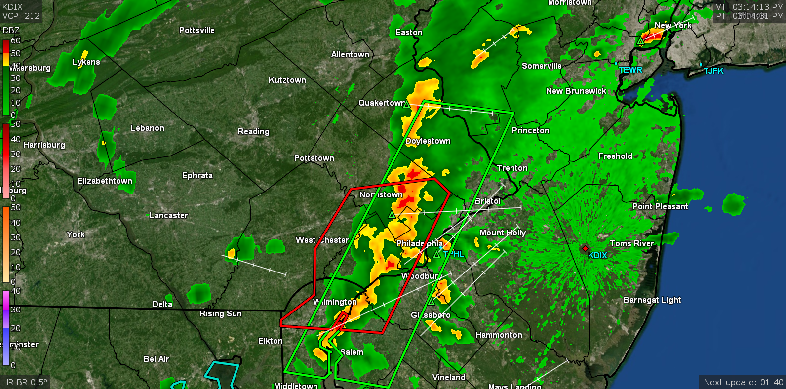
Temp had shot up here when the sun was out and it literally went from the low - mid 70s, right straight to 85. Then it clouded it up with the incoming line and the temp dropped a bit but it is still 84 with a dp of 72! Steam bath. This may mean business...
-
Starting to get some fog moving in here once the occasional light puffs of wind went silent. Temp is up to 71 and it's overcast with fog and mist.
-
Wow. Finally got an update at what happened at that Acme in Flourtown. Heavy rains & roof collapse around 4 am this morning contributed to a break in the sprinkler system pipes that flooded and damaged the interior of the supermarket. They said employees in the store were able to self-evacuate but there's no ETA for when the store might reopen as they have to assess the damage. ETA - looks like DIX came back online around 6:30 am. Sun is popping in and out here now too.
-
Looks like the heaviest may be over here and picked up an additional 0.08" since my last report, taking me up to 0.91" for the event. Looks like DIX may have dropped offline just after 6 am. Currently 70, mostly cloudy and misty, with some sun attempting to shine through the clouds.
-
I had heard on KYW's traffic report earlier this morning that there was a possible lightning strike/fire/roof collapse "at a supermarket" in Flourtown. The streets marking the boundary of the closure of Bethlehem Pike suggests that it might have been the Flourtown Acme (there's a Giant a bit further down Bethlehem Pike). Have been hunting for some more info as I do go to that Acme on occasion.
-
Finally got in on the action within the past couple hours. Had the heaviest between 3 am - 4:30 am accompanied by a garden variety thunderstorm (with lightning), something that was missing with previous storms. The small band of storms has moved to the north of here at the moment. Currently at 0.83" from the overnight rain, overcast/misty and 69.
-
I have been dodging the bullet the past couple days. Had 0.01" yesterday and today (so far), both days with scattered non-measurable sprinkles on and off during the day with periods of sun both days. Yesterday's rain was more north and today I was fringed with the rain with the heaviest cells just a few miles to my north that fizzled over my area but then reformed into a line that eventually intensified over lower NE Philly and across into Jersey. I did hit 85 yesterday and had a high of 82 today. Currently 75 and overcast with dp 69.
-
Looks like the main line (and its remnants) have pretty much cleared my area and I ended up with 0.22" of rain so far today. Current temp is 72 and it's partly sunny (but with a heavy cloud deck that the sun is has been peeping through) and soupy out with dews in the upper 60s/low 70s.
-
Was just under a line of heavy rain. Had made it up to 85 this afternoon just after 2:30pm after a non-measurable brief sprinkle came through around 1 pmish that dropped the temp about 5 degrees from the high at the time... but definitely added some humidity. Currently up to 0.11" with it so far (seems to be moving quickly) and temp is down to 78 and falling.

-
Was in the Narberth area in Delco when the sky just opened up. Heard all the EAS flash flood warnings come through on my way back home through Manyunk and on up to Chestnut Hill. Lots of standing water. Got an additional 0.56" of rain from the last round giving me a total of 1.30" for the day at post time. Currently 63 with a little leftover light rain.
-
Looks like round 1 is pretty much done and I ended up with 0.74" of rain. Currently overcast and 58.
-
The rain didn't get underway here until just before 4 am and it's been going in varying intensities from light to moderate since. Am currently up to 0.70" (close to what I got the last event after 2 days) with moderate rain and 57.
-
After some dribs and drabs yesterday, finally got a heavier brief round of rain(>1"/hr) around 8pm last night. The measurable pretty much cut off after 9 pm resulting in 0.64" for the day but did resume just after midnight, with a brief shower around 12:30 am and a couple more showers between 4 and 5:30 am for another 0.14" (total for the 2-days so far was 0.78"). It was pretty steamy with dews in the low 70s yesterday afternoon that steamed up the windows. Currently overcast, breezy, and 67 as the back edge moves east and the cold front moves through.
-
That high to the north has been stubborn but it brought a beautiful day, albeit one with a lot of cirrus. I just came back inside and couldn't figure out why it felt "chilly" at 71 but then saw the winds have been generally easterly blowing in from the chilly ocean. It did get up to 78 though with the dews ranging from the mid-40s to the low 50s. Currently 71, partly sunny and breezy with what looks like a thick cloud deck sitting there hovering to the south.
-
Got a couple rounds of brief scattered but heavy (1"/hr) showers overnight - one around 10:30 pm with 0.27" and the other (with same rates) around 2:30 am with another 0.27" for a 2-day total of 0.54". The way it was clouding up yesterday afternoon, I expected something much earlier but much of the activity seemed to be to the south and east of here. It did make it up to 85 yesterday before the clouds started rolling in. Currently a steamy (windows fogged up) 69, with dews in the upper 60s, and mostly cloudy with the sunrise.
-
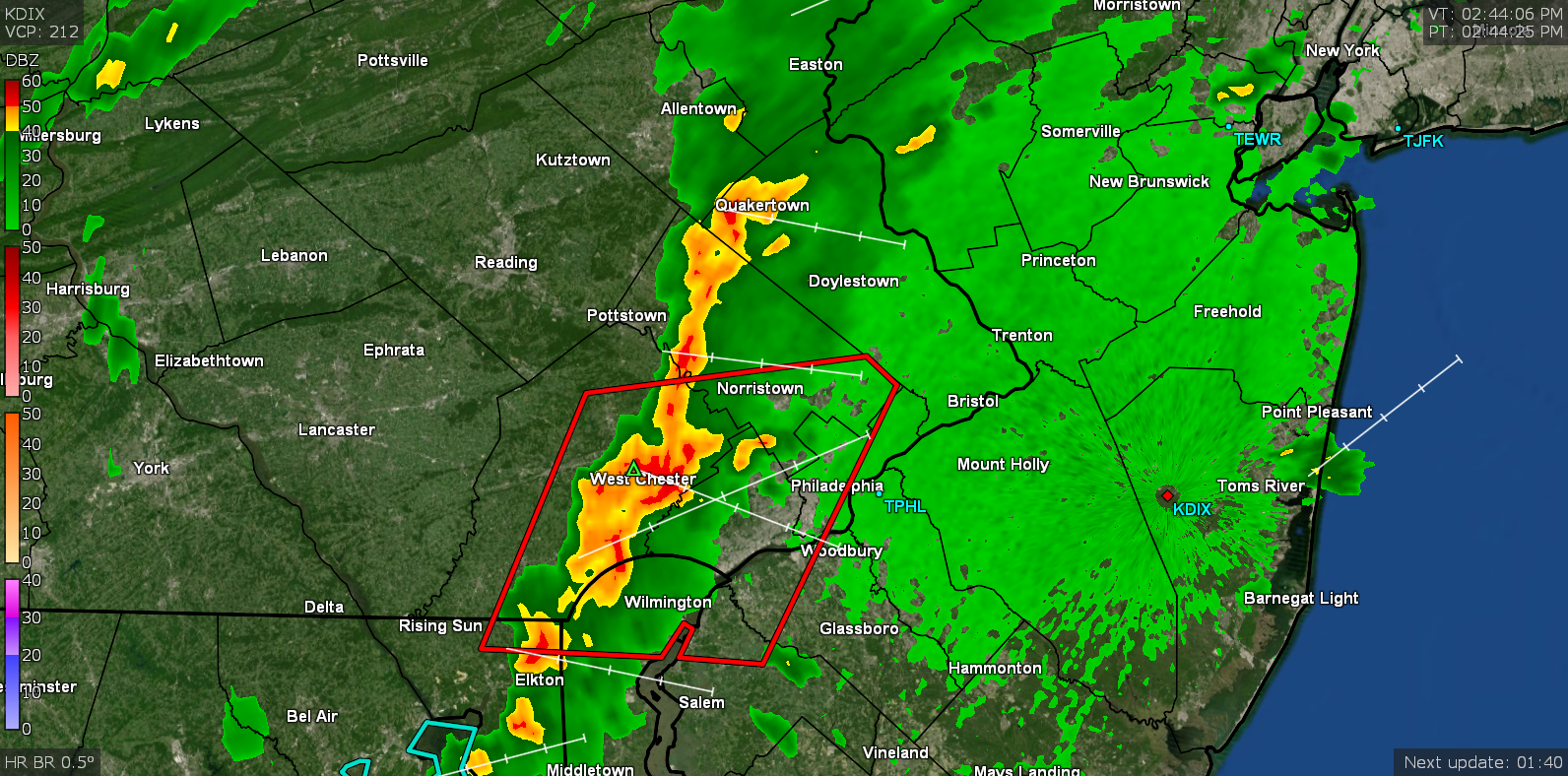
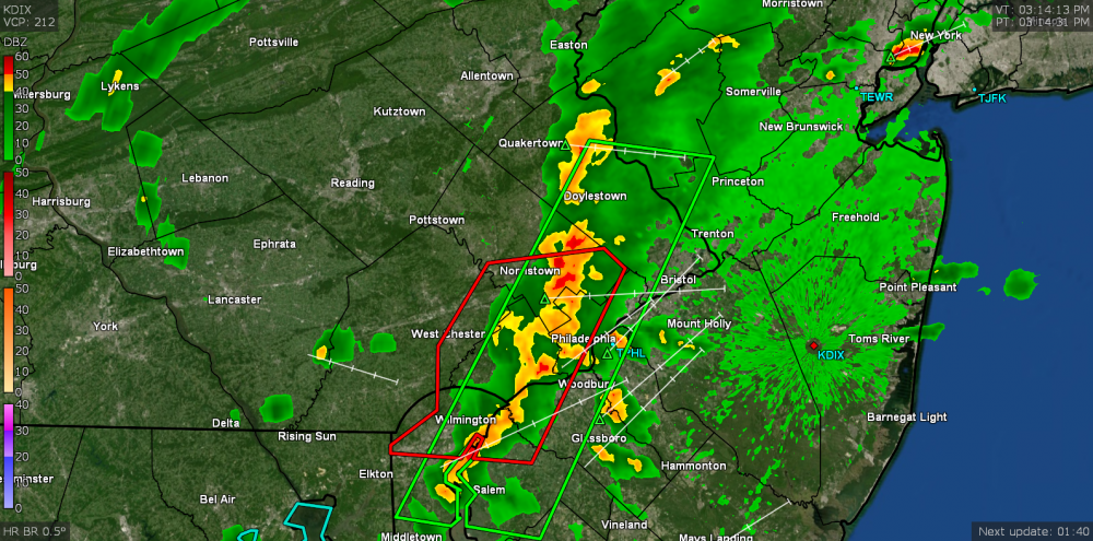
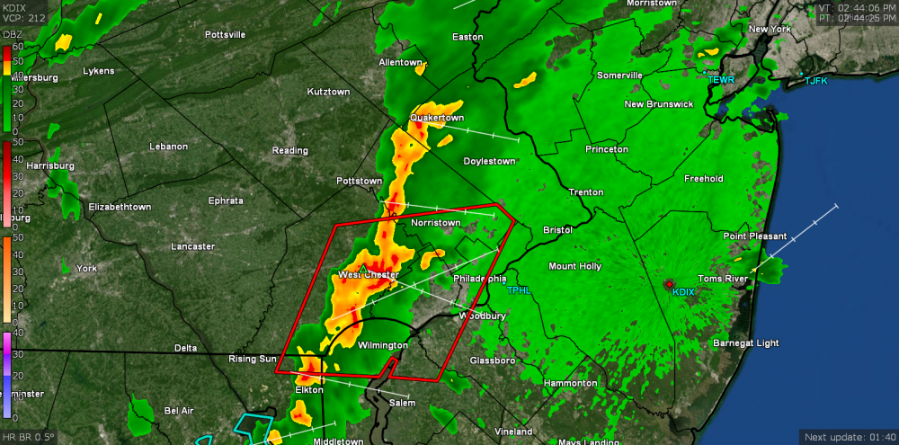
Sun back out. The cell had a history of producing 1/4" hail but apparently here over the city, the atmospheric heat sink melted the small hail pieces resulting in huge rain drops (I thought it might have been hail and stood out in it but it was all liquid) - and not even enough to tip the bucket. Temp is down to 75 but I noticed the dp was dropping a bit - down from the mid-60s earlier to upper 50s.
-
Am probably going to get sideswiped by the worst of the cells to my NW (other than one little finger. It has gotten dark and the thunder has been rumbling in the distance... Currently 78. It just started raining big drops.