Hurricane Agnes
-
Posts
8,877 -
Joined
Content Type
Profiles
Blogs
Forums
American Weather
Media Demo
Store
Gallery
Everything posted by Hurricane Agnes
-
Just hit 93 here with a dp of 74 and heat index at 102. Had to go out earlier today and it was getting rough out there. There's been a good amount of cumulus clouds to occasionally block the sun, so that may slow the speed of the temp ramp up a bit. I expect the asphalt roads will start to soften by this weekend though.
-
Sun is starting to peep out here. The heavy rain missed this area but I picked up an additional 0.05" for a grand total of 0.07" for the day. The heavier blip went south of me and certainly caused a whole lot of racket (didn't see any lightning but heard quite a bit of thunder) and the follow-up smaller blip broke up and fizzled as it came over me. It did knock the temp down quite a bit as it's currently 77, but the dp is a steamy 76 (heat index 83), and it's partly sunny.
-
Wow. Just saw this article about straight-line wind damage in Ewing. Hope Ray's parents weren't impacted - https://6abc.com/weather/straight-line-winds-blamed-for-storm-damage-in-ewing-twp-nj/5403184/
-
I got missed by that round but the temp eventually dropped down to 80 about 45 minutes ago but is creeping back up again and now at 83. Dp did drop as well and is down to 70 (if you can consider that a "drop" although it was mid-70s earlier so I suppose it is.... ). There's another broken line coming this way so will see if it back builds and holds together or breaks up and goes around me again.
-
Hearing all kinds of thunder from that cell that has been moving through eastern Delco across into West Philly about 7 miles to my south. My sis in Upper Darby had texted that they were having a "super thunderstorm" and pouring rain. This is the thing making a lot of noise all the way up here (sitting right over north central Philly)! Here the temp is down to 84 due to the overcast and a little rain (not enough to tip the bucket). But the dp is up to 76.
-
The sun came out faster here than I expected although it has been in and out this morning. It's up to 88 here with dp 74 (heat index is 96) and overcast. I see a series of broke lines moving this way from the west and southwest so will be interesting to see how much they stay together or whether I get bullseyed by any individual cells.
-
Final rainfall for yesterday ended up being 0.25". The low this morning was 74 and got a scattered blip of rain earlier this morning that deposited 0.02". Currently 76 and overcast/misty with steamy dews in the mid-70s.
-
Have finally been getting some steady rain. It's light (am up to 0.08" so far) but at least it's cooling the hot pavements and asphalt. The temp is down to 75.
-
Still no measurable rain here. It sortof scooted around us here where I am in NW Philly. The temp is down to 80 but the dews are still in the low 70s so what moisture did fall from the sky is keeping it juiced up. Still getting occasional thunder and lightning. ETA - finally got enough to tip the bucket to 0.01" & temp down to 78.
-
Still haven't gotten the rain yet but still breezy and just had some thunder. Am in the green hole that formed between yellow/red blobs... Mt. Holly just threw up a warning just as I was about to post. Temp is down to 85. ETA - am getting some rain droplets but nothing measurable yet.
-
Gust front is coming through. Looks like the heavier cells broke up as they hit the hills around here. Temp is down to 87. Rain is on the doorstep. Getting lightning but not hearing thunder yet.
-
Wow. Was just outside. That's a fierce looking storm. Getting the winds right now. Temp still 88.
-
Will be here soon... getting some clusters of mammatus. Temp is 88.

-
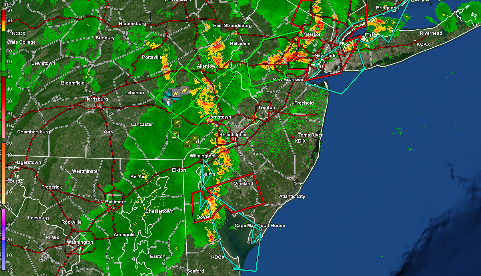
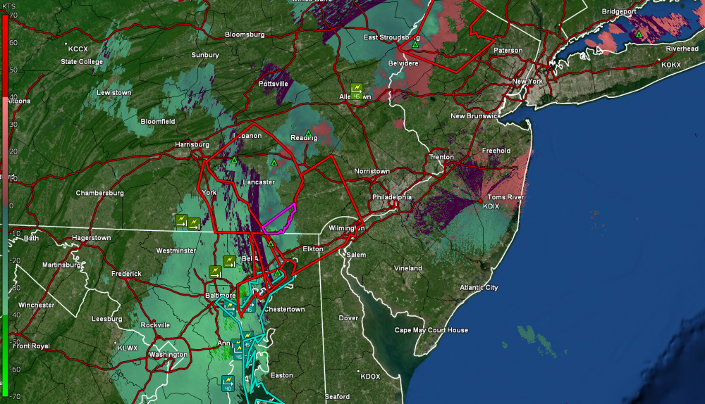
It has been moving pretty slowly (in a relative sense) which could prolong the rain amounts (have been shifting between 2 laptops with the 2 GR programs).
-
We used to have one of those 220V behemoths at work (old building) before they put in the (useless) retro-fitted cooling towers & chillers (that were totally unbalanced). Temp here is 89 and it is getting dark already. That line looks like it means business!
-
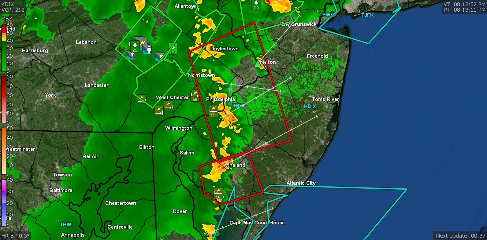
FWIW since I'm still playing with the program but here is the SRV from GR2Analyst & the nrot view as well (zoomed to also show the TOR)...
-
I actually had a decent mix of both cirrus and cumulus most of the day here so during those times when they blocked the sun, that did hold the temps down from going on a sustained rise to higher than what I ended up with.
-
I think at some point this afternoon when I was glancing at my console, the heat index hit 106. And this is just day 1. I guess how the rest of it plays out will be determined by how much rain we get tonight and tomorrow.
-
Looks like I topped out at 96 with the highest dp during that time being 75. Only thing that kept it from being worse was that there has still been a light but active breeze today. Currently 92 with dp 71 and partly sunny.
-
I've had to do that too. I usually don't leave it running once the storms are pretty much over but have kept it up the past couple days.
-
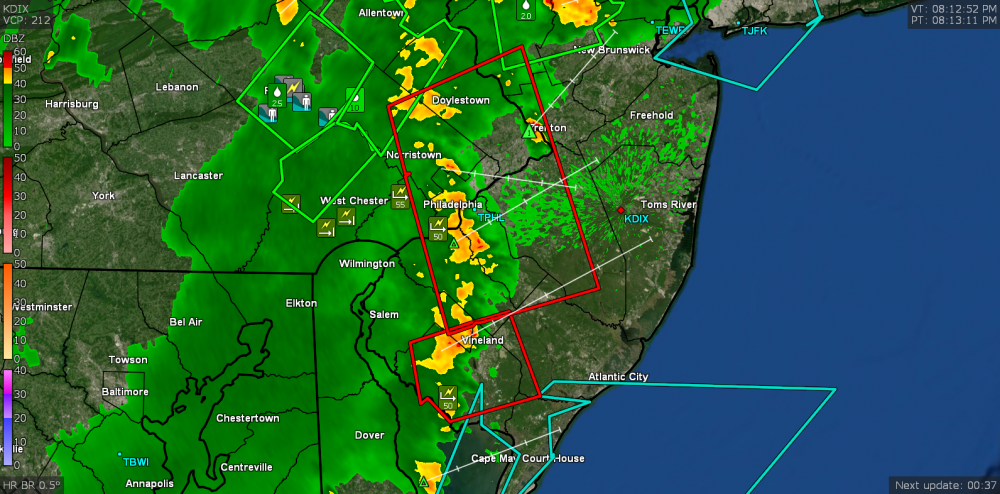
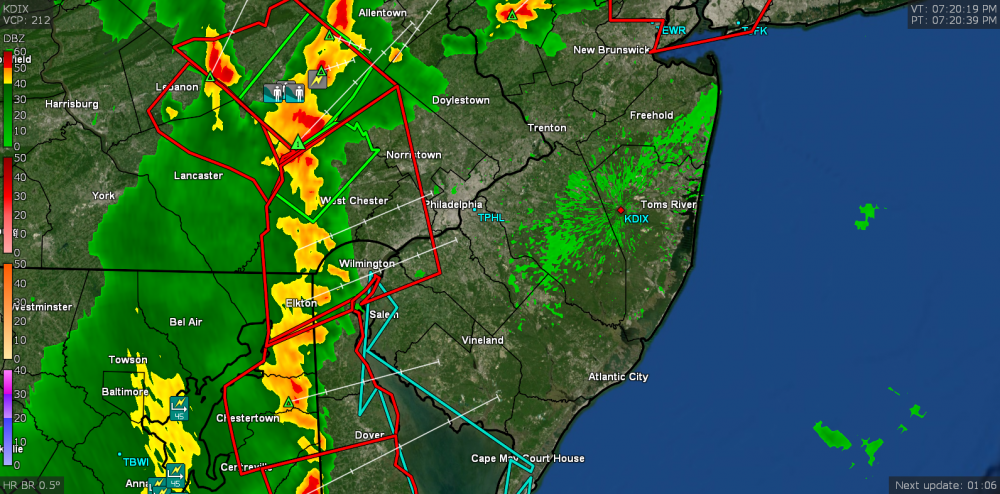
SPC has gone ahead with the Severe Thunderstorm Watch for the area -
-
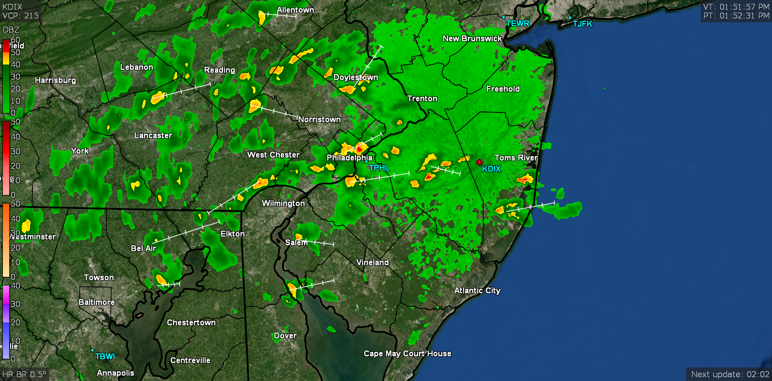
I have been running GRLevel3 in the background and it has been updating for me - just updated (VT/PT @ 12:50 pm).
-
I started hearing them in the morning around July 4th here in Philly (just once) and then again in the morning a week ago the day before the heavy rain, and again yesterday morning and on/off during the day yesterday. Before that it was mainly in the late afternoon and early evening.
-
Just hitting 92 IMBY with a dp of 75. My station is showing a heat index of 104.
-
OMG already 89 here with a dp of 75. ETA now at 90.