Hurricane Agnes
-
Posts
8,877 -
Joined
Content Type
Profiles
Blogs
Forums
American Weather
Media Demo
Store
Gallery
Everything posted by Hurricane Agnes
-
Some fascinating stuff going on here -
-
You can track some hurricanes in the interim.
-
Made it to 71 yesterday (but not until late in the day) after a low of 54. This morning was a whole other story where I bottomed out at 50. The dews are also in the low - mid 40s here. Currently slowly on the way back up with a temp of 52, and clear.
-
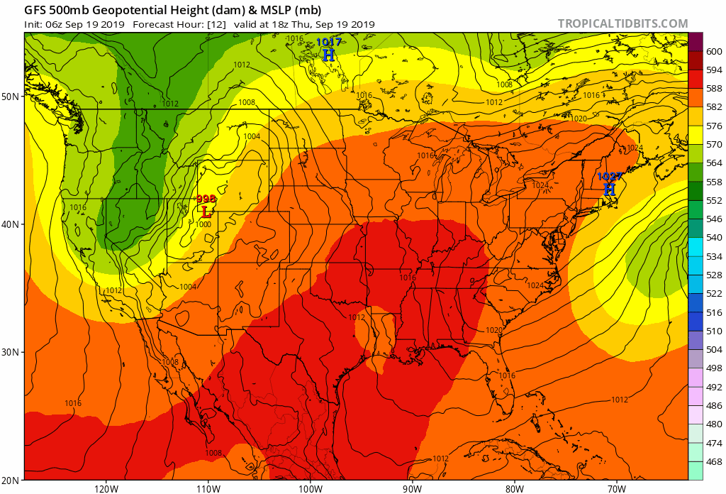
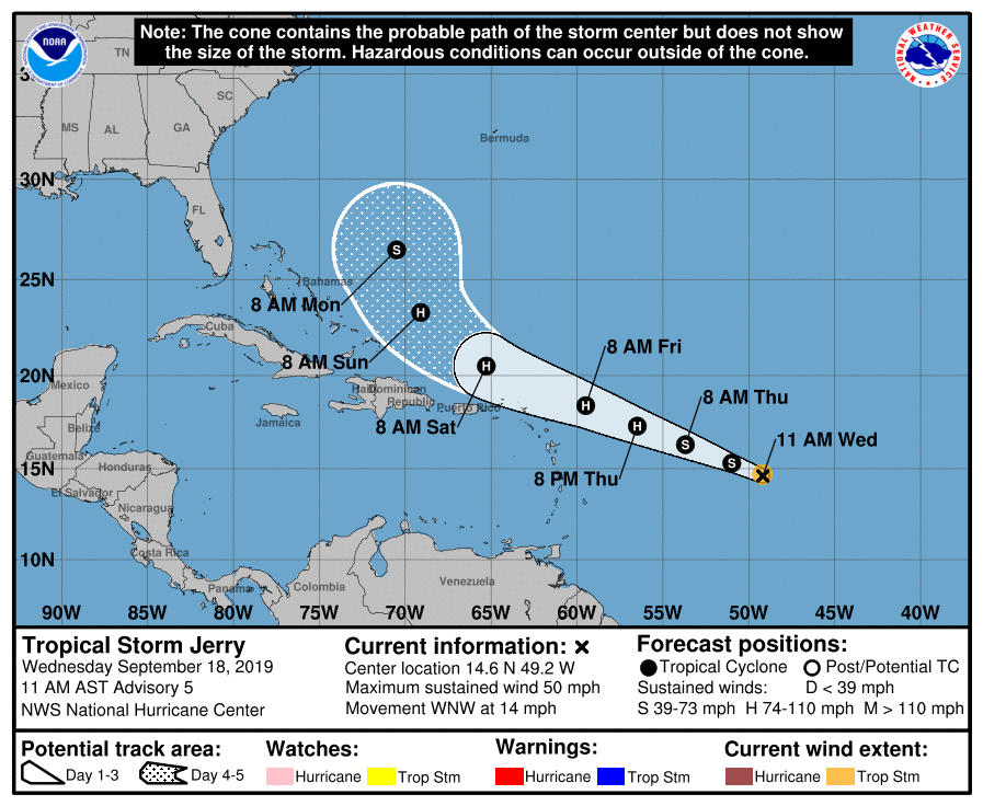
Yikes! If anything like the GFS verifies, you'd have Bermuda having been swiped from the north by Humberto and then get swiped from the south by Jerry (and even this far out, it is too close for comfort if the track doesn't do a major shift, although it looks to be a much weaker system than Humberto from this run ).

-
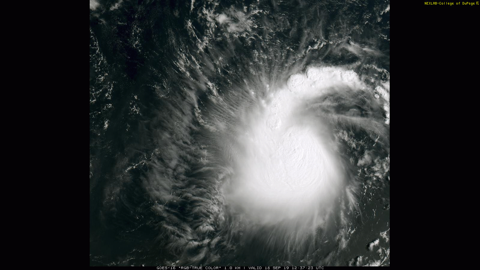
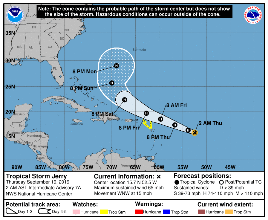
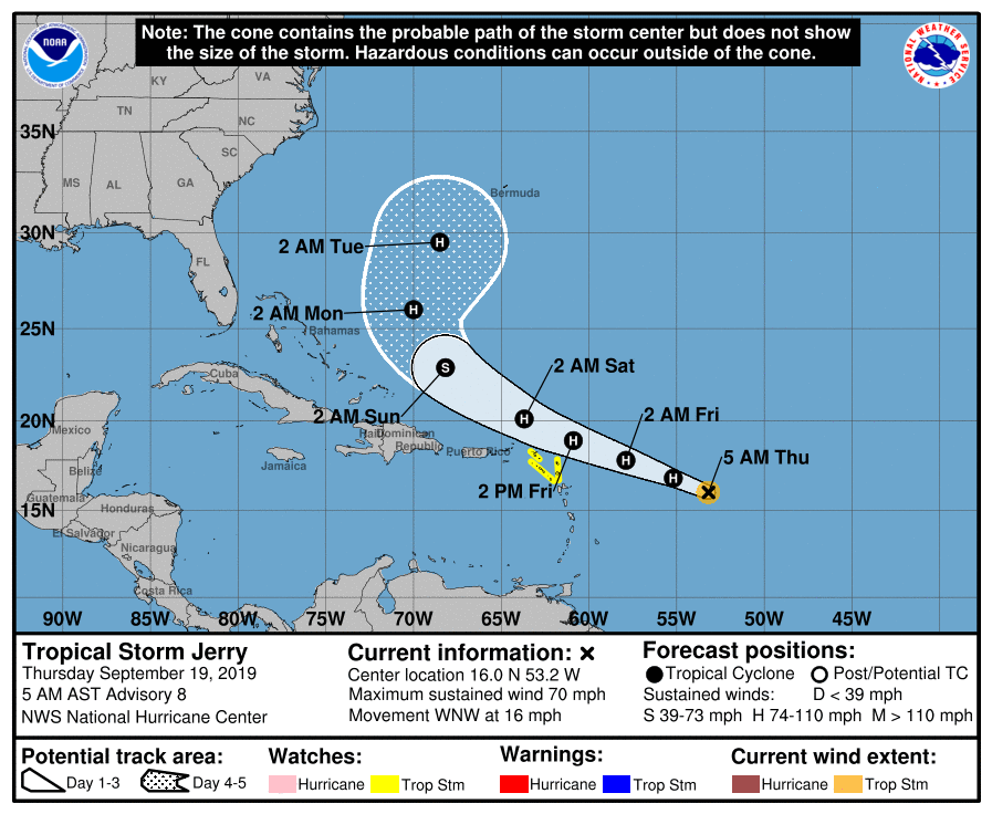
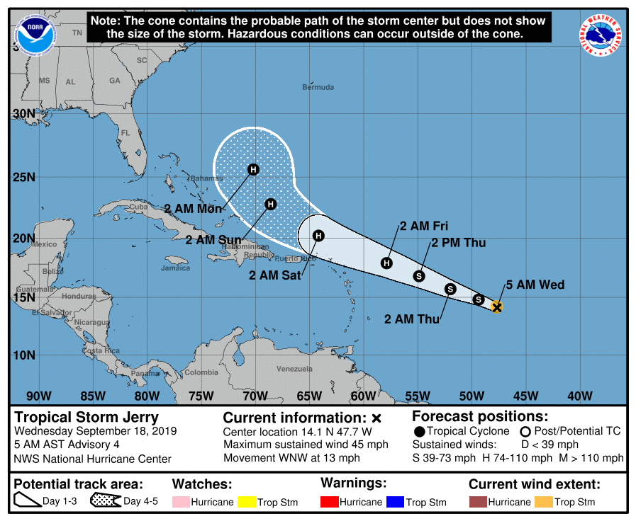
2 am & 5 am updates (steadily strengthening and expected to be a hurricane today, with the 5 am showing it just 5 mph short) -
-
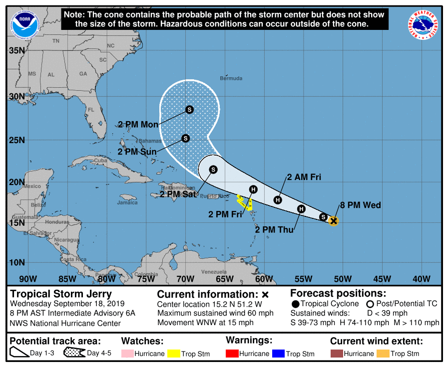
8 pm update (pressure slowly dropping as it gets itself together but it is moving at a good clip) -
-
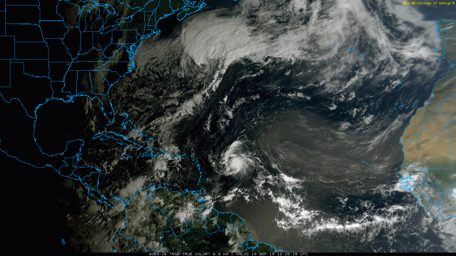
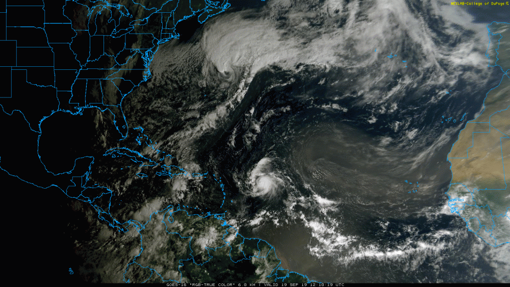
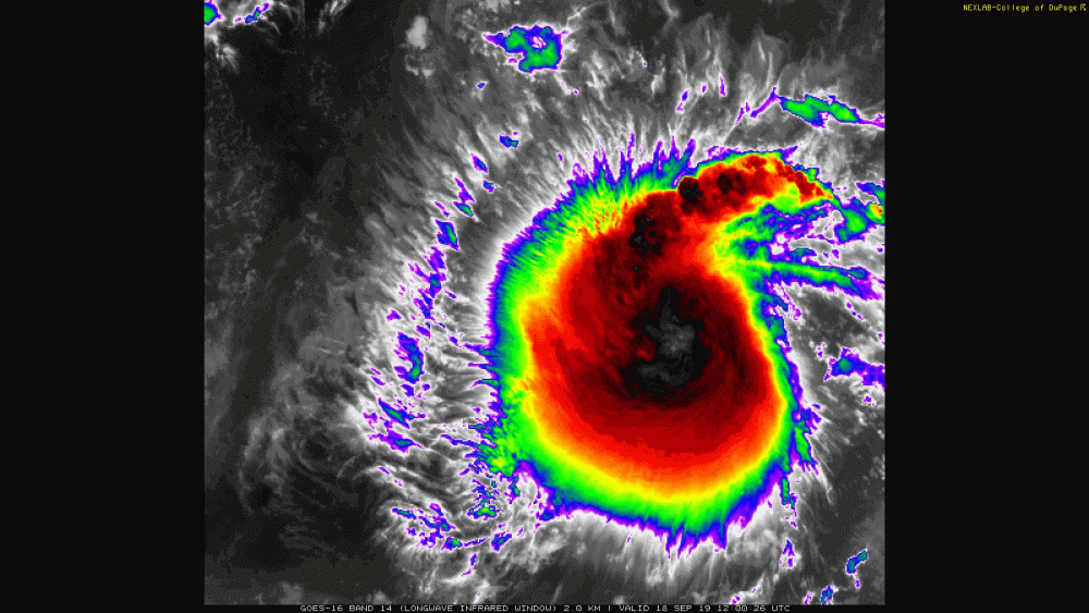
It is kinda cool to see that on vis...
-
There's a Hurricane Hunter that flew over to it and is surveying the area around the north and west perimeter. JPSSs tweeted this not long ago (with mention that NHC expects it to become a hurricane by Thursday/Friday) -
-
Gotta keep watching that path!
-
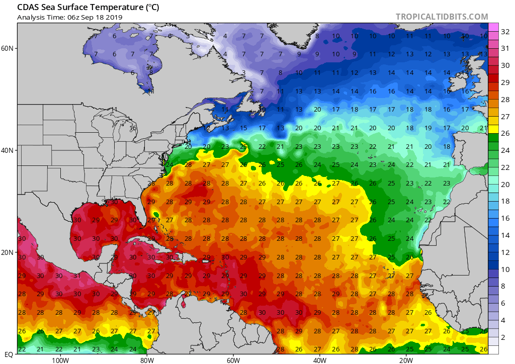
As an interesting note, the SSTs are still toasty even after the passage of both Dorian and Humberto (although I know this is slowly ramping down from the peak period for ocean temps)!

-
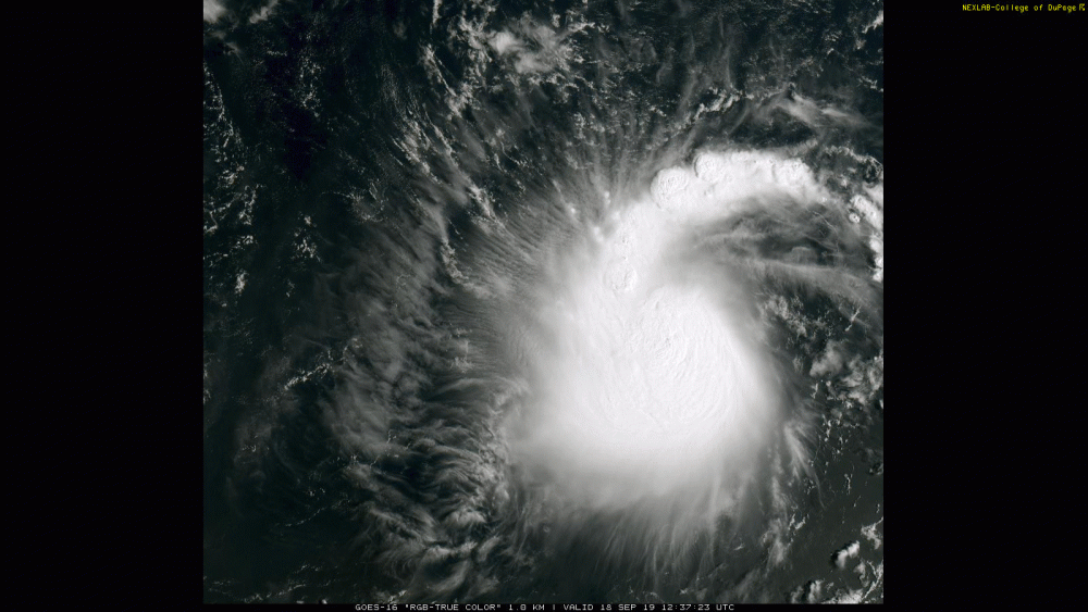
NOAA Satellites has a good look at Jerry from above -
-
Humberto is booking along at 16 mph at last update so am wondering how long before that feature will have no longer have a major impact.
-
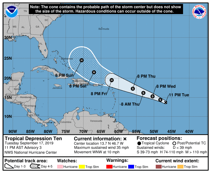
NOAA9 is on its way to Jerry so it will be interesting what that finds...
-
That makes no sense given Humberto is churning up the water along those tracks (at least the more northern OTS ones). At least the GFS (verbatim) has it roll around on a path south of Humberto.
-
That's been the suggestion - shear. Will have to see if the ridge moves away enough to minimize that. Looks like it's having a bad hair day to boot! Seeing the high top clouds popping all over that NE quadrant.
-
I was looking at the 0z Euro & GFS earlier this morning and they both had it following Humberto OTS. 6z GFS is holding with the OTS solution.
-
Some thoughts on Jerry from Levi -
-
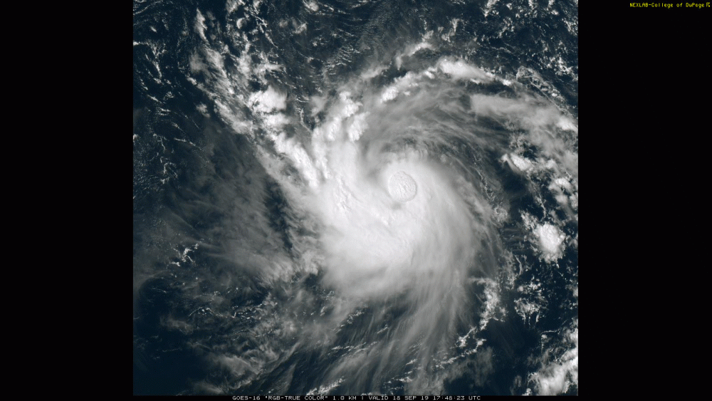
It's TS Jerry now and has it's little spin going!
-
The locusts have those longish strands with tiny leaves on each side and the tiny leaves will start yellowing in the fall before dropping. I was surprised to see some of the street tree locusts around here with clusters of yellowing leaves scattered throughout the canopy. The magnolias have gotten their fall coloration (purplish). Not seeing any maples coloring up yet though (they are the true harbingers of fall)!
-
Had a pleasant high of 76 yesterday after a low of 58 but this morning's low of 54 was fall's clarion call telling the plants to get ready (already seeing some trees turn color including some of the thornless honey locust trees)! Amazing after over a year of above normal rain, that we have finally hit a bit of a dry (in a relative sense) spell. Currently 57 and clear.
-
Jerry is here! This is gonna be one to really watch due to the track.
-
11 pm (no real changes yet) -
-
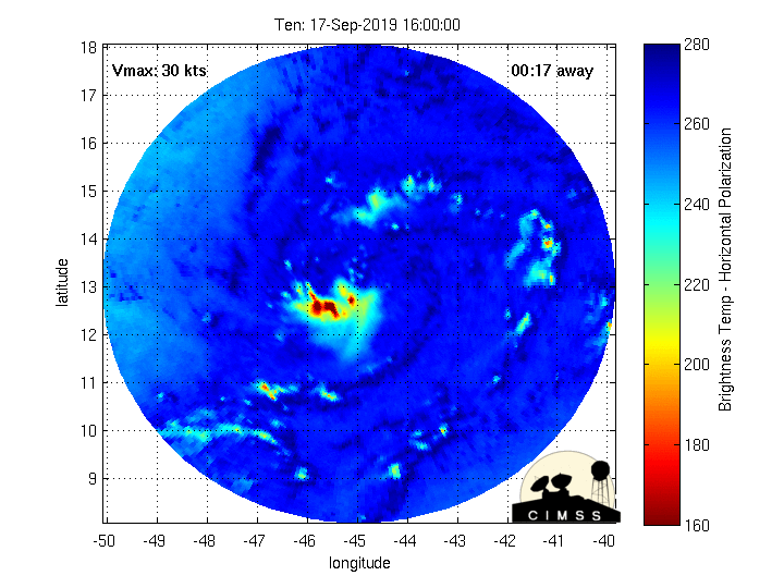
It's trying to get some circulation going and you can see it a little in the MW!
-
A couple tweets from Levi -
-
Ended up with a high of 81 yesterday after a low of 65 and 0.09" of rain from ~2:00 am.... and with the front, the dews finally dropped down into the low 50s by the late afternoon. Today is a different story with the temp already having hit 83 and dews in the low 60s, so you can feel the humidity a bit more. Currently clouding up and temp down to 82. I noticed that KDIX, KDOX, and TPHL are all offline at the moment.