Hurricane Agnes
-
Posts
8,877 -
Joined
Content Type
Profiles
Blogs
Forums
American Weather
Media Demo
Store
Gallery
Everything posted by Hurricane Agnes
-
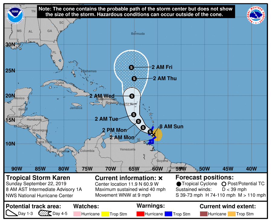
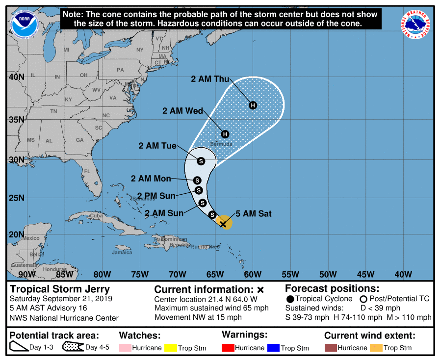
8 am update (intermediate) -
-
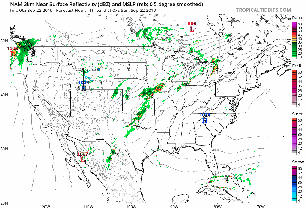
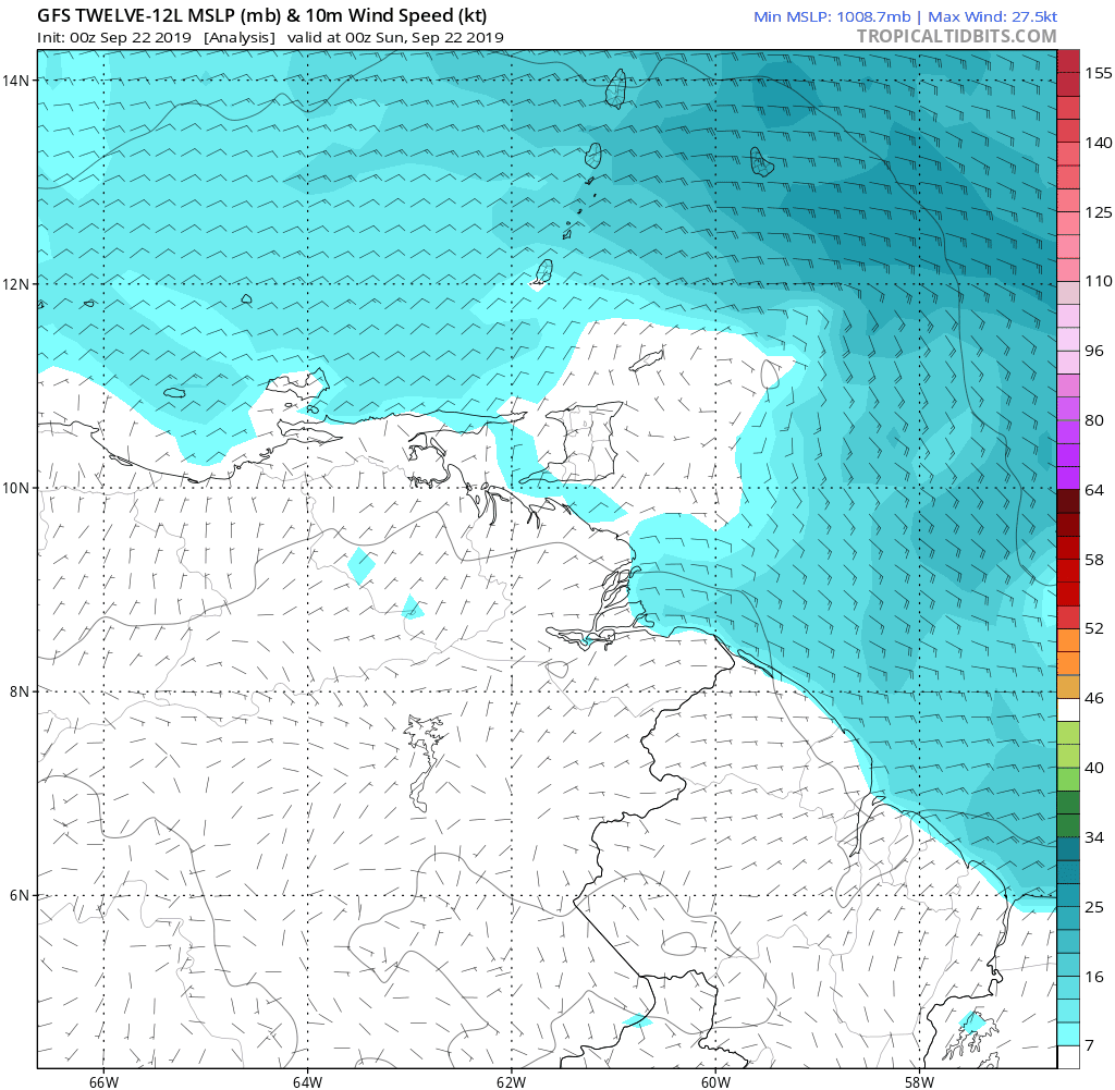
6z NAM has it -

-
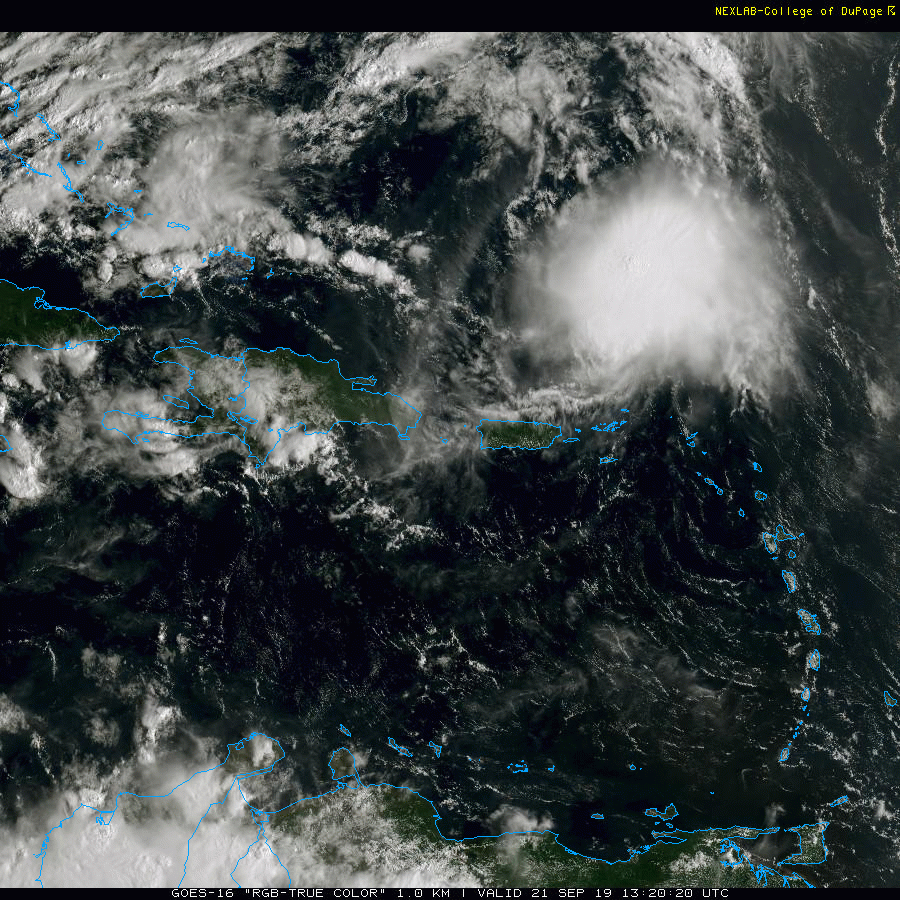
I am an early riser so if you see me here late at night, my mind is normally blown. I am surprised this one kicked off before the one coming off the African coast that may end up named today (or perhaps tomorrow) as Lorenzo. Am watching that one too because it has a clear path to intensify although it may run into the same types of fish-storm conditions that Gabrielle experienced. Oddly enough, Jerry, as wacked-out as it is, may help clear the way a bit for Karen.
-
They had the recon in there scheduled for yesterday ("Windward Islands" recon) and will be in there later this morning and this afternoon -
-
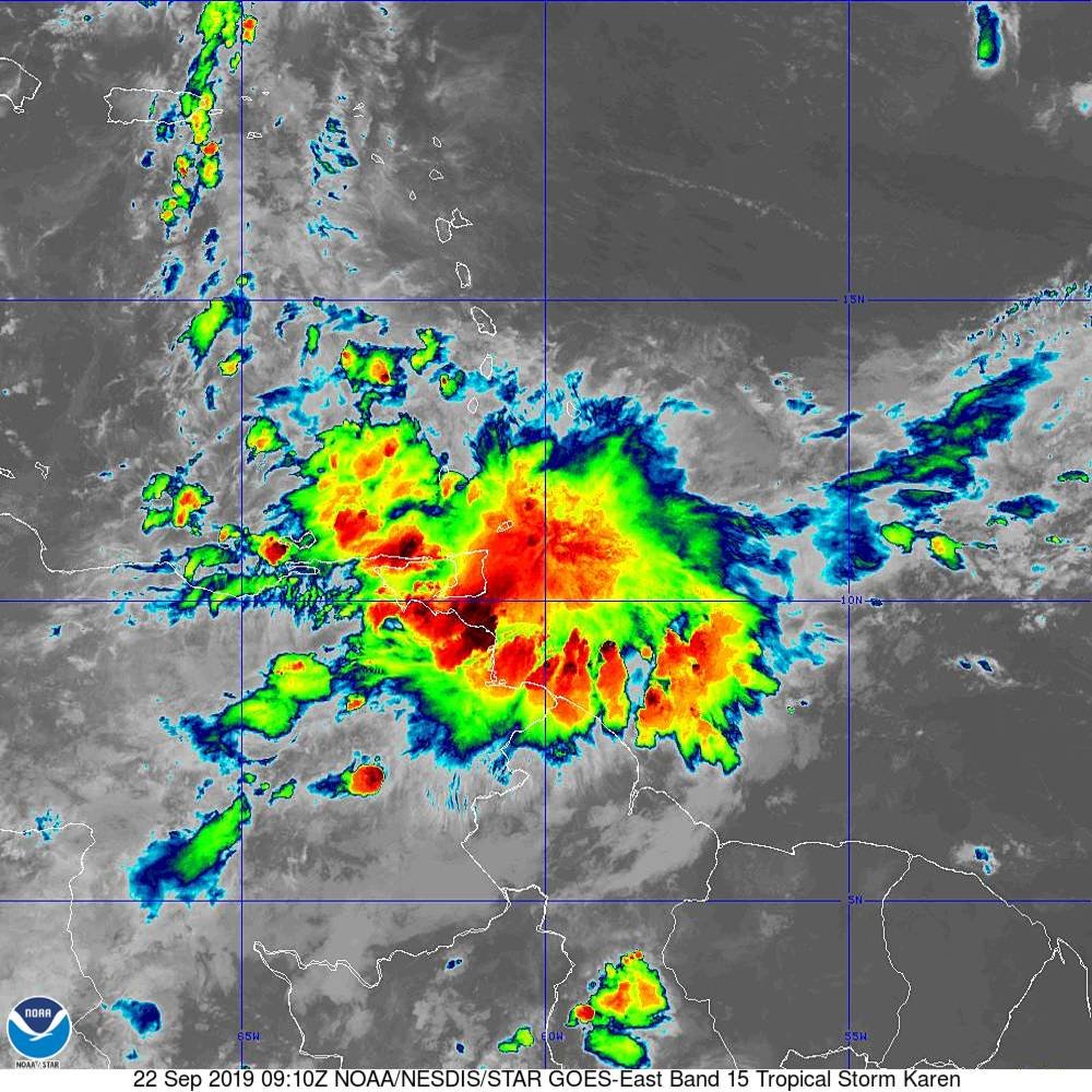
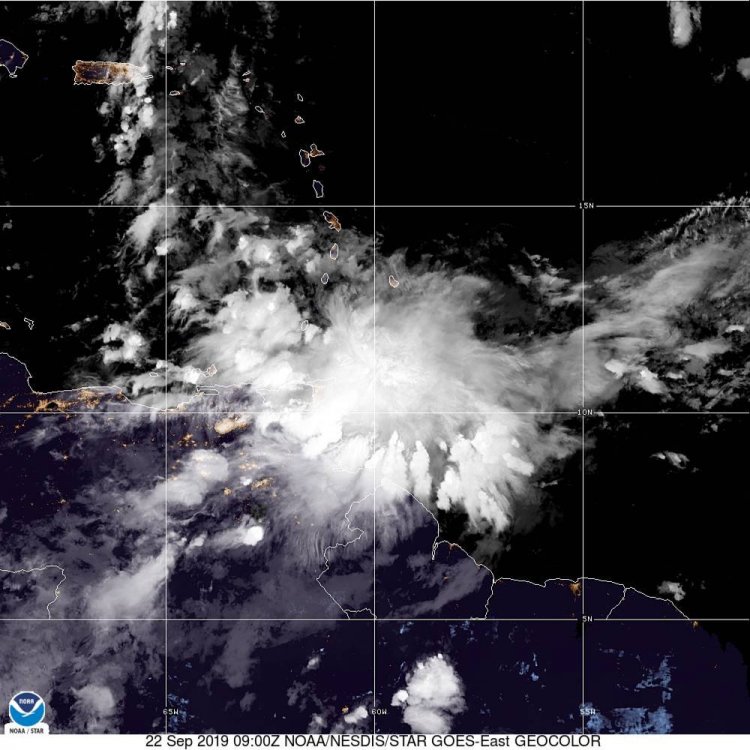
I'm just trying to find any sort of circulation in it!
-
This thing is so new that had to dig for something that even showed it (GFS Hurricane model for 12-L) . I know a recon was scheduled to go in there today but that may end up being supplemented -
-
Like a nebula - a TS is born!

-
Here we go -

-
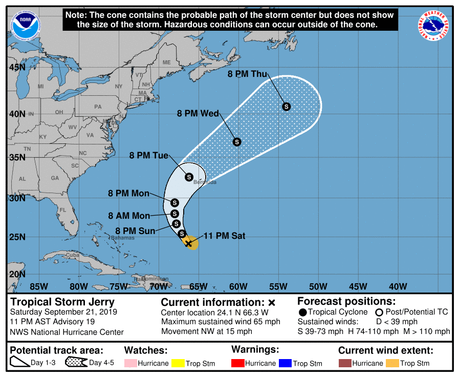
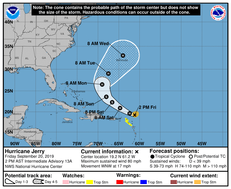
11pm update & ETA 5 am update (no real changes other than continued weakening and a track that appears to now be mirroring Humberto, swiping Bermuda from the north) -
-
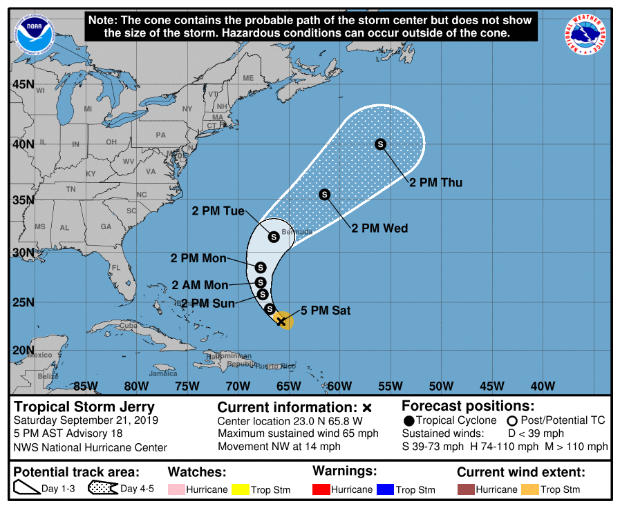
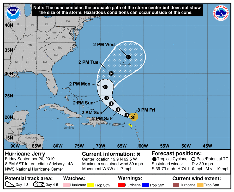
5 pm update (fan dancer Jerry has weakened further although still a higher-end TS... but the idea of any further strengthening has basically been tossed away with its feathers, although it's still on track to hit Bermuda up for some dollar bills) -
-
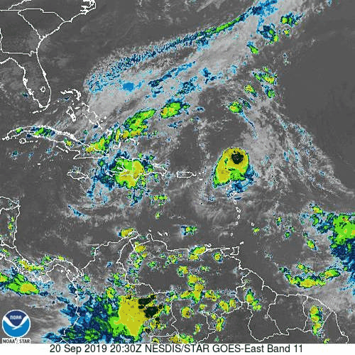
Levi's tweet about the sheer (and it is literally coming from all directions at different levels of the atmosphere to boot)!
-
To me, this illustrates the problems that Jerry has been facing!

-
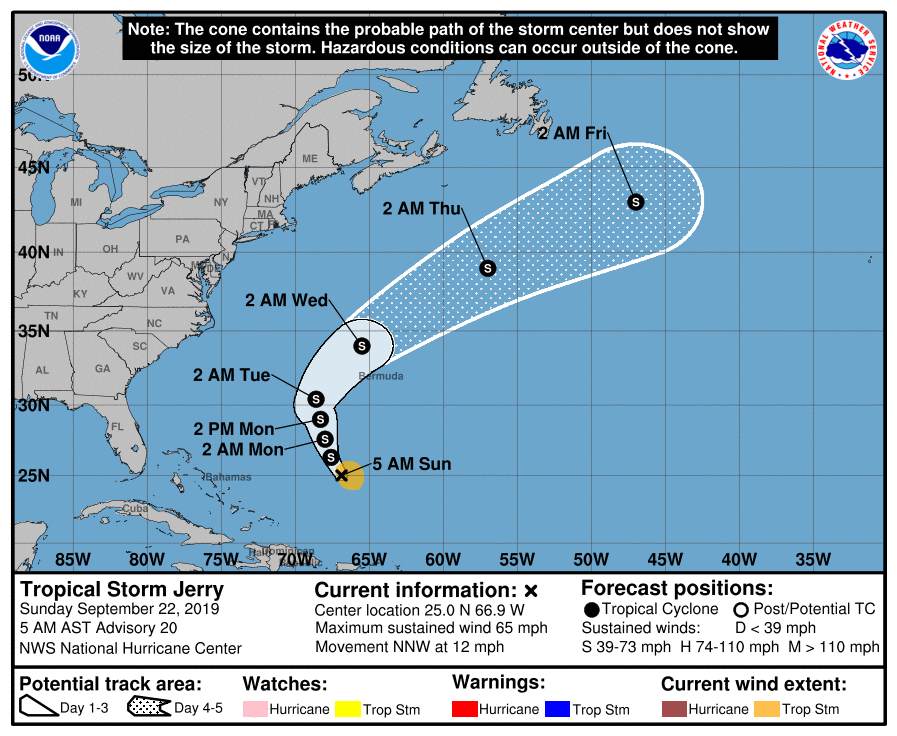
11 am update (not much change but core is getting weaker) - Also interesting that the track has changed very little. Still on target to hit Bermuda.
-
Made it to a high of 75 yesterday and did watch the ISS flyover last night (which was for an extended time - i.e., several minutes flying overhead). There was a very thin deck of cirrostratus, but that did not affect the viewing. Meanwhile the heat is coming (maybe the last gasp of mid-upper 80s or higher, but we'll see). After a "warmer" low of 55 this morning, it is currently 68 and mostly sunny, with a mix of cumulus and cirrus.
-
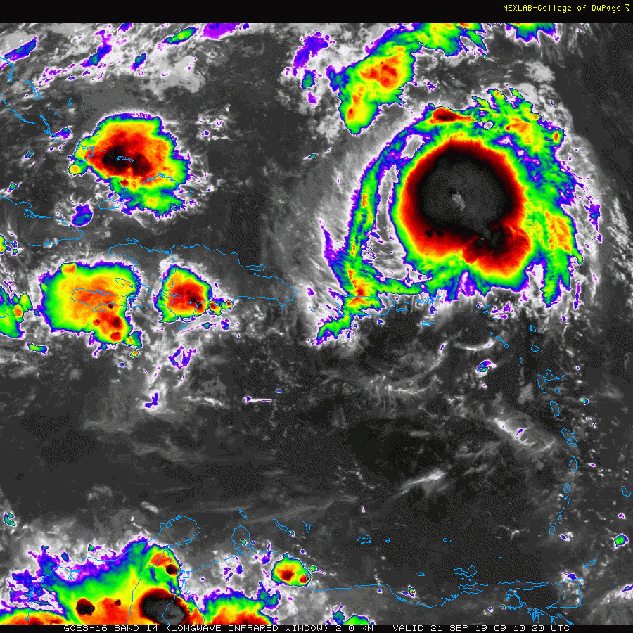
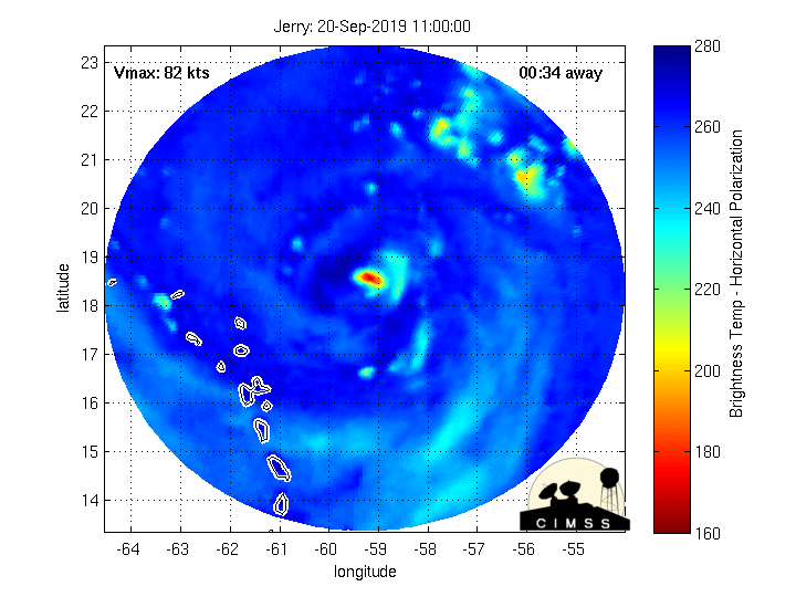
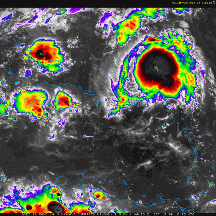
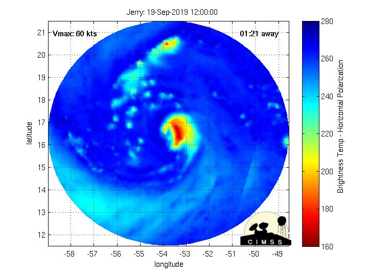
MW showing Jerry like a rollin' wagon of fireworks!
-
2019 Atlantic Hurricane Season
Hurricane Agnes replied to AfewUniversesBelowNormal's topic in Tropical Headquarters
Here's the update on that map (with the downgrade of Jerry) - Looks like they plan to look at that latest system (Windward Islands one) later today (with another recon planned for tomorrow) - https://www.nhc.noaa.gov/text/MIAREPRPD.shtml -
This one's for you!
-
As of the 2 am update.... Well Jerry blew off his top like a volcano and is now down to a TS & looks like it will take longer before the theoretical reintensification (also including the latest 5 am) -
-
Jerry's fired up and ready to go!
-
8 pm update (not much change) -
-
A Milton the Monster toot toot from the top of the ole noggin!
-
Finally have some kind of MW depiction of Jerry (the site hadn't updated from yesterday's data) -
-
5 pm update (Jerry still trying to hold itself together) -

-
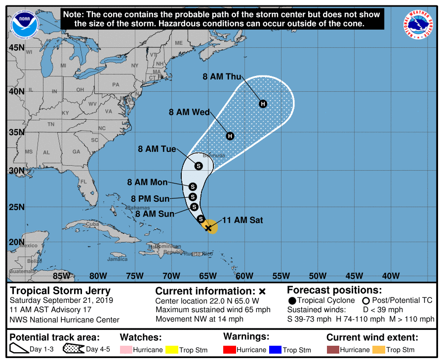
2pm and surprisingly they kept the pressure but it is now barely a hurricane - They have it drop down to a TS and then somehow regenerate back up to a hurricane later.
-
The 12z GFS has it do that (and I think the HWRF uses that for its modeling). It's got a daunting wall of dust and a ridge to have to punch through to do that though.