-
Posts
2,859 -
Joined
-
Last visited
About Edge Weather

Profile Information
-
Gender
Male
-
Location:
Tewksbury Township, Hunterdon County, NJ
Recent Profile Visitors
-
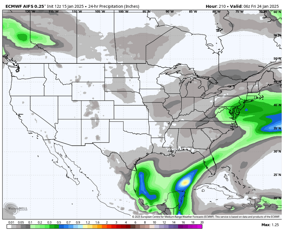
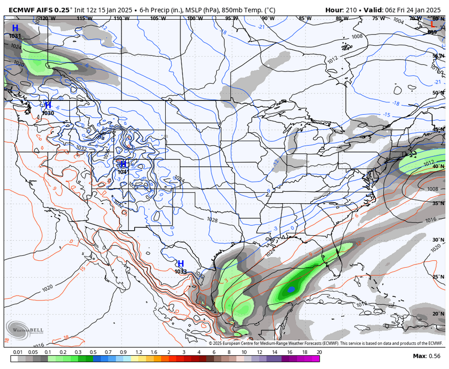
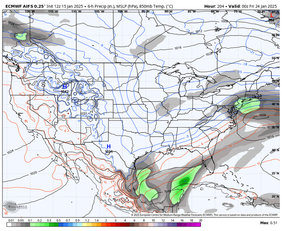
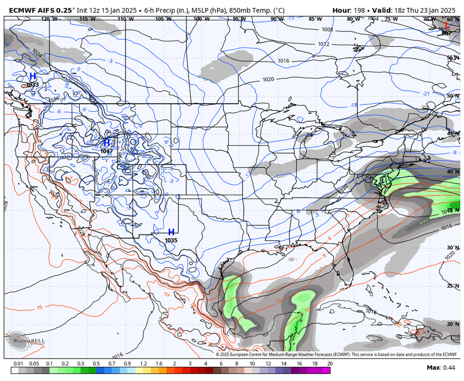
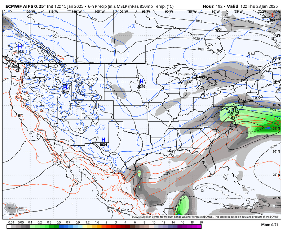
There is the potential for very significant coastal storm Thursday, November 22nd, if the pieces come together, as one disturbance will be approaching from the Southeastern United States, as another disturbance approaches, through the Great Lakes. IF these two disturbances come together there would be the potential for a very significant coastal storm. This potential is highlighted somewhat with the latest run of the ECMWF with AI based implementation, rather than the traditional physics-based model. This new model implementation is performing better than the traditional physics-based model. Click here for more information from ECMWF on the AI model. All images courtesy WeatherBell Analytics.
-
Jan 11th-12th Super Bomb or Super Bummed?
Edge Weather replied to Rjay's topic in New York City Metro
Omg, put a fork in it already people.- 993 replies
-
- 2
-

-
- metsfan vs snowman
- bomb
-
(and 2 more)
Tagged with:
-

Jan 11th-12th Super Bomb or Super Bummed?
Edge Weather replied to Rjay's topic in New York City Metro
Not much change on 18z GFS- 993 replies
-
- metsfan vs snowman
- bomb
-
(and 2 more)
Tagged with:
-

Jan 11th-12th Super Bomb or Super Bummed?
Edge Weather replied to Rjay's topic in New York City Metro
12z AI Gencast Euro a bit less amplified this run.- 993 replies
-
- metsfan vs snowman
- bomb
-
(and 2 more)
Tagged with:
-

Jan 11th-12th Super Bomb or Super Bummed?
Edge Weather replied to Rjay's topic in New York City Metro
Who would stay there? It is soooo cold and snowy when you could live in Florida, California, Texas, etc. A little something there for everyone. And Vermont is gorgeous and honestly has more to offer for snow lovers, as does Maine.- 993 replies
-
- 1
-

-
- metsfan vs snowman
- bomb
-
(and 2 more)
Tagged with:
-

Jan 11th-12th Super Bomb or Super Bummed?
Edge Weather replied to Rjay's topic in New York City Metro
The amount of wishcasting here is unreal. Clearly this storm looks like crap. The only model that shows anything significant is the GFS, which has taken a major turn towards every other model.- 993 replies
-
- 6
-

-

-

-
- metsfan vs snowman
- bomb
-
(and 2 more)
Tagged with:
-

Jan 11th-12th Super Bomb or Super Bummed?
Edge Weather replied to Rjay's topic in New York City Metro
EC with Ai implementation from gencast is slightly better than the operational run- 993 replies
-
- 1
-

-
- metsfan vs snowman
- bomb
-
(and 2 more)
Tagged with:
-

Jan 11th-12th Super Bomb or Super Bummed?
Edge Weather replied to Rjay's topic in New York City Metro
Agreed. 18z EC EPS is definitely better if you want snow on Saturday.- 993 replies
-
- 2
-

-
- metsfan vs snowman
- bomb
-
(and 2 more)
Tagged with:
-

Jan 11th-12th Super Bomb or Super Bummed?
Edge Weather replied to Rjay's topic in New York City Metro
No other model is really jumping on board anything close to the GFS. Doesn't necessarily mean the GFS is wrong, just saying.- 993 replies
-
- 1
-

-
- metsfan vs snowman
- bomb
-
(and 2 more)
Tagged with:
-

Jan 11th-12th Super Bomb or Super Bummed?
Edge Weather replied to Rjay's topic in New York City Metro
It shows that we aren't getting much of anything.- 993 replies
-
- metsfan vs snowman
- bomb
-
(and 2 more)
Tagged with:
-

Jan 11th-12th Super Bomb or Super Bummed?
Edge Weather replied to Rjay's topic in New York City Metro
Well, EC EPS isn't even close to anything interesting. Not over yet for sure, but right now definitely looks like a no go.- 993 replies
-
- metsfan vs snowman
- bomb
-
(and 2 more)
Tagged with:
-

Jan 11th-12th Super Bomb or Super Bummed?
Edge Weather replied to Rjay's topic in New York City Metro
EC says NO- 993 replies
-
- metsfan vs snowman
- bomb
-
(and 2 more)
Tagged with:


