Volcanic Winter
-
Posts
1,513 -
Joined
-
Last visited
Content Type
Profiles
Blogs
Forums
American Weather
Media Demo
Store
Gallery
Everything posted by Volcanic Winter
-
What, a model spread of +3 to -6 is totally normal and definitely not hilarious.
-
@EasternLI about to get arrested for aggravated assault on the SPV. I’ll bail you out brother.
-
A 50/50 low forces a slower transit of the target storm? Is that the gist of that? That wasn’t a term I was familiar with prior to coming here.
-
Being very tongue in cheek. It’s exciting but I can see why / how this is probably an unlikely solution at this point. At least it looks like a Miller B now? Crazy the evolution of this thing past two days.
-
It’s hanging on my fridge already.
-
Too late, I’m all in. Choo choo baby. Hear that? Hype train is right on schedule.
-
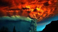
I made this post over in the NYC thread and wanted to share it here in case anyone finds this interesting, especially those with a good understanding of atmospheric physics may gleam something from this WRT current events: I’m all aboard Hunga Tonga having a hand in some of these unusual dynamics and volatility. I just saw this paper last night and finished reading through it, it appears initial observations underestimated the SO2 flux rather significantly (though still a lot less than Pinatubo). However, the enormous instantaneous injection of water vapor remains a major variable. Just wanted to share the paper for anyone who may be interested. It’s dense and technical but is extremely informative and touches on HTHH’s substantial atmospheric and potentially climatological impact: https://www.nature.com/articles/s43247-022-00618-z
-
Yeah I only got about 5 inches down by me but where I work got 18. My first snowstorm with my new WRX though with fresh Blizzaks on it, so I had fun pulling up to my unplowed lot at work and driving over the fresh snow like it’s pavement.
-
Yeah dude, we scored. At one point my area was a potential jackpot zone, but it just didn’t explode fast enough and it became more of a LI / NE storm. Like I said, was still a wonderful event. I got skunked in 2/1/21 whereas where I work got 18 inches. And 20 was a turd of a winter, so it was nice to see some real snow again.
-
16 inches. Perfect really, all things considered. Remember all the uncertainty and with the GFS shunting it out south and East with barely a dusting for anyone? Nail biter through and through.
-
1/29 was a fun storm with a lot of hype and excitement around it. Def enjoyed in Toms River area. Also was notably a very cold storm, at the peak in the early AM we were 22F. Perfect.
-
Dude I was here for the NAM gigaweenie maps, it was hilarious. At one point it had me over like 40-50 inches.
-
I think the best takeaway right now is from Bluewave in that such a strong -AO in Dec may correlate with recurrent blocking in JFM. Of course we all want a big one by the end of Dec, but if it doesn’t materialize at least we can hope for better chances going forward. Last Jan was nice and good for me as a cold lover but I remember we had a crazy progressive pattern that just didn’t yield a lot of excitement until 1/29, and that didn’t even pan out for a lot of us. Was lucky to be coastal for that event but of course it was mostly a NE storm. I am definitely feeling better about our winter prospects this year. Feels like it’s been too long since our last KU type storm, and I’m really hoping we score at least one whether it’s the end of Dec or the end of Feb.
-
I’m all aboard Hunga Tonga having a hand in some of these unusual dynamics and volatility. I just saw this paper last night and finished reading through it, it appears initial observations underestimated the SO2 flux rather significantly (though still a lot less than Pinatubo). However, the enormous instantaneous injection of water vapor remains a major variable. Just wanted to share the paper for anyone who may be interested. It’s dense and technical but is extremely informative and touches on HTHH’s substantial atmospheric and potentially climatological impact: https://www.nature.com/articles/s43247-022-00618-z
-
Not expecting to see a flake, except maybe one or two at work. But I’m very happy we appear to be in a much better position than a few days ago. Keep the faith, hoping we pull a white rabbit out of a beanie the rest of the month.
-
GFS with the Dec 23rd gigastorm . At least it's better than showing a torch lol.
-
Yeah. I genuinely don’t have any complaints given my latitude. We can do very well.
-
I lived in North Brunswick prior and grew up in central Monmouth. I honestly do alright by me. I’m very recessed from the ocean and on the western border of TR and Manchester. On my Tempest, my overnight lows are readily well below the city. Already been down to 19F this Dec. from a temperature standpoint being near the Pine Barrens helps tremendously and I tend to avoid immediate coast ocean influence with the exception of extreme onshore flow. I do miss north / south oriented storm cutoffs and the consistency of snow up north, but playing the lottery of coastal bombs often leaves me more than satisfied. 1/29/22 we got 16 inches and for the month wasnt far off 30 IIRC at my house. I’ll take it. If the ACY storm was further north a hair I would’ve added quite a bit more to total. I love playing the coastal bomb lottery here bc once in a while it pays off beautifully. With that said, I have long term plans to move into upstate Ny or NE. And I work just outside Newark, so I end up participating in more north NJ oriented events anyway. I def wouldn’t want to live on the extreme coast as my parents do, I definitely live in a sweet spot for the southern part of central NJ. The temperature difference from My house to theirs is rather extreme at times, and I tend to get much more snow than them.
-
The increase in number of 50+ degree days is very, very telling. It’s also much greater than I would’ve anticipated, that’s a huge jump.
-
The point is historically we have a colder climate here, so it’s frustrating for someone who loves snow and cold. Of course things are different today when we have accelerated warming relative to other areas of the country. NJ I believe is 2.9F over pre-industrial? That’s huge. We’re not Canada but neither are we the southeast. I think it’s reasonable to expect to have “a winter,” but of course between subjectivity of what that means and warming that’s becoming less and less reasonable. Not to get tangential; in the Pleistocene the Laurentide extended to 40N, NYC. NA was able to extend its glaciers very far south. When I drive to work and see Manhattan I often try to visualize a fat glacier there instead, it’s wild. Not to ramble, I just mean we shouldn’t have to hug a Leprechaun every time it snows here. I do wonder how much longer the warming SST’s will pump up our snow totals instead of hurting them by warming the air mass too much. Is that a near future threat you think?
-
Cocked, locked, and ready for duty!
-
HTHH did not inject the stratosphere with the sulfur loading typical of an eruption this size. It injected about 1/40th the sulfur of Pinatubo (a similar sized but more traditionally magmatic and gassy large eruption), but as you mentioned, injected a massive amount of water vapor. Apparently 1/10th of the total that normally resides up there was added via this eruption. Pinatubo caused jet stream disturbances in addition to significant cold anomalies for several years after 1991, but the traditional process for accomplishing that is via sulfur aerosols. HTHH injected more water vapor than anything else in the satellite era. The effect will be... ? Analyzed in retrospect most likely. Put me down, however, for wishing HTHH was a more traditional large eruption with a larger sulfur flux. But I absolutely agree with and believe there will be an additional 'chaos' element in the climate system for a couple years due to this event.
-
Yeah it's a total blast, swinging between jacked to the tits and crestfallen is definitely healthy lol.
-
But don’t you all just love a good underdog story?


