
Volcanic Winter
-
Posts
1,513 -
Joined
-
Last visited
Content Type
Profiles
Blogs
Forums
American Weather
Media Demo
Store
Gallery
Everything posted by Volcanic Winter
-
That storm track is absolutely wild. You can see how it contours the cold air dome across the US, riding the boundary and ... giving a nice secondary jackpot to the Outer Banks . This really does seem reminiscent of the 2013-2015 winters to me, but of course with less snow. I really do feel there's reason yet to be optimistic about the rest of winter, while February is likely to average warmer than Jan, there's no guarantee it will be snowless. We may have better luck once the cold isn't so overbearing, since this year it oriented in a way that was harmful to snow here with that death vortex east of New England. Chin up though, IMO. We have snow on the ground and a nice winter feel at least for the cold this week. It could certainly be worse!
-
 Thank you Walt, your efforts are very much appreciated. I was definitely paying attention for a bit of snow on snow, but yeah - modeling not looking good at the moment. We’ll see what happens.
 -
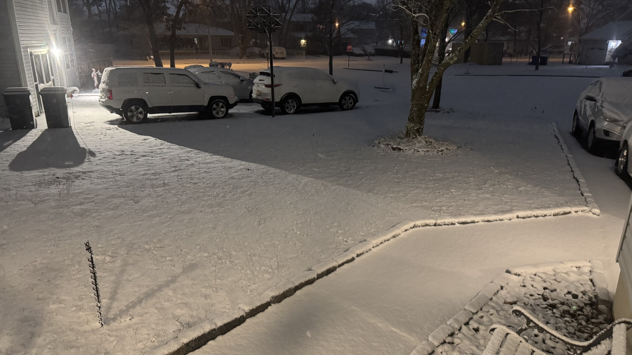
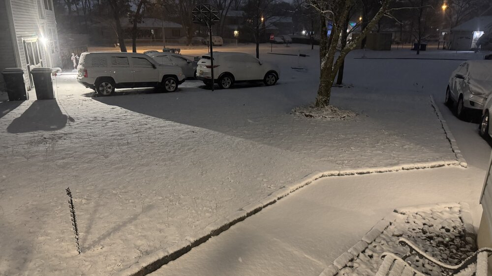
Well, that was fun. I think we all at least got a nice covering, with some of the north and west crew really cashing in? Ended up with 1.75-2 inches here on top of a thin layer of slush that is sure to turn into an actual glacier Sure beats bare ass ground going into this week. That storm had to be an enormously difficult forecast to make, for example my location which many models showed as generally all snow except Canadian guidance - there just wasn’t the precipitation to cool the column earlier on, it was actually extremely dry here until like 5pm. We had a little rain earlier in the day, but definitely paltry in terms of QPF. Then a period of very light sleet / graupel before we finally got into a main heavy band and the column instantly cooled to below freezing and put snow on the ground. Tough forecast. I think the city had similar issues, or was it just more plain temp problems there early on? The precipitation shield also really just seemed spotty and a bit shredded, certainly with some very heavy bands embedded though. Doesn’t seem like any model actually got the storm fully correct.
-
Finished up just under two at my house. About 1.75. But really nice powder on top of a layer of literal ice (already), shoveling / cleaning cars was interesting. If the early precip were snow I probably would’ve had only about 2.5” or so, there was a definite death of moisture at around 40n with this system. Regardless, I’m more than happy with the wintry vibes. I’m at about 4.25 inches on the season - Toms River / Manchester border. Be safe guys. Seeing the consistency of that icy slush under the powder I really think tomorrow AM is going to be messy in spots, so locales on a line from me to the city that started with rain / mix.
-
I’m nearing 2 inches, beautiful powder. I’ll take it.
-
The band that’s just exiting me down in Toms River was beautiful… very high rate and heavy snow. That should plaster you guys good.
-
-
The beginning of that band dropped me 2 degrees and ended the graupel / mix and absolutely started ripping snow here. That has to help the city / LI. The rates are high.
-
This current band could probably get me to 1-2 inches, and I’ll take it. Most of CNJ looks to be in the heavy stuff for a bit. And this should move NE and hopefully clobber LI. Temps really dropped in this band with the significant rate increase.
-
Ripping and sticking here now in western Toms River. Just needed the rates to pick up, which they did. Very anemic with precip to this point so far, but we’re in the goods now. 32/31
-
33/32 here with temps steadily falling. Light snow increasing in rate as we work into a better band - we’ll see what happens. Actually didn’t even have much rain here, just a little bit a few hours ago and it turned into a mix / graupel fairly quickly. I’ll be satisfied with whatever falls here as at least we know it’s not going anywhere any time soon, and will look quite a bit nicer than bare ass ground for the upcoming cold.
-
It’s interesting they don’t even have WWA in SE MA up to Boston. That seems risky with some models still mostly hanging on to all snow solutions, no? Especially with the RGEM shifting, that seems like a huge risk to the immediate Boston metro let alone Monmouth / Ocean here. Can’t recall such stubborn divergence this late in the game, maybe 1/29/22 which was also very difficult to forecast with models split down the middles on the low position and banding pretty much right up to nowcasting. edit: Looks like they did finally add a WSWatch to the immediate Boston metro, which makes sense to me. Seems official forecasting for this event is playing highly conservative. Not suggesting it’s the wrong approach, just interesting to me.
-
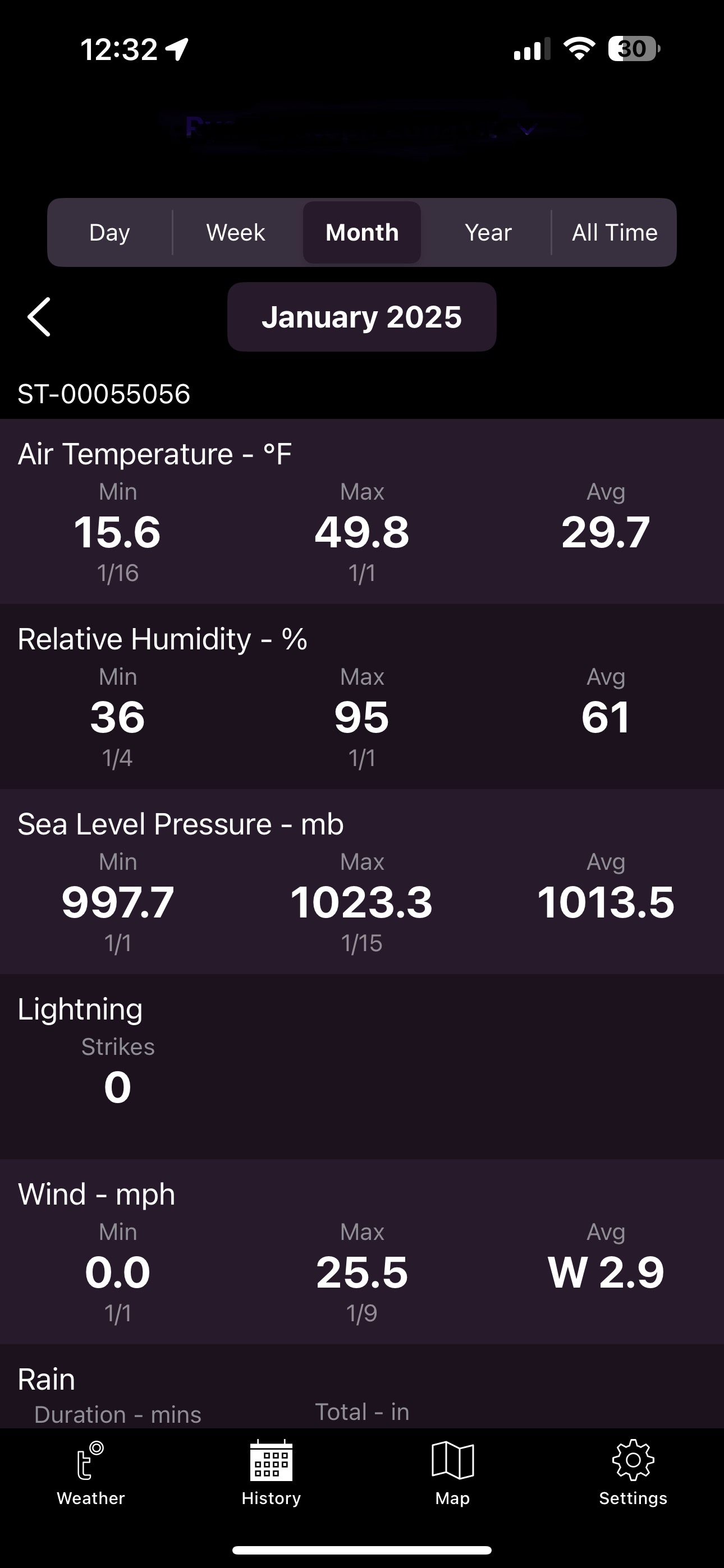
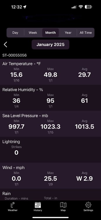
So far Jan is averaging 29.7F IMBY. Pretty wild that it’ll drop further after next week, only a brief dip into the 40’s - no signs of hitting 50 soon either which has been a lock every January lately.
-
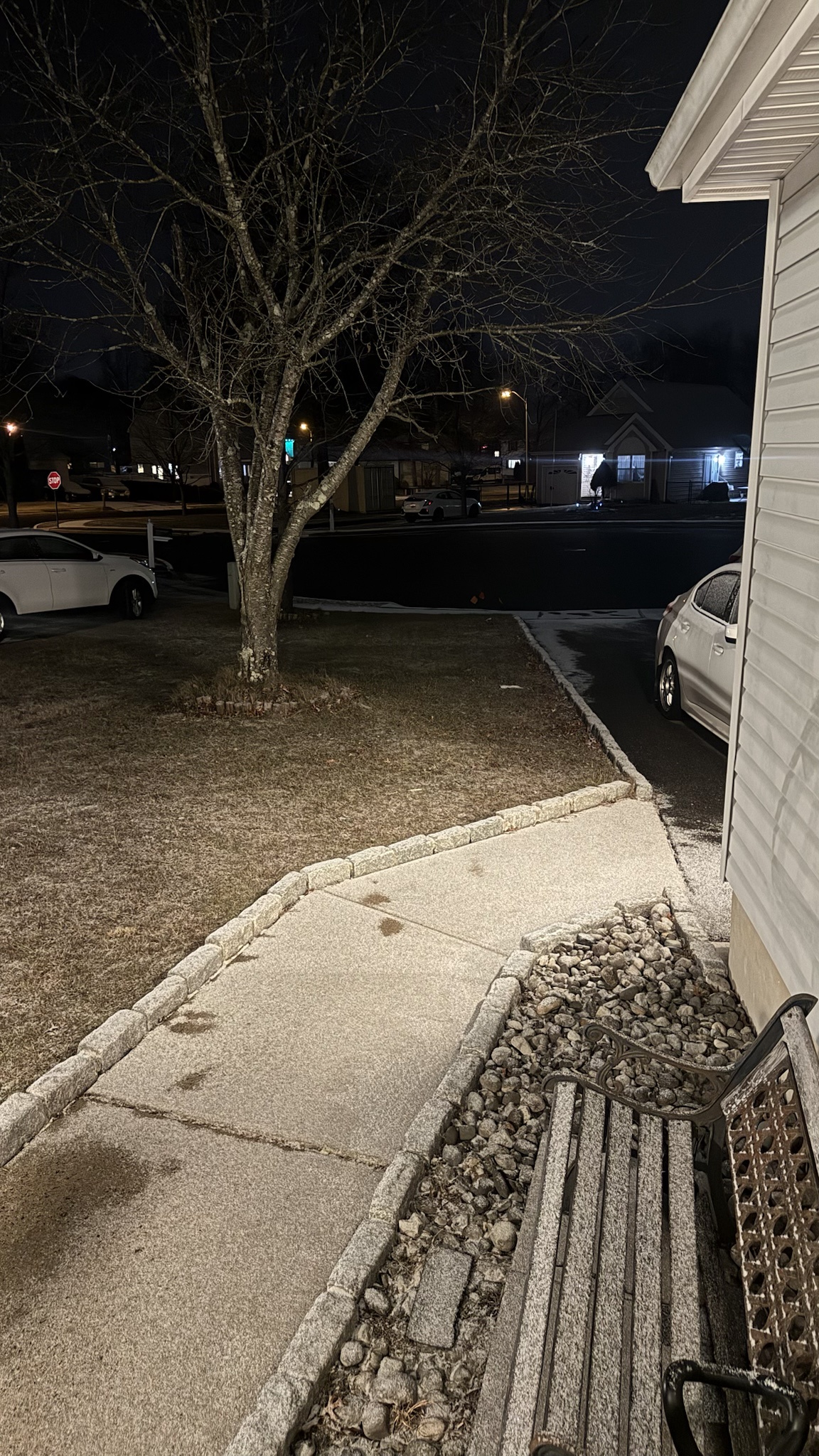
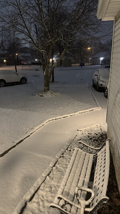
Nice semi-coating here, at least seeing some flakes flying. And the world’s smallest pile of snow is… on life support but still hanging on.

-
Been meaning to watch that one, we just finished up For All Mankind which was some of the best television sci/fi since The Expanse. I know about all the Severance hype (also Silo!), really meaning to watch it soon. Apple TV is killing it with genre shows.
-
Jan 11th-12th Super Bomb or Super Bummed?
Volcanic Winter replied to Rjay's topic in New York City Metro
Thanks. Still hanging on here.- 993 replies
-
- 2
-

-
- metsfan vs snowman
- bomb
- (and 2 more)
-
Jealous?
-
@Typhoon Tipalways has such a way with words .
-
Yup, 39 here as well with overcast. Was forecasted to be into the low 40’s. We’ll see the next few hours but the temperature rise hit a wall around 10:30.
-
I'm still holding some paltry snow piles (off only 1.5-2 inches of high ratio fluff), so far definitely reminded of the 2013-2015 winters, where even here I had snowpack for weeks on end (was just talking to my wife about how we had an absolute glacier on our front porch for weeks). If we just had some more snow, this would've been great winter to retain it. At least relative to other recent winters where even good snow is here today, gone tomorrow as we hit 50-60 inevitably two or three days later.
-
Ah more familiar territory for me. I’ll either be the southern jackpot zone or be cursing the taint/rain while NYC gets (hopefully) buried. Pretty much looks like OTS & fringed through an interior NNJ -> CNE type event are all on the table, so at least will make for some interesting tracking.
-
The highs have been definitely solidly BN for most of us, the minimums have seemed to vary from NN to even AN. I think it’s the contrast to recent winters where we’re locked into upper 40’s and 50’s for weeks on end with only a 48-72 hour reprieve to normal or slightly BN temps that is making this so notable right now. I think it’s just a perspective thing and also the sharp contrast to previous winters, I’m most curious how February turns out because we had a similar month in Jan 22 only to go to a hard reversal in Feb.
-
We’ve had a string of warm, wet, and nearly snowless winters. Now we’ve at least reshuffled the deck and have a colder winter, albeit dry and suppressive to this point. It’s Jan 11th… We have time to play this out and see how things progress. And climate change isn’t a catch all behind every point to point swing of the teleconnections. It’s more like loading the proverbial die towards specific outcomes being more frequent (like warm and wet). This is the first winter so far that is presenting with a different character, so let’s play it out at least another … month maybe? Before getting completely down in the dumps. It definitely sucks, but I think there’s reason enough to remain somewhat optimistic for at least a couple decent snow events at least with actual (relative) cold in place for the next several weeks.
-
Jan 11th-12th Super Bomb or Super Bummed?
Volcanic Winter replied to Rjay's topic in New York City Metro
What is Boston at?- 993 replies
-
- 1
-

-
- metsfan vs snowman
- bomb
- (and 2 more)
-
Jan 11th-12th Super Bomb or Super Bummed?
Volcanic Winter replied to Rjay's topic in New York City Metro
I’m at like… 2.25-2.5? 2 inches and two solid coatings. Something like that here. Better than literally nothing.- 993 replies
-
- 3
-

-
- metsfan vs snowman
- bomb
- (and 2 more)