WxSynopsisDavid
-
Posts
500 -
Joined
-
Last visited
Content Type
Profiles
Blogs
Forums
American Weather
Media Demo
Store
Gallery
Everything posted by WxSynopsisDavid
-
Radar attenuation. Those towers are very large and blocking view of the west and south side of the storm. Reason why the intensification is surprising to you because you didn’t account for such.
-
Mind you, this Rapid Intensification process was friction induced. People often forget about the critical angle of approach and how the Florida west coast often induces frictional RI processes on approach.
-
I been rather quiet with this storm, but it was humorous to see all the trolls posting how Helene was struggling. Or the post in particular saying the ceiling was Cat 2 and it would be a 100-105mph cane. With that said, 150mph-155mph appears to be the ceiling now. Helene has the potential to achieve its actual peak on landfall.
-
 Nice burst of deep convection going up around the eye. Deepest convection is in the N and NE quads of the core.
-
Have seen this rodeo a lot in recent years. Hurricane approaches land and friction tightens up the core.
-
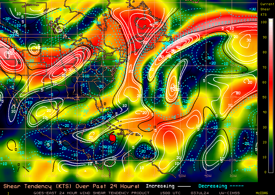
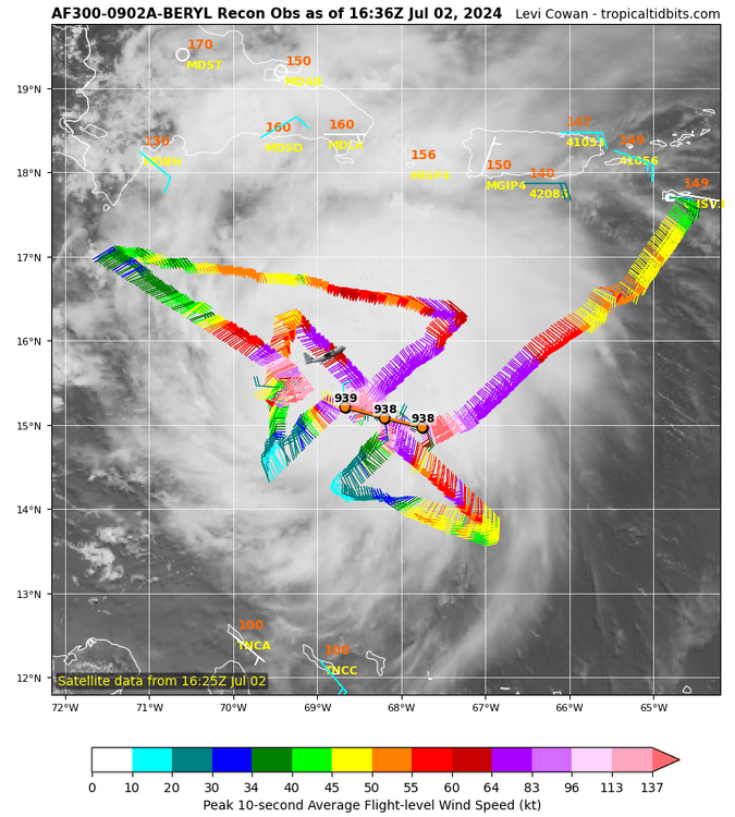
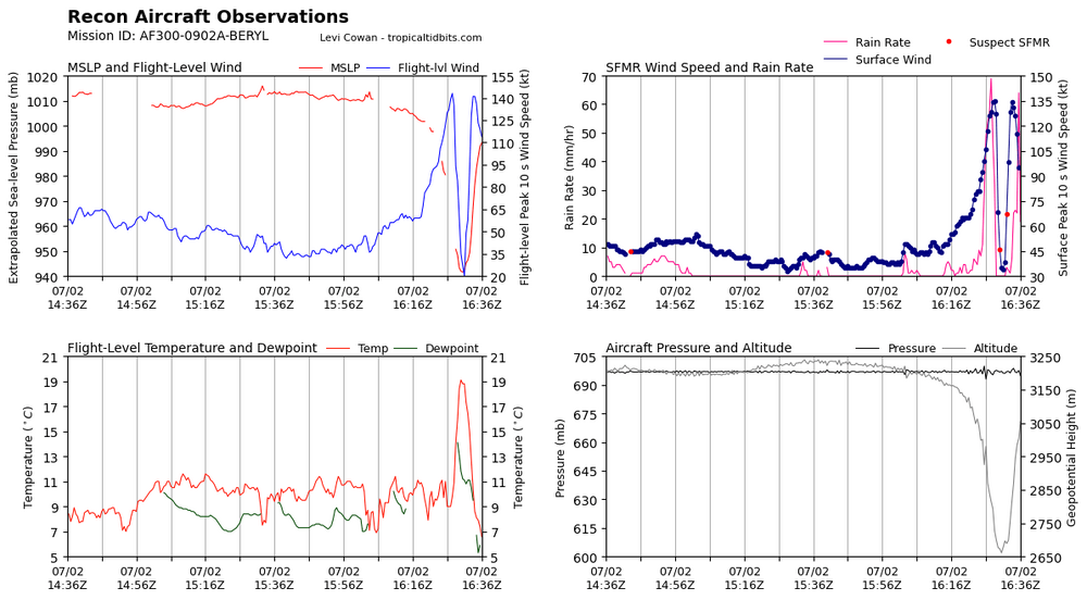
The pocket of 35-40kt shear quickly abated the environment ahead of Beryl. That high pressure to Beryls south is starting to once again build overtop of Beryl. Shear values overall are much lower than forecasted.
-
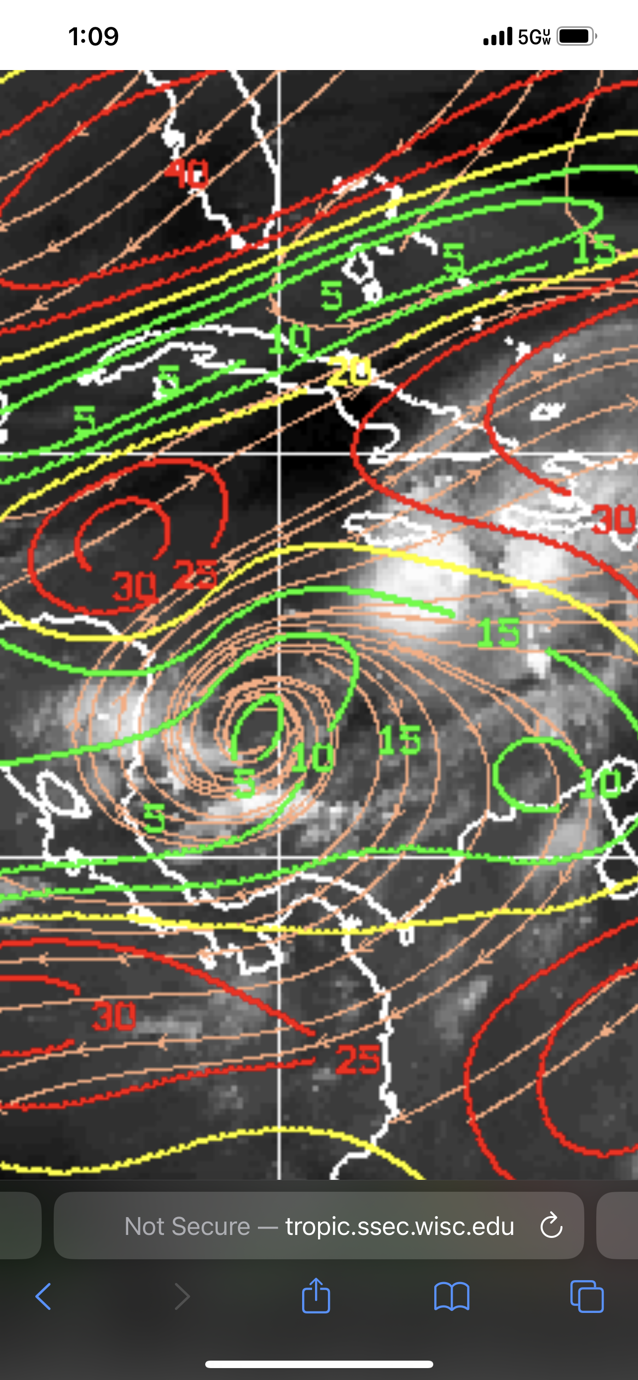
Not much to say other than to post the infrared loop. Still images can be deceiving, an animated loop is more precise. As we can see, when Beryls appearance looks ragged, Beryl explodes in the next frame. Beryl does not show any significant signs of weakening. That deep convection upshear in the north eyewall with a recent spike of lightning activity says otherwise.
-
Unreal that Beryl maintains Cat 5 intensity. Shear and dry air impacting Beryl but new convection is firing upshear and into dry air. Beryl is doing Beryl things, very impressive and unprecedented for Atlantic Basin hurricanes.
-
Compared to earlier, its current appearance is rugged and lopsided. Beryl is certainly starting to feel the impacts of shear and dry air.
-
Beryl starting to look rugged, losing that symmetrical appearance. Shear and dry air impeding the northeast quad.
-
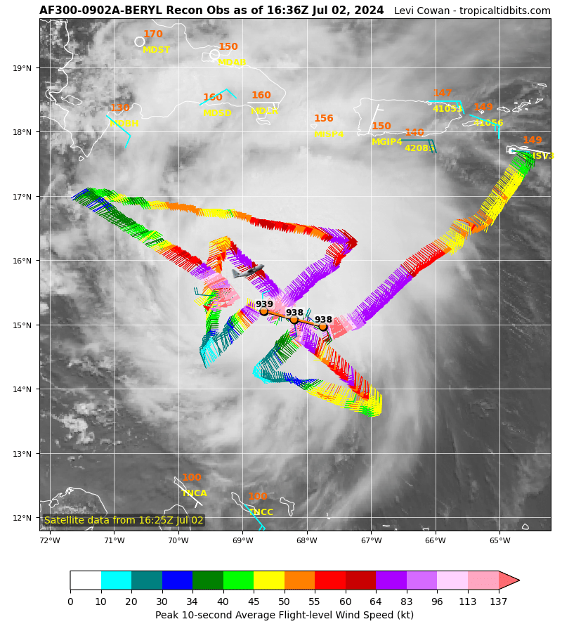
If an EWRC does not commence, Recon Hunters will find Beryls true peak. This monster is a Category 5, and Beryl made the evolution to Cat 5 look easy.
-
Also a textbook, classic example to teach in “Tropical Weather 101” of what happens when everything in the environment comes together.
-
The fact it achieved this intensity so rapidly in an environment that wasn’t exactly pristine is all the more impressive. Other canes have had environments more conductive and failed to take advantage of the opportunity. Beryl more than achieved its peak. Really have to credit the high pressure overhead Beryl that aided in ventilation at the perfect time, right when diurnal max was peak.
-
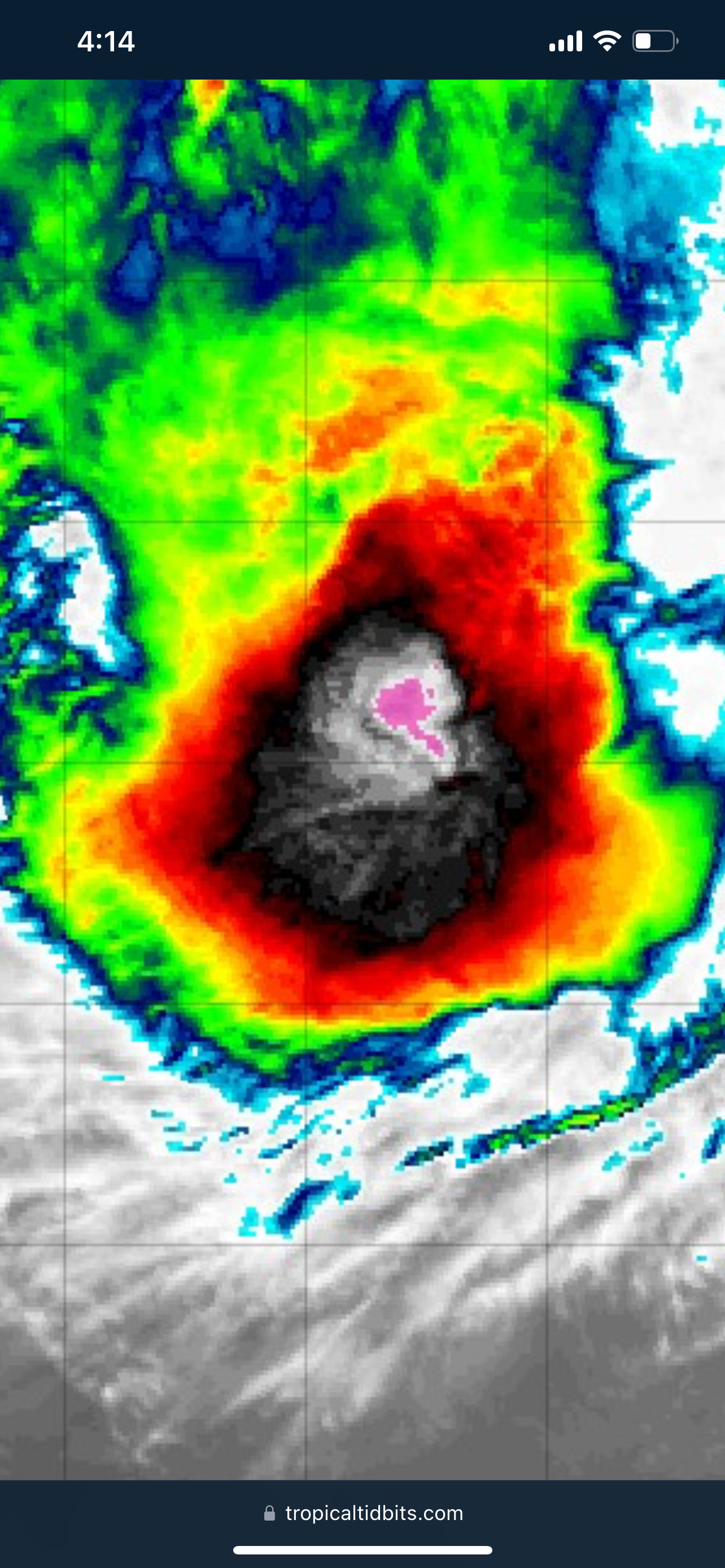
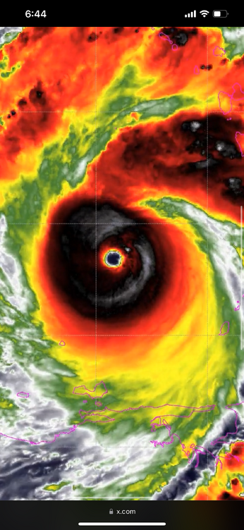
That is one of the most stunning, jaw dropping infrared scans of an Atlantic Basin hurricane ever. An absolute buzzsaw, almost annular. Is this really June or is this August and we entered a multi-verse?
-
I too request pdf, you are not alone in that department.
-
Beryl to be in the middle of an EWRC and maintaining its intensity and wind speeds is impressive. The case studies on Beryl will be great reads.
-
Honestly, with Beryl being so small it’s growing highly unlikely that an EWRC begins before striking the islands. With the dry air preventing expansion of the windfield, it will take land interaction with the islands to induce an EWRC. This is where my concern grows. If Beryl waits until land interaction with the islands to induce an EWRC, than it’s possible that completes before entering the Caribbean near Jamaica. Smaller storms are more resilient to shear. If Beryl maintains this small compact size than those intensity forecast showing weakening approaching the Yucatan could be wrong. It’s very possible that Beryl achieves a second peak on approach to the Yucatan. Really believe this is what Josh Morgerman is banking on. Reason why he did not play Island Roulette. Interesting enough, I heard that some in-house data at the NHC is starting to show this potential 2nd peak scenario.
-
I agree with that statement. 2 sections of that damage path warranted EF5. The subdivision near the water (can’t remember if he exact location) featured numerous well built homes wiped clean.
-
Reading was 215mph and 600ft off the surface. So plausible to say 190-200mph.
-
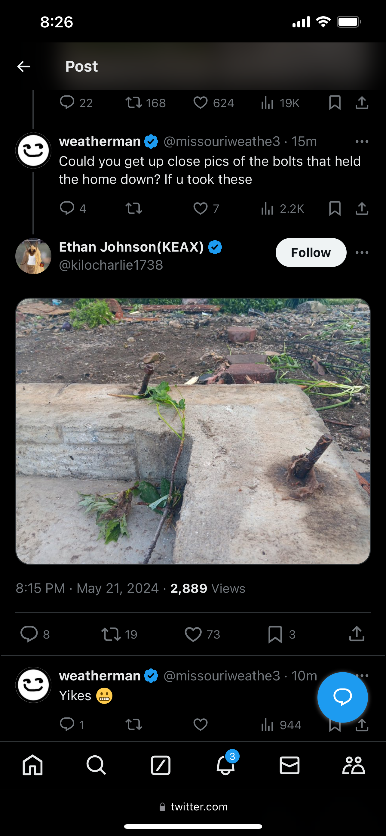
Numerous slabs wiped clean have bent anchor bolts. Tim has rated past tornadoes EF5 (ex: the 2011 EF5’s) off of this sole indicator. That and/or missing anchor bolts, but there’s no reports of any missing anchor bolts, as of yet.

-
Greenfield, IA tornado will be “at least EF4”. Pretty significant damage indicators being found. Of significant, the asphalt scouring and how the debris looks granulated. Typically these are trademarks of upper echelon high end tornadoes, along with debris lofting 40k feet into the atmosphere. I would venture to say preliminary rated 190mph or 200mph until engineers get on site to conduct their analysis. Engineers such as Tim Marshall.
-
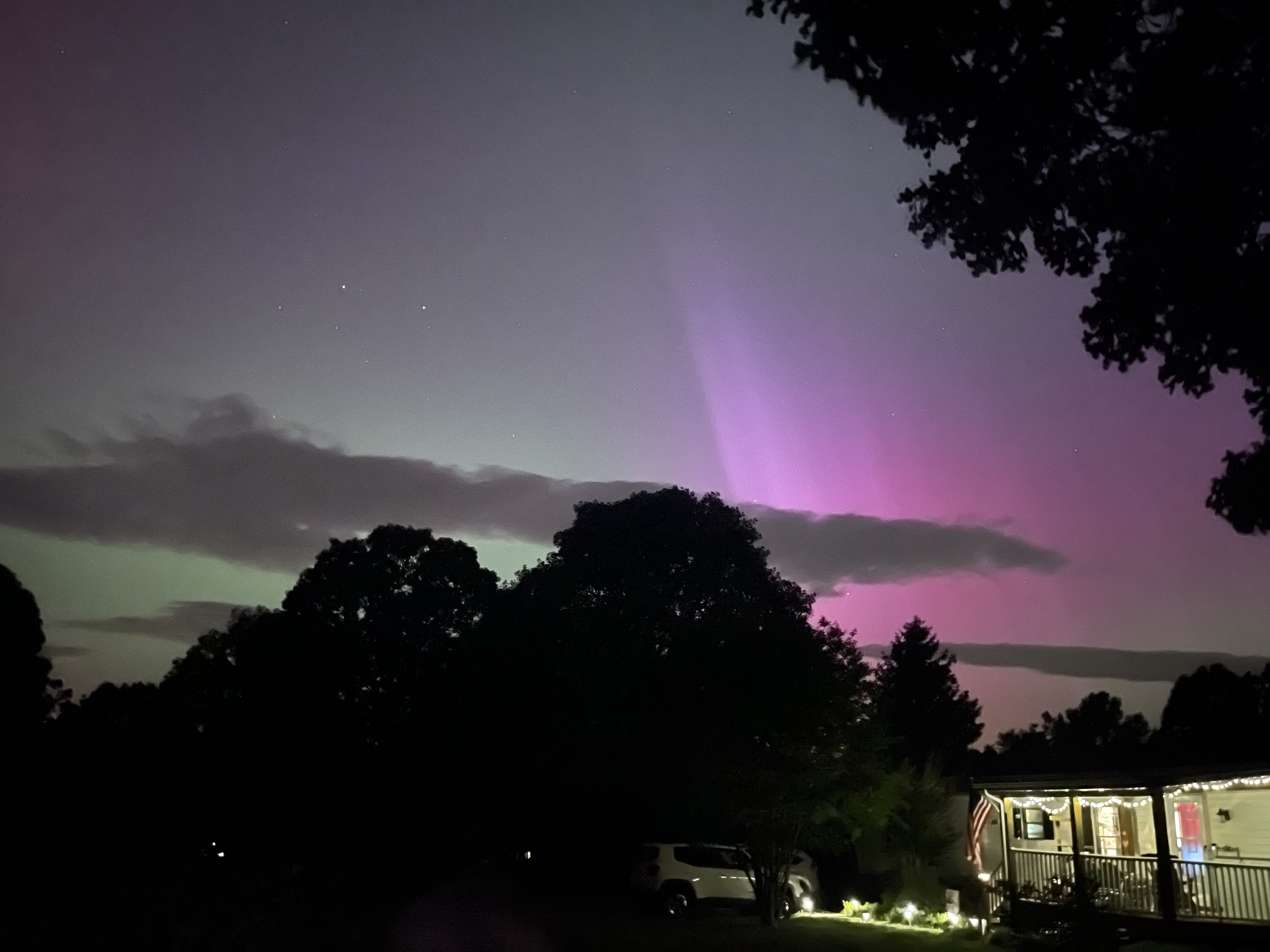
Got a decent view in Huddleston, VA

-
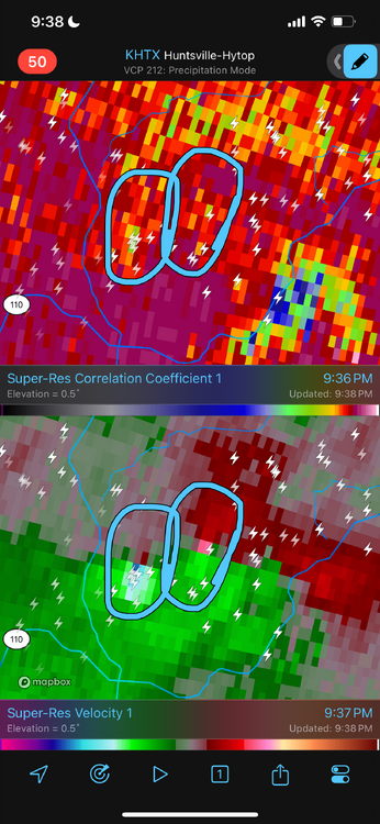
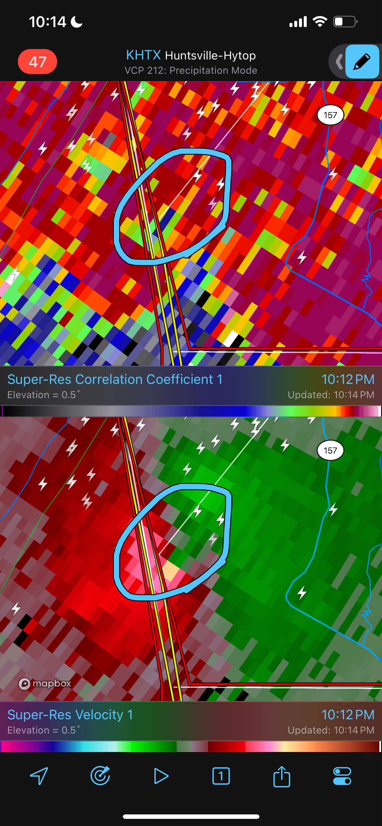
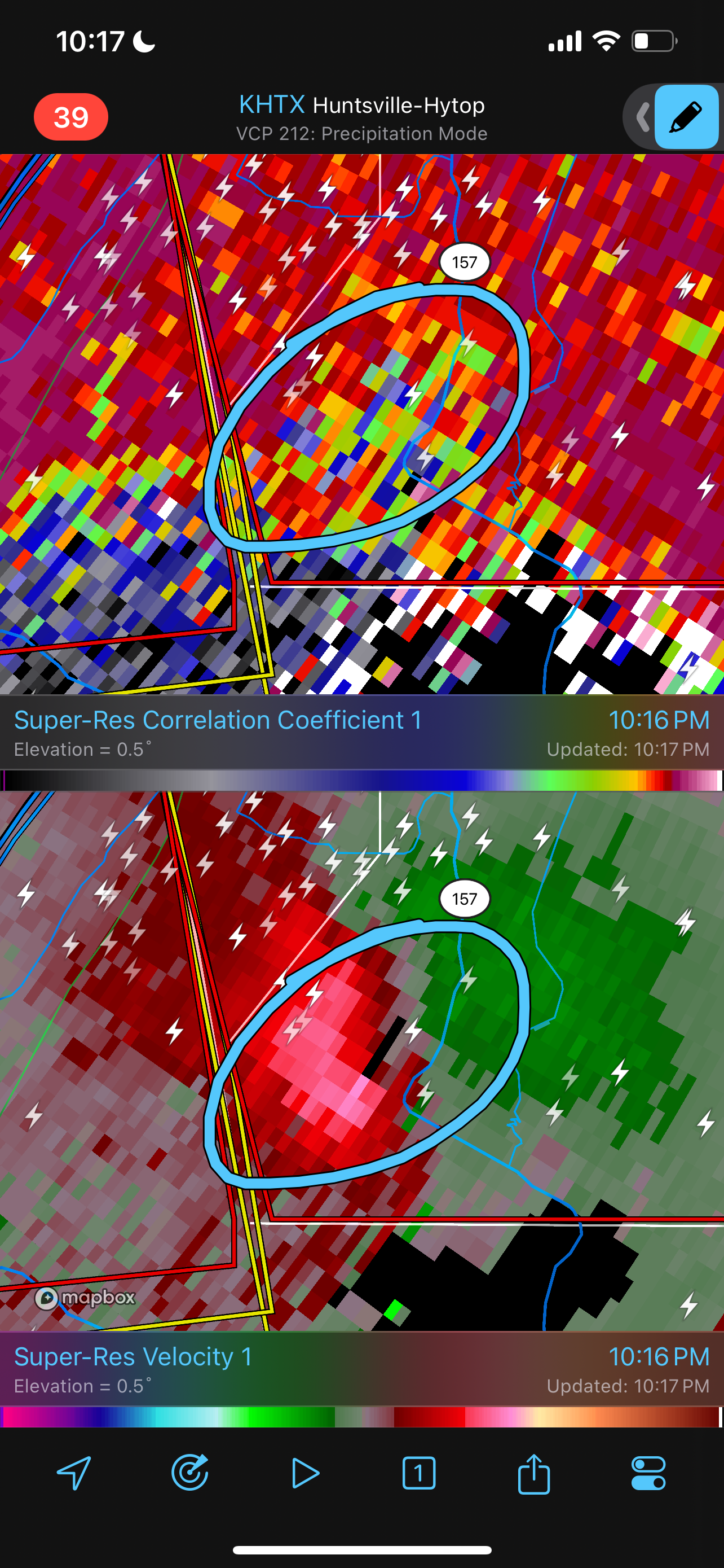
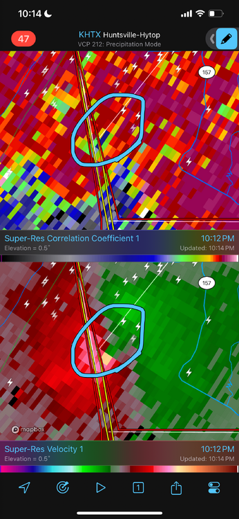
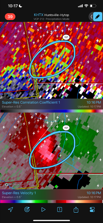
Significant Tornado just tracked out of Alabama into Georgia.
-
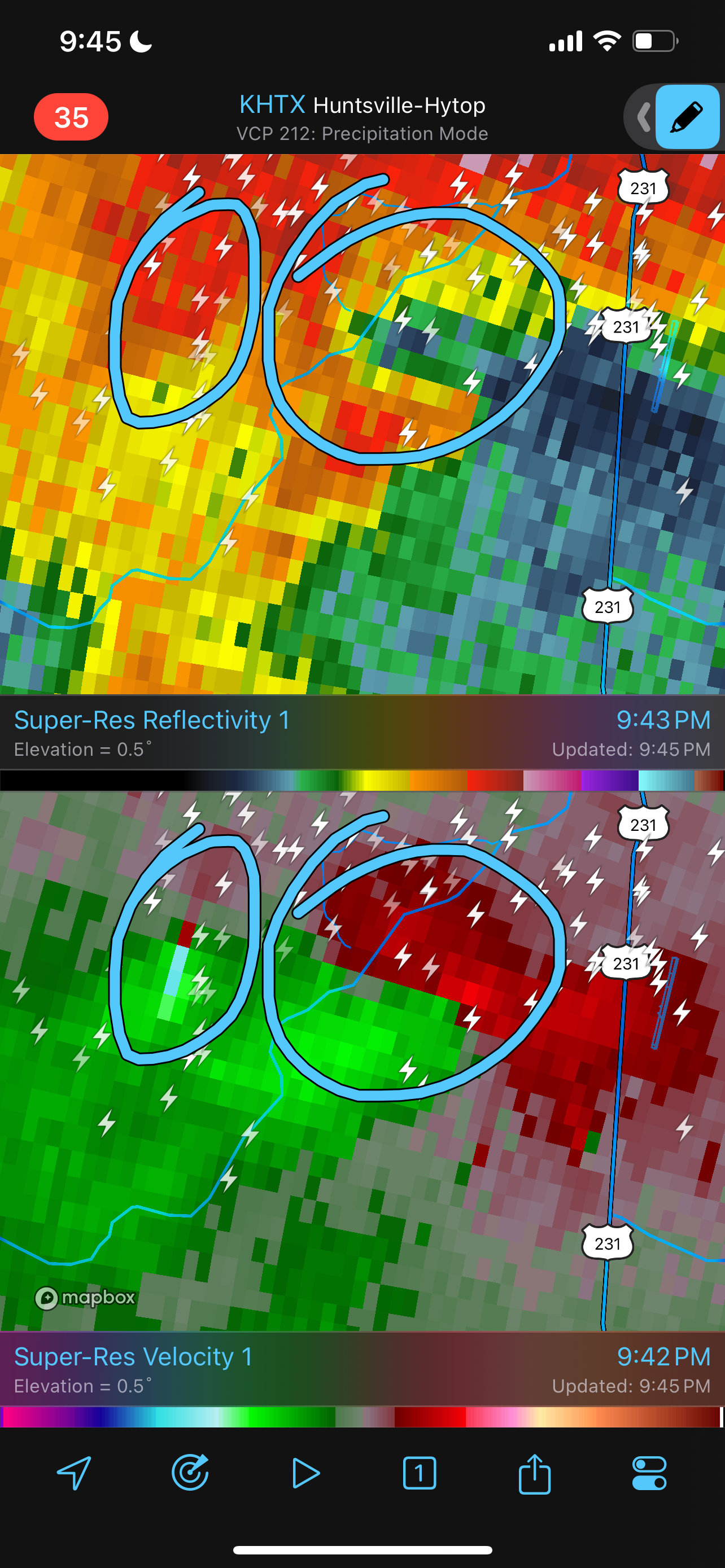
Looks like a potential meso-vortex with a satellite.

-