WxSynopsisDavid
-
Posts
500 -
Joined
-
Last visited
Content Type
Profiles
Blogs
Forums
American Weather
Media Demo
Store
Gallery
Everything posted by WxSynopsisDavid
-
GEFS says “the whole sub forum can eat with this run”
-
Tasty….that’s a big south and east shift right off the coast
-
Well…….think the GEFS just said “hold my beer”
-
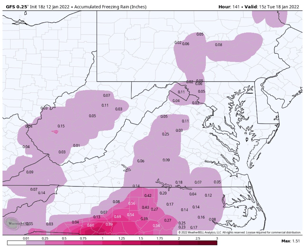
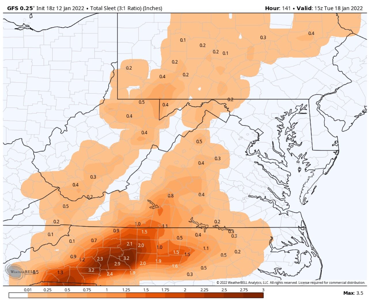
Seems odd to me, I would think this 00z run would produce more Ice
-
I’m right there with you. I’ll drink an extra one tonight for you
-
Trends are our friend tonight. Even if it’s 1 mile lol
-
Oh for crying out loud. Cut me a break….welcome to the party DT. Pull up a chair and get comfortable. If I had a dollar for every message I received today on my Facebook page regarding Storm specifics I could probably afford a down payment on a car
-
I can agree with that…but what I was saying is the current state of the model data we are 50/50 from swinging in either direction. Either the sub forum gets a big time snow or the sub forum gets a mixed bag precip event. Even with a mixed bag event, yes, 3-6 is doable.
-
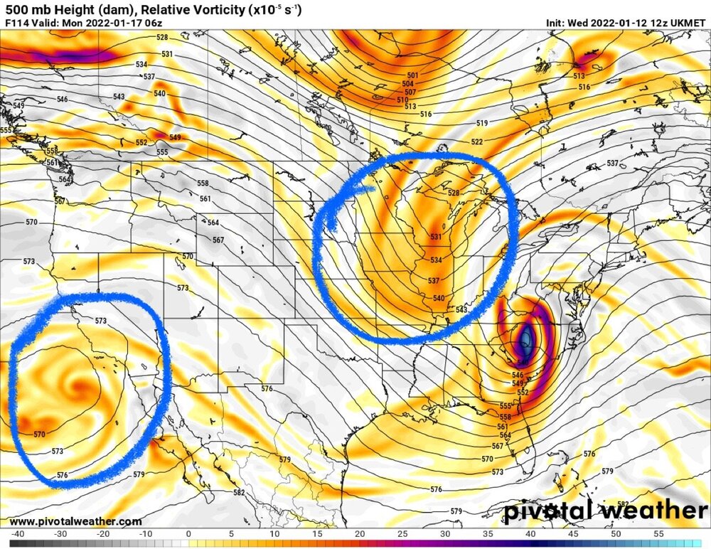
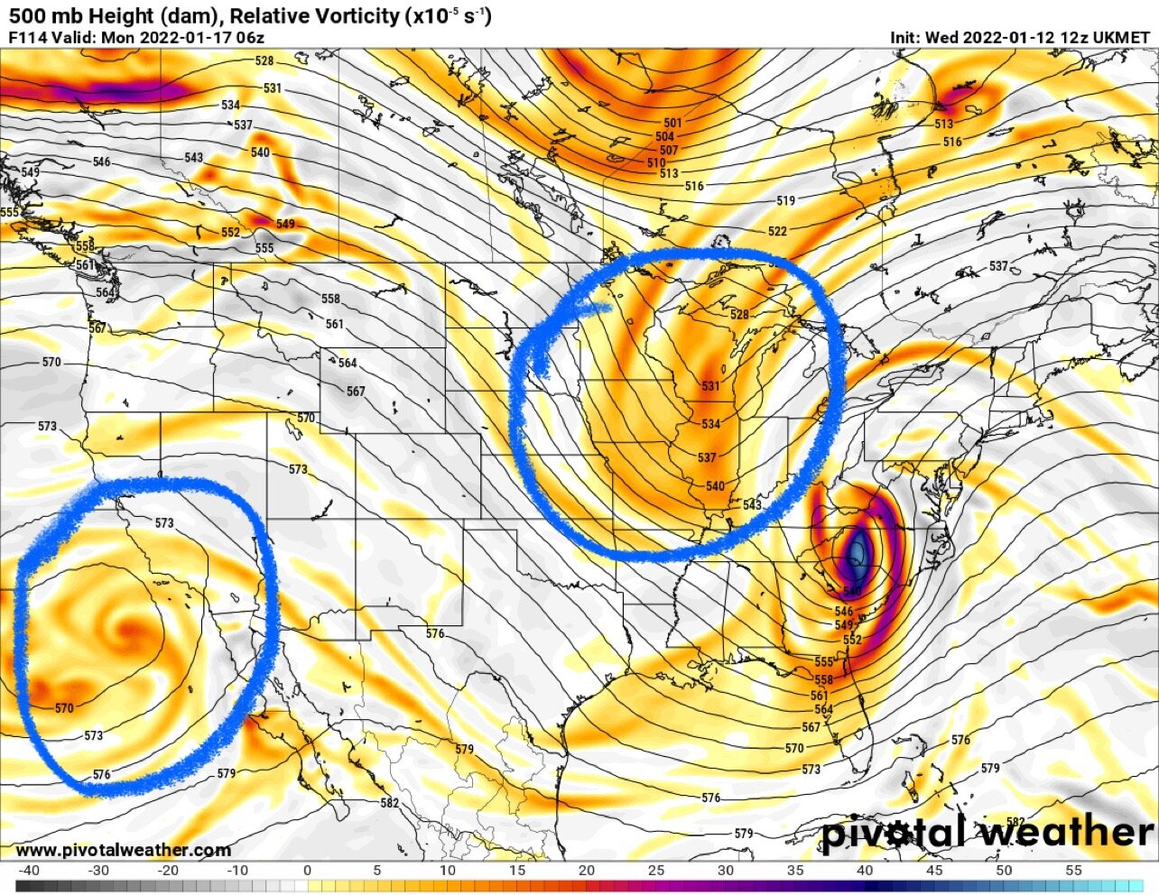
Agreed. Climatology speaks volumes here, so do analogs. What is shown is not a typical end result to the depicted storm evolution and track
-
Still think the models are not handling the northern stream energy properly. Unfortunately we might not have a better idea until tomorrow or Friday when NWS ballon soundings are conducted and the data gets ingested. Honestly this is a close call right now for a large portion of this sub forum. Either a big snow or a huge swing and miss with a mix bag. It’s like we are in the 9th inning, 3-2 count with the bases loaded. Tying run on first base, grand slam would win it. The pitcher is prime Randy Johnson and we are a rookie no name call-up from the minor leagues.
-
Just being truthful man, literally no positive trends right now. Pretty sad when I keep finding myself clicking on the NAM for a refresh (literally going to the last resort) but realizing “geez, it’s not even in range yet”
-
But….wouldn’t be surprised to see the operational models tonight crap the bed and produce a cold rain with some sleet and ice for areas east of the mountains. One can hope
-
Another “fly in the ointment” with this forecast is the Baja Low. Operational models are having a hard time with it, along with the northern shortwave. Ensembles seem to be handling them better. Honestly…you would think that the expected trend is a crush job showing up with later model runs for NOVA