WxSynopsisDavid
-
Posts
500 -
Joined
-
Last visited
Content Type
Profiles
Blogs
Forums
American Weather
Media Demo
Store
Gallery
Everything posted by WxSynopsisDavid
-

January 28-29 2022 Miller abcdefu Storm Obs/Discussion
WxSynopsisDavid replied to mappy's topic in Mid Atlantic
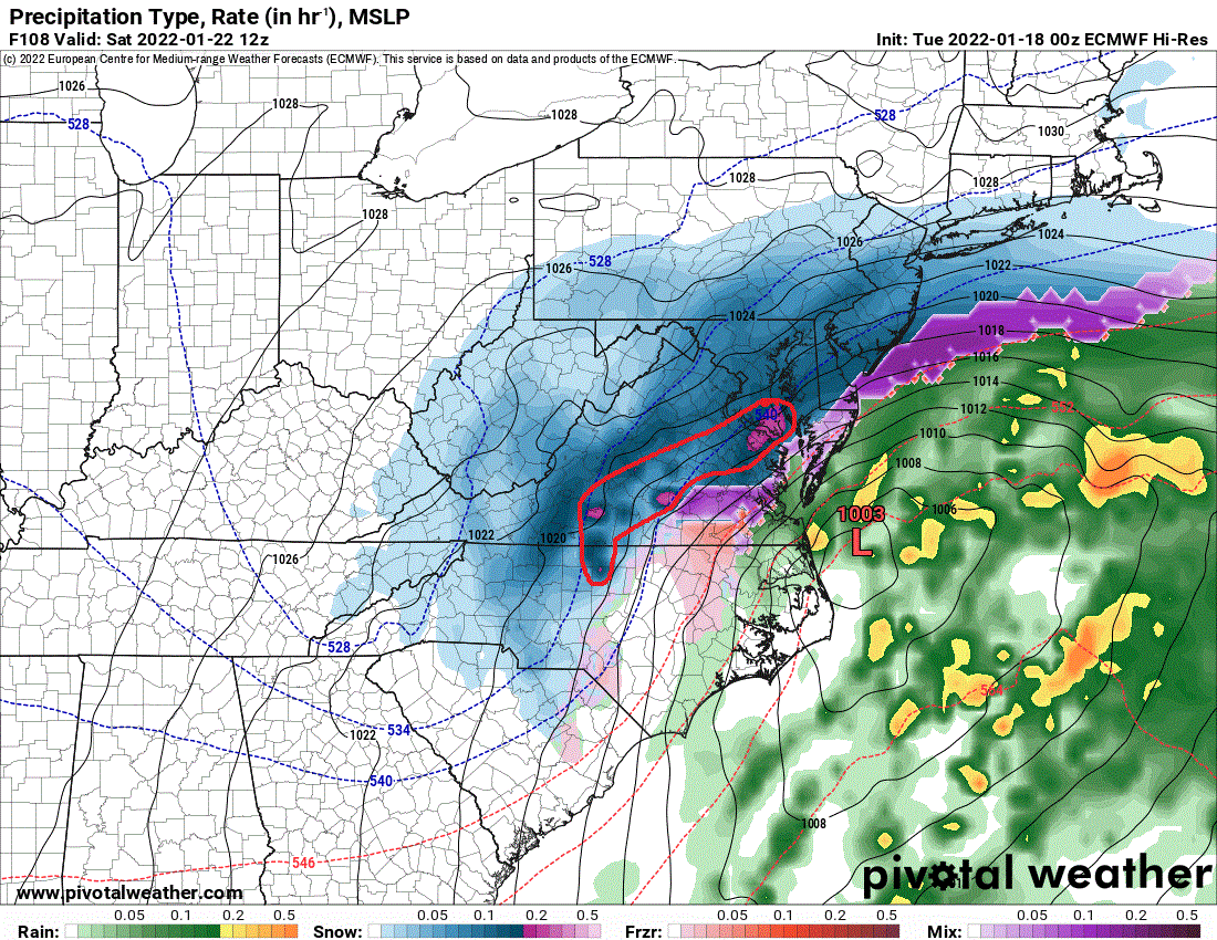
No you didn’t, but I mentioned guidances as reference to the fact that the forecast is on point and matches what the models had in terms of the track. Also, was not arguing you but rather stating a known fact, that current location for the center you are saying is waaaay offshore is not far enough east to stunt precip to the west. A low can be in that very exact spot and still be producing precip along the coast and points inland. Other factors come into play like they are tonight such as the phase, strong confluence, development of a double low, expansion to precip field, intensification, etc. This is not your normal low pressure system, so it’s current track will still produce nor is it hinging on influence with an 850 to come west. Also, I remember notable lows in the past that were farther to the east that still pounded the northeast…even hurricanes. Several nor’easters and let’s not forget Hurricane Sandy were farther east -
January 28-29 2022 Miller abcdefu Storm Obs/Discussion
WxSynopsisDavid replied to mappy's topic in Mid Atlantic
Really at this stage of the game the models carry zero weight, they will often swing and miss concerning the mesoscale. Radar and satellite observations will be the go-to as we can toss the models in the can until next storm -
January 28-29 2022 Miller abcdefu Storm Obs/Discussion
WxSynopsisDavid replied to mappy's topic in Mid Atlantic
Incorrect. That’s not waaaaay offshore. Every guidance I seen had the coastal about in that general area. What happens is the coastal develops a double low and along with the phase happening, the coastal storm gets pulled back west once it is paralleled to OBX. As it stands, everything is going as forecasted for the Delmarva into the northeast. -
January 28-29 2022 Miller abcdefu Storm Obs/Discussion
WxSynopsisDavid replied to mappy's topic in Mid Atlantic
If we are referring to Lynchburg, VA I was at the Sheetz on 460 in Bedford about 30min ago. That was a very quick change from just rain to a rain/snow mix -
January 28-29, 2022 Miller abcdefu Storm Threat
WxSynopsisDavid replied to WxUSAF's topic in Mid Atlantic
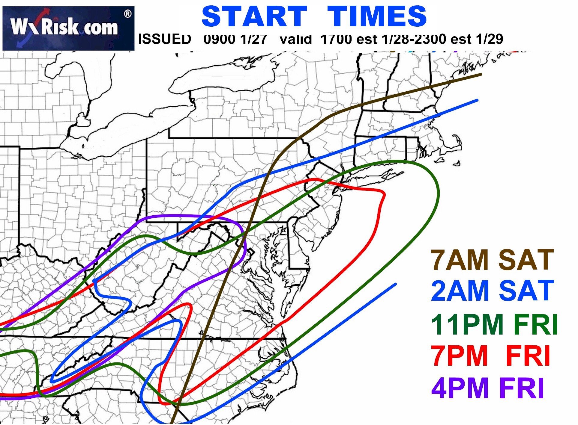
So does the data get ingested into those WxRisk maps DT been hard at work with? Asking for a friend -
January 28-29, 2022 Miller abcdefu Storm Threat
WxSynopsisDavid replied to WxUSAF's topic in Mid Atlantic
My apologies, drinks on me -
January 28-29, 2022 Miller abcdefu Storm Threat
WxSynopsisDavid replied to WxUSAF's topic in Mid Atlantic

-
I know I been reading his post. At some point it becomes an annoyance. If he doesn’t know how to interpret radar and satellite imagery there’s enough of us in here that can teach him. But to scream bust with every storm, every setup, it gets old. Just stop looking at the model data and move on. Honestly that’s probably the issue, looking at model data in the present which conflicts with radar/satellite imagery.
-
Pretty negligent to be saying this is a bust when we aren’t even through 50% of the storm yet. Someone needs to learn how to look at radar and satellite imagery and calm down.
-
Richmond Metro/Hampton Roads Discussion
WxSynopsisDavid replied to RIC Airport's topic in Mid Atlantic
-
January 20-22 “bring the mojo” winter storm threat
WxSynopsisDavid replied to lilj4425's topic in Southeastern States
-
Jan 21 - 22 Weekend SE VA and Eastern Shore Snow
WxSynopsisDavid replied to stormtracker's topic in Mid Atlantic
-
Richmond Metro/Hampton Roads Discussion
WxSynopsisDavid replied to RIC Airport's topic in Mid Atlantic
SREF ticked west again, west trend is continuing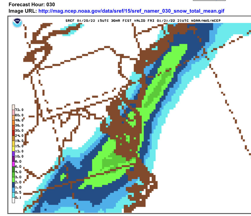
-
January 20-22 “bring the mojo” winter storm threat
WxSynopsisDavid replied to lilj4425's topic in Southeastern States
Why does weather always seem to shaft Alabama? No pun intended lol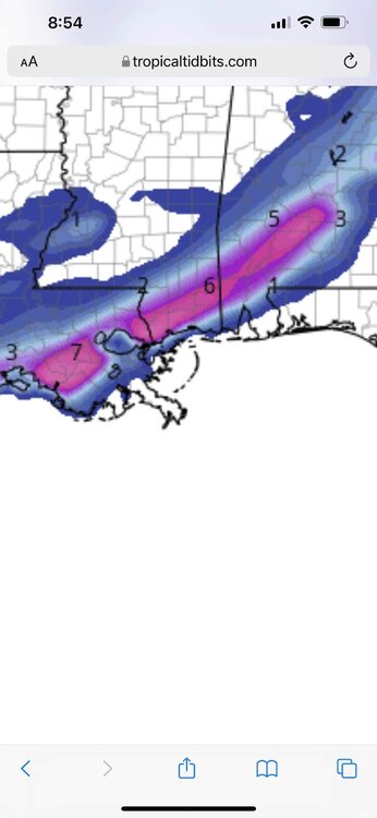
-
January Medium/Long Range Discussion
WxSynopsisDavid replied to WinterWxLuvr's topic in Mid Atlantic
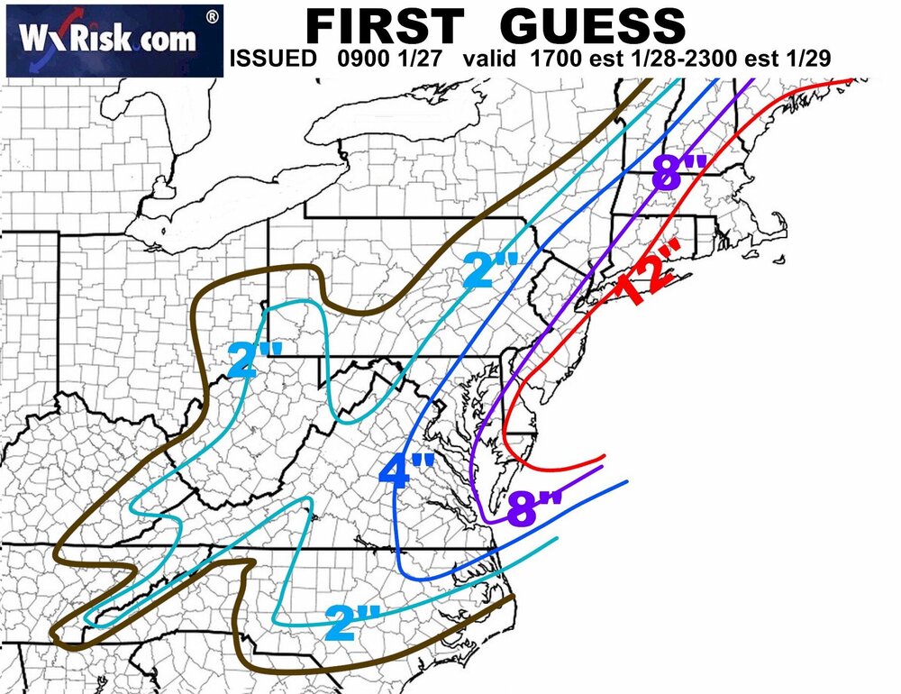
Now we get his famous "2 and a quarter" first and final call maps along with his cluster f*** start time maps. I sense him making an emergency trip to his local Wal-Mart to stock up on crayons. -
Richmond Metro/Hampton Roads Discussion
WxSynopsisDavid replied to RIC Airport's topic in Mid Atlantic
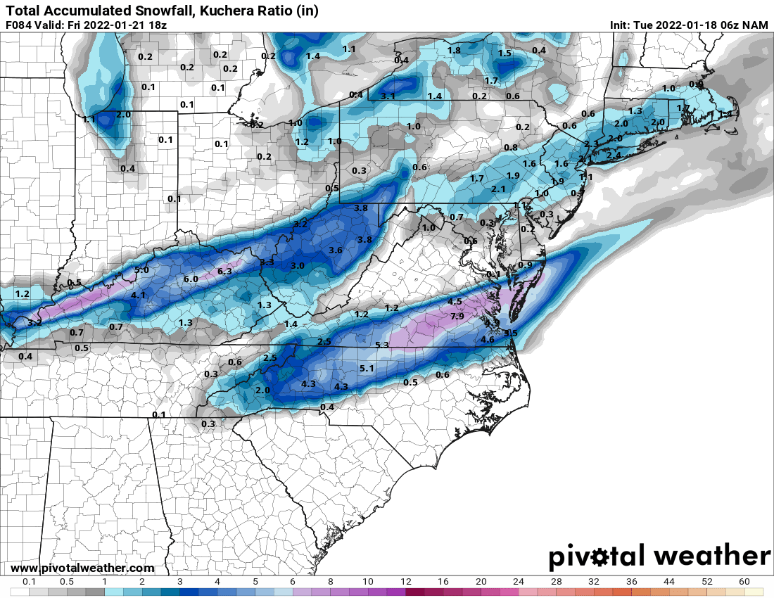
6z NAM at end of its range is still snowing. 8in of snow on the ground across south central VA into the middle peninsula. This is a healthy, tasty pre-game for the Saturday storm.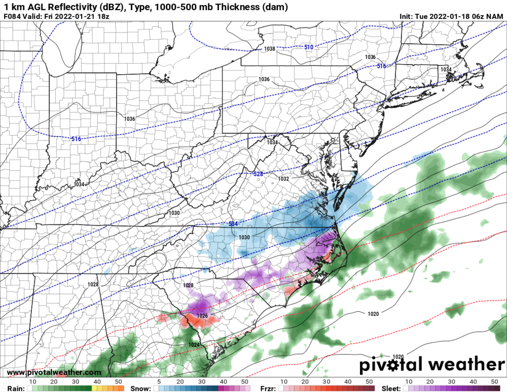

-
January Medium/Long Range Discussion
WxSynopsisDavid replied to WinterWxLuvr's topic in Mid Atlantic
Well...we both know what's next. Those dreadful "2 and a quarter" first call maps and those horrendous start time maps that are a cluster f***. -
January Medium/Long Range Discussion
WxSynopsisDavid replied to WinterWxLuvr's topic in Mid Atlantic
At end of run (Day 10) theres another storm developing coming out of Texas -
Richmond Metro/Hampton Roads Discussion
WxSynopsisDavid replied to RIC Airport's topic in Mid Atlantic
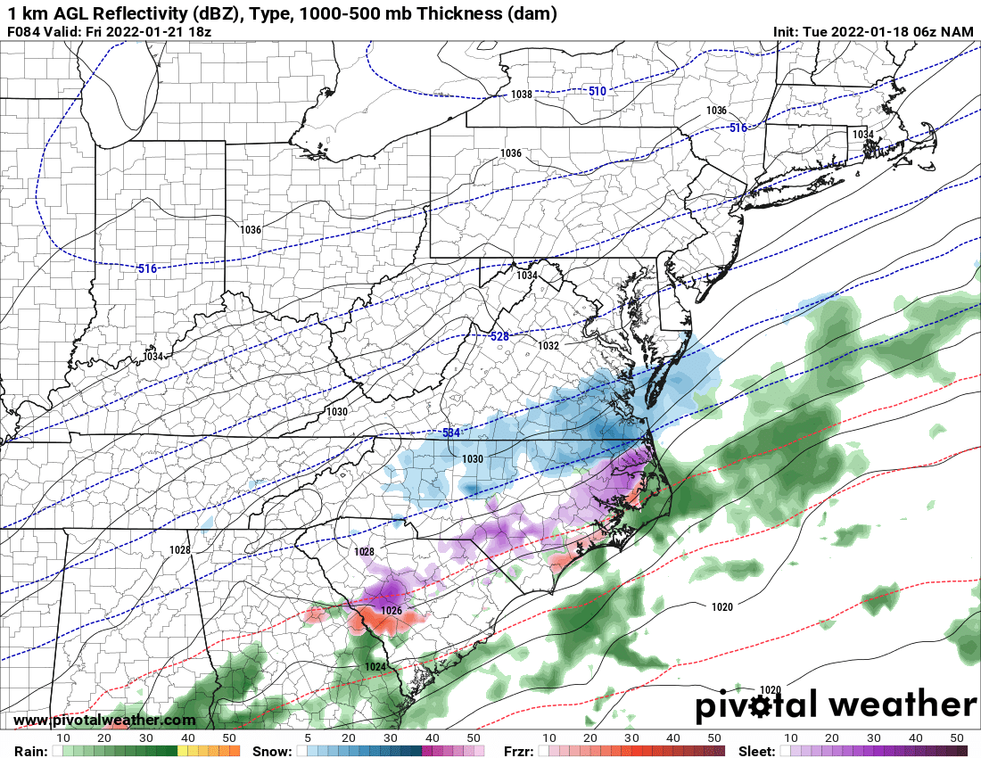
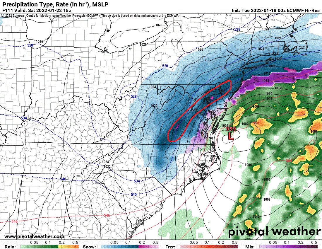
That is a nasty deform band. As I said earlier, you can see the pockets of pink in that deform band. Ridiculous rates and ratios under that thing.
-
Richmond Metro/Hampton Roads Discussion
WxSynopsisDavid replied to RIC Airport's topic in Mid Atlantic
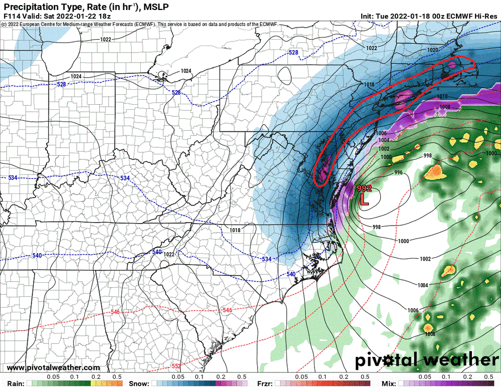
The whole state is 12in+ except for SW VA and SE VA both even both of those areas are 8-12in. This is pretty ridiculous, that would shut the whole state down for a few days. Whats very interesting is between hour 108 and 114 the deform band maxes out on the color table. Pockets of pink showing up in the deform band. That band would be laying down 3in to 4in rates an hour, ratios would be pushing 15:1. Wonder if this scenario starts to lock in and hold on the globals or if we see another back-and-forth swing later today -
January Medium/Long Range Discussion
WxSynopsisDavid replied to WinterWxLuvr's topic in Mid Atlantic
Hour 108 through 114, that deform band is maxing out on the color table. Pinks showing up in that deform band. Some areas that get underneath that thing will have ridiculous snow rates, 3 to 4in/hr easy. Ratios will definitely be 12:1 to 15:1 -
January Medium/Long Range Discussion
WxSynopsisDavid replied to WinterWxLuvr's topic in Mid Atlantic
....and points north of RVA -
January Medium/Long Range Discussion
WxSynopsisDavid replied to WinterWxLuvr's topic in Mid Atlantic
Thats a pretty ridiculous deform band setting up shop over central/eastern VA at hour 102. RVA is getting crushed -
January 20-22 “bring the mojo” winter storm threat
WxSynopsisDavid replied to lilj4425's topic in Southeastern States
Honestly, if the low could be a little deeper and undergo bombogenesis that would be really nice and everyone in the subforum would cash in and be able to eat lol -
Richmond Metro/Hampton Roads Discussion
WxSynopsisDavid replied to RIC Airport's topic in Mid Atlantic
This block to our north, per the UK and EURO, and even the crappy GFS looks a hell of a lot better than what we had in place with this recent storm. Will have to say I am concerned with your reasoning for being cautious as that could lead to a significant icing event. This has even been shown on previous runs of the globals in regards to this next storm. Those runs were putting down copious amounts of Ice across the eastern Carolinas