WxSynopsisDavid
-
Posts
500 -
Joined
-
Last visited
Content Type
Profiles
Blogs
Forums
American Weather
Media Demo
Store
Gallery
Everything posted by WxSynopsisDavid
-
...and a prolonged wind event at best.
-
A better option at this point for Tampa Bay would be if this thing can landfall vs a potential stall off the coast. Both scenarios will be bad but the landfall scenario would probably be the best case scenario at this point. Hard to fathom the disaster this would be
-
That is going to be absolutely nasty for Tampa Bay with storm surge going up into the Bay with nowhere to go.
-
Ultimately the storm speed/trajectory is going to be determined by the trough sweeping south too as well as the evolving blocking pattern.
-
I'm talking about past events and how the GFS handled them. This is typical GFS
-
Yeah I would say the GFS is out to lunch on this one. GFS tends to struggle with these Florida canes because it either likes to slide the trough out quicker or it holds it back longer. GFS never really depicts these troughs right.
-
Don't agree with the GFS wanting to take Ian on a slow craw up the western FL coastline. Really think this comes ashore near Tampa or just to the north of Tampa. Either way, whether this landfalls Tamp or it slow crawls, both scenarios paint a disastrous storm surge/pro-longed wind event for Tampa Bay.
-
Very concerning, that slow creep on approach and near stall right off the coast of Tampa would be a huge storm surge disaster for that area. Definitely not good by any means
-
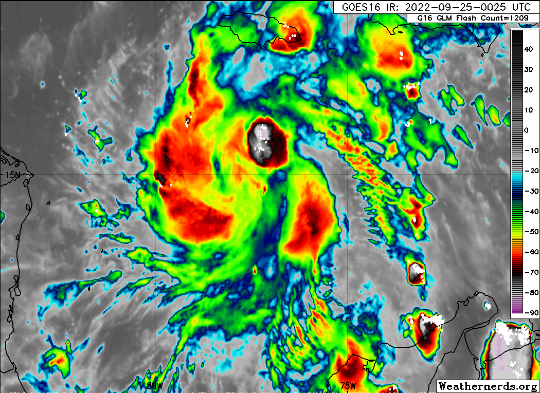
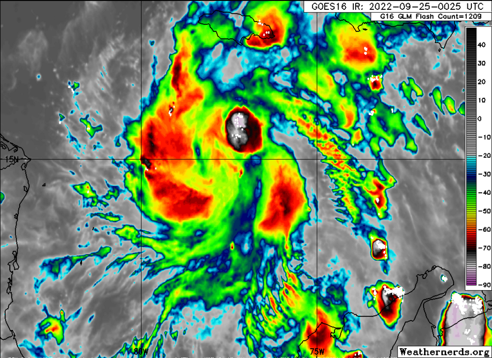
In addition, when looking at satellite loops the outflow is improving at a rapid pace.
-
Btw....just an FYI....not sure if anyone is following Super Typhoon Noru but it just completed an explosive intensification process that saw it gain 85kts+ in the last 24 hours. Upper echelon event for intensification processes worldwide
-
It all comes down to Cuba. What happens after it passes Cuba.
-
Its going to be a stretch if it can rapidly get organized and establish the CDO. The main window for RI we were anticipating was tomorrow evening into Monday morning. If it can get going tonight it will be ahead of schedule on the intensity forecast and most likely lean on the high-end side of the forecast outlined by the NOAA NHC.
-
Oh most definitely, very impressive how quick this is happening
-
New convective burst rapidly going up near the center. This is likely the start of things to come over the next 24-36hrs so I completely agree with your analysis.
-
The track ultimately is going to come down on Ian's intensity when it gets to Cuba. Weaker storms tend to go east where the stronger storms tend to drift west. In the meantime its honestly hard to tell what this is going to do for the long-term. It only takes 1 rapid or explosive intensification phase for Ian to become a powerful hurricane by the time it gets to Cuba.
-
The global models did not have any but some of the hurricane and NOAA NHC in-house models had some dry air over the next 12-18hrs. However, even those runs didn't have the dry air significantly impacting Ian.
-
This should restrict outflow and prevent the CDO from organizing in the short term. Definitely should act as a cap in the short term
-
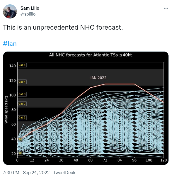
Something I'm noticing in every new model run that comes in Ian is actually holding its intensity longer on these north and west tracks. Last night some of the models were ripping apart Ian and causing him to weaken almost to a TS on landfall. Model runs today are relaxing on the shear and dry air near the coast. Definitely not a good trend IMO.
-
Yes, however its still underestimating the environment Ian will be in. Does intensify at landfall though
-
The environment depicted does not support significant weakening as depicted. I could understand if there was shear but GFS looks to have no shear there
-
Hard to tell, these hybrid hurricanes fluctuated back and forth up until landfall
-
Recon not yet sampled the area where highest surface winds would be
-
-
Yeah these internal processes can be prolonged and last a day or more. Some cyclones can be plagued with constant internal processes their whole life. Theory here is that Fiona has had this constant EWRC to fend off the sheared environment it was in.