WxSynopsisDavid
-
Posts
500 -
Joined
-
Last visited
Content Type
Profiles
Blogs
Forums
American Weather
Media Demo
Store
Gallery
Everything posted by WxSynopsisDavid
-
Concerning the dry air though, topography yes, i agree
-
Not supported by recon though
-
Until Ian crosses Cuba we are unfortunately going to see this back and forth game concerning the track in relation to the building HP
-
Yes they were, NAM pack were among the first models outside of the NOAA NHC in-house models to accurately predict Michaels rapid intensification
-
Ian moving over some notable warm eddies in the next several hours so I wouldn't be surprised to see another rapid pressure fall
-
Its coming along nicely, that eye looks healthy
-
Yes CAMS are Convective Allowing Models. And yes as standalone model runs, no they shouldn't be used. As in......molding a forecast to the track depicted on the NAM. However the closer you get to an actual landfall they help to sniff out the mesoscale environment ahead of the storm (since they are programmed/designed for the mesoscale). In years past I have actually used the NAM to help indicate effective timeframes when possible internal processes would happen. Also, the NAM has a tendency to sniff out last minute shifts in track as landfall approaches. They are effective tools and have their purposes like every other model. Though they are not ocean coupled they also help with forecasting so I agree to disagree with your statement.
-
NAM landfalls south of Tampa Bay and the FV3 Hi-Res seems to be following the same track. Interesting to see the CAM start to lean towards a Tampa or points south landfall......very similar to some of the EURO op runs and the ensemble runs we seen the last few days
-
Ian is trying to evolve into a buzzsaw
-
Indeed we are seeing structure improvements and the pressure is steady now with minor pressure falls. Remember though, there is a lag between us seeing structure changes and the pressure actually tanking. By 5am we should see another significant pressure drop. It takes a few hours for the pressure to respond. It all does not happen at one time
-
Very healthy CDO with deep convection wrapping around the center. Ian is off to the races now
-
That suddenly made me hungry...but I'm at work tonight and cant cook shrimp lol
-
...and we will just ignore the fact its virtualy stalled doing that so yeah, no upwelling what so ever lol
-
For humor purposes only.......want to see the potential "world record" RI process inbound? A 103mb drop in 12hrs.......brought to you by.......your neighborhood friendly 00z 3km NAM run
-
And there its is, finally, the eye of Ian
-
If we are talking about Indian Pale Ale's....I'm game for that lol.
-
If this rate of intensification continues that we have seen this evening, and it solely depends on Ian getting a CDO and an eye soon, you could be waking up to find Ian stronger than a Cat 1.
-
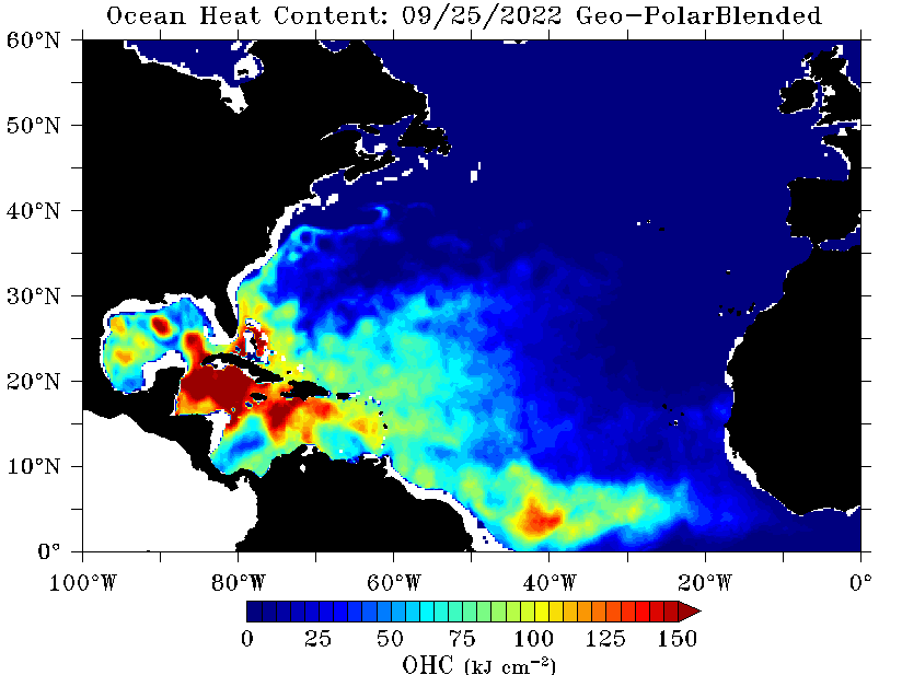
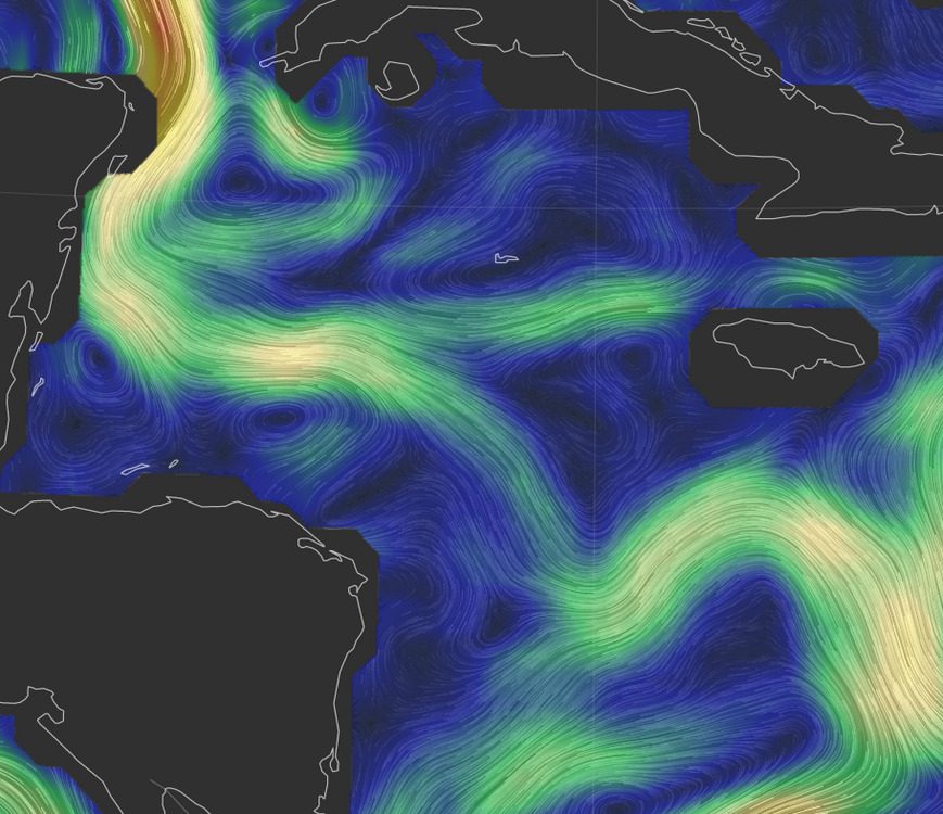
Ian is now over 85-87 degree SST's, moving over bath water. Ian has all the ingredients it needs to RI now.
-
Looking at the environment ahead of Ian tonight, besides the lack of dry air and windshear the OHC is very high ahead of this system. Also, something to note here, there are a few warm eddies ahead of Ian so its very possible this anticipated RI process could lean towards an "explosive intensification" process once Ian gets an established CDO and eye. Its also now following the tail end of the loop current so we should start to see remarkable/appreciable structure changes soon.
-
Until Ian gets better organized and we see an eye develop, we wont have any better idea in the long term and neither will the models. Expect additional back and forth in terms of track until then
-
"The little engine that could"
-
Exactly, which draws into perspective that Ian is deepening at a much faster rate than what was originally forecasted and shown by the models. This is going to be huge/detrimental to the forecast track so I expect further adjustments on the models tonight.
-
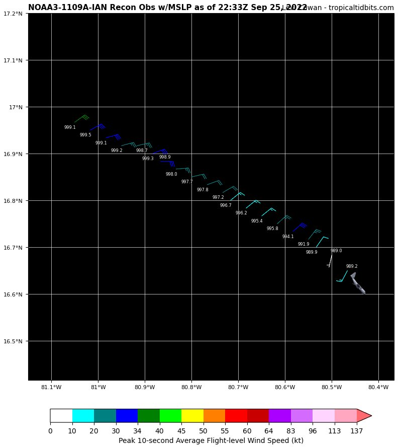
990mb currently, that is a 15mb drop in 5 hours. Very certain we see hurricane force winds at the surface in the next several hours once convection gets going

-
Ian down to 990mb, looks to be a temperature spike near the center too. We are likely about to see convection rapidly going up near and around the center very shortly
-
To you guys who live in Tampa Bay, I wish you guys the best of luck with this storm and I hope you all fare better in the long term then what we are seeing.