WxSynopsisDavid
-
Posts
563 -
Joined
-
Last visited
Content Type
Profiles
Blogs
Forums
American Weather
Media Demo
Store
Gallery
Everything posted by WxSynopsisDavid
-
Or we can try and figure out where those "DT-Forecasted" snowstorms went. Lets look at his social media post on Nov 30th and play the game of "decipher the code" or "solve the equation". Maybe its a typo...he meant "Major East Coast Rainstorms"
-
It wont, it will just help to "ease" the nerves of those on the cliff ready to jump until the 00z suite starts rolling.
-
Oh it’s the season…..that time of year when DT breaks out the colored pencils. Also, one of his better jumbled up “art pieces” he has posted. He actually colored inside the lines this time. But we all know his snow maps are coming shortly and we will be struggling to decipher/crack the code and/or solve the equation to figure out what zone we are in.

-
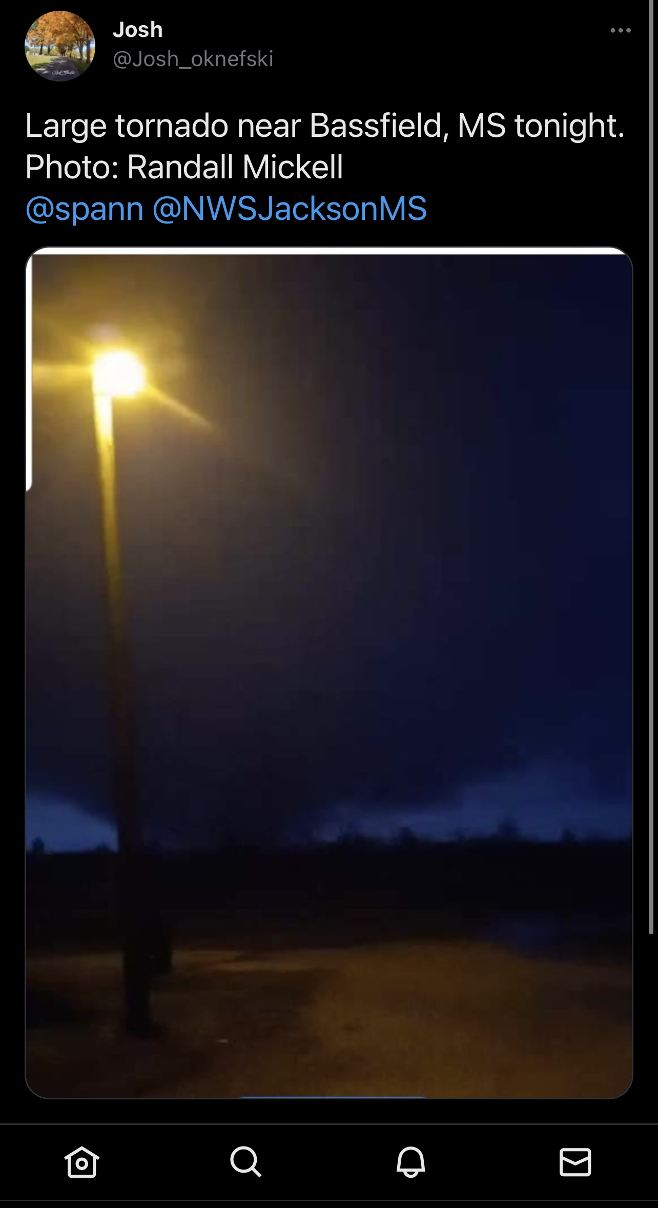
 Just seen this on Twitter, apparent picture of the Bassfield tornado as it was tracking through. Picture seems to be about the time the tornado peaked
-
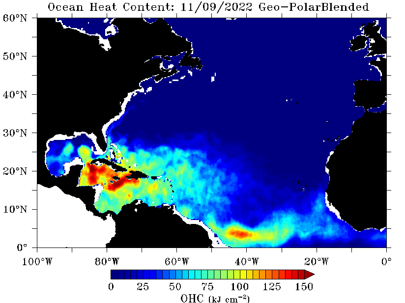
The combination of high ocean heat content, Gulf Stream, and notable warm eddies does point towards Category 3 being the ceiling and a real possibility now.
-
Major November Outbreak Possible
WxSynopsisDavid replied to Tallis Rockwell's topic in Central/Western States
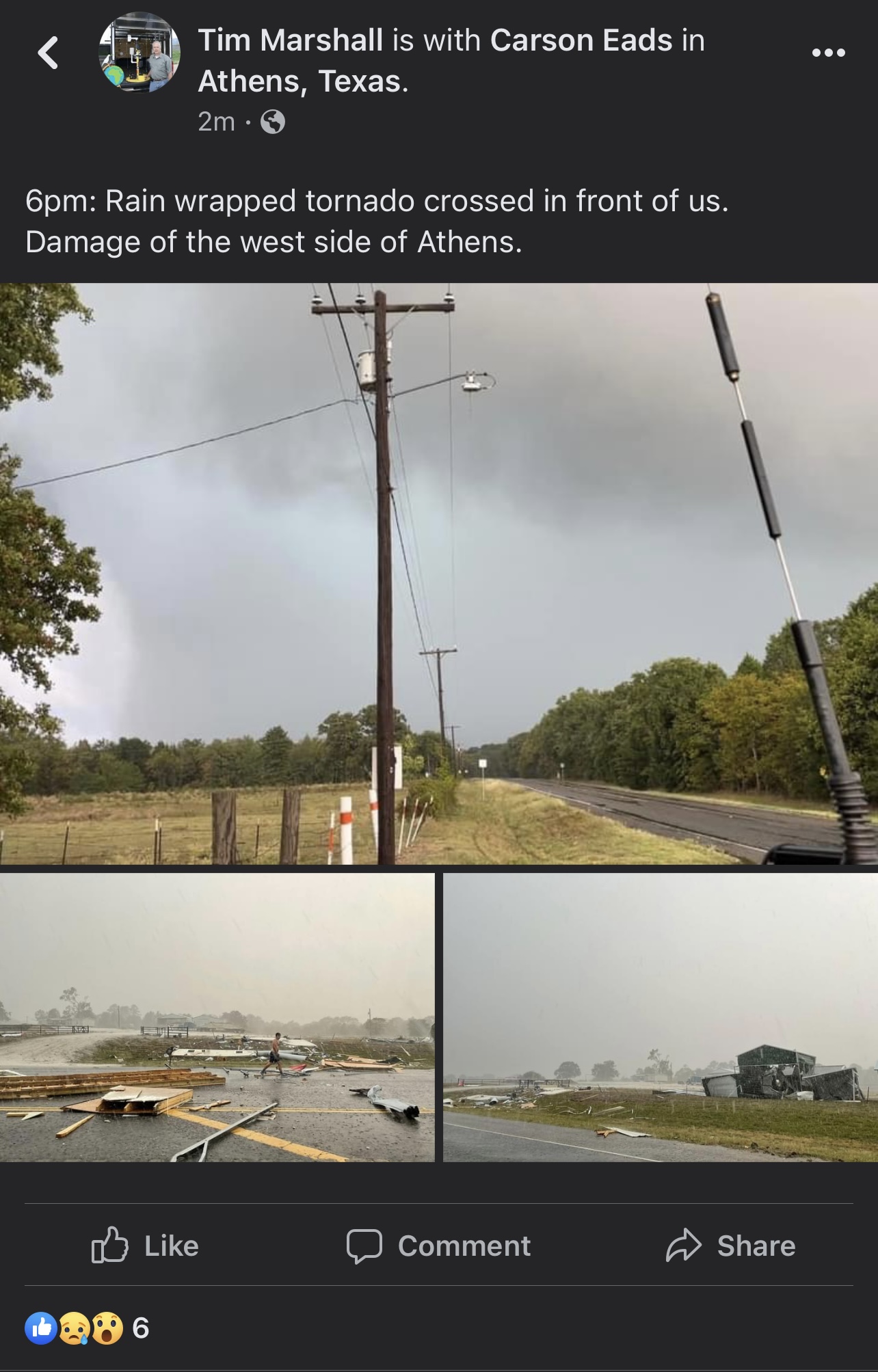
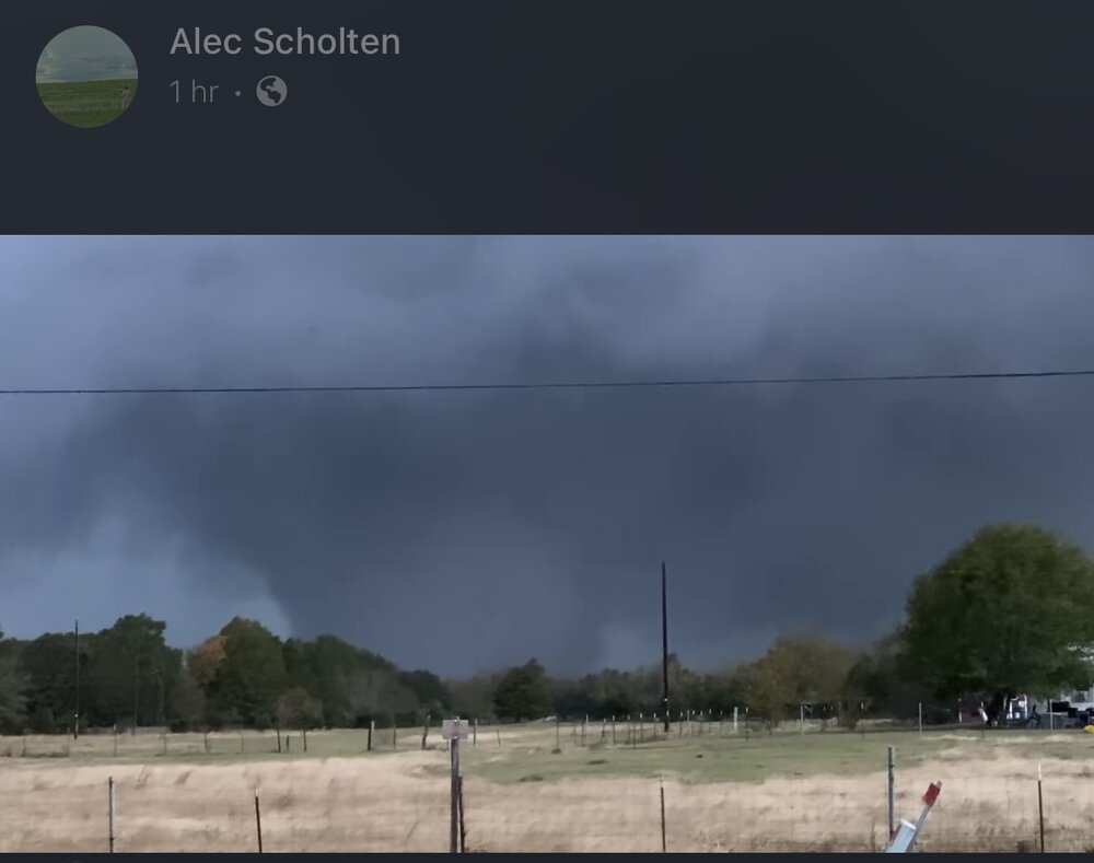
The massive violent wedge earlier when it was passing by Clarksville, TX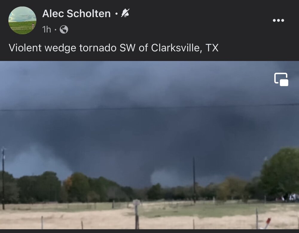
-
Major November Outbreak Possible
WxSynopsisDavid replied to Tallis Rockwell's topic in Central/Western States
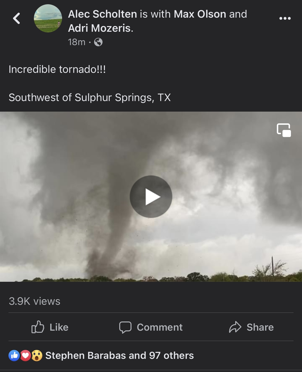
The tornado earlier near Sulphur Springs, TX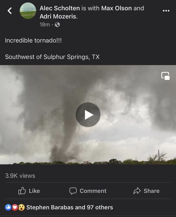
-
Major November Outbreak Possible
WxSynopsisDavid replied to Tallis Rockwell's topic in Central/Western States
-
Julia | 85 mph 982 mb peak | EPAC Crossover #2
WxSynopsisDavid replied to Iceresistance's topic in Tropical Headquarters
Yup there were several runs showing that -
Maybe someone can help validate this claim but I seen various sources say "at least 10,000 missing". That number, along with the death toll, still does not factor in Cuba from my understanding. Also, the Ian wikipedia page has been updated and shows "10,000 missing". Just curious if the number being reported is true.
-
At least 1 death in NC was attributed to carbon monoxide poisoning because someone started up their generator inside their house and went to sleep shortly after.
-
Fantastic? No it has not been fantastic. Matter of opinion I guess, but often after these storms we get stories they report and it an exaggeration of the truth due to the fact they don’t do their homework. There’s already been some things covered/reported on in the wake of Ian that is questionable.
-
Death Toll now stands at 87: 83 in Florida and 4 in North Carolina
-
Julia | 85 mph 982 mb peak | EPAC Crossover #2
WxSynopsisDavid replied to Iceresistance's topic in Tropical Headquarters
Across the northern Gulf, yes. But I wouldn't write the Gulf off yet. A path into southern FL or southern TX is still on the table if a system could stay across the southern Gulf. Also, we seen recently with Fiona and Ian that if these systems can RI and establish a deep core with convection upshear they can become resilient to not only shear but mix out dry air from the CDO. A lot of uncertainties remain and its way too early to say for sure what's going to happen. Let's hope the 18z GFS is right -
Julia | 85 mph 982 mb peak | EPAC Crossover #2
WxSynopsisDavid replied to Iceresistance's topic in Tropical Headquarters
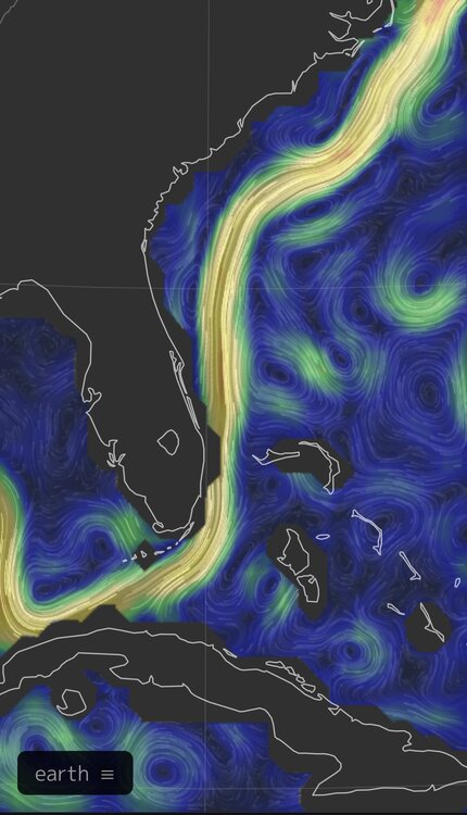
Let's hope your theory is right because SST's in the Gulf are still 85+ and there is still a pocket of high Ocean Heat Content -
Julia | 85 mph 982 mb peak | EPAC Crossover #2
WxSynopsisDavid replied to Iceresistance's topic in Tropical Headquarters
Deja vu all over again, this early track consensus reminds me of the early days of Ian. Though this system should track more to the north and not into South America, its very interesting to say the least -
I remember with Katrina the media paid little mind to MS/AL coastline ahead of Katrina. When we started to see the devastation, of course the media started changing their tone. Just similar mistakes being made here, media only out for the hype/ratings and hone in on major cities without covering all the areas to be impacted.
-
And just like Katrina, outside of politics and politicians, the media is at fault here with Ian.
-
And here presents another difficulty no matter what we use: saffir simpson, IKE, severity index, etc. The media is problem #1 here. They misunderstand how hurricanes are rated by the SS and often times only focus on gusts without explaining sustained winds and how they are dangerous. Another issue are all these media outlets incorporating their own rating scales (low, medium, high/minor, moderate, extreme). Often they will create their own tracks/paths for these storms and it either conflicts with what the NHC has and/or they overlay their forecast on top of NHC's cone. The media also does a poor job concerning the cone NHC uses because they don't use it properly and explain to their audience what the cone actually is. Impacts are felt outside the cone and the media makes it seem its the opposite.
-
Seen a new estimate today, $63 billion for Florida. Again that’s mostly for damage caused in SW FL and not the flooding damage through central and eastern sections of the state. I’m curious as to the total cost Ian will have inflicted overall. 2 US landfalls with extensive flooding which should put him in the Top-3 for US hurricanes. And there’s Cuba and we still don’t know a lot about his impacts down there yet. Ian has a shot at being one of the costliest Atlantic hurricanes.
-
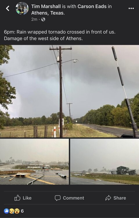
Fairly certain there’s been questions with Michael too. I remember when Tim Marshall surveyed the damage after Michael he noted he couldn’t find proof winds ever exceeded 140mph. His survey didn’t yield any definitive proof either and that was because as he noted a lot of the structures in the panhandle are pre-1995 and were constructed poorly. With Ian, he caused catastrophic damage to an area that has modern building codes and an area that was rebuilt after Charley. We will see what his survey says and what NOAA decides to do in the months to come. In the end NOAA went against the survey and still rated Michael a Cat 5. Also we are still not seeing the whole picture with Ian and it’s still in the early stages of the aftermath.
-
I sincerely hope the media is exaggerating that story or they reported BS and didn’t do their homework like always
-
How could this be used to get the general public to understand it?
-
I do like that scale they have and adopting a similar scale might help the general public understand hurricanes better. However, the scale still focuses on winds. This still doesn’t solve the issue with Sandy, Fiona, Ike. Sandy and Fiona were both hybrids. Fiona struck Nova Scotia with 931mb of pressure but winds were only 100 mph (Cat 2) and Sandy struck the northeast with 940mb but only had 80mph winds (Cat 1). We need a scale that also handles these hybrid hurricane situations properly…..and storms like Ike that were a Cat 2 but generated Cat 4/Cat 5 surge at landfall.
-
I will have to read up on the severity index. The return period study is also interesting so I’ll have to delve into that more. Now concerning the GA/SC coastline, yeah they are overdue and been overdue for a long time. Let’s not forget how close they came with Florence, when in the early stages of that storm the Euro was showing a Savannah, GA landfall as a Cat 4. Than it shifted to a SC landfall before eventually locking on a Wilmington, NC landfall. Not just GA/SC but NC is overdue as well.