WxSynopsisDavid
-
Posts
500 -
Joined
-
Last visited
Content Type
Profiles
Blogs
Forums
American Weather
Media Demo
Store
Gallery
Everything posted by WxSynopsisDavid
-
Impressive but not the surface level
-
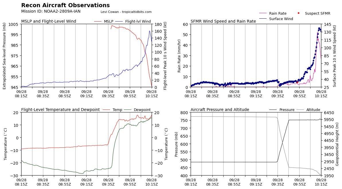
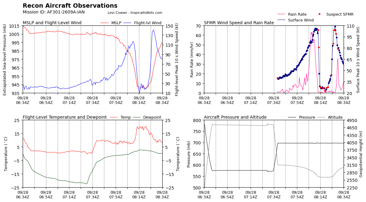
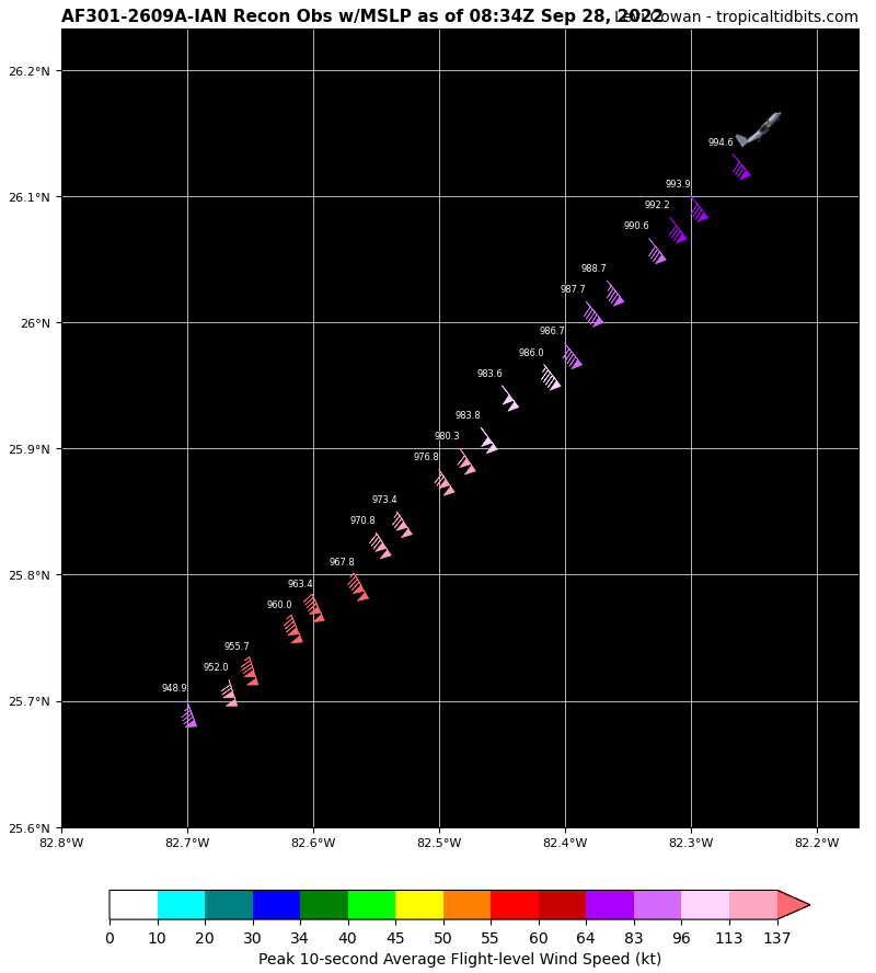
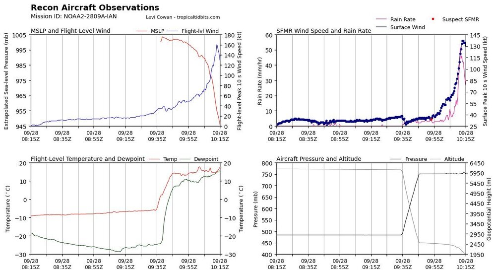
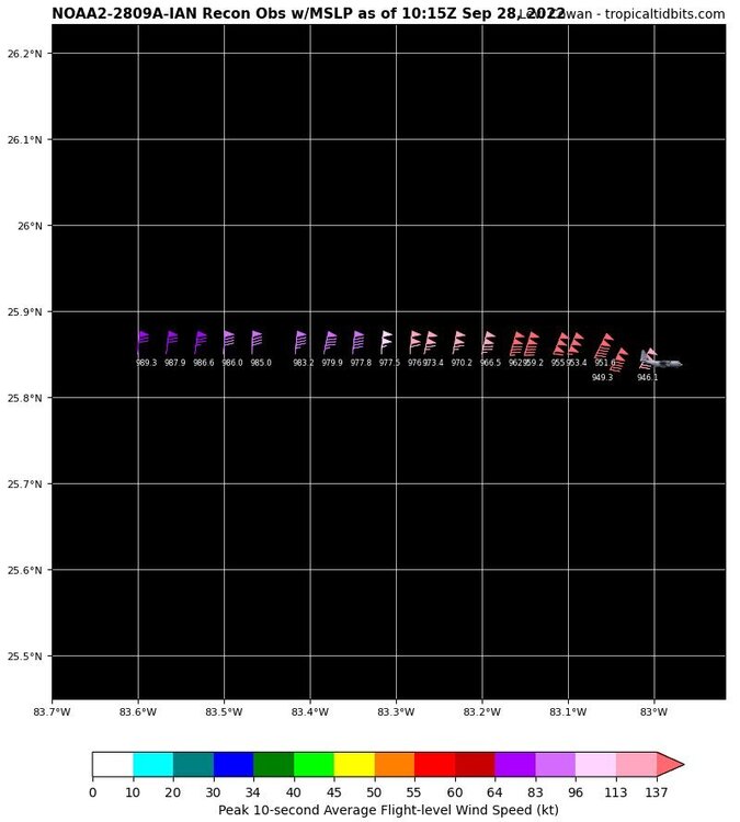
Well…..blending the Flight Level and SFMR data this yields surface winds of 155mph
-
I pulled it and thought it was current but according to the time that would of been like 4:57am….unless I’m going stir crazy. I deleted the post
-
It’s also now over a branch of the loop current which is also aiding the RI we are seeing….along with friction and angle of approach.
-
Ian is now a Category 4, dataset supports it. Also, Ian is an intensifying Category 4


-
Curious as to what they find
-
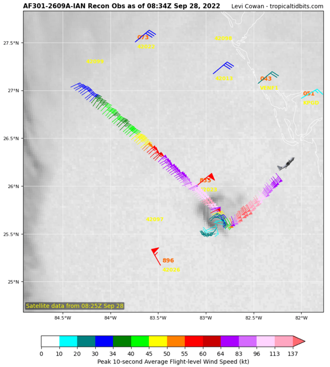
Eye has contracted and is tightening up. Deep convection firing in the N/NE eyewall right now. At 2:00am the eye was over 30mi wide. Now at 3:25am the eye is about 22-23mi wide.
-
Looks like not only is the eye clearing but there are what appears to be mesovortices rotating around inside the center which is giving that ragged appearance on IR. It almost appears like the eye might be a pinwheel eye
-
Its wobbling back and forth, which TC's typically do as their tracks are not smooth
-
The angle of approach and potential friction Ian is feeling would likely enhance any RI process that commences. Correct me if im wrong, given what I just said and the environment Ian is in, this is not the time to have a major hurricane undergo RI. There's little real estate between Ian and Florida now. Also, the classic limiting factors like dry air and shear have done nothing to limit/hinder Ian. With the deep convection primarily located upshear like what was noted by someone else in here earlier, Ian will continue to be resilient to dry air/shear.
-
NOAA NHC Recon Hunters will be dropping a UAS/drone inside Ian tomorrow that will last 3.5hrs. Curious to see what it finds and the data that is collected
-
I really want to comment to this on Twitter but I feel it’s a waste of time. If he’s that ignorant to be using the HRRR right now it will be like talking to a brick wall to make a point. I really wish, as a local met down there, he will focus more on the environment and mesoscale instead of the HRRR’s ever so changing hourly landfall locations.
-
COAMPS 12z, waiting to see if we ever get an 18z run or if they are gonna skip past the 18z


-
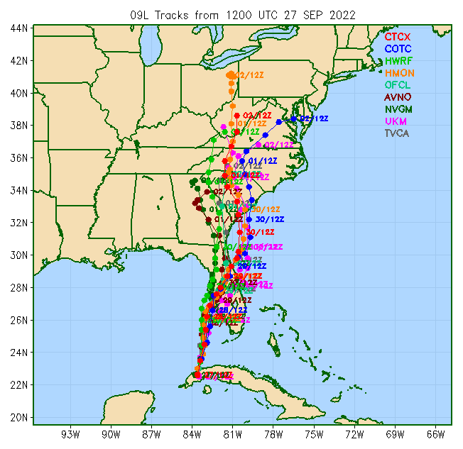
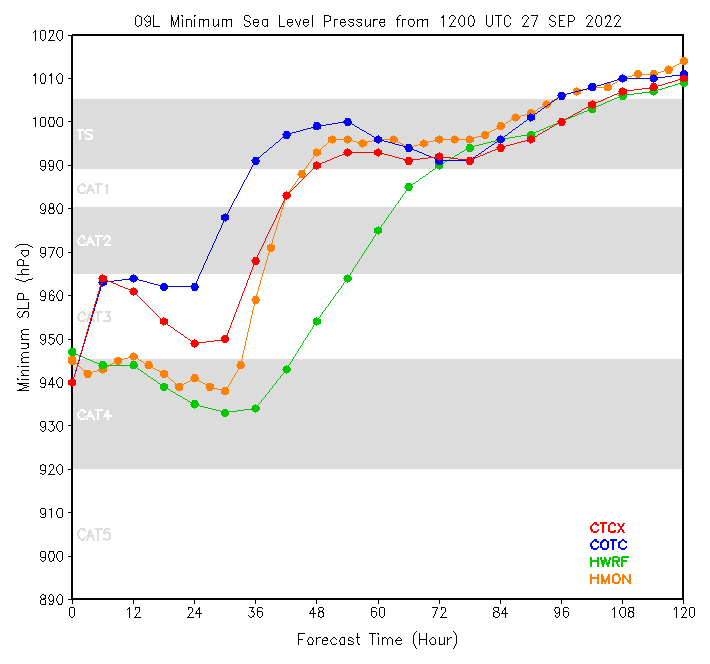
Yes they are hurricane models but they tend to have issues concerning inland tracks at this range. For the time being I would be more focused and concerned with the environment they depict later tonight ahead of Ian
-
True but we are now inside the short range and those models are extremely efficient with picking up mesoscale features. I would be concerned with the environment they are depicting later tonight and why they are rapidly intensifying Ian. I haven’t looked at the runs yet so idk what they are picking up but I’ll give them a look and see
-
Wow
-
1. It’s either completing the EWRC and starting to rapidly intensify again 2. Some dry air entrainment is happening
-
It has time but it’s just a matter of “if” Ian can take advantage of the environment it’s in
-
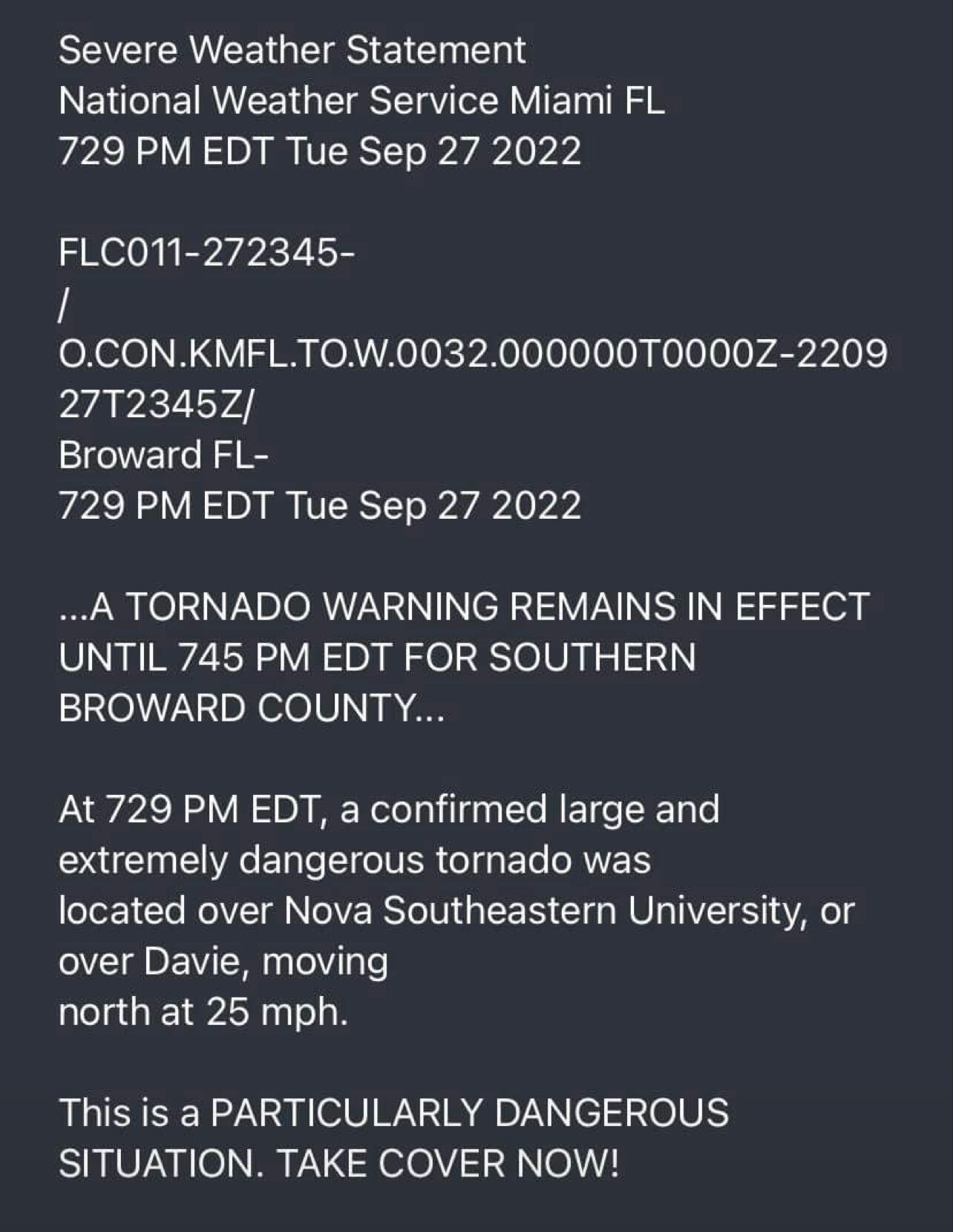
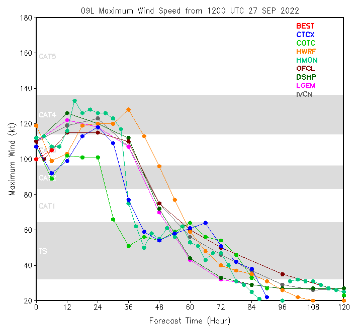
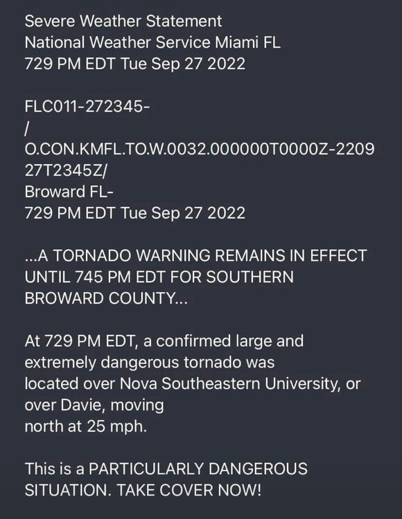
Not everyday you see a PDS Tor Warning with a tropical system
-
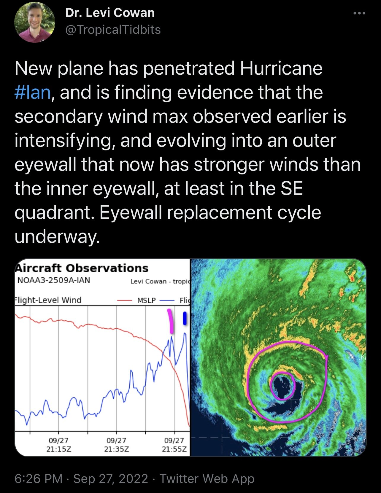
Issue is the south quad of outer eye, but that looks like it’s closing off now. Once that happens the outer eye takes over and inner eyewall will collapse
-
It actually needs to close off the south quad. Once that happens it is game on
-
Appears it’s already happening

-
Of course, I was reading something awhile back on shear and EWRC and was trying to remember the article. Definitely concerning we are down to dry air and EWRC to hinder Ian
-
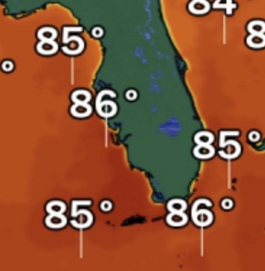
Warmest SST’s ahead of Ian will be on landfall directly over the loop current running up to Ft Myers. Pocket of 86-87 degree SST’s

-
Thanks for the clarification, I tend to focus on the mesoscale a lot in this range and I didn’t see that there the other day.