WxSynopsisDavid
-
Posts
500 -
Joined
-
Last visited
Content Type
Profiles
Blogs
Forums
American Weather
Media Demo
Store
Gallery
Everything posted by WxSynopsisDavid
-

Severe Weather 3-30-23 and 3-31-23
WxSynopsisDavid replied to cheese007's topic in Central/Western States
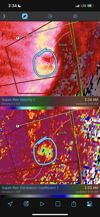
Radar velocity scans were showing 3 couplets with TDS. That was a potential trio, one of them would of been rain wrapped. -
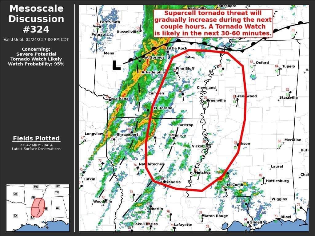
We are all focused on the current, on going major outbreak. There will likely be no post made until after this current outbreak is over.
-
Confirmed by Brandon Copic, dual tornadoes on the ground near Keota
-
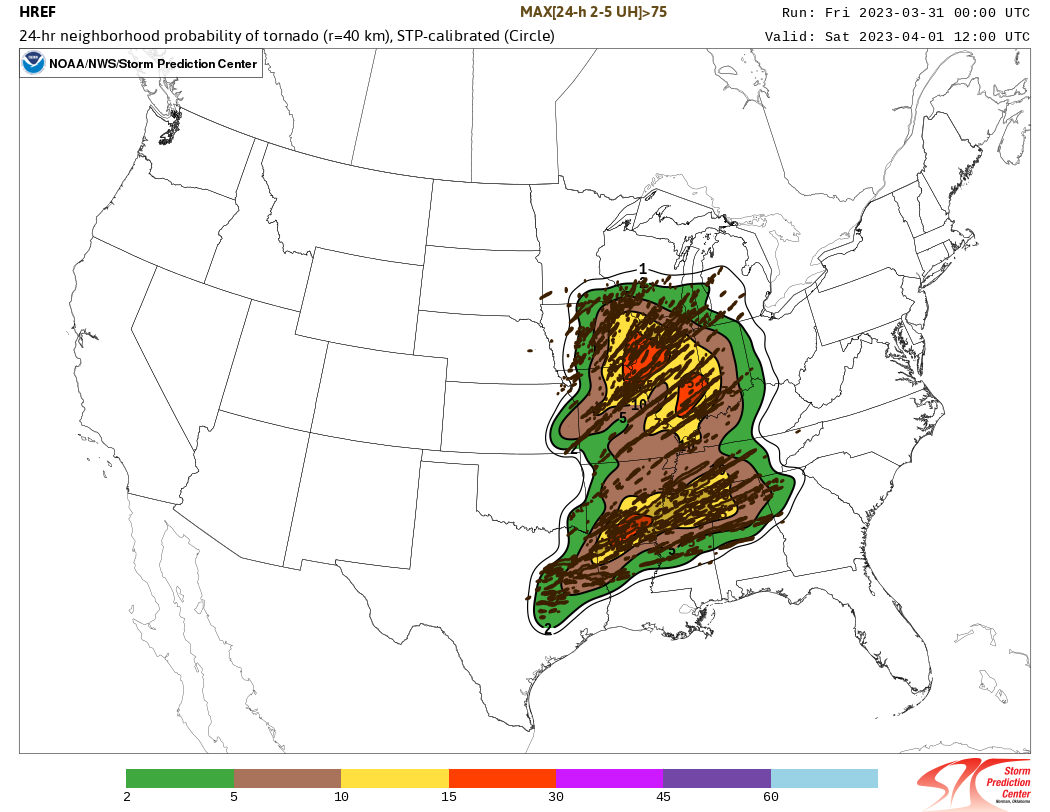
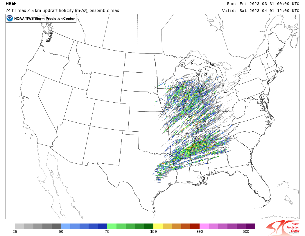
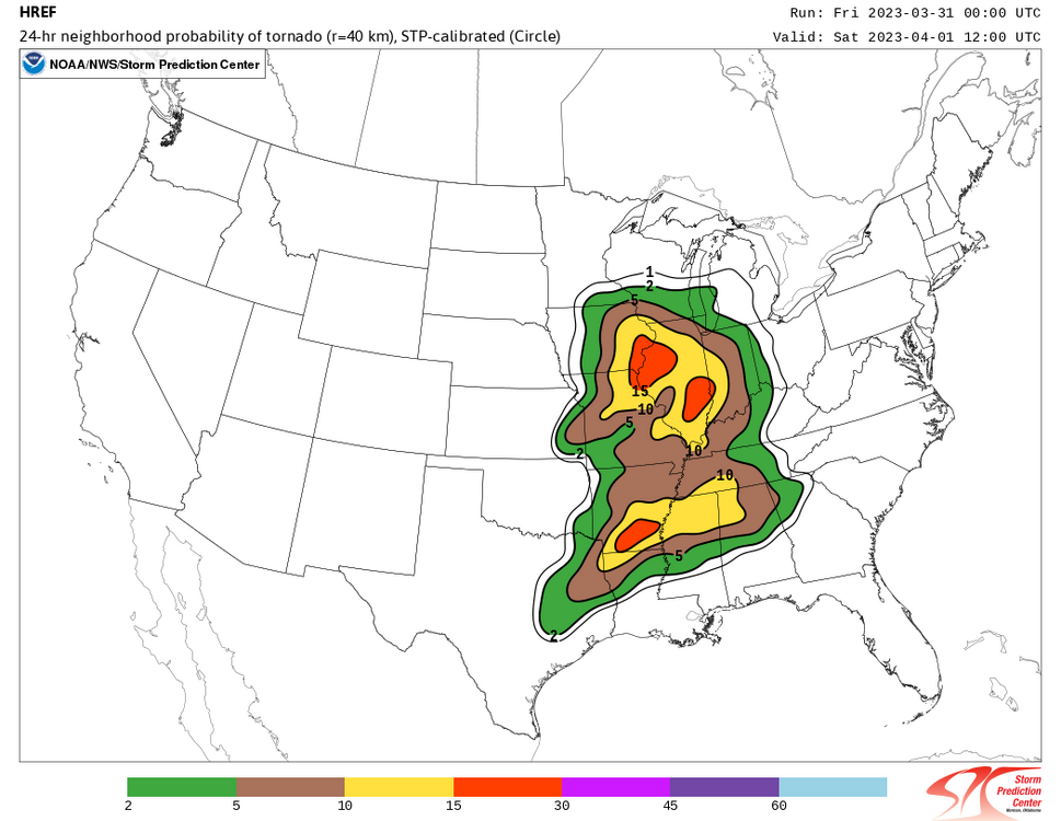
The 00z HREF spits out a “super outbreak”. Curious to see the next updated HREF run.

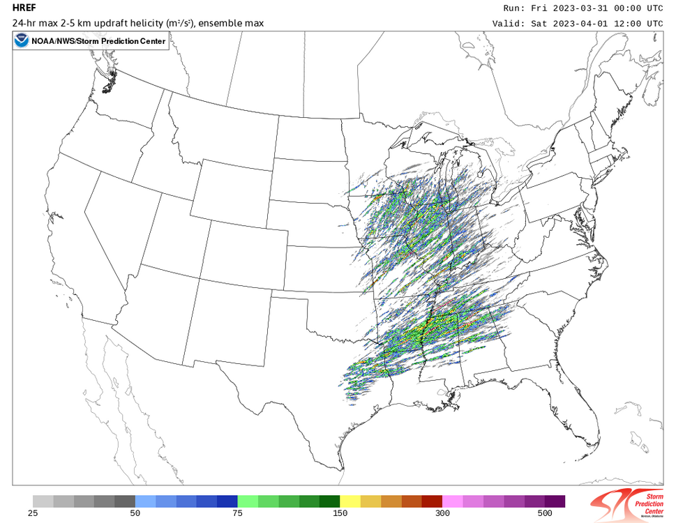
-
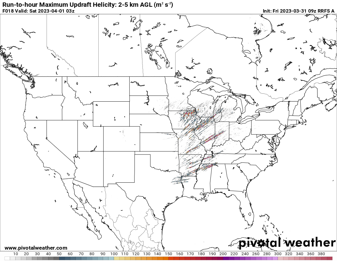
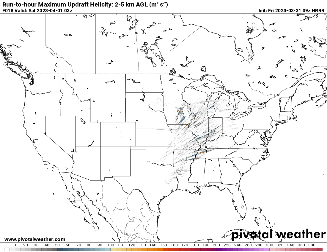
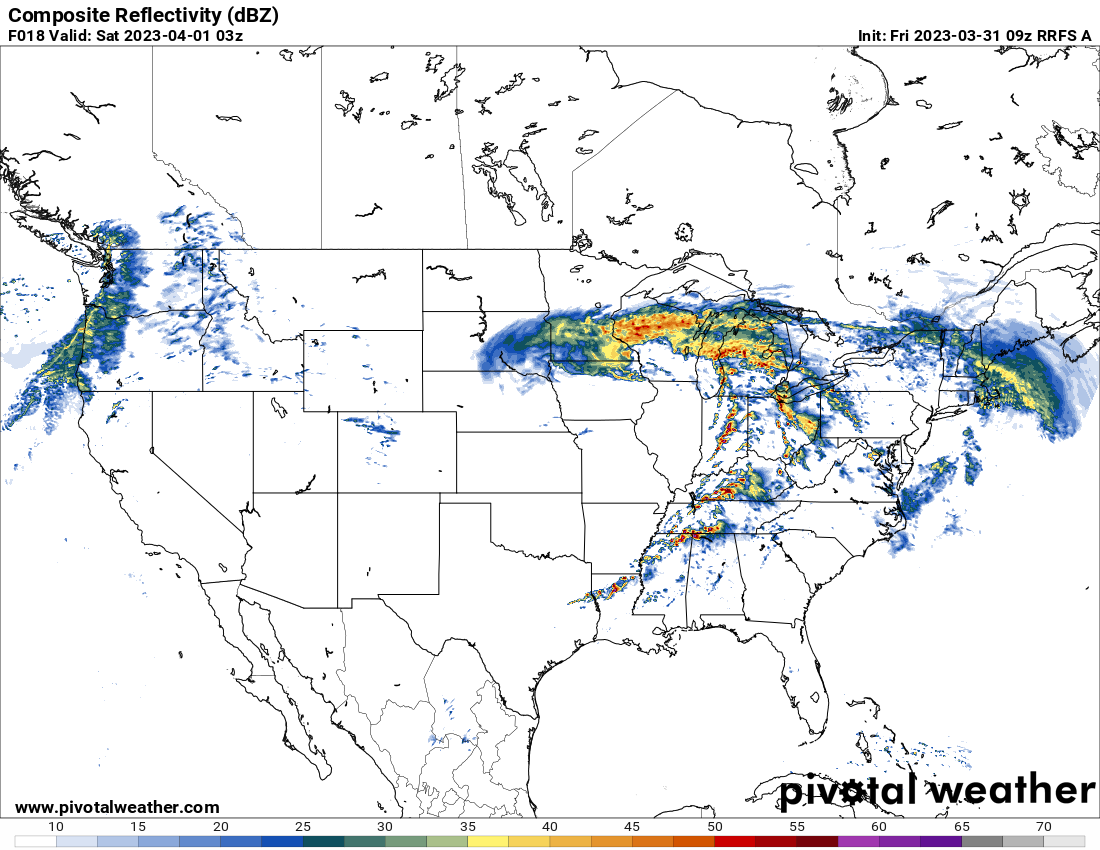
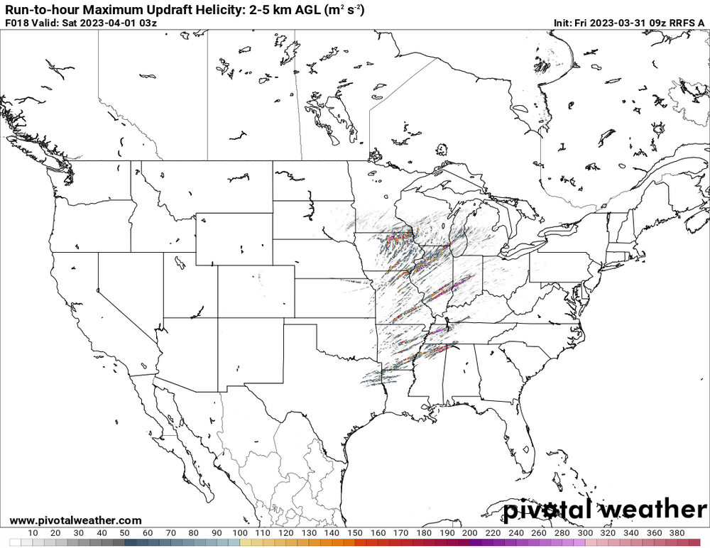
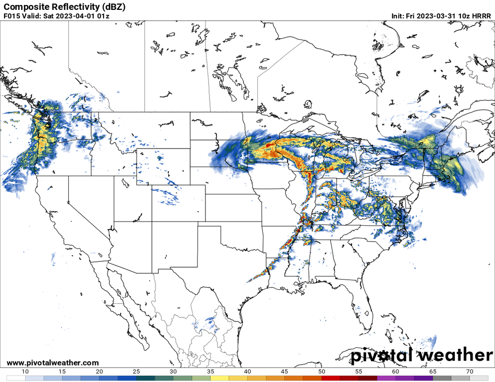
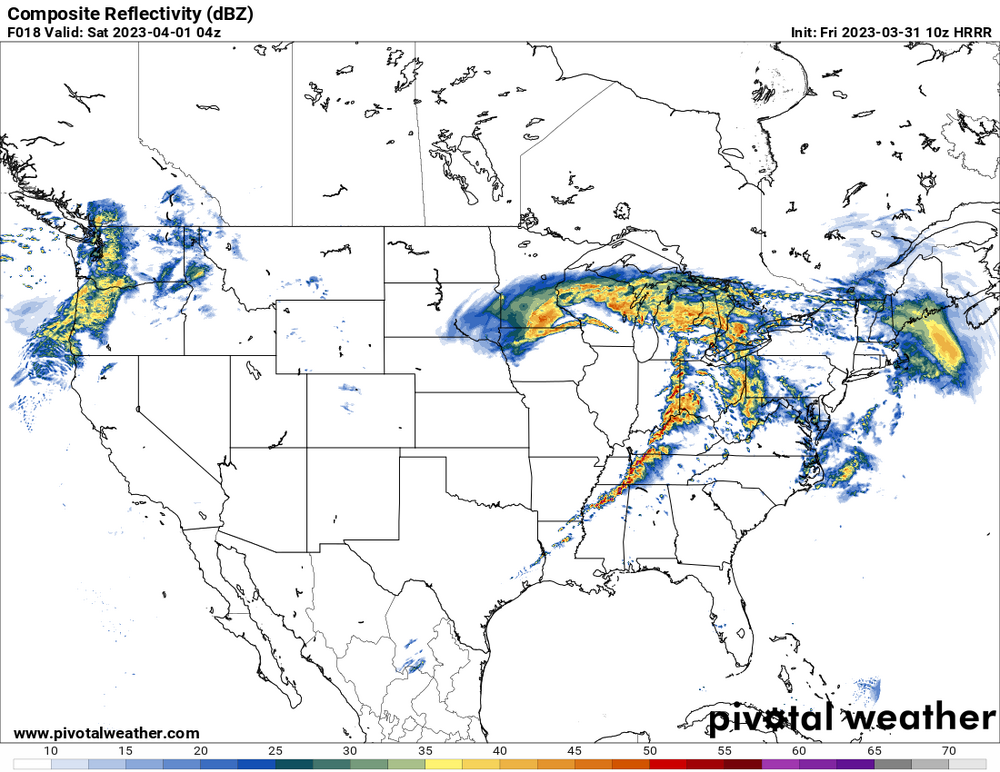
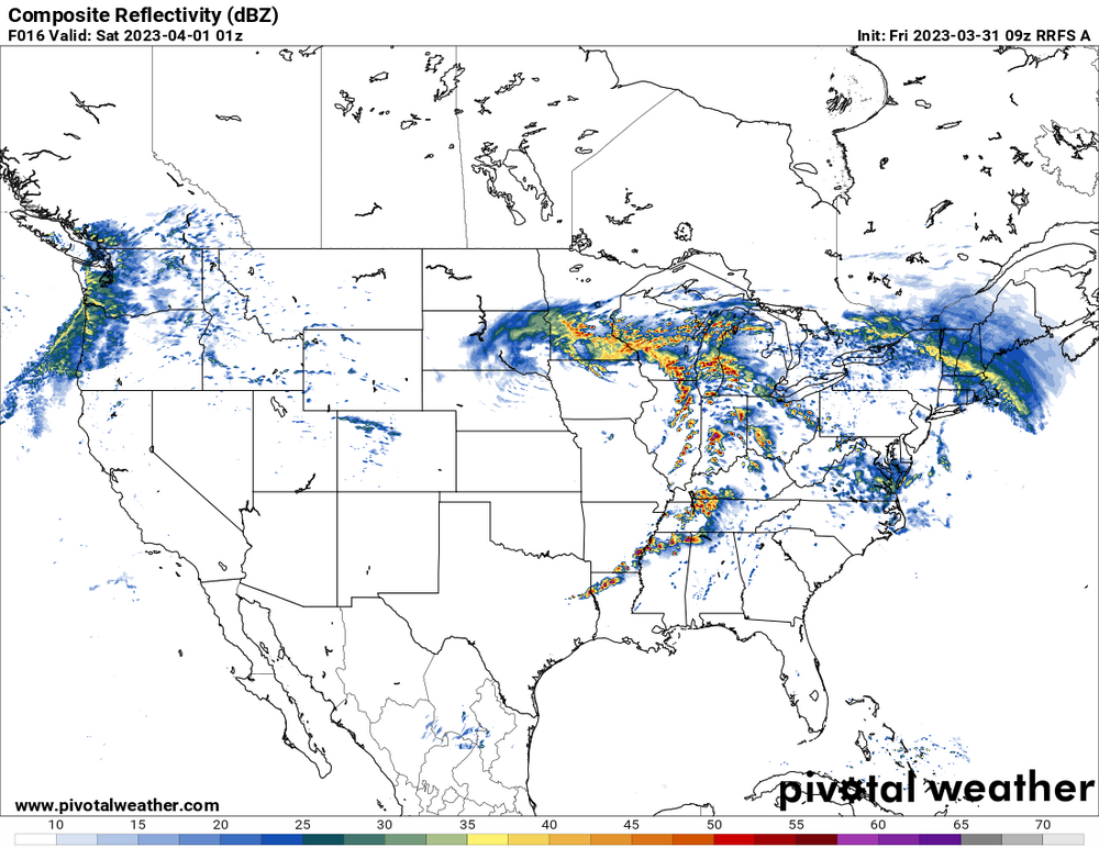
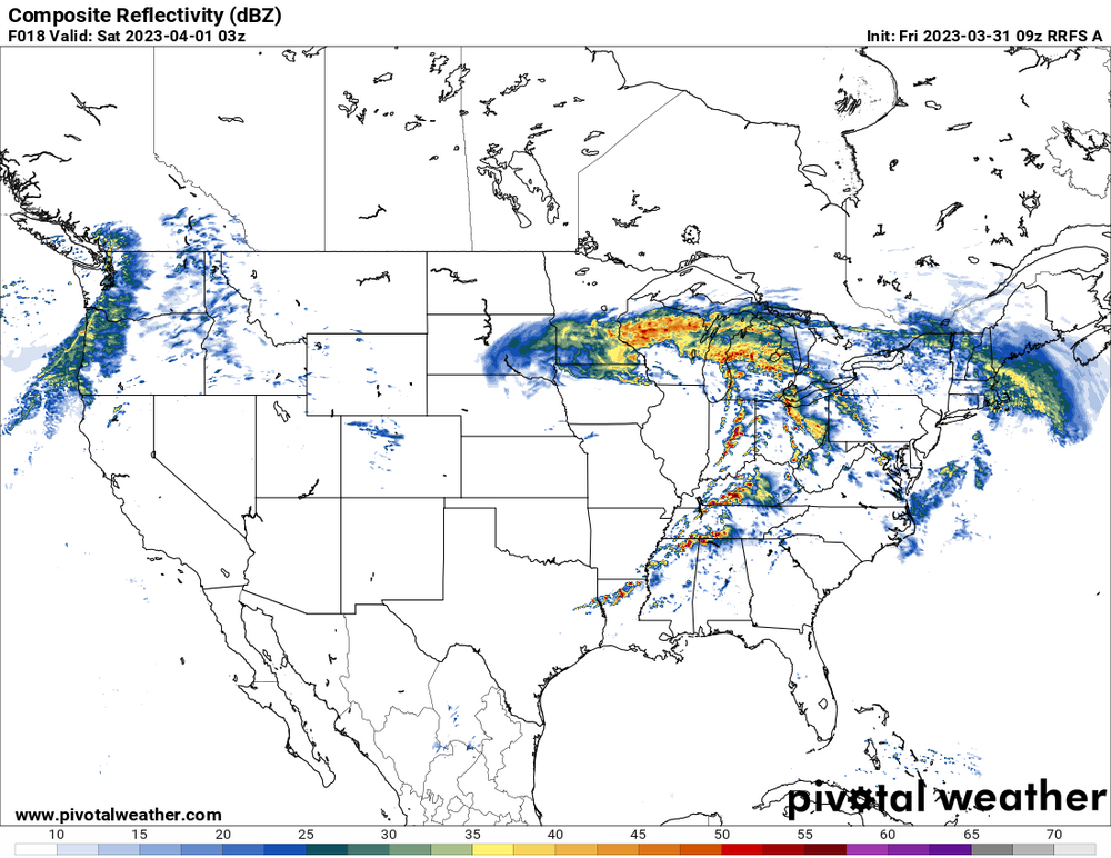
09z RRFS-A and 10z HRRR helicity swaths

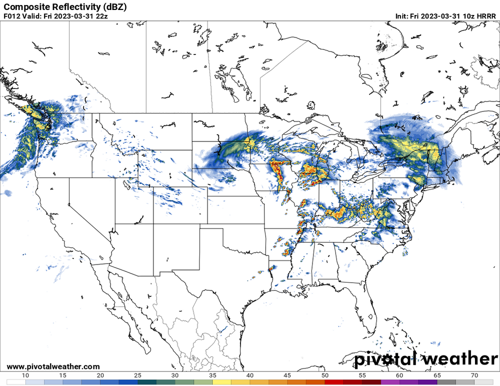
-
10z HRRR
-
09z RRFS-A is insane, don’t really have the words to describe that scenario. About as high end as you can get. Even tries to get some supercells going out east from northern VA up into PA.
-
-
Severe Weather 3-30-23 and 3-31-23
WxSynopsisDavid replied to cheese007's topic in Central/Western States
That is pretty extreme. Between the HRRR and the rest of the CAM, this is as an extreme/high-end as you can get outside of a super outbreak scenario. The parameter space and warm sector is indeed impressive. -
Dynamics can compensate for lack of instability (high shear/low cape outbreaks). In fact some of the higher end, more substantial outbreaks have featured such setups. Though I live in the Midatlantic (Virginia), I can testify that overcast and 60f temp means very little in the way of hindering the setup. I chased the 2/24/16 outbreak here in VA. There was an overcast all day and temps were bouncing between 50-70 all day. 2 devastating high-end EF3’s struck Appomattox and Essex. Also, our state record tornado that struck Petersburg on 8/6/93 was a high-end F4. That day also featured an overcast and thick cloud deck.
-
Severe Weather 3-23-23 through 3-26-23
WxSynopsisDavid replied to cheese007's topic in Central/Western States
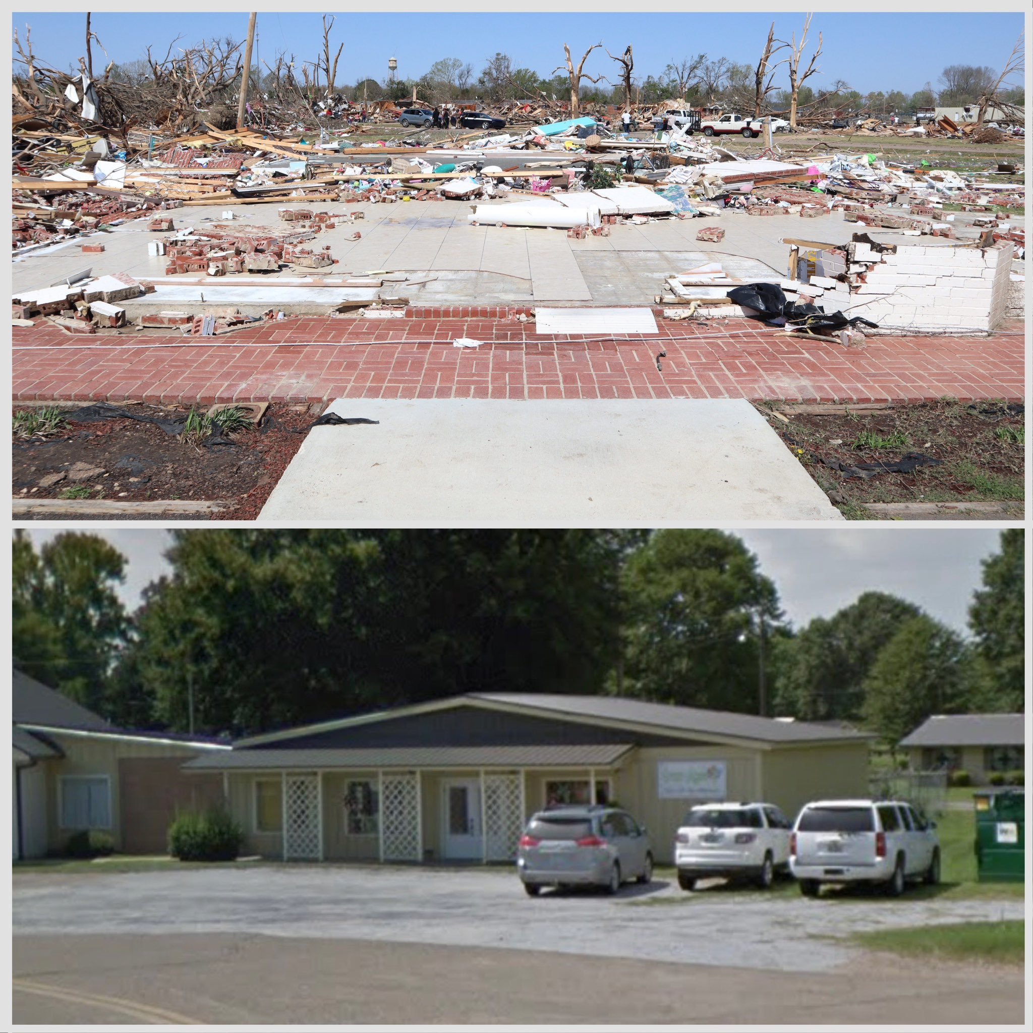
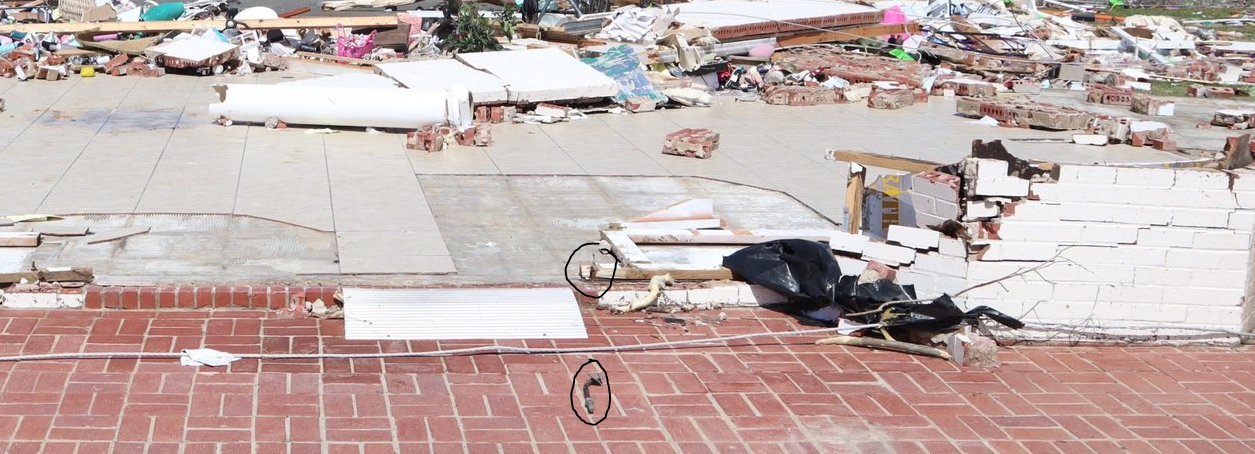
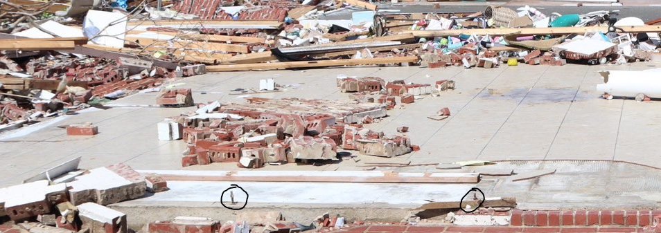
Florist shop in Rolling Fork, made of brick, completely slabbed. Most of the slab was wiped clean. One of the anchor bolts was completely removed from the slabbed and bent. Also notice the tree damage in the background.

-
Severe Weather 3-23-23 through 3-26-23
WxSynopsisDavid replied to cheese007's topic in Central/Western States
Let’s hope it was a drone -
Severe Weather 3-23-23 through 3-26-23
WxSynopsisDavid replied to cheese007's topic in Central/Western States
-
Severe Weather 3-23-23 through 3-26-23
WxSynopsisDavid replied to cheese007's topic in Central/Western States
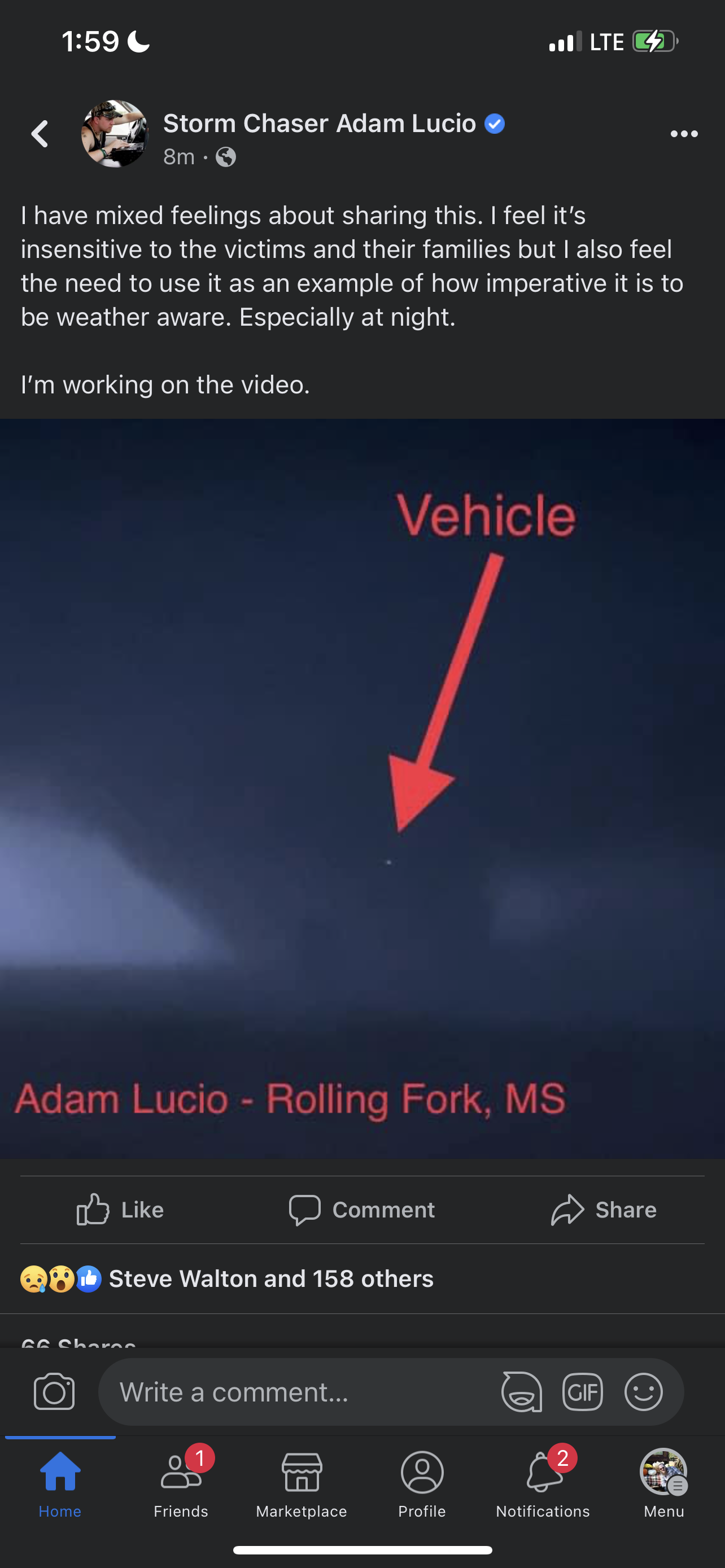
A vehicle got sucked into the tornado and lifted into the upper most portion of the vortice. Adam Lucio has video of the vehicle getting sucked into the vortice, won’t share it due to sensitivity but here’s a screenshot of the vehicle going up into the upper most portion of the vortice.
-
Severe Weather 3-23-23 through 3-26-23
WxSynopsisDavid replied to cheese007's topic in Central/Western States
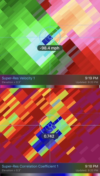
The fact it was close to the radar yet still getting 260mph+ velocities is ridiculous. -
Severe Weather 3-23-23 through 3-26-23
WxSynopsisDavid replied to cheese007's topic in Central/Western States
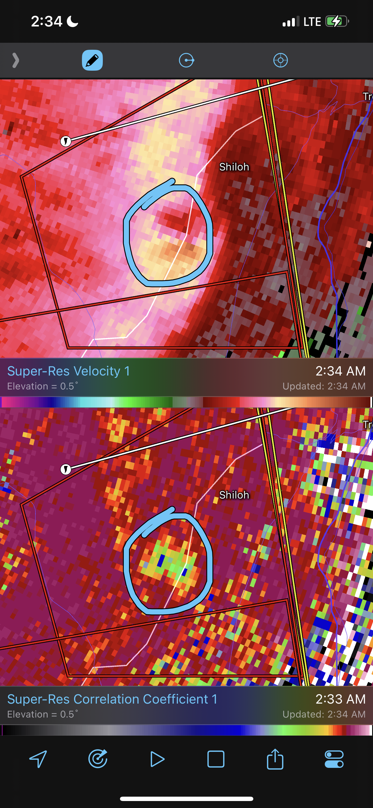
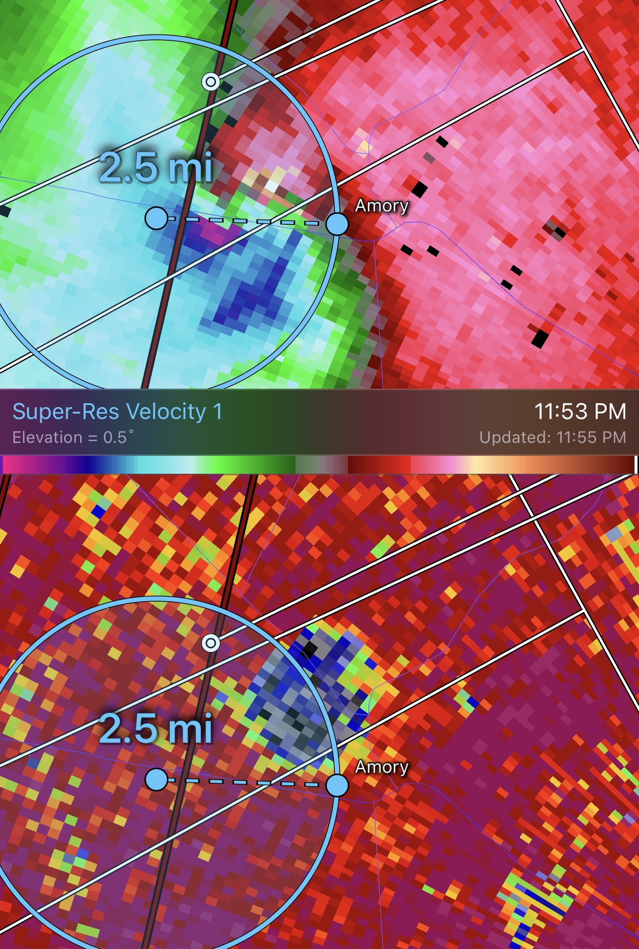
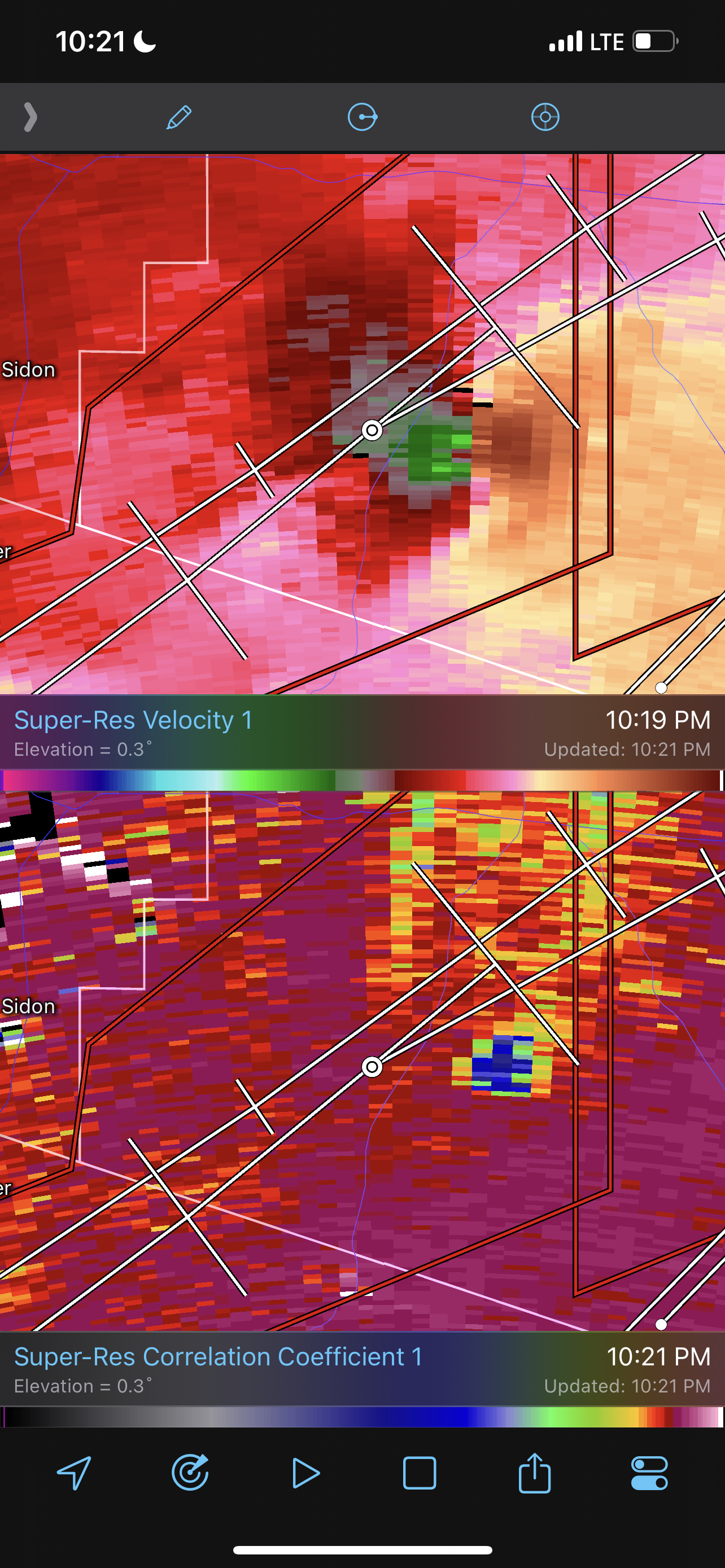
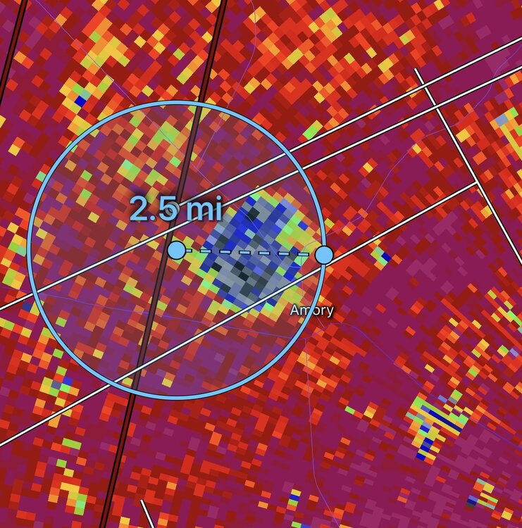
Both the debris ball and couplet exceed 2.5mi in width. This is a potential record tornado in progress for width and a potential top-5 violent tornado in terms for velocity. Really hope this isn’t mixing to the surface but given debris is exceeding 40,000ft it’s likely this is an EF5.
-
Severe Weather 3-23-23 through 3-26-23
WxSynopsisDavid replied to cheese007's topic in Central/Western States
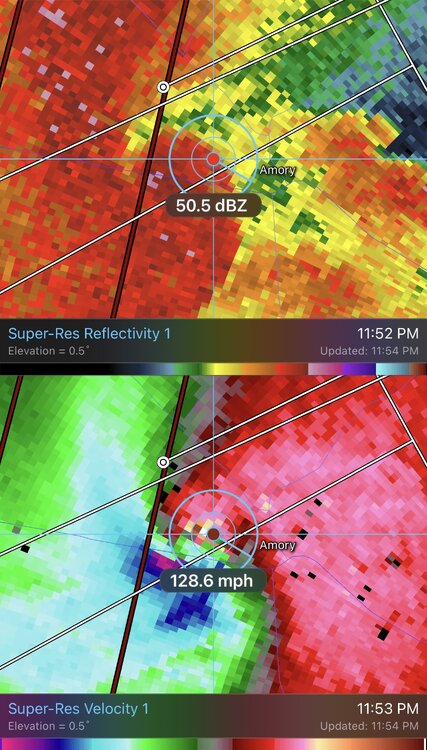
Wow….260mph+ gate to gate. It’s been a very long time (since Moore and El Reno 2013 EF5’s) that Ive seen radar velocities this extreme.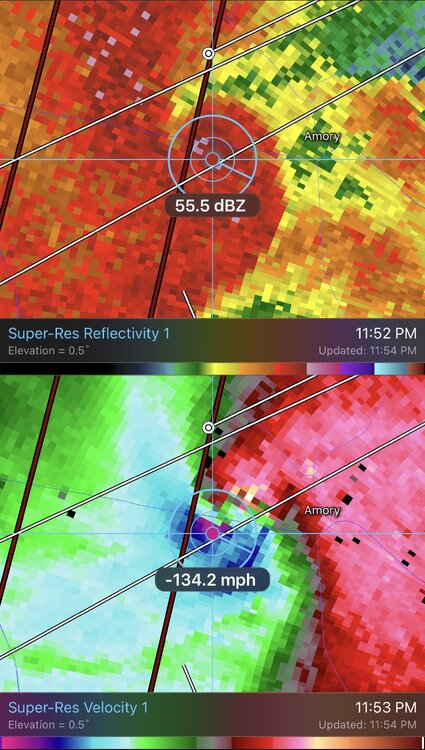
-
Severe Weather 3-23-23 through 3-26-23
WxSynopsisDavid replied to cheese007's topic in Central/Western States
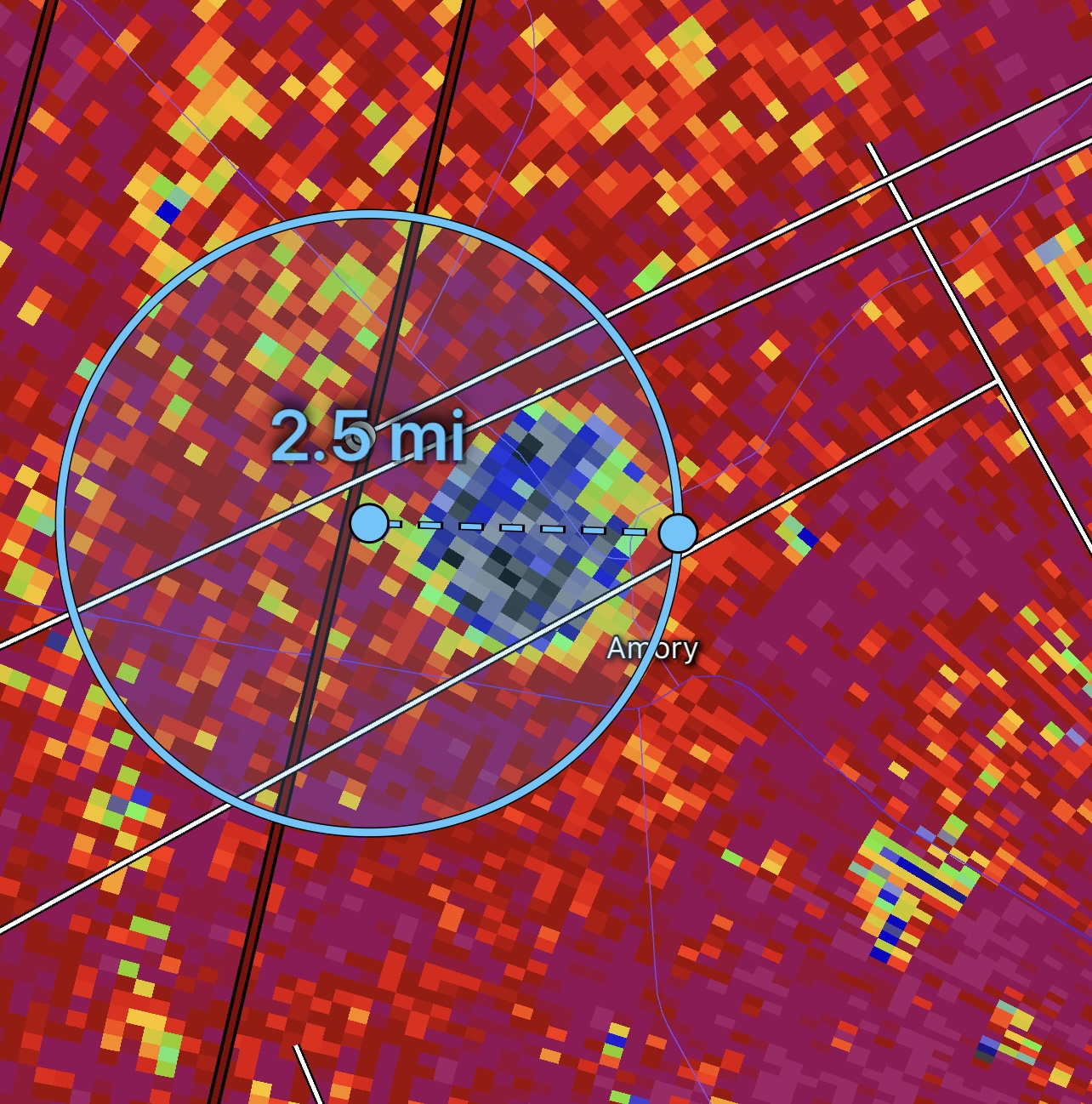
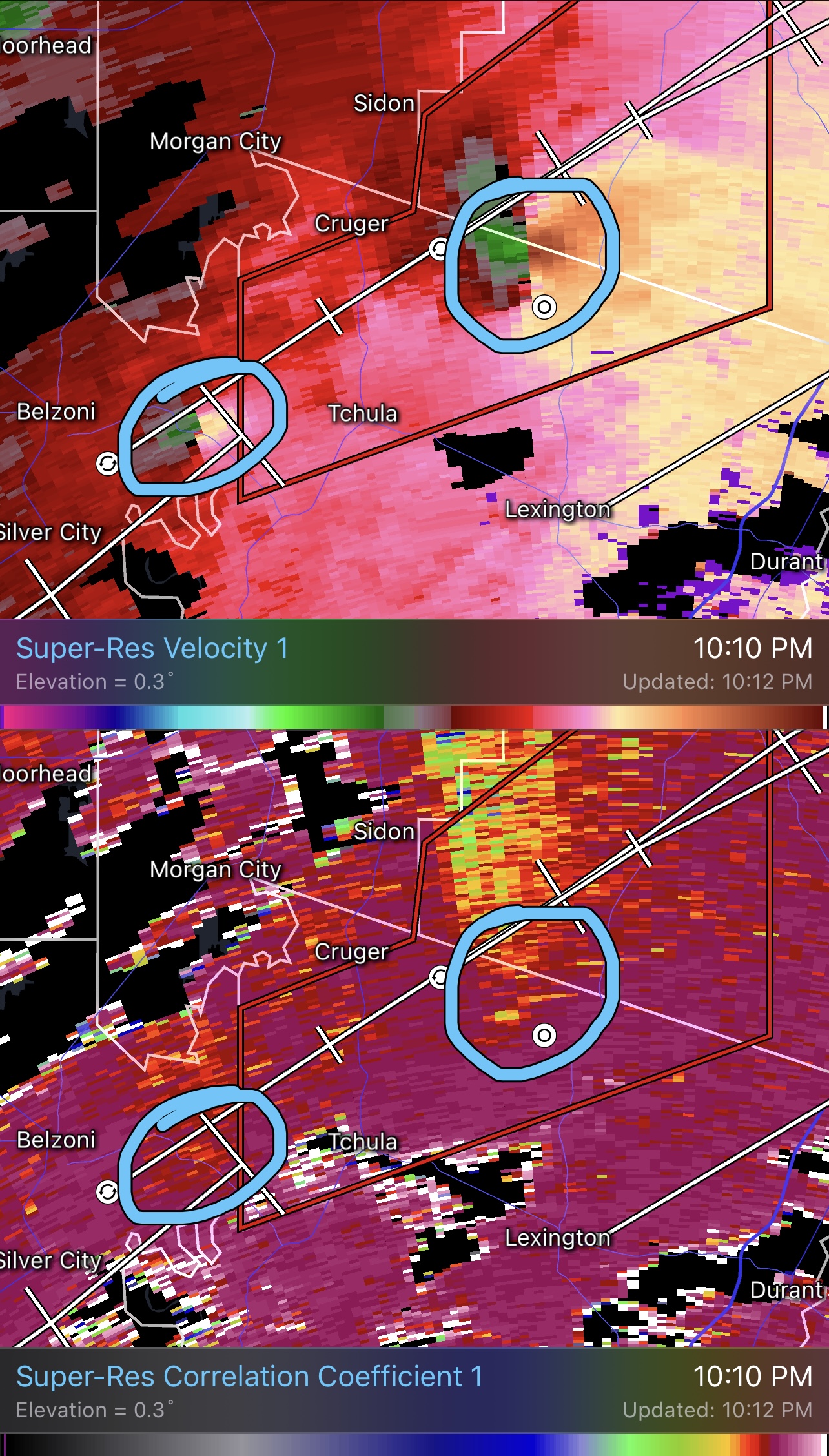
Starting to see velocities increase with a tighter gate to gate. Debris ball back on radar now. Don’t think the main/parent violent tornado ever weakened, it obviously moved into a rural area and now beginning to move into a more populated area. This tornado now has a historic feel to it, for all the wrong reasons.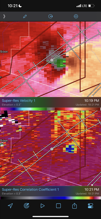
-
Severe Weather 3-23-23 through 3-26-23
WxSynopsisDavid replied to cheese007's topic in Central/Western States
As of what has already happened wasn’t enough, new tornado now going up 30mi back to the SW behind the long tracked violent tornado. Following the same path as the main tornado we been tracking. Debris signature and gate to gate signatures evident.
-
Severe Weather 3-23-23 through 3-26-23
WxSynopsisDavid replied to cheese007's topic in Central/Western States
Very impressive that this tornado been on the ground as long as it has. Definitely a textbook situation to teach concerning what happens when a supercell matures and can get surface based/rooted.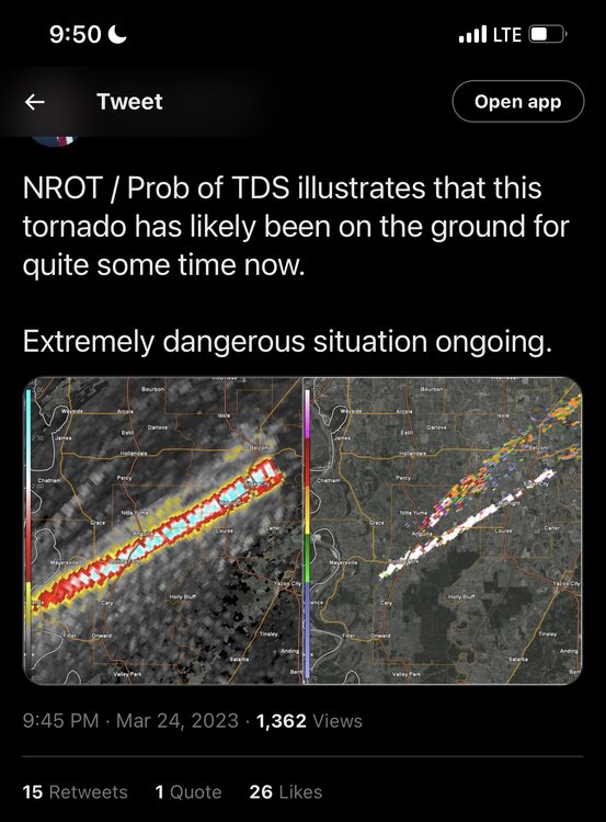
-
Severe Weather 3-23-23 through 3-26-23
WxSynopsisDavid replied to cheese007's topic in Central/Western States
Yeah the duration of this TORE is approaching rare territory. -
Severe Weather 3-23-23 through 3-26-23
WxSynopsisDavid replied to cheese007's topic in Central/Western States
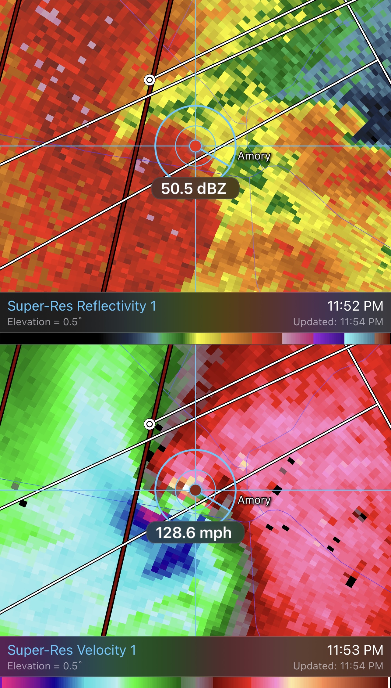
Very indicative of a EF4+. Not a good thing to see on radar. -
Severe Weather 3-23-23 through 3-26-23
WxSynopsisDavid replied to cheese007's topic in Central/Western States
Gate to Gate is 185+. Well into the EF4 range with velocities still increasing. This supercell is surface based and rooted, this will likely be a cyclic long tracked long lived violent tornado.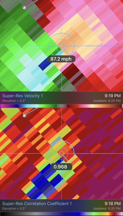
-
Severe Weather 3-23-23 through 3-26-23
WxSynopsisDavid replied to cheese007's topic in Central/Western States
-
Severe Weather 3-23-23 through 3-26-23
WxSynopsisDavid replied to cheese007's topic in Central/Western States
7pm-11pm looks to be the best window for significant severe weather. QLCS looks to be a broken line with some discrete supercells.