StruThiO
Members-
Posts
82 -
Joined
-
Last visited
About StruThiO

Profile Information
-
Location:
Florida
Recent Profile Visitors
The recent visitors block is disabled and is not being shown to other users.
-
-
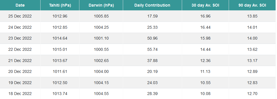
I'm sure some kind of Darwin low had to have skewed this, but nonetheless, I've never seen daily SOI values of +50
-
-
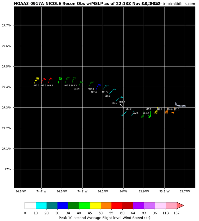
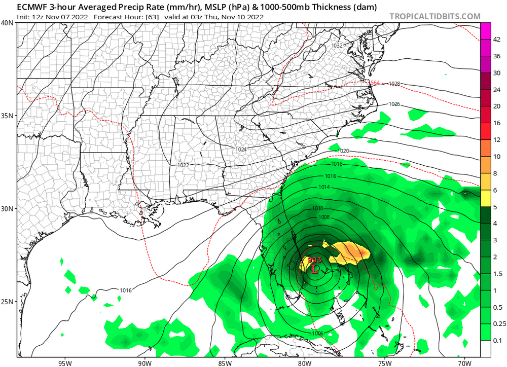
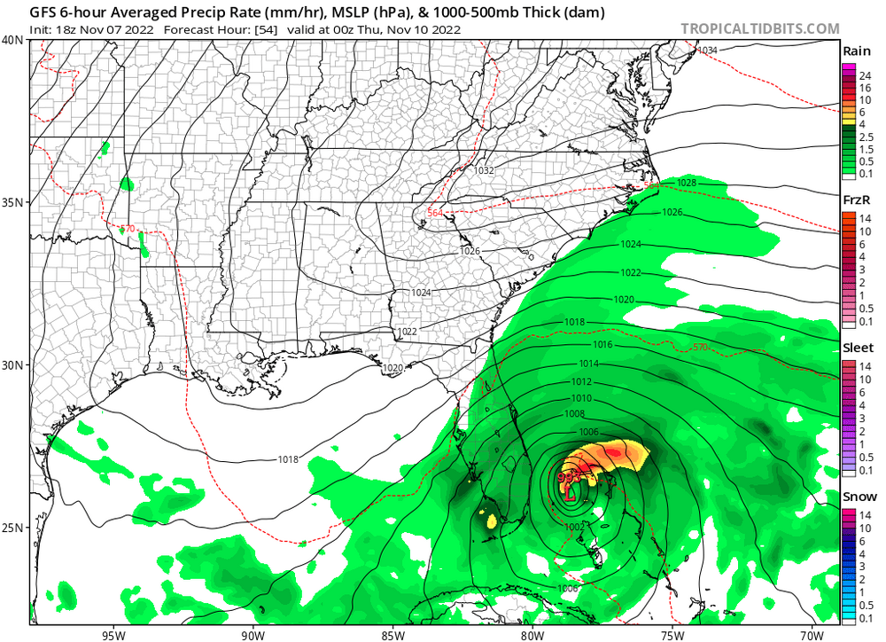
Here's how Nicole's current pressure of ~993-4mb (per 995mb dropsonde w/ 29 kt surface wind) compares to global guidance from two runs ago near landfall: BTW, once this becomes a hurricane this season will have had more hurricanes form just in November than during all of 2013. As usual, that analog never holds any serious weight to it. RIP downcasters and bears
-
Denial is the first stage
-
2022 Atlantic Hurricane season
StruThiO replied to StormchaserChuck!'s topic in Tropical Headquarters
Took 36 hours for a 60% chance of development for now 93L Julia has killed at least 60 people, I wonder if that makes it three. Not bad for another 2013 :rollseyes: -
2022 Atlantic Hurricane season
StruThiO replied to StormchaserChuck!'s topic in Tropical Headquarters
Here's a link to a real loop (ie, more than five frames): https://i.postimg.cc/DZFc677f/47489913.gif -
2022 Atlantic Hurricane season
StruThiO replied to StormchaserChuck!'s topic in Tropical Headquarters
-
2022 Atlantic Hurricane season
StruThiO replied to StormchaserChuck!'s topic in Tropical Headquarters
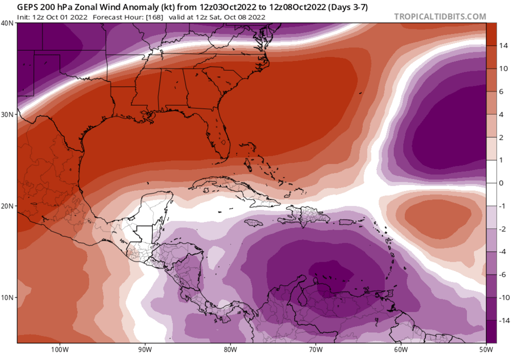
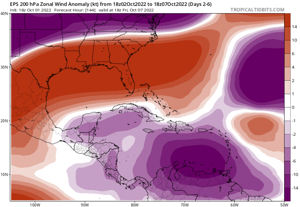
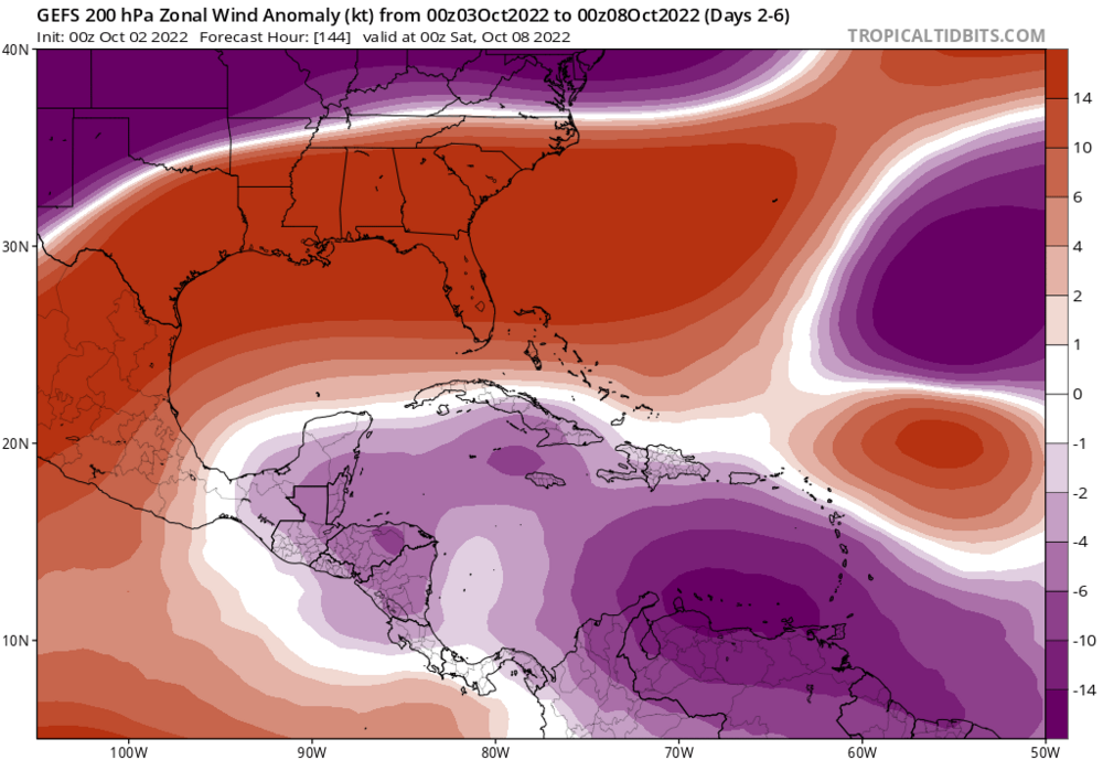
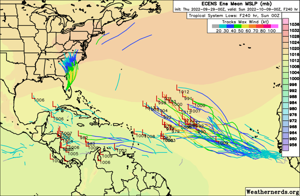
No idea why people aren't discussing this. Globals unanimously depict favorable anomalously easterly upper flow over the Caribbean, consistent with La Nina. This looks like trouble to me. -
2022 Atlantic Hurricane season
StruThiO replied to StormchaserChuck!'s topic in Tropical Headquarters
-
2022 Atlantic Hurricane season
StruThiO replied to StormchaserChuck!'s topic in Tropical Headquarters
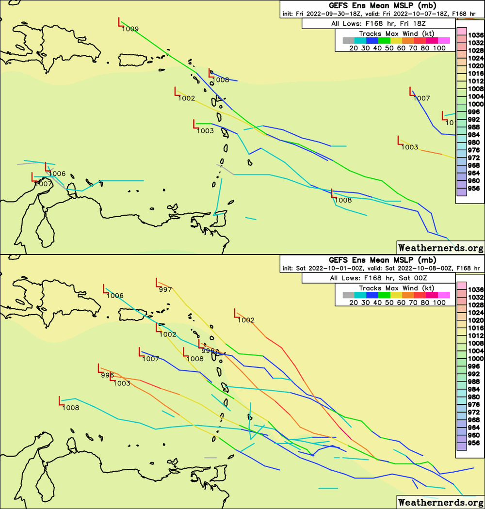
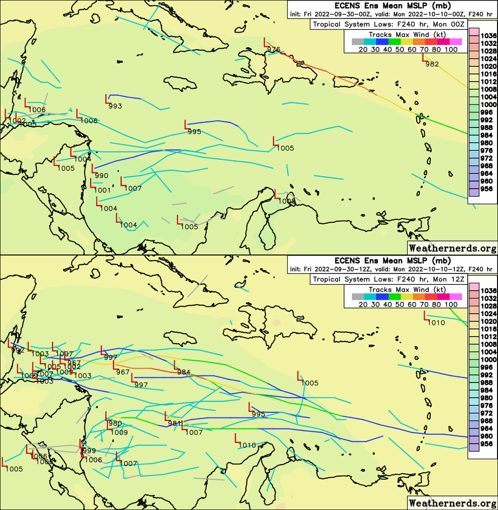
Do NOT like the trend between yesterdays 0z EPS and todays 12z Appears to be associated with the tropical wave along 40W. -
2022 Atlantic Hurricane season
StruThiO replied to StormchaserChuck!'s topic in Tropical Headquarters
https://twitter.com/philklotzbach/status/1575692301665333248?s=46&t=po7jyfuLJh7ZOOxtnYMNWQ -
2022 Atlantic Hurricane season
StruThiO replied to StormchaserChuck!'s topic in Tropical Headquarters
-
2022 Atlantic Hurricane season
StruThiO replied to StormchaserChuck!'s topic in Tropical Headquarters
ACE is ALREADY NEAR-NORMAL. WE ALREADY DID -
CHARLEY. CHARLEY. CHARLEY. IT'S SPELLED CHARLEY.



.thumb.gif.a715da77210b72b58d2ed90ebf5c9746.gif)
