WeatherAU
-
Posts
47 -
Joined
-
Last visited
Content Type
Profiles
Blogs
Forums
American Weather
Media Demo
Store
Gallery
Everything posted by WeatherAU
-
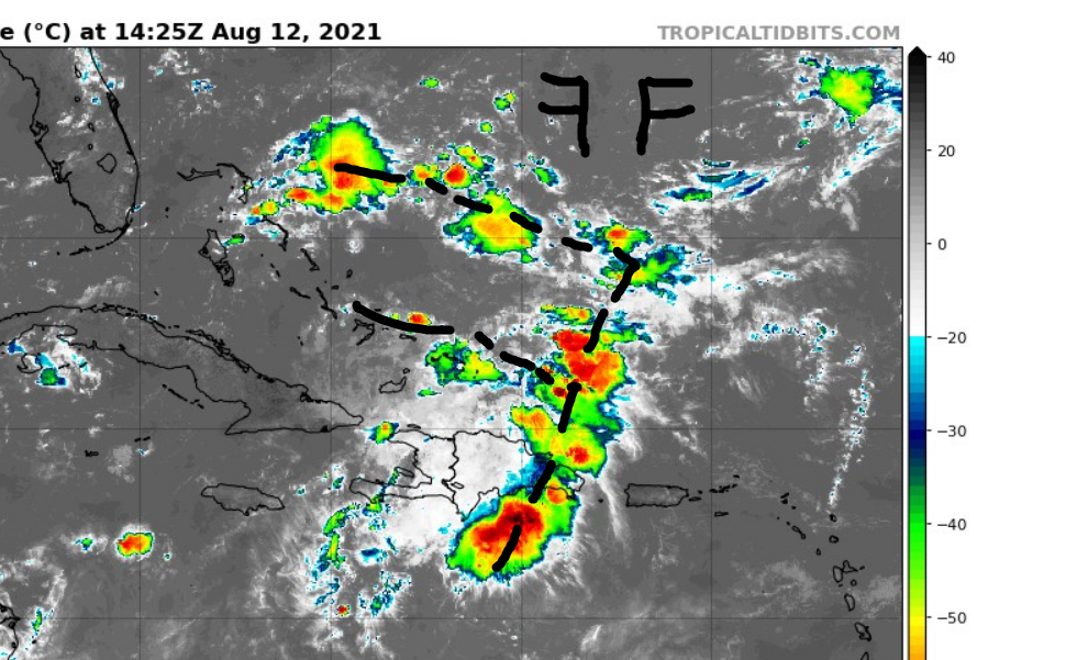
Friends take a look at this BLOB as well ... Henri could pass over this region!
-
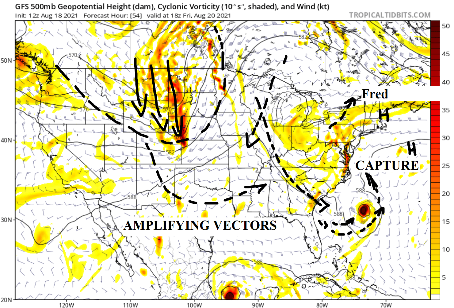
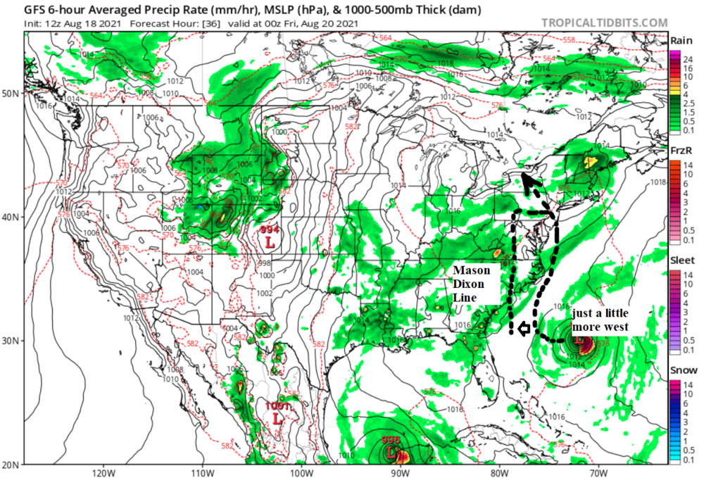
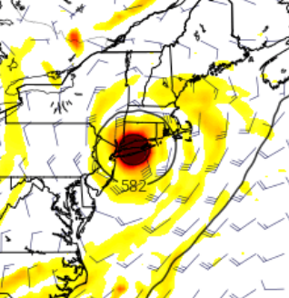
Lots to talk about the recent 12z GFS run. This is MDL - Main Development Low ::: Mason Dixon Line is similar but call it this way - no problemo... It is a line that tells how far a TC needs to go to potentially affect Central NJ works for Nor'Easters as well
-
Perfect Circle! RED AMPED VORT - Henri TC A bit of thread the needle

-
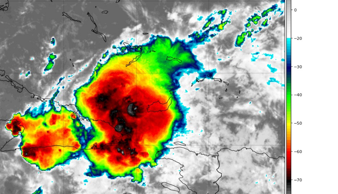
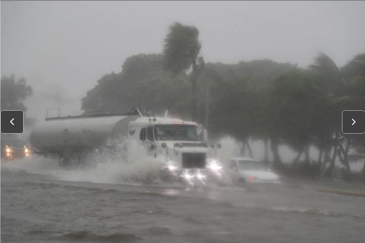
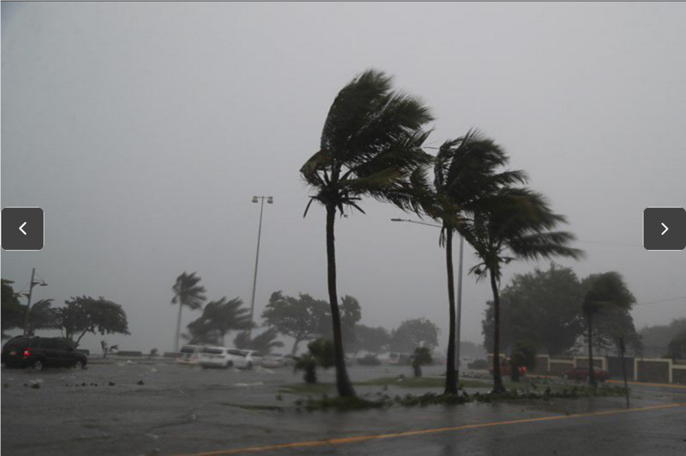
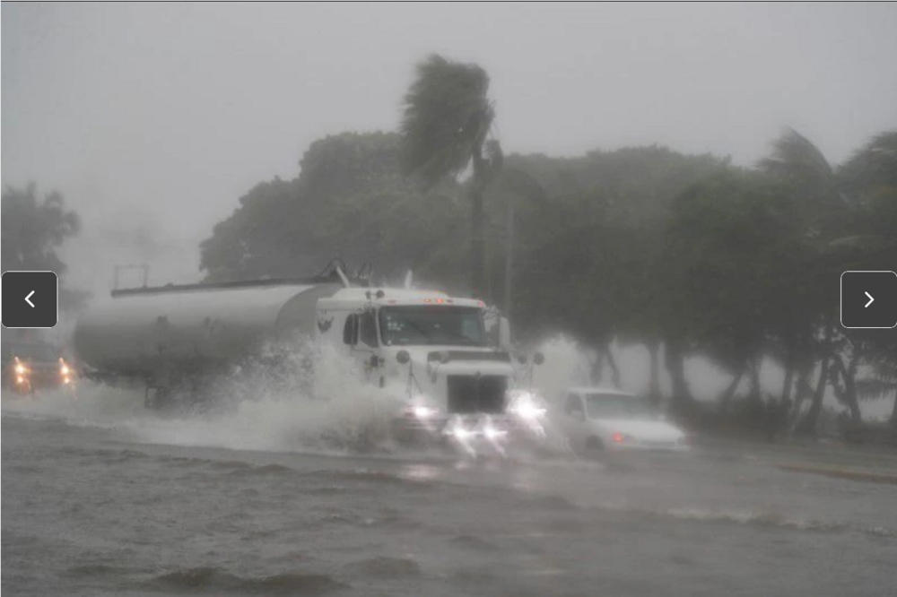
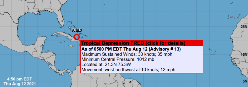
No matter what happens to Fred this is a dangerous storm considering photos from the Dominican Republic.
-
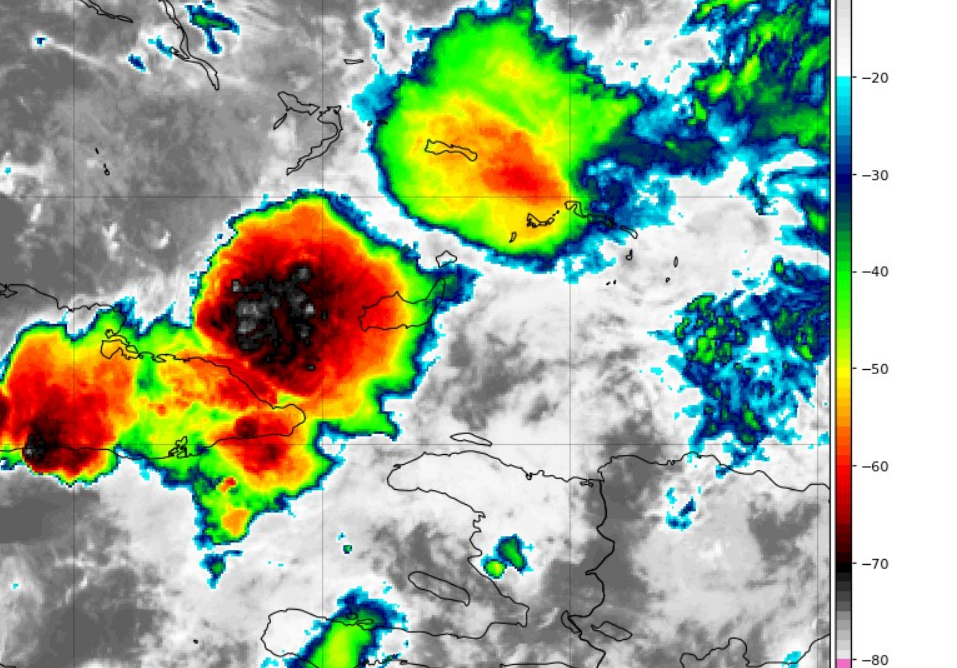
Expanding signature definitely trying to gain massive cloud composition

-
Convection calmed nothing yet to suggest imminent RI.
-
Santo Domingo, Dominican Republic //// Fred aftermath REUTERS
-
Window of opportunity for Fred as the convection visually backlogged itself and feels like extending timing over 30-31C... Mother Of God knows what would happen next. Shear is annoying! This stops me for a hype now...
-
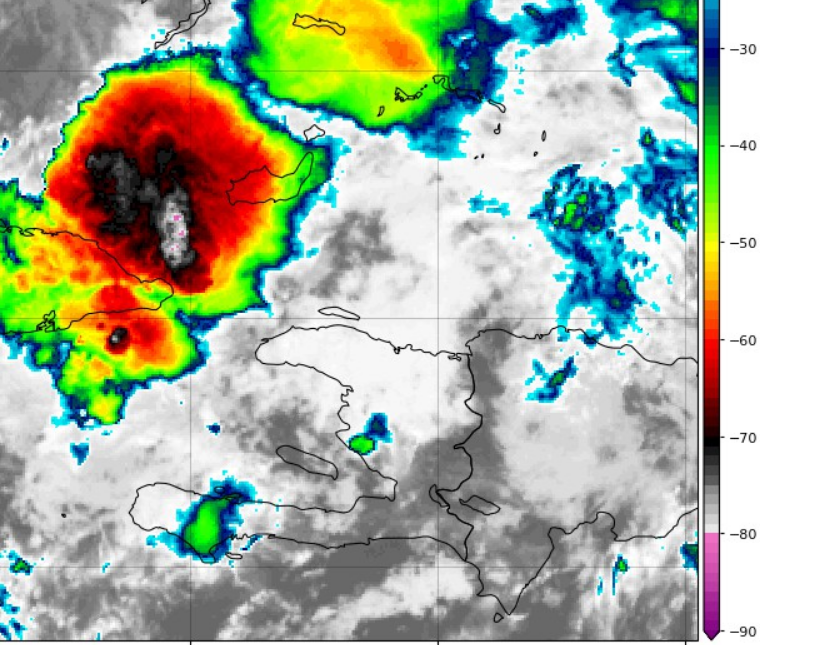
Rapidly lifted air-mass triggered cloud tops around -90C ... just now... enough to initiate the giant engine start...
-
Take a look right at this moment how this new convection has a perfect circular motion. https://www.tropicaltidbits.com/sat/satlooper.php?region=06L&product=ir not moving much at all
-
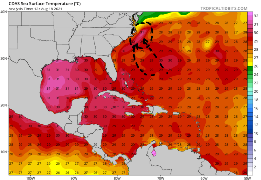
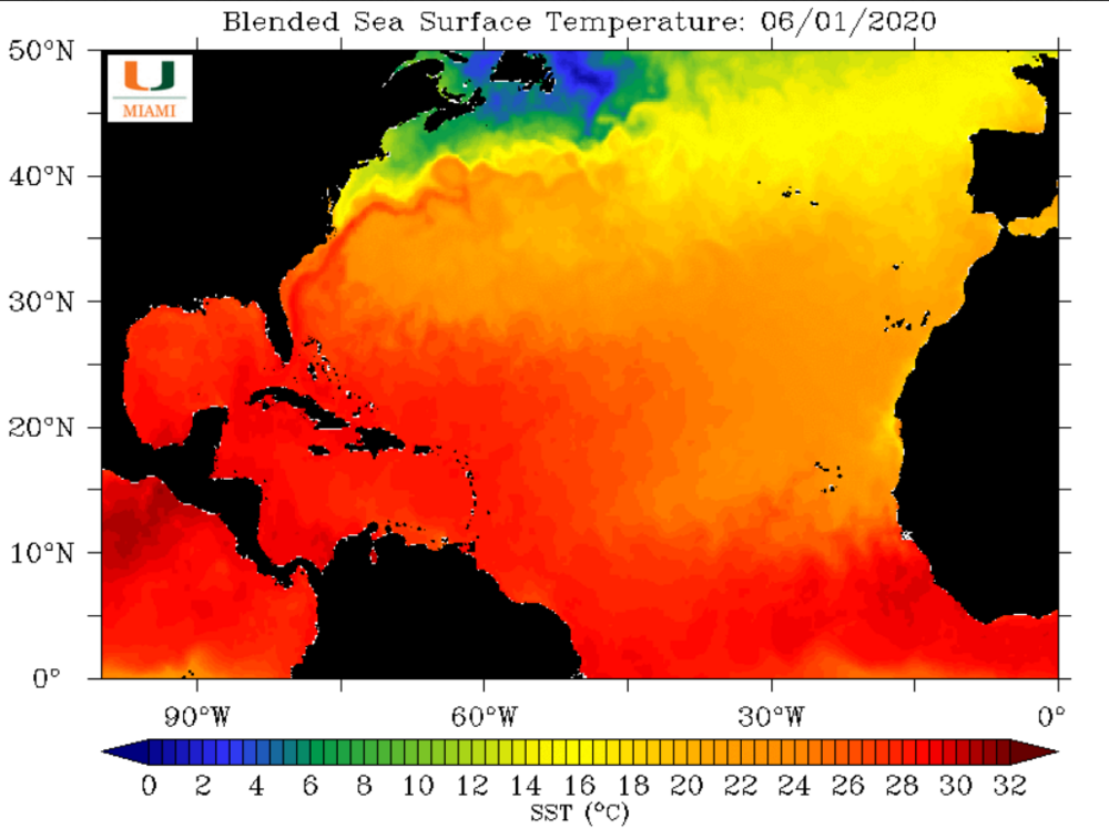
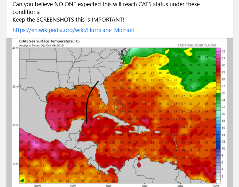
Talking about comparisons here to help out what Fred might decide (30-31C is serious). Referencing Tropical Storm Cristobal while water temperature was around 28C at the time - Gulf of Mexico. However, Michael (Oct sun angle) intensified to CAT5 28-29C at that time. Dorian (late Aug sun angle) 30-31C at that time. https://en.wikipedia.org/wiki/Tropical_storms_Amanda_and_Cristobal Timing... August is warmer/hotter than June (Cristobal). Ocean is warmer and surface is humid- air parcels contain much more kinetic + potential energy, Lifting Index (land) (a much more meaning (than CAPE) for water surface ocean heat content), CAPE (not so much, but over land is a different story)... Keywords Google: ocean heat content and this website will come up where you can go back and find previous year history SST, Ocean Heat Content etc...
-
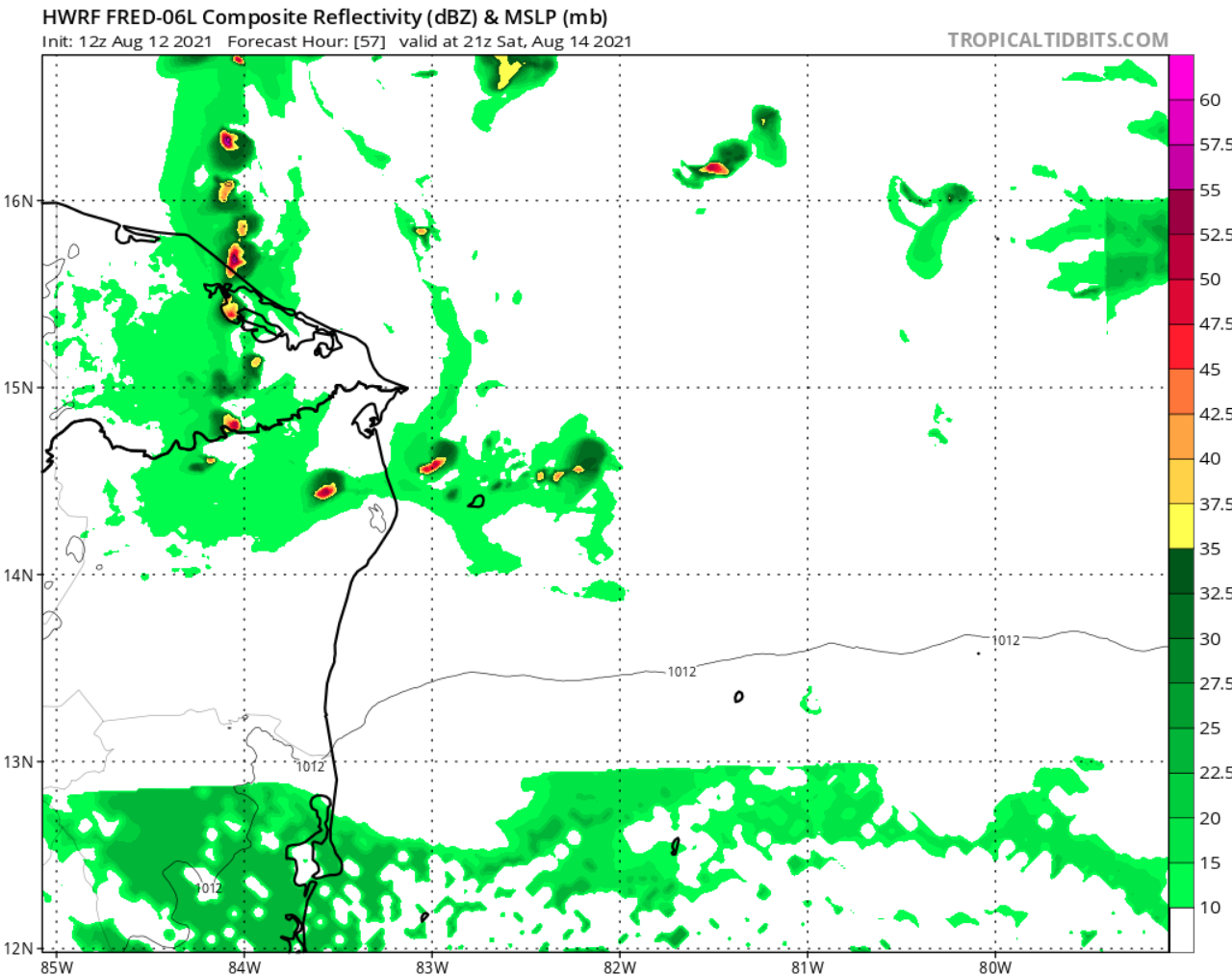
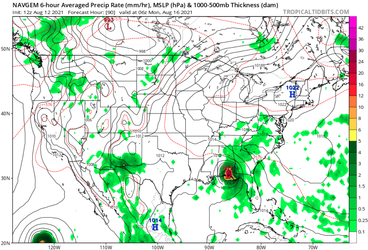
12z HWRF suggests this is going into GOM if that happens - MAJOR? HWRF says solution is INCONSISTENT ::: RECON? On the other hand NAVGEM has tight gradient suggesting also a major status...


-
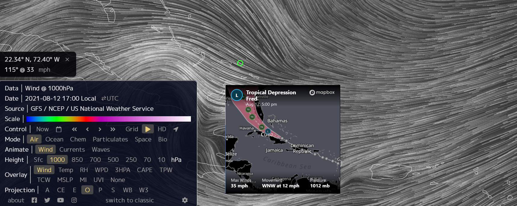
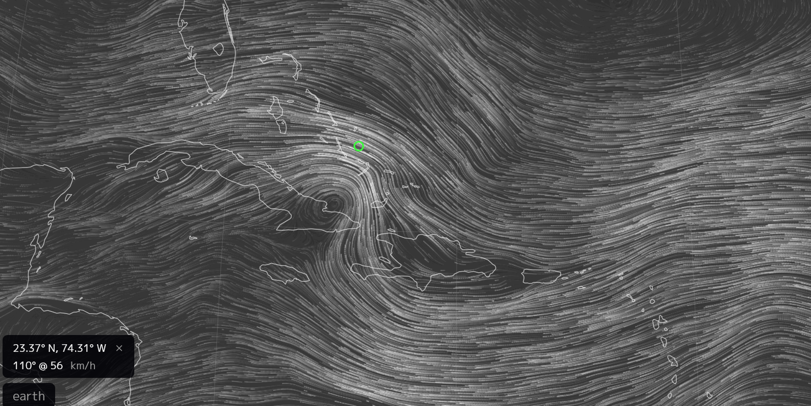
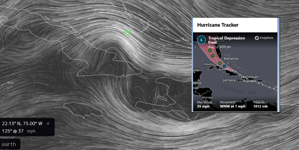
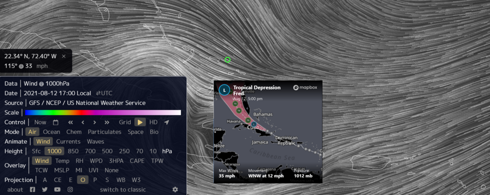
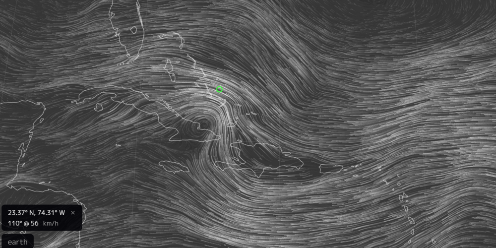
About right and website is fast enough. https://earth.nullschool.net
-
Not sure how accurate this is... It is a good playground. https://earth.nullschool.net
-
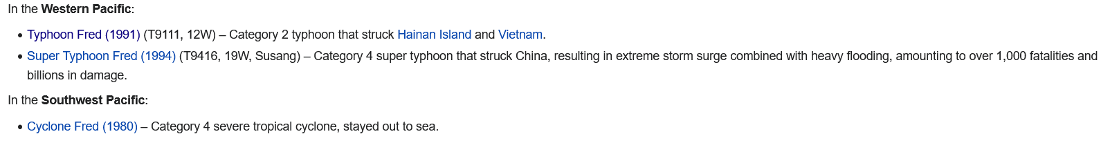
Fred is notorious for typhoons/pacific side might not know well the Atlantic yet or the Caribbean!

-
My mistake. Confused with Floyd, Fred is a new name.
-
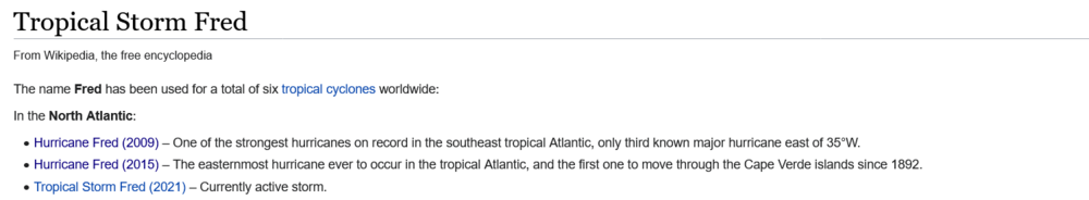
This is unusual formation PTC. Usually TDs have optimistic feelings in regards forward motion and sensing warm water ahead... It is written in the physics of the wave IMO. I do not think this is the same idea under the same name - Fred (2009) https://en.wikipedia.org/wiki/Hurricane_Fred_(2009)
-
2021 Atlantic Hurricane season
WeatherAU replied to StormchaserChuck!'s topic in Tropical Headquarters
Wow at the 00z GFS again remnants from Fred, earlier in the run shown inject energy to rotate another low most likely named Grace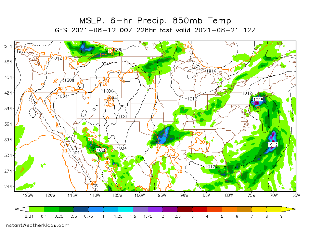
-
Not optimal usage of 30-31C warm water... if ends up 1009mb low or something similar this is probably the right definition - Potential Tropical Cyclone. It has the potential but not like Laura, Dorian, Michael, Irene for example.
-
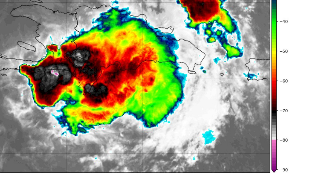
Exceptional view only if it was visible SAT ... spot around -90C maybe... suggesting or trying to decipher the orographic lift conditions but having hard time.

-
Fred finds it difficult to sustain harsh environment... weak storm ::: somewhat manages to spark -80C as of the timing of this post... It is plugged in the outlet definitely.
-
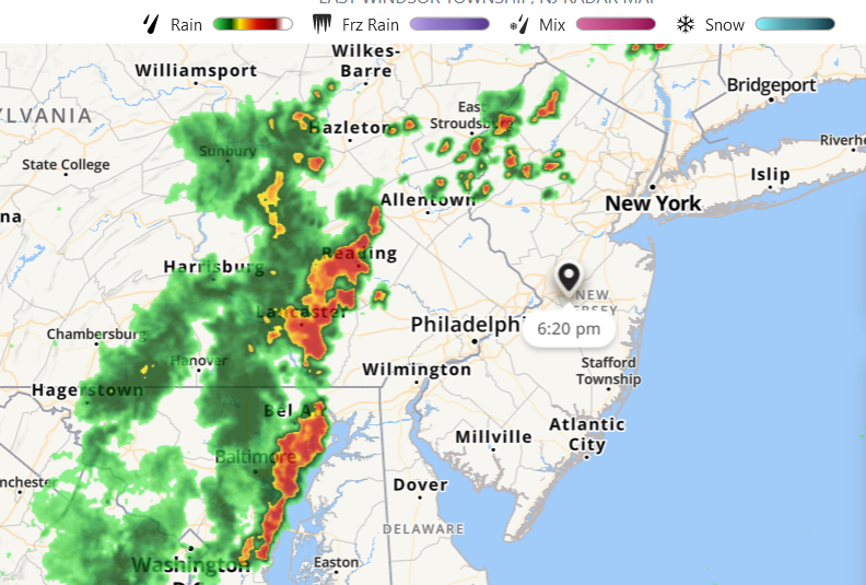
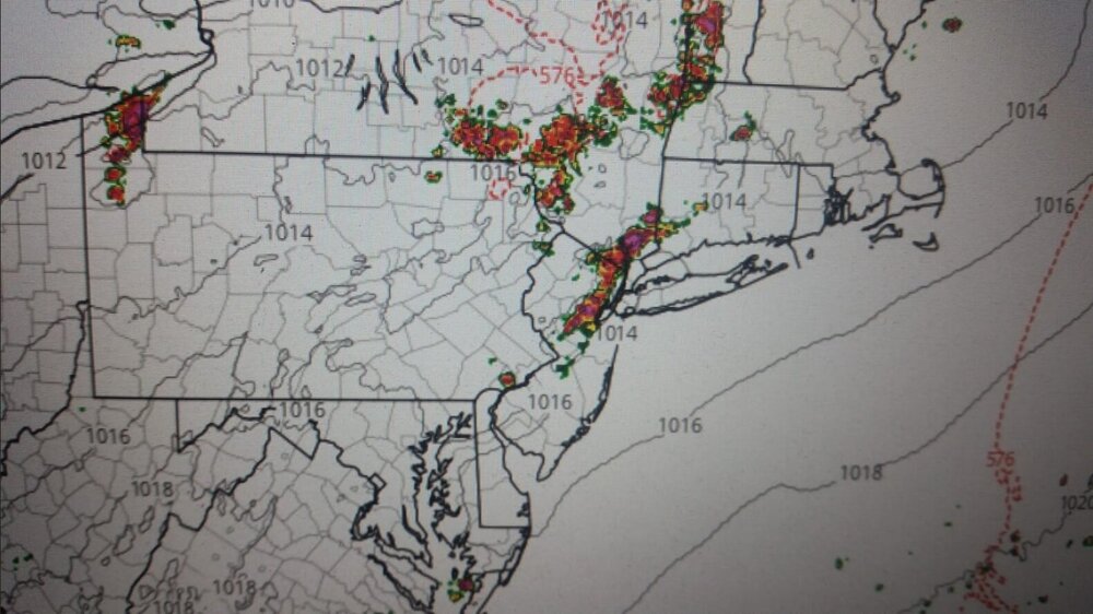
Oh Yea! CNJ is gonna win this SVR weather

-
2021 Atlantic Hurricane season
WeatherAU replied to StormchaserChuck!'s topic in Tropical Headquarters
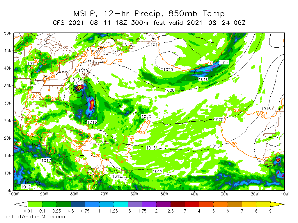
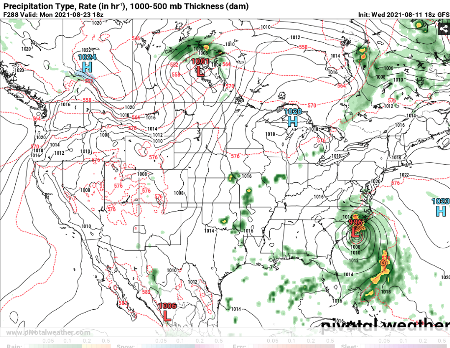
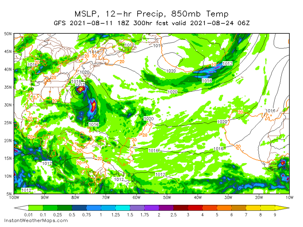
18z GFS has a strong High this is going west northwest IMO FWIW long range GFS of course. Will update this post till landfall or OTS scenario. Lots of rain from what looks like to be Grace 12in SE coast FWIW Grace is looking like an absorption Fred remnants... another run in a row suggesting this scenario.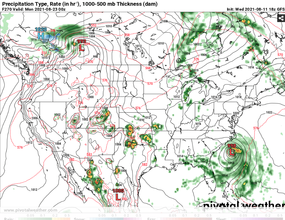
-
Tend to disagree... Latest CFS Weeklies support another one incoming
-
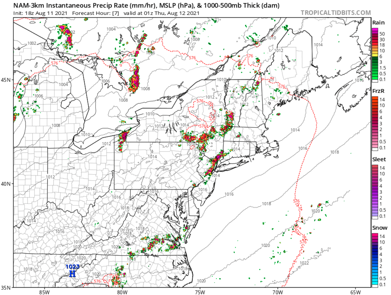
Wow at the 18z 3km NAM SHARP cut-off but radar looks good something incoming for Central NJ all-over-again