SolidIcewx
-
Posts
1,487 -
Joined
-
Last visited
Content Type
Profiles
Blogs
Forums
American Weather
Media Demo
Store
Gallery
Everything posted by SolidIcewx
-
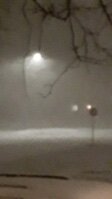
Nice back building with that storm in Eastern Oakland and Macomb counties
-
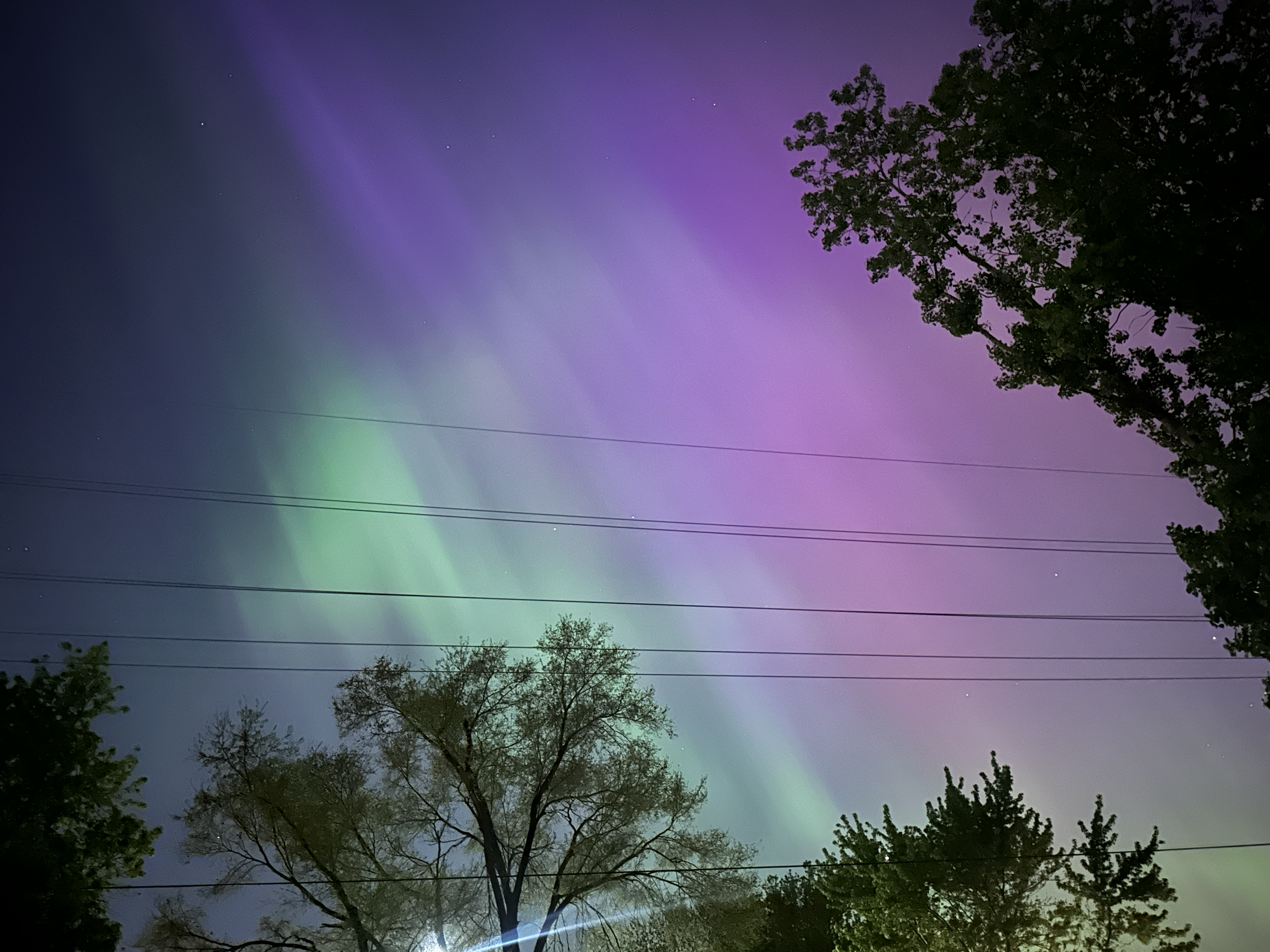
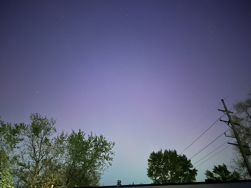
Supposedly this was one of the great events of the last 500 years. Even sightings as far south as Hawaii now. Very grateful to be able to see such a display even within the suburbs
-
Supposedly there was a report in PR seeing red lights off in the northern Horizon. 24-48 hours of storms still left. I leave for Siesta Key FL tomorrow and I pray we get a strong storm again tomorrow night and I can get some pics to post.
-
Apparently reports of sightings in NW FL
-
Even better wave. This is pretty nuts

-
Looking south in Canton MI amazing how even with light pollution you can still see them
-
G4 geomagnetic storm ongoing right now. Hope some of us can get some pics to post
-
That sunspot is a beast. 5 CMEs in the past few days. The next couple days can’t go fast enough so it turns out of our direction. July 2012 we missed a massive almost carrington style solar flare missed earth by 3 days
-
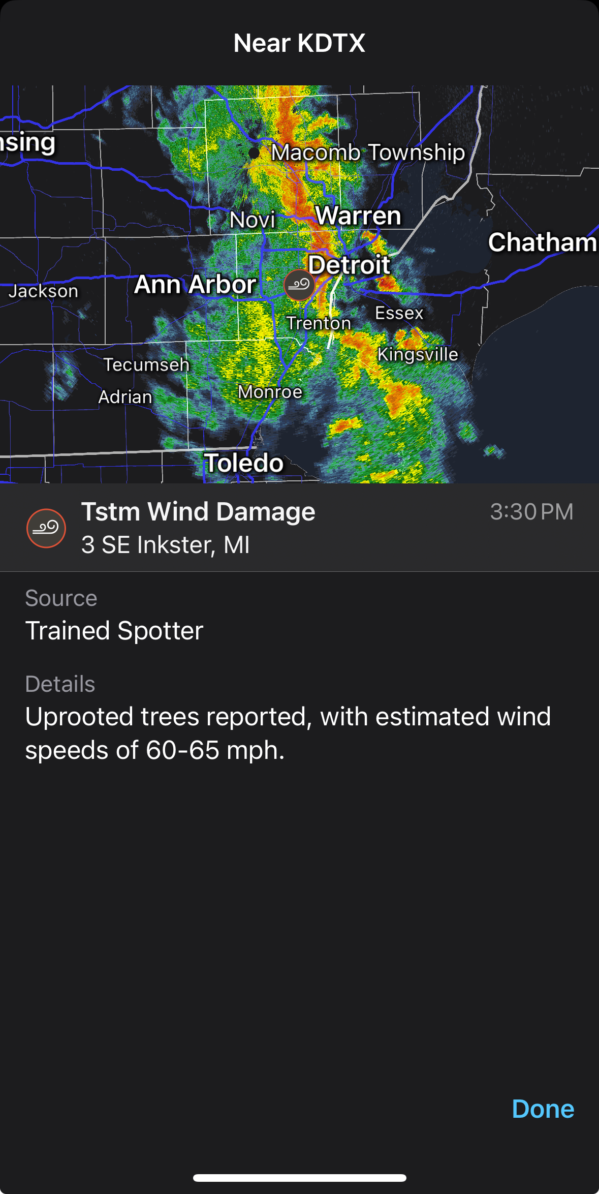
Ohh my God. That’s insane for this region. Hopefully everyone was safe
-
Looks like the storm that hit north of Tulsa yesterday
-
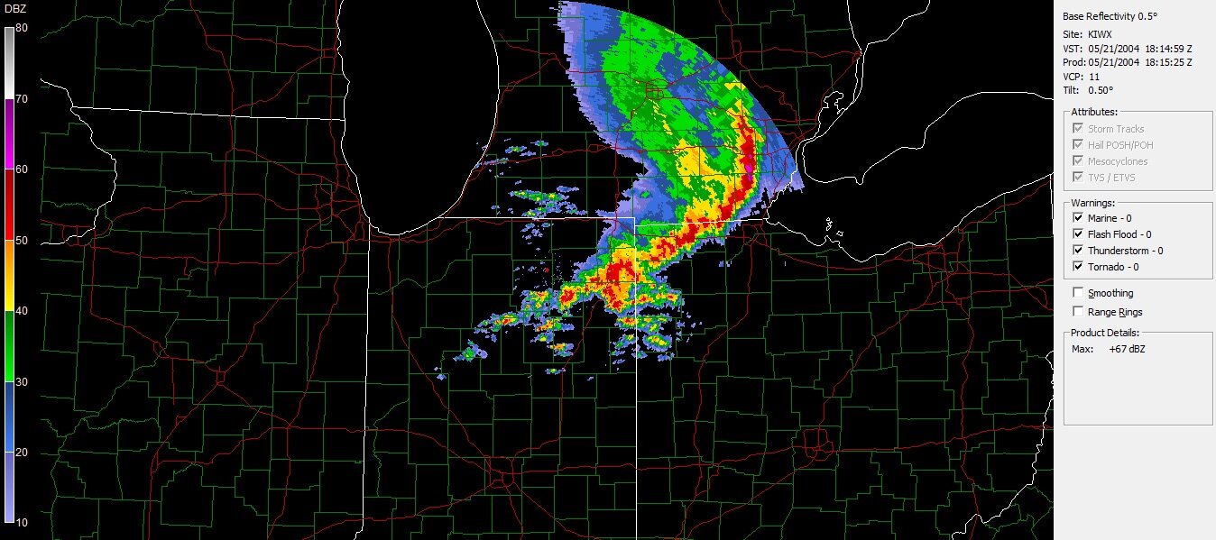
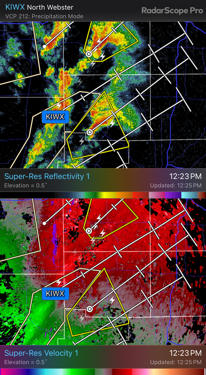
PDS Tor warning
-
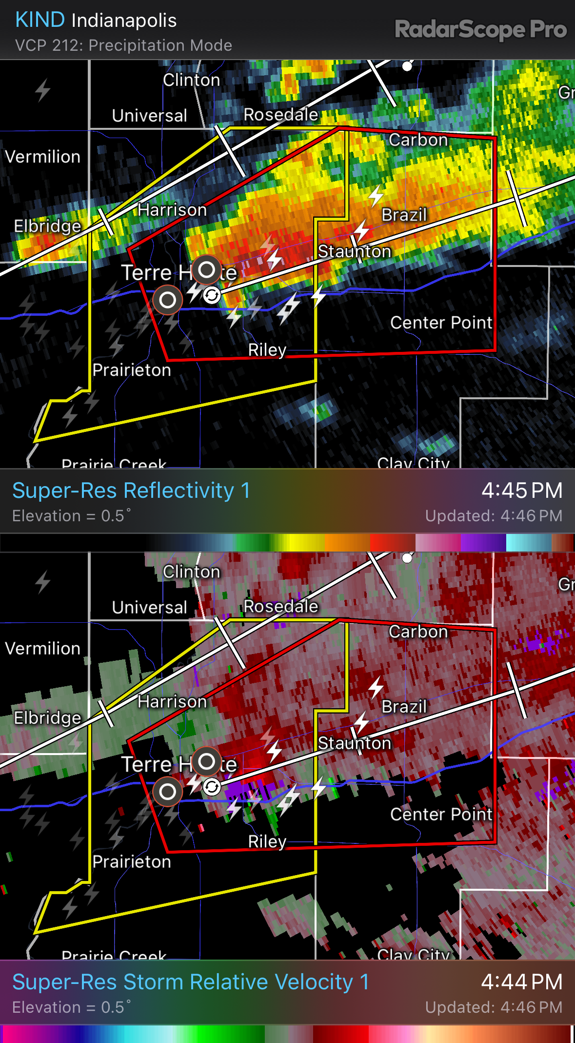
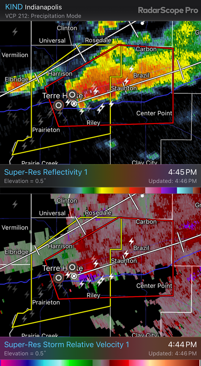
That cell by three rivers is wrapping up like crazy
-
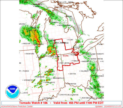
Definitely one of the funkier shaped tornado watches I’ve seen
-
Starting to get a hook
-
This is one of the moments I wish I was working out by Lima and Dunkirk again lol
-
Most definitely pleased. Really good thunder for 25 mins or so
-

-
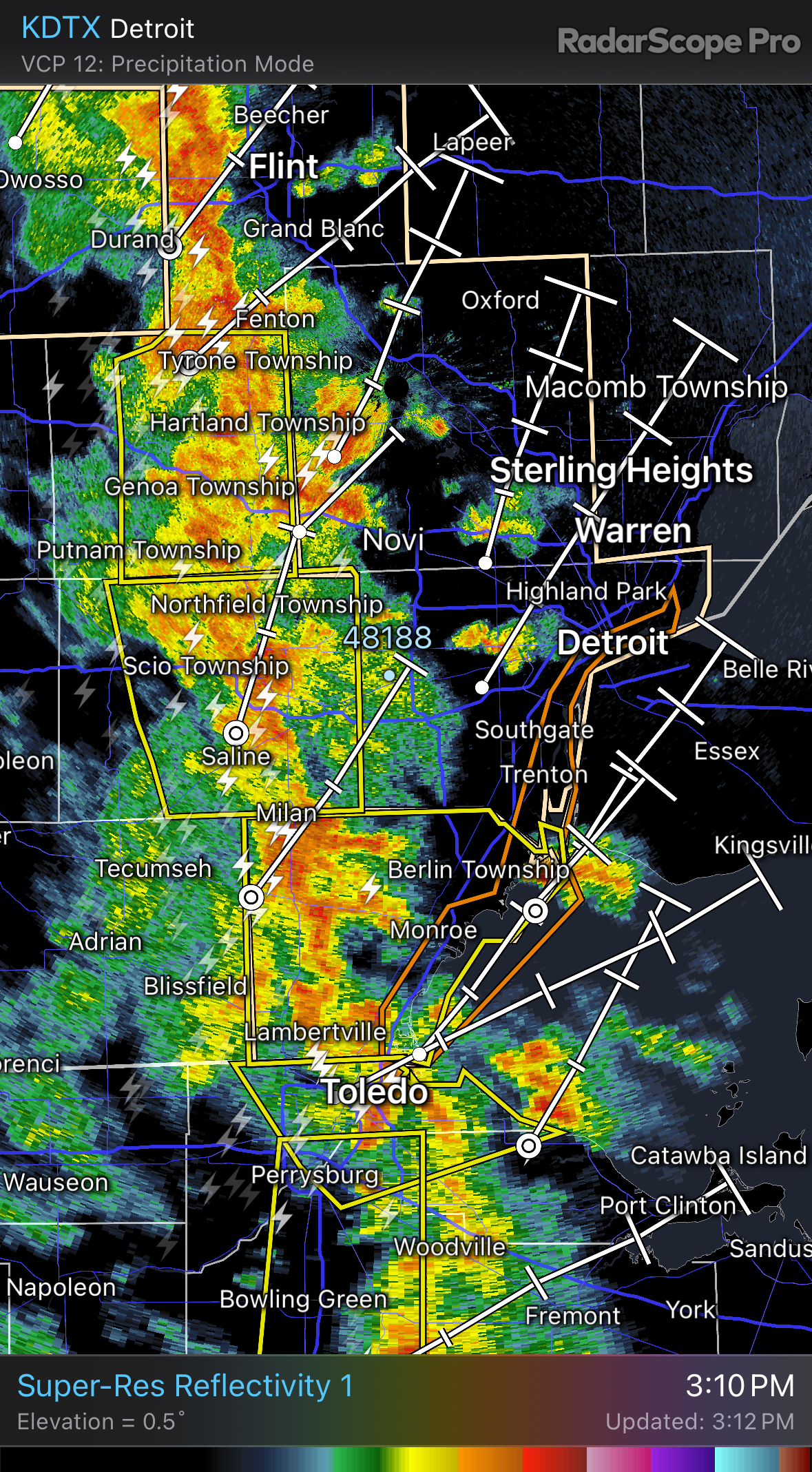
Can’t complain at all. Some nice storms rolling through SE MI
-
Got some hook echos forming a bit. Definitely some storms have that look to them.
-
Today has a feel to it. Sun is poking through pretty good atm
-
Remaining scattered showers this morning will be working northeast of the terminals between 12z-14z. In the wake of this activity, MVFR cigs begin to shift over the area as warm front encroaches and winds veer to the southeast and south with time into early afternoon. Scattered to numerous thunderstorms are still expected along a cold front from mid to late afternoon with the most likely window holding in the 19z-21z time frame with some stray showers or storms perhaps developing a few hours before the main line crosses the area. Heavy rain and gusty winds can be expected. Winds switch to the southwest to west after the cold front passes with MVFR cigs predominant in this flow wrapping around low pressure to the north. For DTW/D21 Convection...A north to south oriented line of thunderstorms is anticipated to develop and move through between 19Z and 21Z. Expect reduced visibility from heavy rainfall and strong winds from stronger thunderstorm. The environment will bring some potential for tornadic thunderstorms. Will need to monitor potential development of discrete cells a few hours prior to 19Z ahead of the main line and adjustments in timing of the main line remains possible with upcoming TAFs.
-
DTW crew is quiet this morning
-
It’s almost Backdoor Cold Front season
-

2024 Short/Medium Range Severe Weather Discussion
SolidIcewx replied to Chicago Storm's topic in Lakes/Ohio Valley
It’s getting ridiculous. Seeing a lot of that BS on Reddit now also. Made a comment a couple days ago about how I’d be more worried about SLW than an individual tornado in a small localized area. Got downvoted into oblivion for being honest. People following social media a bit too much imo. Granted there are good posters out there just seems few and far between. -
Funny you mention Lee’s. Just tried them a couple weeks ago. One just opened up by me like a month ago. I gotta agree they were good.