SolidIcewx
-
Posts
1,526 -
Joined
-
Last visited
Content Type
Profiles
Blogs
Forums
American Weather
Media Demo
Store
Gallery
Everything posted by SolidIcewx
-
Not quite sure why they have little impacts from Fort Wayne up through DTW. Based off everything I’d say Major impacts especially in the Detroit metro with it being rush hour and later
-
Yeah that’s a dream. Snow rates would have to be 2” an hour at least. That would bring a lot of chaos around here too
-
You win on that one brother lmao. Looks like we need to get the ice skates out
-
Yeah shreks swamp here. Frozen just a 1/3 inch below
-
Road crews putting salt out on telegraph road in Taylor 4 miles east of DTW. Don’t matter with rain
-
I hope that trend stays where it’s at but I feel more SE then it is now. They are talking about 12:1 snow ratios maybe higher
-
-
That’s what I am praying for just not the ride to get my partner after she gets off at 830pm lol. Looking like I get to use 4WL
-
Yeah lots of things in effect. Morning going to work will be fine going home then picking up the lady will be the fun part
-
-
Frozen ground and about 4 where the sun did not hit
-
Should be fun once all that water freezes and snow is whipping around everywhere
-
Link?
-
Damn right it is. Intoxicated on the job
-
I know right. I’m praying for little ice don’t want those winds mixing with even moderate accumulation
-
Gfs and nam smoking with snoop dogg
-
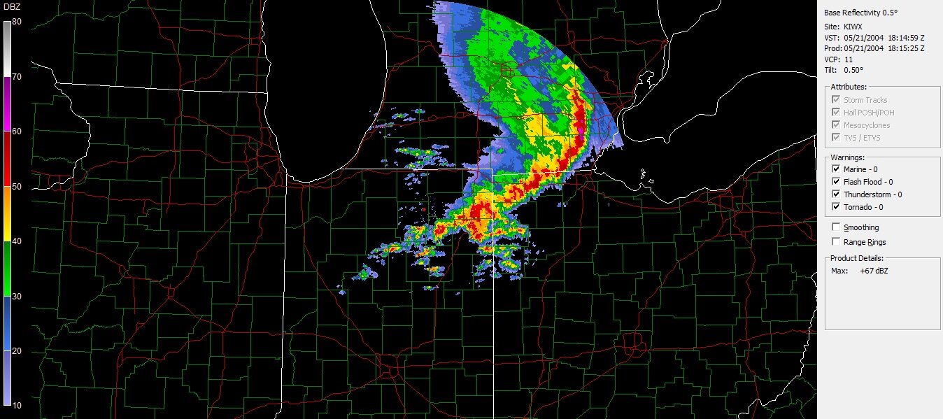
Detroit Nws passing off winter storm watches off to the overnight. I agree that local stations around here downplaying but rightfully so. As I read into it more they did admit that amounts could be well underdone
-
I know this is off topic but what is a good paid site for models? I know about PW but want to know what some Mets are using. Anyways being this close to the event and so much difference’s going to be interesting to see what local Mets are saying around here. Will be fun ride home from work Thursday
-
It’s a war of models even tho we are 30 ish hours of getting some precip
-
I seen something on DTW’s forecast that they are calling Thursday a potentially advisory event. I can see they are very skeptical after last time
-
Looking like almost 50 just after midnight and by the end of the day it drops down to 10. Everything is going to freeze and freeze fast
-
That’s ice zone for me. Good thing I got ice skates that’s how I’ll get home from work
-
I agree anything but a ice storm
-
I’m feeling a good ice storm here in DTW. As for how much not sure
-
That’s what has been on my mind last few days even with a 3 to 5 incher would definitely be some crazy sights


