SolidIcewx
-
Posts
1,487 -
Joined
-
Last visited
Content Type
Profiles
Blogs
Forums
American Weather
Media Demo
Store
Gallery
Everything posted by SolidIcewx
-
I’m not sure how the Detroit metro would handle a sig tor.. been a very long time
-

2023 Short/Medium Range Severe Weather Discussion
SolidIcewx replied to Chicago Storm's topic in Lakes/Ohio Valley
The way it’s looking so far anything that does happen you should be within easy driving distance hopefully -
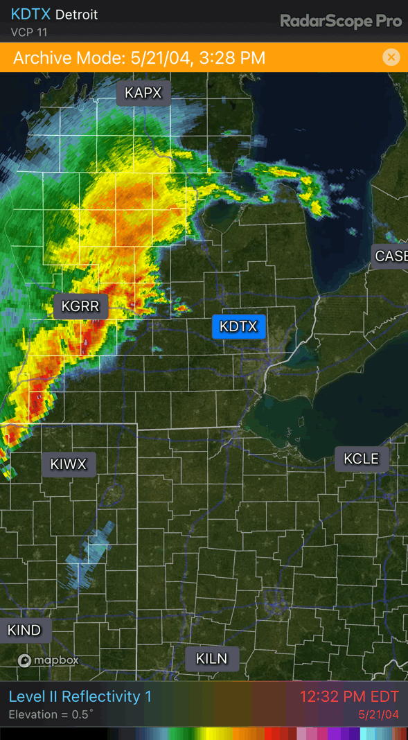
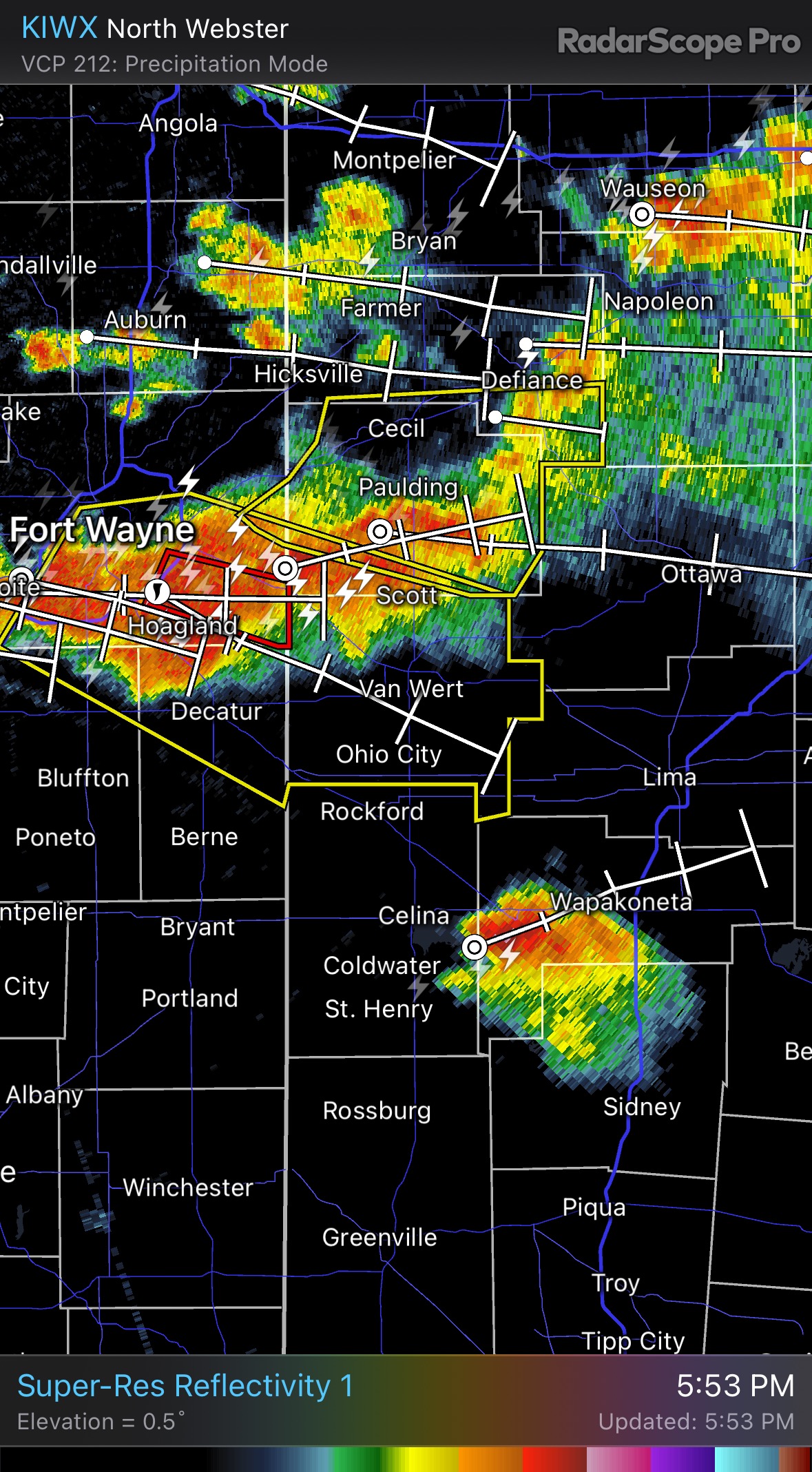
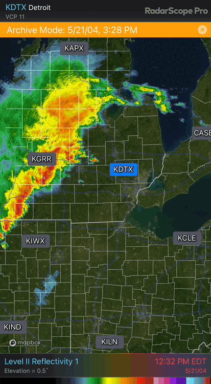
Nice analog to start the day. Anyone remember this baby rolling through?
-
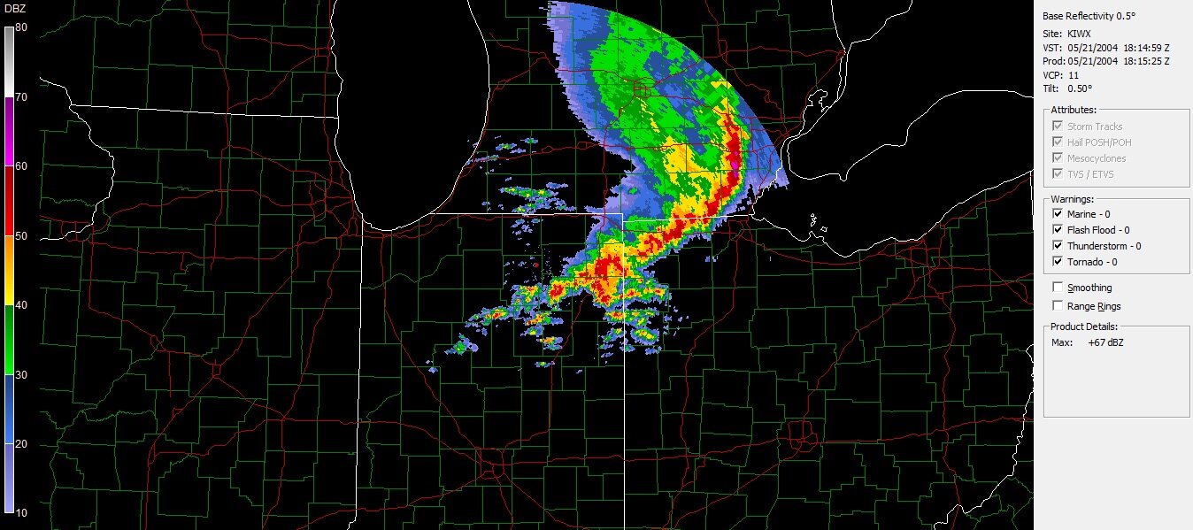
Possible crusher rolling through. See how the convection in the Dakotas area plays out today and tomorrow morning for the southern lakes. Getting some may 2004 vibes
-
2023 Short/Medium Range Severe Weather Discussion
SolidIcewx replied to Chicago Storm's topic in Lakes/Ohio Valley
Possible another round Thursday night into Friday. Let’s see where that front sets up -
2023 Short/Medium Range Severe Weather Discussion
SolidIcewx replied to Chicago Storm's topic in Lakes/Ohio Valley
That’s what I’m saying pretty intrigued to say the least. DTX had a really nice discussion last night. Waiting on a more detailed one from KIWX -
2023 Short/Medium Range Severe Weather Discussion
SolidIcewx replied to Chicago Storm's topic in Lakes/Ohio Valley
Very curious to see how Wednesday will unfold.. very good directional shear. DTX and KIWX had some nice updates -
Beautiful over there. Homes in the area are really cool too. Neat town
-

-
Euro was showing possible 70 degree dews in portions of the UP end of next week
-
2023 Short/Medium Range Severe Weather Discussion
SolidIcewx replied to Chicago Storm's topic in Lakes/Ohio Valley
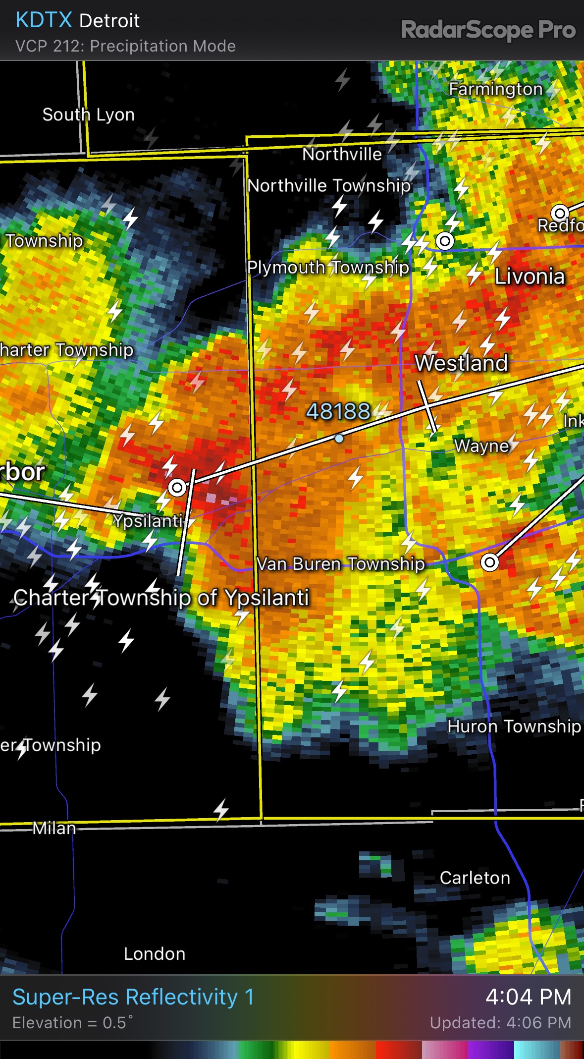
How common is it for hail of this magnitude to fall in the Great Lakes area? -
2023 Short/Medium Range Severe Weather Discussion
SolidIcewx replied to Chicago Storm's topic in Lakes/Ohio Valley
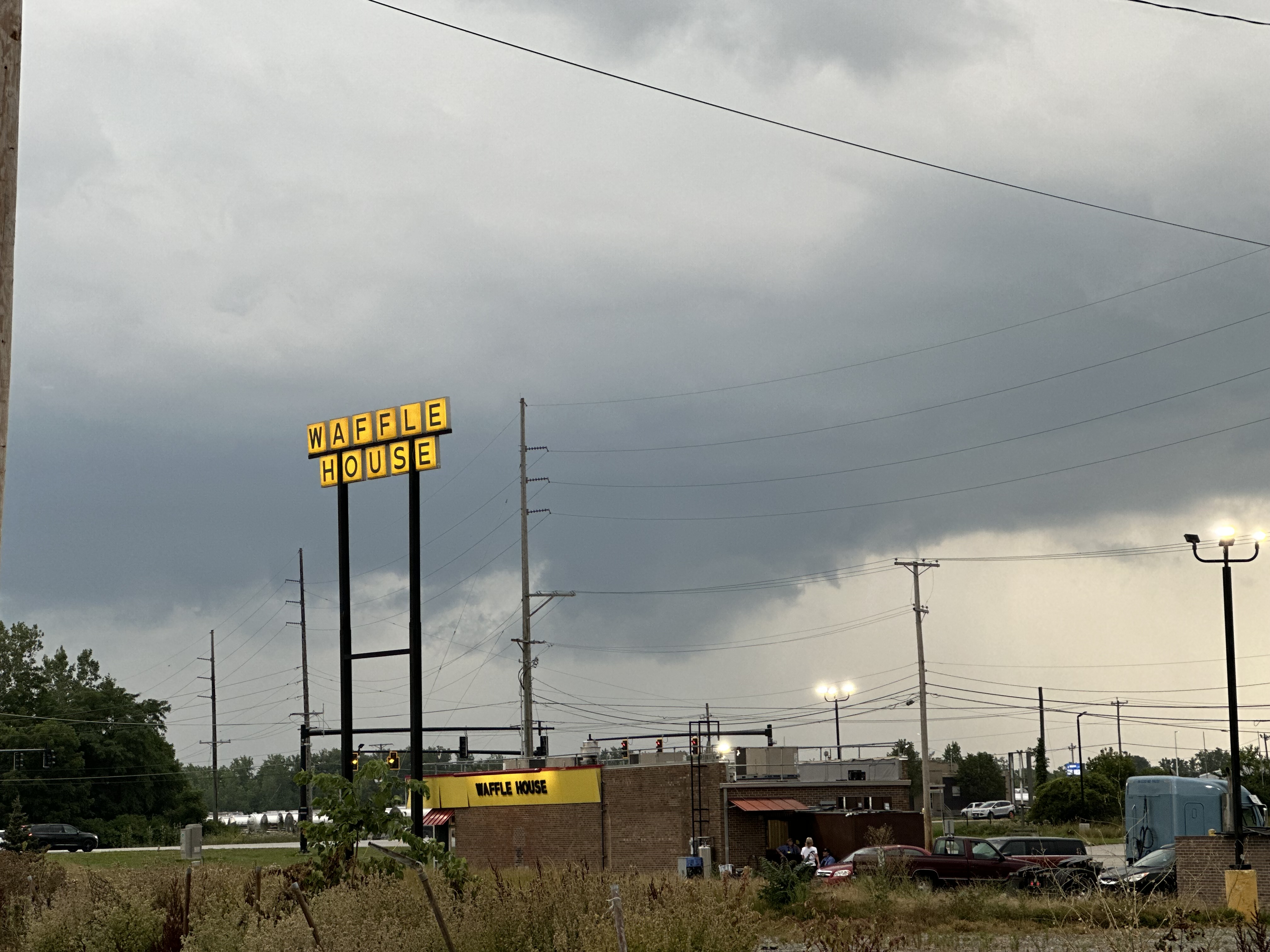
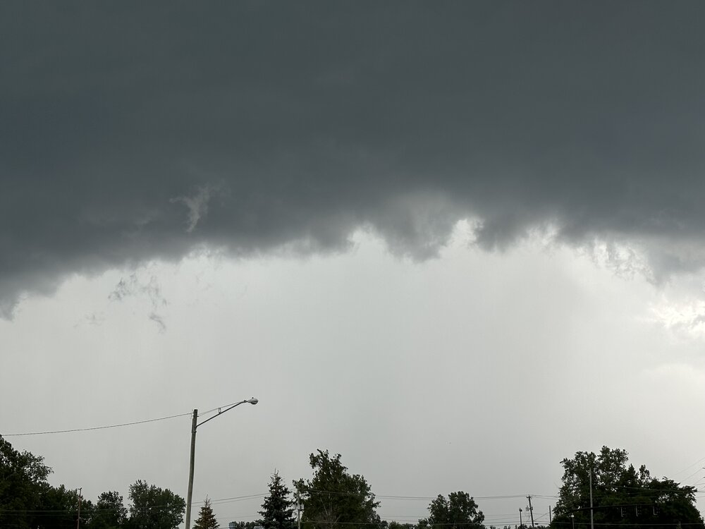
Not often you get a view behind the shelf cloud and also get a hail core. Strong 50mph gusts just from the outflow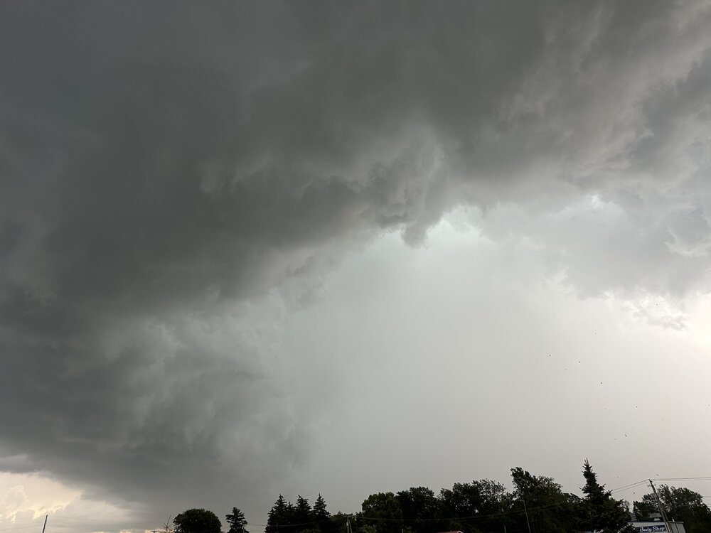
-
2023 Short/Medium Range Severe Weather Discussion
SolidIcewx replied to Chicago Storm's topic in Lakes/Ohio Valley
-
2023 Short/Medium Range Severe Weather Discussion
SolidIcewx replied to Chicago Storm's topic in Lakes/Ohio Valley


-
2023 Short/Medium Range Severe Weather Discussion
SolidIcewx replied to Chicago Storm's topic in Lakes/Ohio Valley
Might be getting into a nice storm sandwich here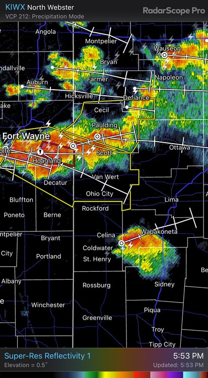
-
2023 Short/Medium Range Severe Weather Discussion
SolidIcewx replied to Chicago Storm's topic in Lakes/Ohio Valley
If it was a loonie every time you would be rich -
2023 Short/Medium Range Severe Weather Discussion
SolidIcewx replied to Chicago Storm's topic in Lakes/Ohio Valley
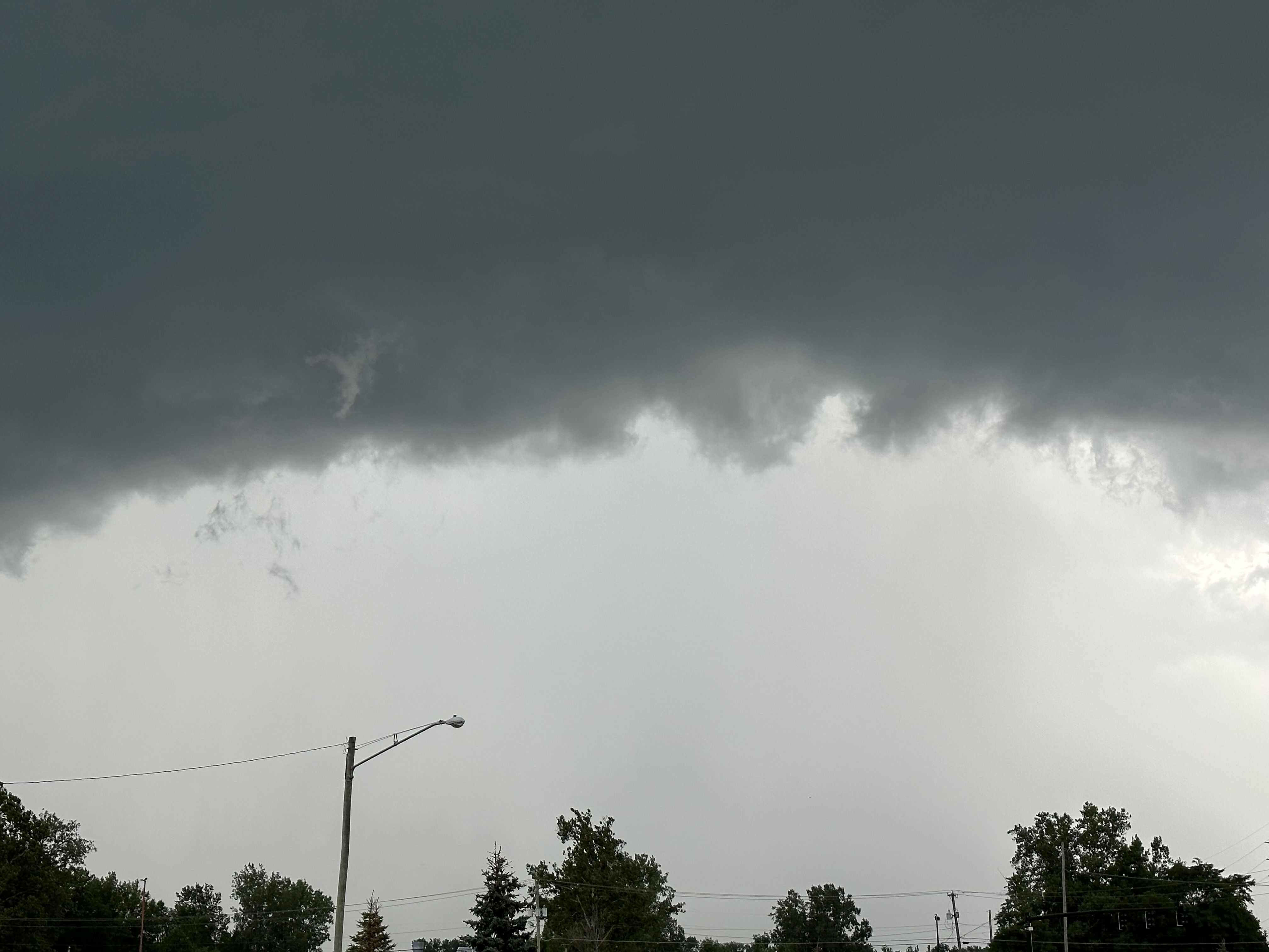
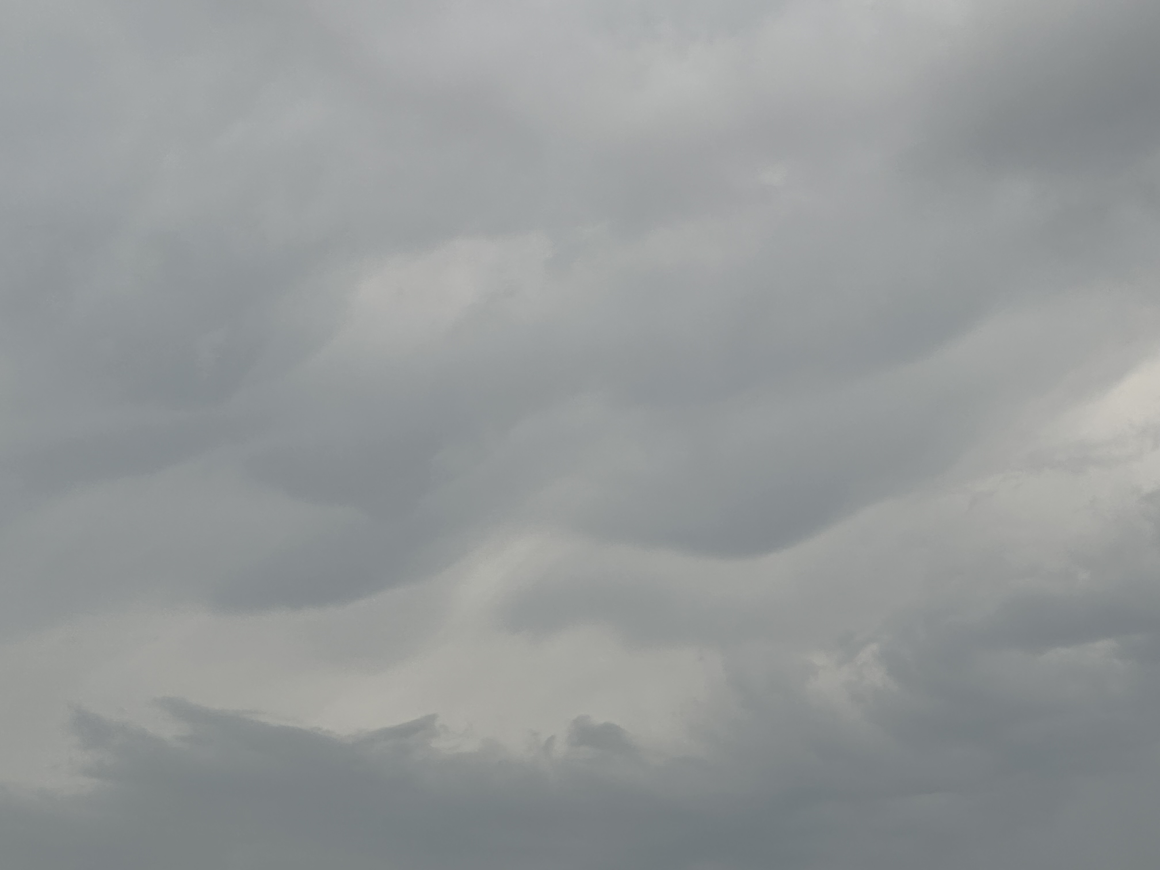
Starting to look fun to the NW. clouds getting real dark here way ahead of the storms -
2023 Short/Medium Range Severe Weather Discussion
SolidIcewx replied to Chicago Storm's topic in Lakes/Ohio Valley
Siche event in coming on Lake Erie -
2023 Short/Medium Range Severe Weather Discussion
SolidIcewx replied to Chicago Storm's topic in Lakes/Ohio Valley
Near golf ball size hail at my house in south canton from what my fiancé is telling me. I’ll try to get pics from her if I can. Sounds like quite the event up there. Wonder what’s in store for NW Ohio -
2023 Short/Medium Range Severe Weather Discussion
SolidIcewx replied to Chicago Storm's topic in Lakes/Ohio Valley
Second supercell to go by house in a week. Gotta love being away from home when all the goods happen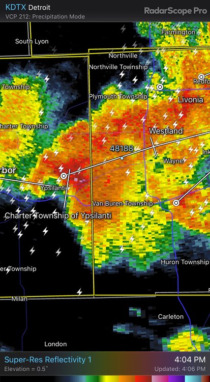
-
2023 Short/Medium Range Severe Weather Discussion
SolidIcewx replied to Chicago Storm's topic in Lakes/Ohio Valley
Grab your baseball glove and come have fun lol -
2023 Short/Medium Range Severe Weather Discussion
SolidIcewx replied to Chicago Storm's topic in Lakes/Ohio Valley
You can really feel it today. Air is thicker than a campbells chunky soup -
2023 Short/Medium Range Severe Weather Discussion
SolidIcewx replied to Chicago Storm's topic in Lakes/Ohio Valley
t Discussion National Weather Service Northern Indiana 1253 PM EDT Thu Jul 20 2023 .SYNOPSIS... Issued at 1249 PM EDT Thu Jul 20 2023 Severe thunderstorms are expected to develop later this afternoon. Large hail and damaging wind gusts are the primary concerns. The severe weather risk concludes by about 10 PM eastern daylight time. Dry, not as hot and humid, on Friday. && .SHORT TERM...(This Evening through Friday) Issued at 1249 PM EDT Thu Jul 20 2023 Increasing confidence on severe weather occuring later this afternoon. Large hail and damaging wind gusts are the primary concerns. SPC Mesoanalysis temperatures and dew points initialize well this hour which bolsters confidence in their derived thermodynamic parameters. A warm front is now approaching the I-94 corridor in MI while a cold front is between Milwaukee and Chicago. Severe weather parameters this afternoon, and going forward, are very favorable for storms capable of large hail, damaging wind, and perhaps a tornado. High resolution guidance, mainly the HRRR, has been fairly consistent run-to-run regarding storm initialization near 3 PM EDT over far southern MI and northeast IN. Forecast soundings show an increasing risk of large hail due to enormous CAPE profiles, Effective Bulk Wind Profiles in excess of 30 knots, SHIP > 1, and mid- level lapse rates in excess of 6.5 C/km. Damaging wind gusts are also a concern due to favorable low-level lapse rates and are perhaps also favored toward Putnam, Van Wert and Allen counties in Ohio as discreet storms early attempt to become linear through time. The tornado risk is meager with small SRH values, generally unidirectional low-level flow, and LCLs in excess of 1km. Though, discrete storms toward the warm front would have the greatest tornado potential due to enhanced helicity there. Lastly, South Bend and points southwest might miss out on the severe weather risk because storms seem favored to develop east of there and then (of course) drift southeast. High confidence that storms will exit the forecast area by 9-10 PM EDT; notably sooner for those in southern MI and far northeast IN. Just a touch cool tonight with lows near 60. Cooler and not as humid on Friday with dry weather. -
2023 Short/Medium Range Severe Weather Discussion
SolidIcewx replied to Chicago Storm's topic in Lakes/Ohio Valley
Now I wonder if the southern end is where supercells will form. Or will this be a large bowing segment going through multiple states with imbedded rotation -
2023 Short/Medium Range Severe Weather Discussion
SolidIcewx replied to Chicago Storm's topic in Lakes/Ohio Valley
Strong SW winds developed here in the past couple hours