SolidIcewx
-
Posts
1,487 -
Joined
-
Last visited
Content Type
Profiles
Blogs
Forums
American Weather
Media Demo
Store
Gallery
Everything posted by SolidIcewx
-
Really depends how they set up. Obviously not like the west side of the state. Definitely would like to be a couple more counties west at least. Hell my profile pic is of during a nasty snow squall I think 6 years or so back. I’ve always wondered if it’s possible to get a nasty lake effect event from Erie if winds come from the east.
-
Toss..
-
That would be the one benefit. I think my companies policy is 0F and below. Or if wind chill is -20F and below. My work tablet probably won’t work right on Tuesday with that cold.
-
Yeah not looking forward to working in those conditions at all. Looking very impressive so far. Been consistent for over a week with signals.
-
All I’m asking for is 3-4 to at least give it a winter vibe next week vs a frozen wasteland vibe. But this is why model watching is fun. Will see if we get a major change today
-
-
Looking forward to that awesome bare ground for the coming arctic outbreak. Will have that really wasteland look to it
-
Hopefully can get a few inches out of this. Would be unpleasant to have an arctic air outbreak with barley any snow on the ground
-
Euro just needs to go south by 50
-
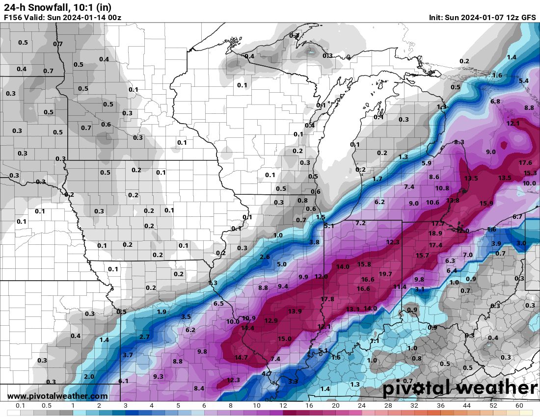
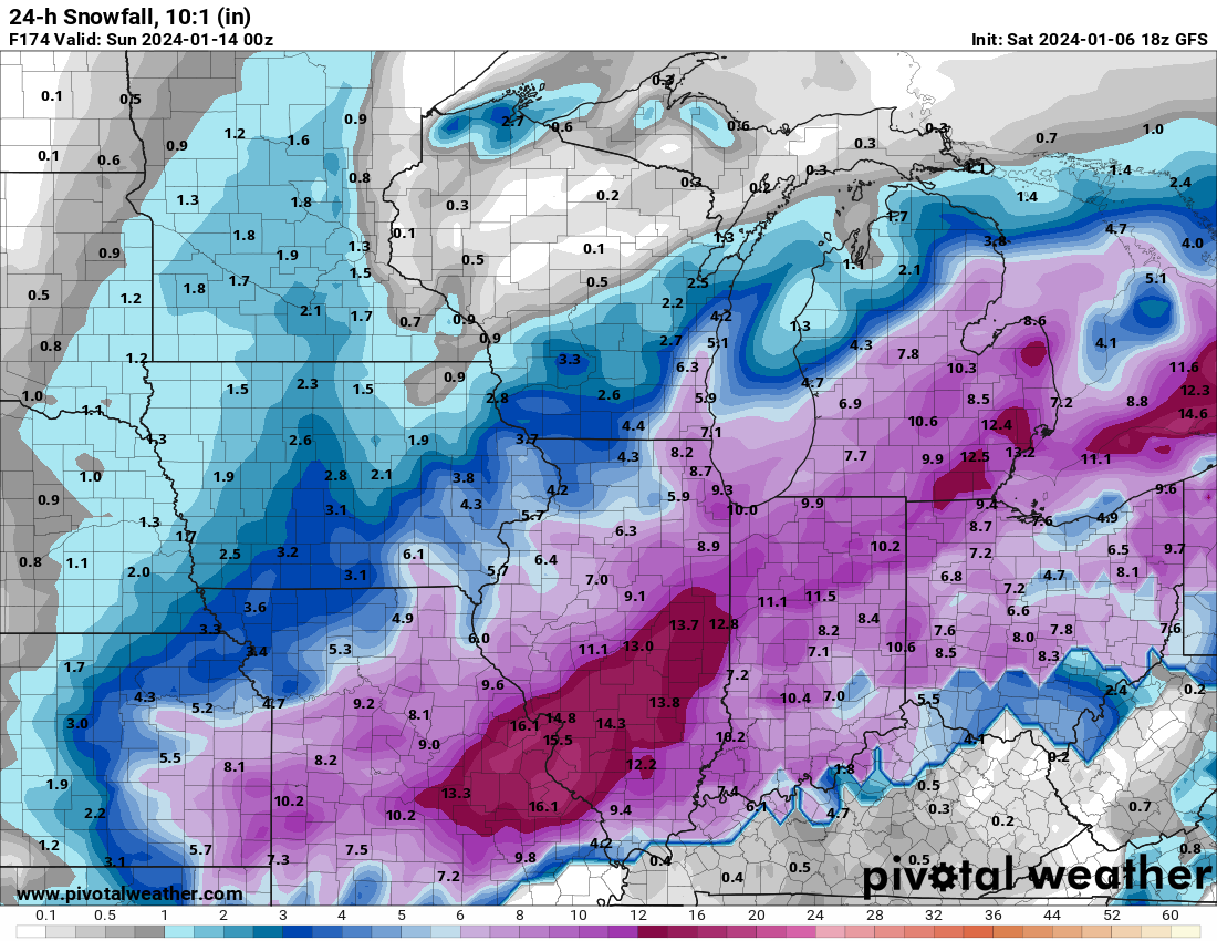
I’ll take that GFS run any day of the week.
-
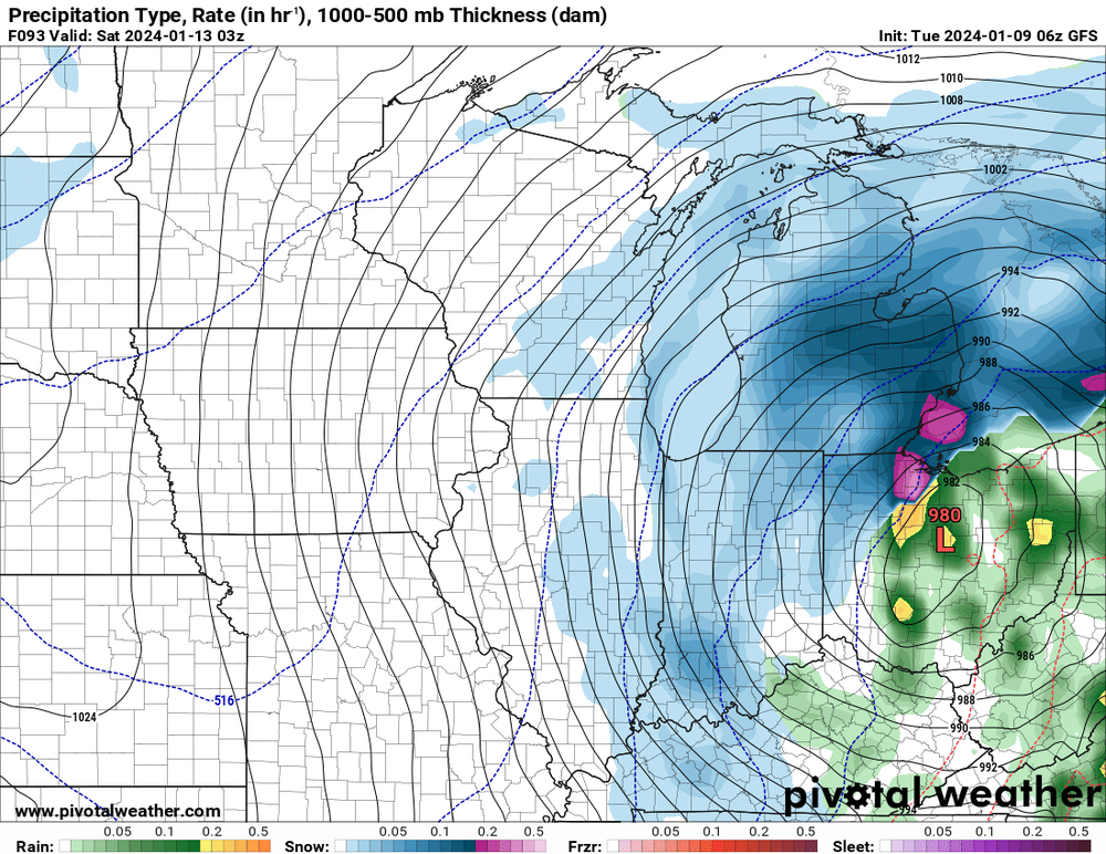
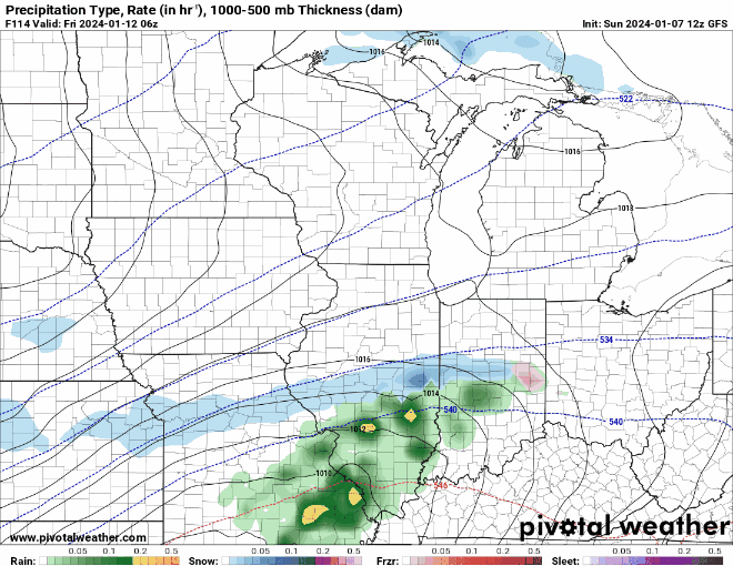
What would be a good analog for this storm? Seems like it might get moisture from Gulf and Atlantic
-
Just a few more days for us
-
Man this would slap the DTX crew
-
I’m not too worried about totals. 6” and blizzard conditions is more than enough for me
-
Obviously smoking on break too
-
Bust out that Wyandotte magnet you have as you said things are looking good for us. Great shot at the wealth being spread especially to those south of state lines.
-
We still have a few days to have it sorted out. More cold air to work with also. I’m more concerned if this ends up being a GAF and it’s a quick wind driven few inches then cold. Hopefully this storm goes more SW-NE instead of S-N. We had some good storms last winter but having a blizzard this time around I know I would be satisfied for the rest of the season lol.
-
Ahh yeah that makes sense. GRR one of the greats imo
-
We will have our shot end of the week. That storm looks gnarly so far. Will see by Wednesday evening what it’s looking like. Lake effect snow machine should kick in once that brutal cold filters in.
-
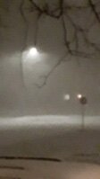
Now that’s a storm that would sink ships. Hard to imagine 45-60 mph gusts on land would not verify. Wicked wind whipped snow
-

Winter 2023/24 Medium/Long Range Discussion
SolidIcewx replied to Chicago Storm's topic in Lakes/Ohio Valley

-
Winter 2023/24 Medium/Long Range Discussion
SolidIcewx replied to Chicago Storm's topic in Lakes/Ohio Valley
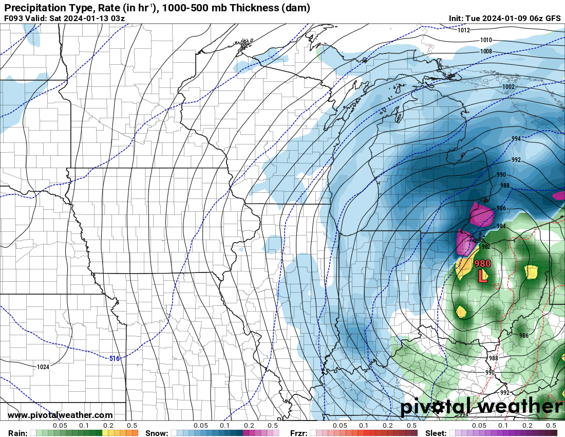
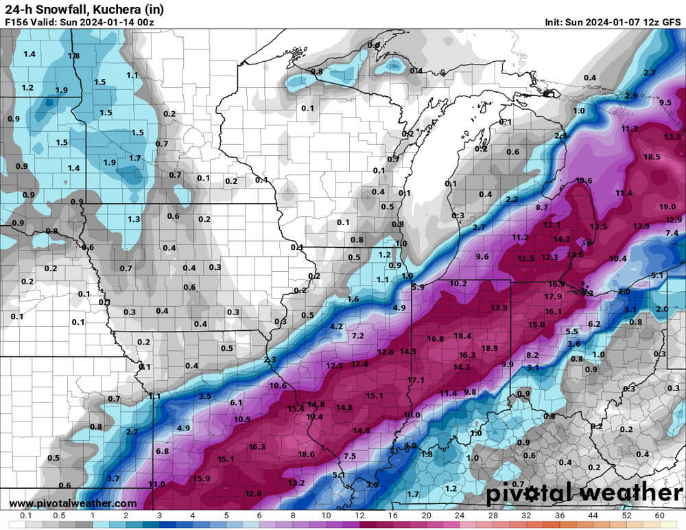
I agree, 18z GFS would be a wonderful spread the wealth situation for snowfall. Whole region would have a true winter look finally this year. Especially since we will have a nice cold outbreak afterwards.

-
Winter 2023/24 Medium/Long Range Discussion
SolidIcewx replied to Chicago Storm's topic in Lakes/Ohio Valley
That would be awesome. Was a really long duration event it felt like also. Cars got buried -
Nam doing nam things again
-
At least the cement snow makes for some awesome pictures. Love the morning after a good paste job by Mother Nature. But on the contrary I would love a nice blowing snow and drifting event.