Iceresistance
-
Posts
4,190 -
Joined
-
Last visited
Content Type
Profiles
Blogs
Forums
American Weather
Media Demo
Store
Gallery
Everything posted by Iceresistance
-
10% HATCHED for Missouri, also includes Springfield
-
And it's right over my Great-Grandparents (Springfield, MO)
-
Very Broad Enhanced risk on Day 3 Only 8% of Oklahoma is not under a 15% chance for Next Tuesday, it's a May-like Setup & it's extremely broad, Enhanced risk may be needed in the next couple of days depending on the model trends
-
I'm at the westernmost fringe of the Slight Risk for Sunday It appears that the Dry Line is along I-35 from Texas to Kansas
-
Christmas Blizzard of 2009: I was only 6 & in Missouri when it struck, a normally 5 1/2 hour trip back home on I-44 took 10-12 Hours instead, my house got 1' of snow February 2011: Nearly 1 Foot again, Temperatures fell to Below Zero after that (Down to at least -9°F) 2013 Christmas Ice Storm: Had to leave for Missouri the day before the scheduled day, Power was basically out for Pott. County for over 1 week while we stayed in Missouri (Never lost power there) February 2014: 5-6 inches of snow March 2015 Snowstorm: 4 Inches & Whiteout Conditions January 2017: 1-2 inches January 2019: 2 inches, but OKC got 4.5 inches in a Snowburst 2020 October Ice Storm December 2020: 3 Snowstorms (Including the Surprise Snowstorm of December 30th) 2020-2021 New Years' Day Winter Storm February 2021 Extreme Cold & Snow 10 & 8 Inches of snow from 2 Storms Temperatures fell to an extremely cold -22°F
-

The updated NWS radar is terrible
Iceresistance replied to Heisy's topic in Weather Forecasting and Discussion
The NWS radar has gotten better now, I've managed to spot a Tornadic QLCS Mesocyclone near Mustang last week using the NWS-Radar & Velocity. -
Which city has the worst weather?
Iceresistance replied to a topic in Weather Forecasting and Discussion
I've thought of that as "Most Extreme Weather" -
Severe Weather October 10th-12th 2021
Iceresistance replied to Sydney Claridge's topic in Central/Western States
NOT AGAIN! -
Southern Plains Winter 2021-2022
Iceresistance replied to Iceresistance's topic in Central/Western States
I can't see it . . . -
Which city has the worst weather?
Iceresistance replied to a topic in Weather Forecasting and Discussion
Oklahoma City -
Severe Weather October 10th-12th 2021
Iceresistance replied to Sydney Claridge's topic in Central/Western States
New Norman sounding has a MUCH weaker Cap & Stronger Thermodynamics for Supercell development -
Severe Weather October 10th-12th 2021
Iceresistance replied to Sydney Claridge's topic in Central/Western States
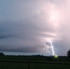
TORNADO ON THE GROUND -
Severe Weather October 10th-12th 2021
Iceresistance replied to Sydney Claridge's topic in Central/Western States
Tom Pastrano is getting a good view as well . . . And Val Castor is starting is get a really good view as well -
Severe Weather October 10th-12th 2021
Iceresistance replied to Sydney Claridge's topic in Central/Western States
Tornado Warning for SW Oklahoma -
Severe Weather October 10th-12th 2021
Iceresistance replied to Sydney Claridge's topic in Central/Western States
May have initiation right now near Altus or Hollis, OK -
Severe Weather October 10th-12th 2021
Iceresistance replied to Sydney Claridge's topic in Central/Western States
This is probably just shy of a PDS Tornado Watch. O_O -
2021 Atlantic Hurricane season
Iceresistance replied to StormchaserChuck!'s topic in Tropical Headquarters
There's 93L ESE of the Leeward Islands -
Severe Weather October 10th-12th 2021
Iceresistance replied to Sydney Claridge's topic in Central/Western States
This link would be EXTREMELY useful for tracking Supercells in Central Oklahoma, trust me . . . https://www.news9.com/nextgen-live-radar -
Severe Weather October 10th-12th 2021
Iceresistance replied to Sydney Claridge's topic in Central/Western States
Also through Shawnee & even ends up at Tulsa -
Severe Weather October 10th-12th 2021
Iceresistance replied to Sydney Claridge's topic in Central/Western States
Moderate Risk bigger & farther North, also includes Tulsa, Bartlesville, & Stillwater -
Severe Weather October 10th-12th 2021
Iceresistance replied to Sydney Claridge's topic in Central/Western States
It's really Windy outside, & my gut is telling me that today is going to be really bad News 9 said that they would not be surprised if there is a PDS TORNADO WATCH from the NWS -
Severe Weather October 10th-12th 2021
Iceresistance replied to Sydney Claridge's topic in Central/Western States
Enhanced risk now includes DFW -
Severe Weather October 10th-12th 2021
Iceresistance replied to Sydney Claridge's topic in Central/Western States
I'm in the Moderate Risk today . . . -
6z HRRR, BIG Supercell into OKC from the SW 12z HRRR: 3 Supercells training one after another from Chickasha to Earlsboro (Also through Tecumseh, OK, imagine going through that! YIKES!) 18z HRRR: Powerful Supercell from near Carnegie to Tulsa (Please note it's what the most notable features from the HRRR)
-
Yes, I'm posting that on S2K

