George001
-
Posts
6,912 -
Joined
-
Last visited
Content Type
Profiles
Blogs
Forums
American Weather
Media Demo
Store
Gallery
Everything posted by George001
-
 This is not my map, it was taken from another site. My apologies for not mentioning this with my original post, I don’t want to take credit for a map that isn’t mine.
 -
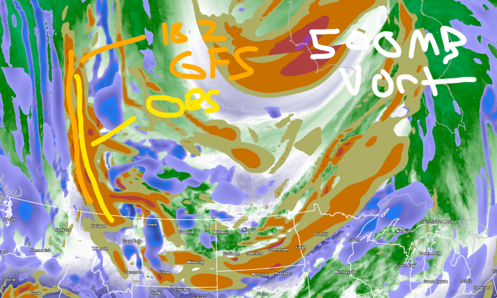
The 18z gfs is slower and more west with the energy that eventually gets buried out west. To my untrained eye (mets here, correct me if I am wrong) it looks like the energy is digging faster and is farther east. In my opinion this tells me gfs and nam are wrong with burying the energy. edit- not my map
-
We don’t need blocking for monster blizzards. Jan 2015 blizzard didn’t have blocking.
-
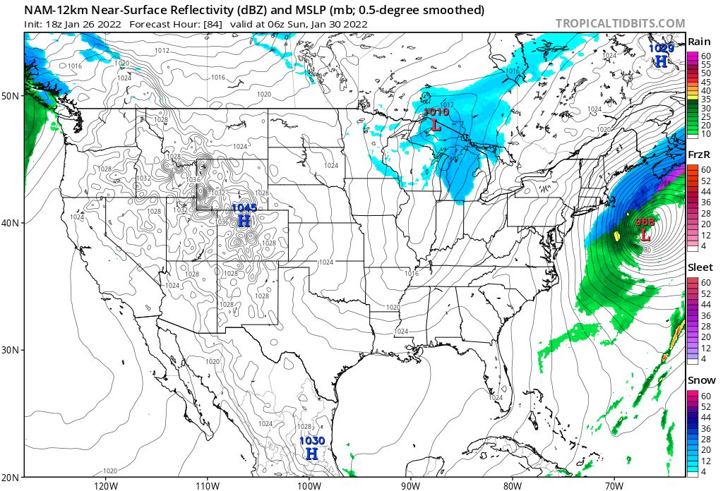
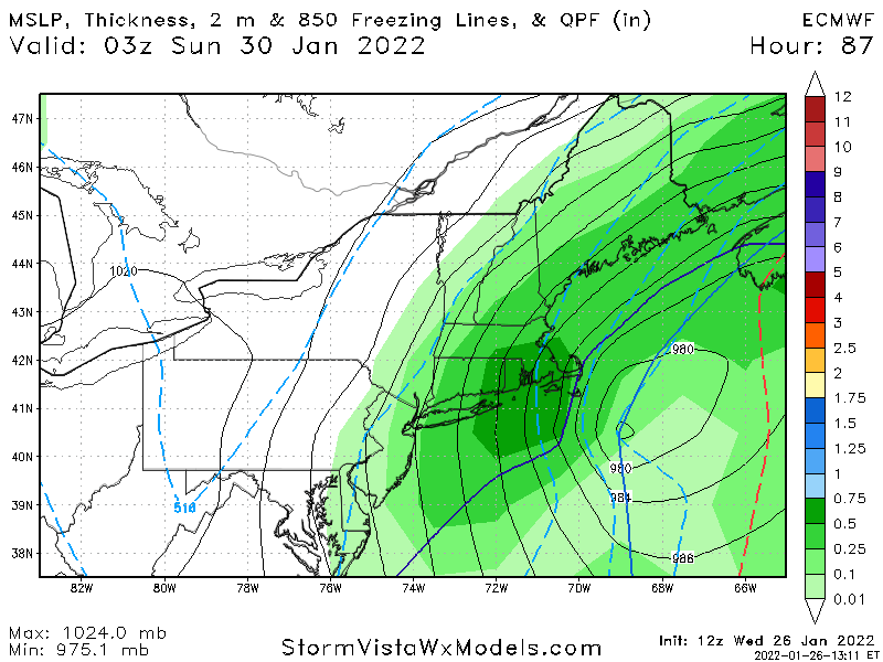
Even on the more east models like the Nam the strength of the low is still deepening into the 970s and 960s. The surface outputs are complete bullshit, the precip shield would be much more expansive. The 500mb is closing off and there are 2 closed contours. That would still be a big storm even if the Nam was right. A 968 mb low with a precip shield that compact with a negatively tilted trough and closed off low? No way in hell!

-
The models are struggling with the pattern. Mistakenly burying the energy out west.
-
Might be a little too conservative, I’m going to make some adjustments after the 0z runs.
-
Yeah gonna enjoy this snow while it lasts lol
-
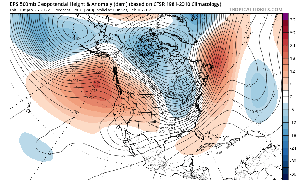
Feb looks like it could be decent. Warm up is probably real, but it looks like it will be short lived and we will have more chances after it. There are signs that although the polar vortex is quite strong, it will be stretched towards our side of the globe. No signs of a split, but we don’t need that. There are signs that the pacific will improve again towards the end of the EPS.

-
The cape gets buried on this run, James would have loved this.
-
If the models keep burying the energy, there will be a lot of innocent people in jail over in NYC.
-
i completely agree, I don’t get the negativity here. It trended west yesterday and back east a little today. It will likely come back west some, Bernie Rayno talked about it on his stream, called it the windshield wiper effect and said not to get too caught up in the QPF and surface shifts from run to run. The only model that truly looked bad at 500 mb was the Canadian, I’d like to see that come back west at 0z. And even that still looked good for a foot of snow, just not the crazy amounts like the other guidance.
-
Navy appears to have shifted west, at h5 it has a closed off low and 2 closed contours instead of only one. Rule of thumb is a foot of a snow for each closed contour (Bernie Rayno talked about it on his livestream, the Euro actually had 3 closed contours). Interestingly the gfs has 3 as well as it goes over the cape and 5 downeast Maine (so it’s surface output is likely bullshit verbatim). The Canadian has only one, which is why it makes sense that the snow totals are lower on that. Nam has 5 closed contours as it crosses over nantucket. Euro last night had 3.
-
Yeah that looks really bad. Buried the energy out west even more, hopefully it comes back west at 0z.
-
That’s the thing, it’s farther east than the other models, yet even if it were to somehow be right (which is unlikely), it would be underestimating the size of the precip shield. The precip shield would likely be way more expansive with a 959mb low.
-
The Canadian buried more energy so it moved east as a result. Not great, but I’m not giving up on this storm. It still has time to come back west.
-
Imo Euro is Mahomes, Canadian is Allen, Gfs is Hoyer.
-
Canadian is a bit east of the Euro but it is a lot farther west than the Gfs.
-
this is true but it is supported by the Euro, and even if reality is like 50 miles east of this it would still be a huge storm with a 2 ft+ jackpot.
-
Yeah the nam looks like it’s ejecting more energy out west.
-
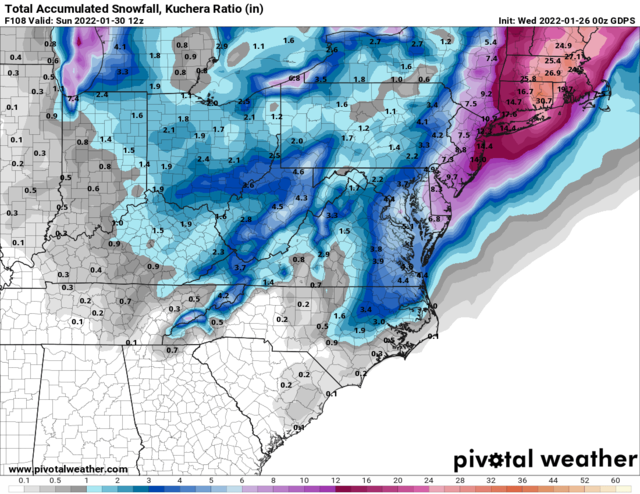
So there’s a chance that the low just…. Disappears? No way! The euro last night had 2-3 feet in eastern mass (with ratios). Based on what I’ve seen on the models I’m convinced my area is going to get hammered with a monster blizzard. 18+ inches with very strong winds.
-
I don’t look at it often but from what I have seen the ukmet tends to have a se bias, and underestimates the strength of lows for storms.