

Mount Joy Snowman
-
Posts
4,984 -
Joined
-
Last visited
Content Type
Profiles
Blogs
Forums
American Weather
Media Demo
Store
Gallery
Everything posted by Mount Joy Snowman
-

Central PA Summer 2026 Discussion/Obs Thread
Mount Joy Snowman replied to Voyager's topic in Upstate New York/Pennsylvania
Current temp of 71 is the low, to go along with .03" of rainfall. Hopefully we can squeeze a little more out of the day, although there doesn't seem to be much support for it. -
Central PA Summer 2026 Discussion/Obs Thread
Mount Joy Snowman replied to Voyager's topic in Upstate New York/Pennsylvania
Looks like 58 will be the low. Humidity creeping up today but nothing too bad. Looks like fairly minimal action tomorrow. Carry on. -
Central PA Summer 2026 Discussion/Obs Thread
Mount Joy Snowman replied to Voyager's topic in Upstate New York/Pennsylvania
Tried to get an early morning photo of MDT for you guys, through the dirty Amtrak window and all. Anyway, can confirm no jets affecting the weather station ha.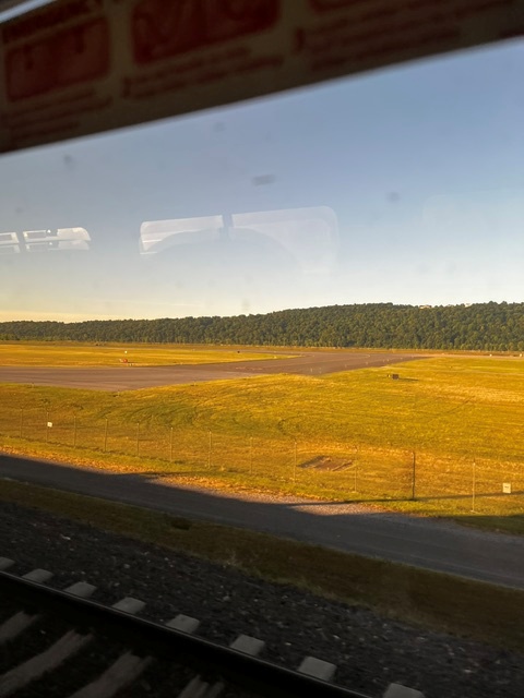
-
Central PA Summer 2026 Discussion/Obs Thread
Mount Joy Snowman replied to Voyager's topic in Upstate New York/Pennsylvania
A crisp 51 when I left the house. A+ day on tap. Onward. -
Central PA Summer 2026 Discussion/Obs Thread
Mount Joy Snowman replied to Voyager's topic in Upstate New York/Pennsylvania
Thanks JNS. Thought you may be the one to know haha. Well, that stinks. That site had been one of my main daily go-to visits for many years. A great one-stop shop. Ugh. -
Central PA Summer 2026 Discussion/Obs Thread
Mount Joy Snowman replied to Voyager's topic in Upstate New York/Pennsylvania
Does anybody know why the CTP page that provides a summary of max/min temps and precip twice a day for the ASOS sites hasn't updated since May 5th? If it is accessible somewhere else could someone please provide that? Below is a link to the page. Thanks. National Weather Service -
Central PA Summer 2026 Discussion/Obs Thread
Mount Joy Snowman replied to Voyager's topic in Upstate New York/Pennsylvania
Low of 61 with .35" of rain. Beautiful days ahead before things turn interesting for Thursday. -
Central PA Summer 2026 Discussion/Obs Thread
Mount Joy Snowman replied to Voyager's topic in Upstate New York/Pennsylvania
Low of 65. Looks like any real action down this way may not occur until after sundown. Then comes the relief, setting up a beautiful couple of days. -
Central PA Summer 2026 Discussion/Obs Thread
Mount Joy Snowman replied to Voyager's topic in Upstate New York/Pennsylvania
Low of 64 and man do things feel better out today. Last baseball game for the boy today and then a mow. All eyes on tomorrow. Also, what a performance by the USA men’s team last night. -
Central PA Summer 2026 Discussion/Obs Thread
Mount Joy Snowman replied to Voyager's topic in Upstate New York/Pennsylvania
Just got back from a week at Bethany Beach and man it’s nasty out there. At least there looks to be some relief not far off. Sunday sounds like it has some real severe potential. Total rainfall in the gauge for the last week was an even .5”. -
Central PA Summer 2026 Discussion/Obs Thread
Mount Joy Snowman replied to Voyager's topic in Upstate New York/Pennsylvania
Low of 65, as the humidity creeps up. Already up to 78. Some nice mid summer-like weather ahead. Onward. -
Central PA Summer 2026 Discussion/Obs Thread
Mount Joy Snowman replied to Voyager's topic in Upstate New York/Pennsylvania
Low of 58, as our heat starts to build. We will be at Bethany Beach all next week and it looks like we'll have a couple of cool beach days to contend with early in the week, with highs right around 70, but otherwise should have a nice week on our hands. We leave tomorrow after a morning baseball game. Kids are getting pumped. -
Central PA Summer 2026 Discussion/Obs Thread
Mount Joy Snowman replied to Voyager's topic in Upstate New York/Pennsylvania
Low of 53 as we start to warm up a bit today but still gorgeous weather. -
Central PA Summer 2026 Discussion/Obs Thread
Mount Joy Snowman replied to Voyager's topic in Upstate New York/Pennsylvania
My P&C has me failing to reach 90s tomorrow and Sunday and has me in the 70s both Monday and Tuesday, so we shall see. But yes longe range looks warm. -
Central PA Summer 2026 Discussion/Obs Thread
Mount Joy Snowman replied to Voyager's topic in Upstate New York/Pennsylvania
Heck yeah, I feel like I've had the windows open for a week straight. -
Central PA Summer 2026 Discussion/Obs Thread
Mount Joy Snowman replied to Voyager's topic in Upstate New York/Pennsylvania
52 when I left the house. Oh what’s that, you’d like another perfect weather day? Your wish is my command. -
Central PA Summer 2026 Discussion/Obs Thread
Mount Joy Snowman replied to Voyager's topic in Upstate New York/Pennsylvania
Hello summer thread. A beautiful crisp morning with a temp of 47 when I left the house, as our stretch of heavenly weather marches on. -
Central PA Spring 2026 Discussion/Obs Thread
Mount Joy Snowman replied to Voyager's topic in Upstate New York/Pennsylvania
Lows for Friday night through Sunday night were 54, 45, and 52, respectively. I power washed for ten hours straight yesterday and feel like I went ten rounds with Hollyfield. Our stretch of weather bliss continues through this week. Onward. -
Central PA Spring 2026 Discussion/Obs Thread
Mount Joy Snowman replied to Voyager's topic in Upstate New York/Pennsylvania
Low of 49. I'm golfing this afternoon and not sure I could draw it up much better. Perfection. -
Central PA Spring 2026 Discussion/Obs Thread
Mount Joy Snowman replied to Voyager's topic in Upstate New York/Pennsylvania
Crystal ball says MDT finishes the month with a mean temp of 62.0 -- good for 1.4 BN and middle of the pack all-time. Book it. -
Central PA Spring 2026 Discussion/Obs Thread
Mount Joy Snowman replied to Voyager's topic in Upstate New York/Pennsylvania
Low of 60 with .13" of rain, marking nine straight days I've recorded measurable precip, totaling 2.46". That streak ends today as an unimpeachably beautiful stretch of weather settles upon us. Onward. -
Central PA Spring 2026 Discussion/Obs Thread
Mount Joy Snowman replied to Voyager's topic in Upstate New York/Pennsylvania
Yes, as @Superstorm mentioned it’s going to be glorious for the next week. The type of weather that could make a grown man cry. Could very easily end up being our best weather stretch of the year, since I don’t see how it could get much better ha. -
Central PA Spring 2026 Discussion/Obs Thread
Mount Joy Snowman replied to Voyager's topic in Upstate New York/Pennsylvania
Love it. Man, this rain is much more robust than anything modeled or forecast for up this way. We actually had a downpour a little while ago here in Harrisburg and still raining very steadily. -
Central PA Spring 2026 Discussion/Obs Thread
Mount Joy Snowman replied to Voyager's topic in Upstate New York/Pennsylvania
Remarkable consistency in my observations lately, with three consecutive days of nearly exactly a third of an inch, then an even one-incher, followed by three consecutive tenth-of-an-inch type days. I understand this probably only interests me ha. carry on. 20-May Heavy Rain 0.34 21-May Rain 0.33 22-May Rain 0.33 23-May Rain 1.00 24-May Rain 0.11 25-May Rain 0.10 26-May Rain 0.10 -
Central PA Spring 2026 Discussion/Obs Thread
Mount Joy Snowman replied to Voyager's topic in Upstate New York/Pennsylvania
65 when I left the house with .1” having fallen and steady rain still occurring.


