

Mount Joy Snowman
-
Posts
3,802 -
Joined
-
Last visited
Content Type
Profiles
Blogs
Forums
American Weather
Media Demo
Store
Gallery
Everything posted by Mount Joy Snowman
-

Central PA - Spring 2021
Mount Joy Snowman replied to Voyager's topic in Upstate New York/Pennsylvania
Absolutely not, if anything just more time to focus on drinking all the beer. Git 'er dun. -
Central PA - Spring 2021
Mount Joy Snowman replied to Voyager's topic in Upstate New York/Pennsylvania
Agree with you both about a cold Memorial Day weekend being no fun for anyone. I will say Monday looks pretty dang pleasant and Sunday is still a bit up in the air, kind of the transition day. Not great either way though. No pool parties this year ugh. -
Central PA - Spring 2021
Mount Joy Snowman replied to Voyager's topic in Upstate New York/Pennsylvania
The WU station nearest to Longs Park immediately to its east (believe it may be Jones Honda) recorded a 33mph gust right as that storm hit and then its weather station was knocked out for a while so who knows how powerful that gust was. I would like that as well. Wasn't aware of any rotation but the clouds were doing some crazy things as that passed by just to my southeast. I saw a number of storm damage reports from up above Halifax and Berrysburg and whatnot so yes that area got hit pretty hard as well. One report of a barn blown over. -
Central PA - Spring 2021
Mount Joy Snowman replied to Voyager's topic in Upstate New York/Pennsylvania
Yep I was in the same boat, could tell it packed a punch though. I was camped out on the front porch watching some pretty wicked cloud formation just to my south. So, my buddy who works for Lancaster City is on site at Longs Park and says they have never seen anything like it, over 75 large trees down. They are sending photos and drone footage to NWS for investigation. -
Central PA - Spring 2021
Mount Joy Snowman replied to Voyager's topic in Upstate New York/Pennsylvania
Quite a few reports of 1/4-1/2" in the berks/schuylkhill area. Largest reports came from Benton and Columbia (Lancaster Co.) though...... 0245 PM HAIL BENTON 41.20N 76.38W 05/26/2021 E1.00 INCH COLUMBIA PA PUBLIC 0734 PM HAIL 1 N COLUMBIA 40.05N 76.50W 05/26/2021 E0.88 INCH LANCASTER PA PUBLIC -
Central PA - Spring 2021
Mount Joy Snowman replied to Voyager's topic in Upstate New York/Pennsylvania
Hmmmmm .11 that could be right I suppose. That area seemed to be a bit of a nadir in terms of totals, judging by the radar estimates. Also a couple Weather Underground stations just to the west on top of the ridge reported a bit under .2 so it's possible it downsloped to .11 by the time it hit MDT. Who knows, just a thought, but anything is possible with good 'ol MDT ha. -
Central PA - Spring 2021
Mount Joy Snowman replied to Voyager's topic in Upstate New York/Pennsylvania
Well I ended up with .54" for the day yesterday, so @Itstrainingtime wins yet again. Man did Longs Park ever take it on the chin last night. LNP has a write-up about the damage with some good pics. Lots of big trees down and here is a trailer that blew across Harrisburg Pike, thinking quite the little microburst hit that area. -
Central PA - Spring 2021
Mount Joy Snowman replied to Voyager's topic in Upstate New York/Pennsylvania
Well it looks like this last round will put you over the top yet again. Looks like I added a little under a half inch from this batch, official reading in the morning. -
Central PA - Spring 2021
Mount Joy Snowman replied to Voyager's topic in Upstate New York/Pennsylvania
Just starting here, nice winds and lightning with this line too, best stuff all day. -
Central PA - Spring 2021
Mount Joy Snowman replied to Voyager's topic in Upstate New York/Pennsylvania
Damn just saw that on the local storm report from CTP. Also says a trailer was blown across harrisburg pike yikes. You in the Neffsville area? I’m always out in Manheim Township, have a number of friends there. -
Central PA - Spring 2021
Mount Joy Snowman replied to Voyager's topic in Upstate New York/Pennsylvania
That second batch brought me up to .09”. Nearly had a third round from an impressive looking cell that formed just to my southwest but it slid by me oh so close...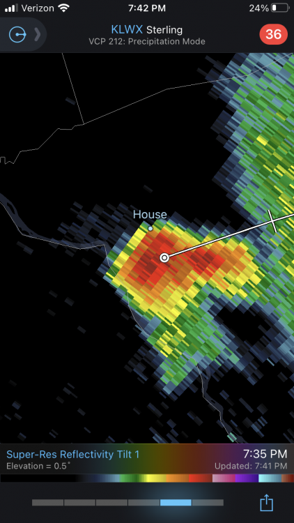
-
Central PA - Spring 2021
Mount Joy Snowman replied to Voyager's topic in Upstate New York/Pennsylvania
I will Bob Baffert my way to victory. -
Central PA - Spring 2021
Mount Joy Snowman replied to Voyager's topic in Upstate New York/Pennsylvania
Well, I got fringed by multiple cells, just two short bursts each lasting less than two minutes (my wife knows something about that, i kid i kid, sort of, moving on) and totaling .05". Really hoping for something to materialize later as some of the short-term models seem to want to indicate but not holding my breath. Hey, at least the temp dropped from 94 to 78 soooooooo that's exciting right!? Ugh. -
Central PA - Spring 2021
Mount Joy Snowman replied to Voyager's topic in Upstate New York/Pennsylvania
Yep but we may be in luck, she's trying her best to reform.... -
Central PA - Spring 2021
Mount Joy Snowman replied to Voyager's topic in Upstate New York/Pennsylvania
Up to 94 here! -
Central PA - Spring 2021
Mount Joy Snowman replied to Voyager's topic in Upstate New York/Pennsylvania
Man, lots of clearing here in the warm sector today, pap is sittin at 91! I'm tellin ya boys, with my low lying location off the ridge whenever we get any type of southerly flow I get hot hot. Some of the guidance has suggested our best shot down this way might not be until later this evening, hard to say but hoping for something exciting to happen, environment sure seems ripe. Looking forward to any reports from the western folks, as things seem to be lighting up out that way. -
Central PA - Spring 2021
Mount Joy Snowman replied to Voyager's topic in Upstate New York/Pennsylvania
I agree with those decrying the spottiness of todays storms, although someone should see at least some marginal severe activity out of it. CTP's thoughts.... As a tongue of higher, deep-layer moisture moves in from the Ohio Valley later this morning through this afternoon. Clusters of showers and thunderstorms will develop, and move east across the Alleghenies toward the noon hour. This convection will increase in intensity and coverage as it moves east across the Central Ridge and Valley region of the state this afternoon. Some of the thunderstorms could become severe with hail and brief, localized strong downburst wind gusts of 50 to 60 mph possible. Latest 26/00Z HREF supports increasing convection beneath the favorable right entrance region of a 90 kt upper level jet located over southern Ontario and Quebec. Convection- allowing guidance supports mostly discrete convection, as the strongest low level convergence remains over the Grt Lks with surface cold front and possibly over eastern Pa with pre-frontal trough. However, backing deep layer shear vectors may transition the event into line segments with some possible broken-s radar signatures associated with localized strong wind gusts where the shear can become nearly orthogonal with the line segments. SPC has expanded the SLGT risk to cover all of PA for this afternoon and early evening. Model soundings indicate mixing will result in falling surface dewpoints in the afternoon across much of the area, so anticipate CAPE only in the 500-1000 range for much of the region. The exception could be over the eastern counties, where there is enhanced southerly flow/moisture advection ahead of pre-frontal trough. -
Central PA - Spring 2021
Mount Joy Snowman replied to Voyager's topic in Upstate New York/Pennsylvania
I had a post yesterday morning discussing records for the weekend but only focused on min maxes, as that's where I thought the best shot was, albeit still a reach. Looks like the record lows for Harrisburg for Fri Sat Sun are 41 40 41. I actually topped out at 80 yesterday, might have been the hot spot east of the mountains ha. -
Central PA - Spring 2021
Mount Joy Snowman replied to Voyager's topic in Upstate New York/Pennsylvania
Yinz aint kiddin about Philly, once went to a regular season phillies game with some buddies while in college and next thing you know as we're just sitting there a beer goes flying by my buddy's head, all because he was wearing a Yankees hat. Then the guy tried to climb over a railing and come fight him, luckily security removed him quickly. Mind you they were playing the Marlins and my buddy is from New York and a life long Yanks fan, it's just the hat he would always throw on to go anywhere. Anyway, one of many tales I could tell about Philly fans but yes it's true that all cities have their nuts, Philly just a few more I would wager ha. -
Central PA - Spring 2021
Mount Joy Snowman replied to Voyager's topic in Upstate New York/Pennsylvania
I do not, but checking my spreadsheet for that day yields the following note: "Late afternoon T'storm with gusty winds and some localized hail". So yeah, there was definitely some severe weather in the area that day. I would typically make a note of any confirmed tornadoes in my area but I must have considered you too far to be local, who knows what I was thinking ha. -
Central PA - Spring 2021
Mount Joy Snowman replied to Voyager's topic in Upstate New York/Pennsylvania
Ha! Don't even go there, or I might have to have another lengthy twitter exchange with CTP -
Central PA - Spring 2021
Mount Joy Snowman replied to Voyager's topic in Upstate New York/Pennsylvania
Well, they're currently .6 above average for the month. So, even with a scorcher on tap for tomorrow I think they've got a shot to come in at or slightly below average if the Friday through Sunday period can average ~10 degrees below normal, which certainly seems possible if not probable. -
Central PA - Spring 2021
Mount Joy Snowman replied to Voyager's topic in Upstate New York/Pennsylvania
Pleasantly surprised to see .22" in the gauge this morning. Hey, what can I say, it's been rough around here lately ha. Now, if we can sore some storms Wednesday evening and then a more soaking rain on Friday we'll be in business. Either way, looking like a cool Memorial Day weekend. Looks like the record min maxes for Harrisburg for May 28, 29 & 30 are 57, 57 & 58, respectively. Saturday may have a shot but probably a bridge too far. I don't think any record lows will be challenged. -
Central PA - Spring 2021
Mount Joy Snowman replied to Voyager's topic in Upstate New York/Pennsylvania
I've only had two thunderstorms thus far this year. Just glanced at the gauge and it looks like maybe 6 hundredths of an inch, the race to a tenth of an inch is on! -
Central PA - Spring 2021
Mount Joy Snowman replied to Voyager's topic in Upstate New York/Pennsylvania
Yep, I'm at only .77" for the month out here ~10 miles west of the airport. Haven't had more than a tenth of an inch since May 7th. We'll see what today brings but I'm not optimistic.


