

TimB
-
Posts
16,577 -
Joined
Content Type
Profiles
Blogs
Forums
American Weather
Media Demo
Store
Gallery
Everything posted by TimB
-
90 has been reached at PIT.
-
Did they ever let you back on Reddit?
-
Whether we hit 90 today or not, it’s very likely that would be our only 90 for the month. We had none in July 2021 and only one in July 2022. The last (and only) time we had 1 or fewer 90 degree days for at least three Julys in a row was from 1958-1962.
-
You don’t think we can warm to 90 in the clearing after these rogue clouds and showers move out but before that larger batch arrives from Ohio? Only need 7 or 8 more degrees.
-
Imagine that
-
NWS still says we’re on track to get into the 90s once the fog burns off. Helps already being at 77.
-
Yeah here we are, 88 at PIT and 84 at AGC. Hope we get a no doubter 90 tomorrow so the record isn’t tarnished either way whether PIT gets to 90 today or not.
-
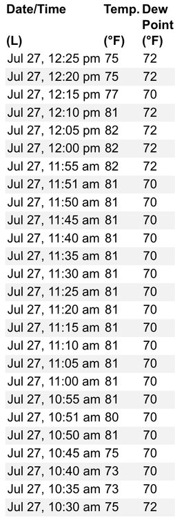
The 75 is definitely wrong. There is no PWS anywhere in the county that’s even below 80 at the moment. Most near the airport are in the low 80s. AGC is 83. Regardless, 90 wasn’t happening either way.
-
There’s something weird with the observations. Jumped from 75 to 81 in 5 minutes earlier, then dropped in the same amount of time a little over an hour later. I trust the low 80s as accurate and the 75s seem to be an error.
-
Yes, was 97 the afternoon of the day it was 85 at 3am. It was 95 the afternoon before.
-
The record for that hour is 85 on 6/29/12. Of course, that was following a day that got to 95. Yesterday only got to 88. The official low in the climate record for that date is 66, but that occurred at 11:59pm. That morning bottomed out at 80.
-
It was still 82 with a heat index of 85 at PIT at 3:15 this morning, but alas, a thunderstorm dashed our chances at a record warm min.
-
Yeah, pretty dependent on what happens with the dying MCS coming out of the Midwest tonight.
-
Tomorrow’s record warm min is within reach. Record is 74.
-
That said, it’ll be interesting to see if PIT can get to 95. The only 95 in the past 11 years is suspect, as it was recorded in that period in September 2018 when the sensor was running high (AGC topped out at 92 on the same date). Throw that out and it’s the longest streak without hitting 95 in the entire period of record.
-
On the plus side, it looks like a slam dunk and the chances of being shut out are pretty much nonexistent.
-
We have a shot or two at getting below 60 this weekend, but there are currently only 4 years in the entire period of record where there have been no 50s in July: 1921 never got below 62, and 1949, 1934 and 1887 bottomed out at 60. So far our lowest in July 2023 is 61.
-
I’m highly skeptical of the Brookville data. The 99/44 and even the 86/37 seem too good to be true. Look at Pittsburgh’s data for the same dates. There’s no way it was 11 degrees warmer in Brookville than Pittsburgh on 7/16, or 13 degrees warmer on 7/30.
-
Lol. 83 at 12:30. Ain’t happening.
-
I’m sure you know this already, but there’s a consecutive days record in play that looks to be pretty much a lock as long as tomorrow hits 110.
-
Tomorrow our normals reach their peak of 83/64. They remain there for 18 days before beginning their slow descent.
-
Not looking good. Clouds stalled all heating.
-
A degree above yesterday’s temp at this time. Should be close. AGC has already reached 92.
-
With July 2023 being slightly above average so far and some warmer days and not so cool nights incoming, that might be a tough task. But June started off well above normal and ended up decisively below, so maybe.
-
I did notice that. I would assume it has something to do with different personnel doing the different outlooks and/or data from different dates being used.


