
wx_observer
-
Posts
192 -
Joined
-
Last visited
Content Type
Profiles
Blogs
Forums
American Weather
Media Demo
Store
Gallery
Everything posted by wx_observer
-
That would be it...I have the same app--wonder why I'm not seeing that green
-
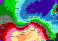
Not seeing a clear sig on the velocity like was there last week though
-
Was just about to post that...my son is in camp in that area too. Not a great week to live in Clinton, huh?
-
Special Weather Statement National Weather Service Boston/Norton MA 1130 AM EDT Mon Aug 23 2021 MAZ004-005-012-231615- Southern Worcester MA-Central Middlesex County MA- Northern Worcester MA- 1130 AM EDT Mon Aug 23 2021 ...Developing thunderstorm over portions of east central Worcester and south central Middlesex Counties... At 1130 AM EDT, Doppler radar was tracking a strong thunderstorm over Westborough, or near Marlborough, moving north at 15 mph. This storm may produce funnel clouds. HAZARD...Winds to 40 mph. SOURCE...Radar indicated. IMPACT...Gusty winds could knock down tree limbs and blow around unsecured objects. Locations impacted include... Marlborough, Hudson, Westborough, Hopkinton, Northborough, Clinton, Southborough, Stow, Bolton, Boylston and Berlin. PRECAUTIONARY/PREPAREDNESS ACTIONS... This storm may intensify, so be certain to monitor for additional information and possible warnings from the National Weather Service. && LAT...LON 4226 7154 4224 7159 4242 7172 4246 7152 TIME...MOT...LOC 1528Z 171DEG 13KT 4228 7157 MAX HAIL SIZE...0.00 IN MAX WIND GUST...40 MPH
-
https://www.gardeningknowhow.com/ornamental/flowers/sunflower/is-my-sunflower-an-annual-or-a-perennial-sunflower.htm If they're annual you may have to put the seed heads back in that same area after the cut flowers die for them to grow back. Perennial ones die off with the frost every year anyway, so they should just grow back next spring.
-
The sad truth is…aren’t most people like this?
-
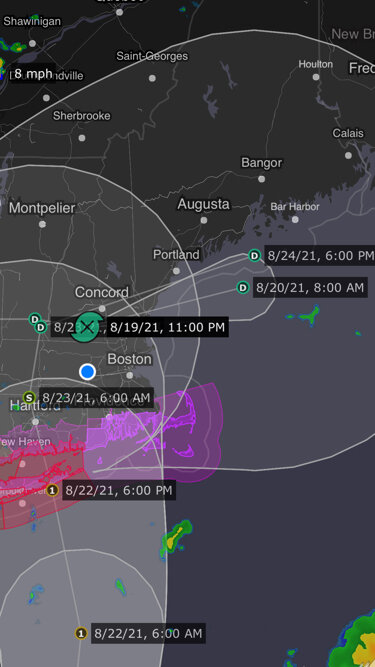
Henri is in no hurry to go anywhere…9 mph forward speed.
-
That’s what we’re getting too. Waves of pretty blustery wind—maybe 30-40 mph ish…then calm.
-
For all those out there meh-ing and poking fun at this storm…there are actually folks that do have some significant damage to deal with. My folks just south of Worcester just had a very large tree fall on their house, well away from the center.
-
Wow, that’s a pretty dramatic zero hour track shift
-
And whomever decided that a tropical system with sustained winds of 39+ was worthy of a warning to begin with…
-
I’m thinking that too. Already a bit of a steady breeze here and the bedroom doors have slammed shut a few times in central ma. Anyone looking to be impressed by a Gloria or bob type storm will be disappointed. But with a highly populated area and widespread lower level impacts I’d be hesitant to call this a meh storm. We just saw what Fred did around here and it had been over land for a few days already.
-
This was from last night before the nudge east. Maybe they’re overcooking it with the intent to “over deliver” on restoration. https://connecticut.news12.com/eversource-nearly-70-of-connecticut-customers-could-lose-power-during-hurricane-henri
-
Did I just hear this right on wcvb? Eversource saying that 50-70% of its customers will be without power for 1-3 weeks?! Maybe I need another cup of coffee…
-
In winter it’s not having heat. In summer…for me…it’s the sump pump not working and the basement flooding. The rest is a nuisance but manageable.
-
Presuming you’ll be taking a ferry, maybe this will help https://www.steamshipauthority.com/Henri
-
huh…funny how close those points and paths are for Fred and Henri as TD’s…just a few days apart
-
Any reason to expect more than EF1 with this?
-
Dang, Gloria...had a suspended ceiling fall in on us during that one. Think we got part of the eye too.
-
By the time you have a guarantee it will be too late. IMO, the real questions to ask yourself are: what is your crop worth, how much of your crop could potentially be saved by doing this, and how much up the shitter you are if you lose it all.
-
I second this---what a great view from there if it's open!
-
That's a juiced up looking band at the Worcester / Middlesex County line. Dang!
-
Central MA, North Worcester: Had just over 3" here at 7:15 am. I shook off some bushes at that time and they are already bending again with new snowfall. My footprints from then are half filled in, so thinking close to 5" total now. Really heavy stuff though--it's compacting a lot. Main roads are melting, but side streets were snow covered this am.
-
Friend driving from Trumbull area to Hartford said the roads were getting bad about an hour ago. Multiple spinouts.
-
With that snow / ice ratio, I better hunt down some cramp-ons...


