wx_observer
-
Posts
192 -
Joined
-
Last visited
Content Type
Profiles
Blogs
Forums
American Weather
Media Demo
Store
Gallery
Everything posted by wx_observer
-
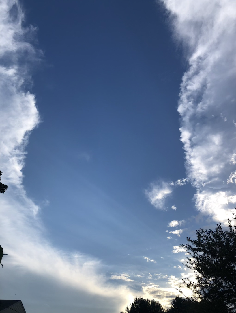
Yeah, the cloud tops aren't as high now and not as much lightning as they reached ORH. But really thankful for the rain either way.
-
That cell in Paxton / Spencer MA is looking pretty spicy. Heading right for me, but I've been whiffed N / S too many times this summer to put any money on it reaching me.
-
I've seen one or two so far. But seeing as I'm planning to get a dumpster to clear out some junk that's been in the yard this week, I think I'm about to discover where they've been hiding out. BzzzZZZzzzzZZZZZ!!!!
-
Seems like I keep finding myself too far north or too far south to get much rain from these storms lately. MA/CT border probably won't cut it for me...and we could really use some rain here.
-
There have been some sightings of flamingos at the beach in Yarmouth, for whatever that is worth... https://www.wcvb.com/article/flamingo-sighting-reported-at-cape-cod-beach/61620985
-
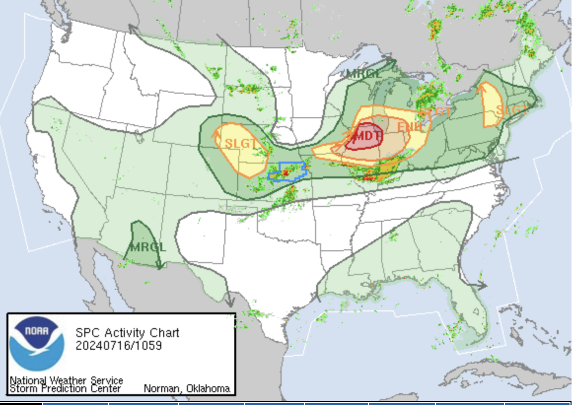
MDT on the map:

-
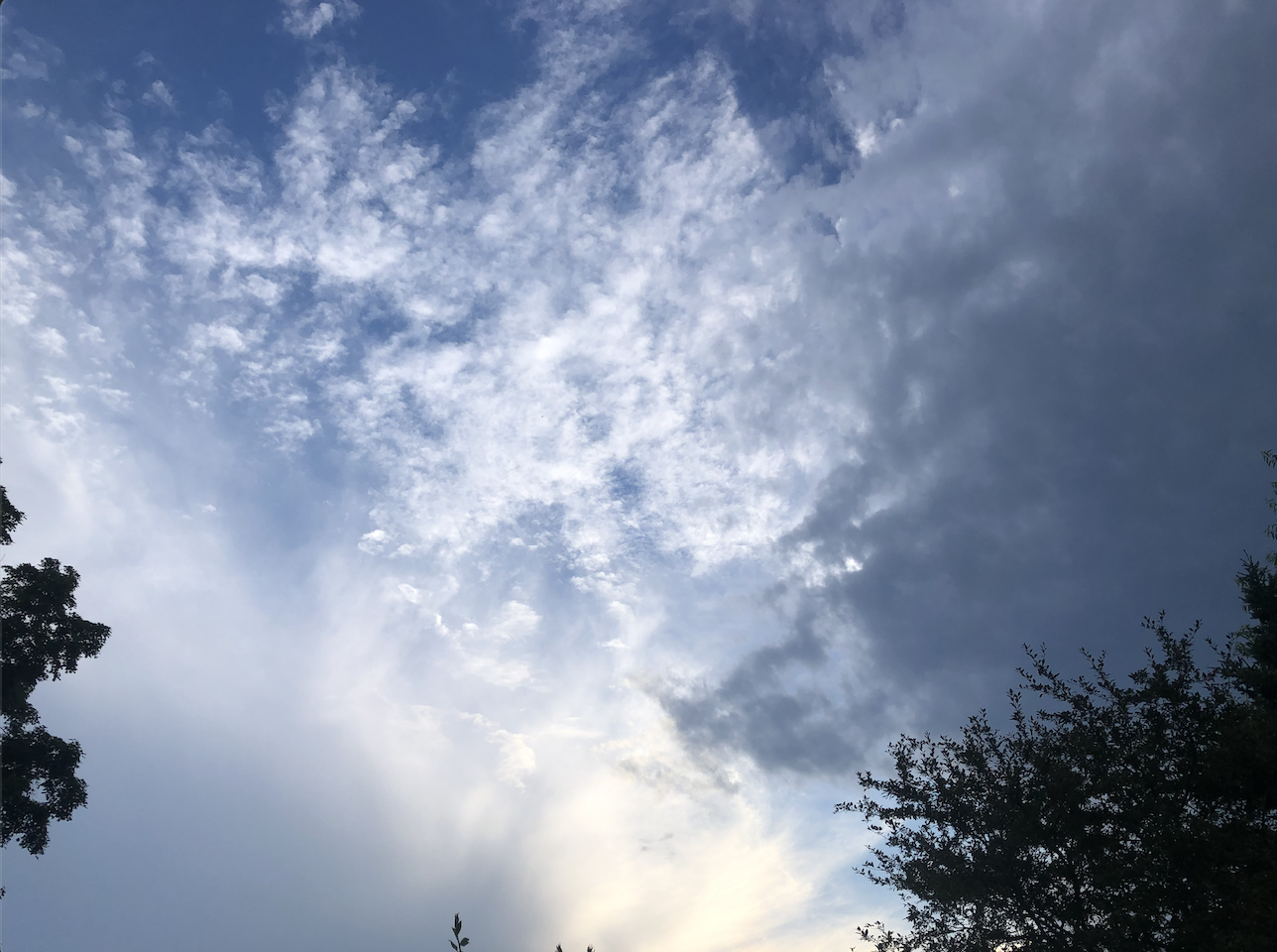
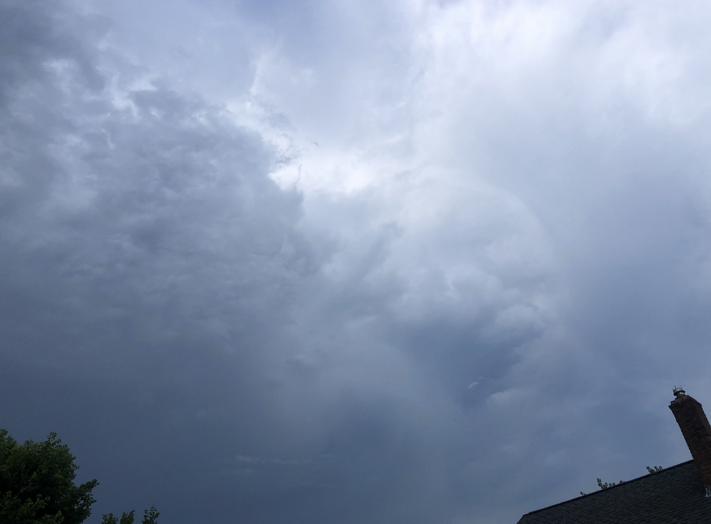
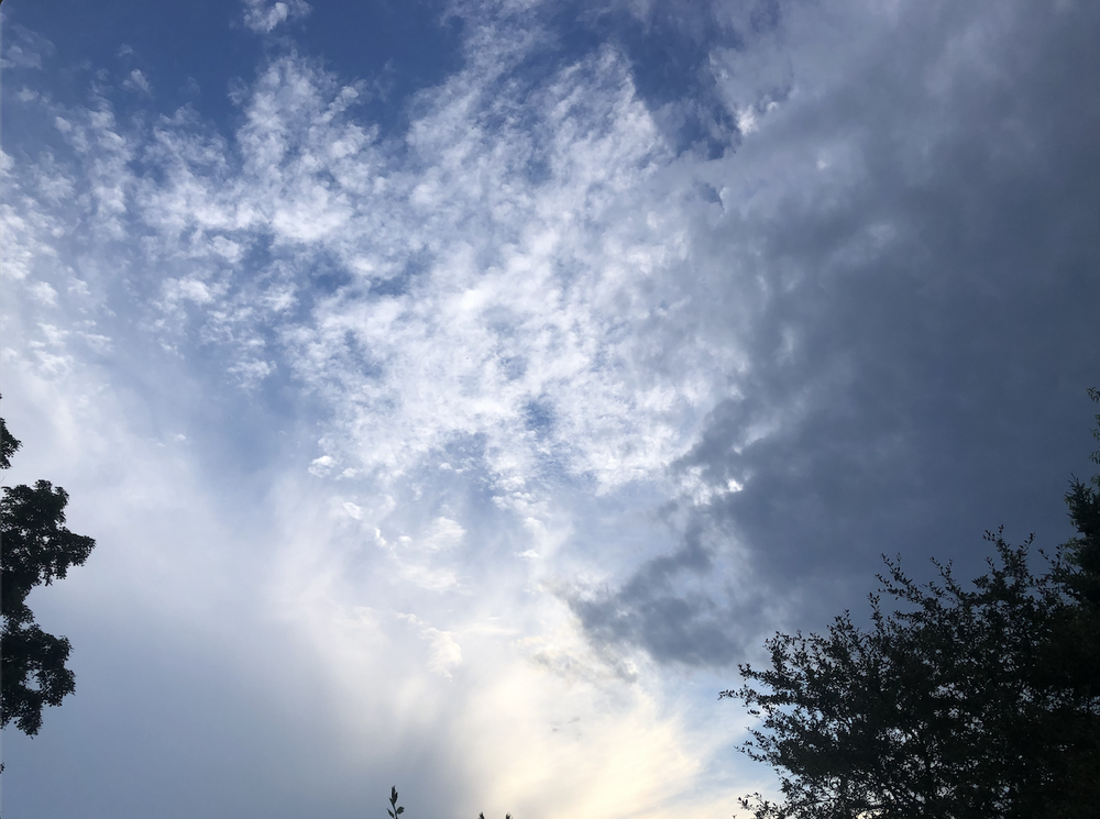
And for the dark side to the North--just missed a huge lightning bolt in this shot. Definitely sliding south towards me more.
-
-

-
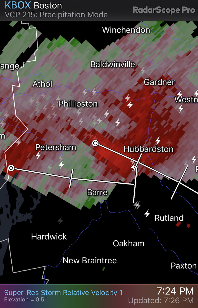
Central MA...looks like I'm in the slot between the storm in Petersham to the North (right) and the cloud deck out ahead of the area of storms near Springfield (left). That Petersham storm has some oomph. Thunder is rumbling the ground here.

-
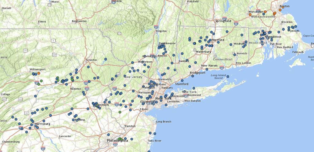
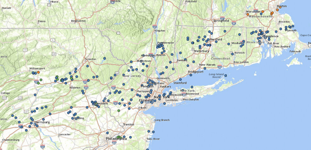
400 Miles takes you to about the mid-point of PA. A lot of wind damage reports over that distance, but most of them are without a specific wind reading.
-
RadarScope has a tornado signature on the cell heading towards Mansfield, ct.
-
The severe thunderstorm warning for the cell that went through Springfield ma says that 80 mph winds were observed. Damage threat: destructive according to NWS
-
We're hilly and wooded up here too, so it's a lot harder to see something coming from further away than somewhere that is largely flat. On top of it, we don't get tornados up here often and have a population less prepared for them. Kind of like getting a winter storm warning in a southern state for only a couple inches of snow. At least basements are pretty common in most of New England.
-
Geez, I can't remember the last time SPC gave us a 10% probability of a tornado. Sounds like it's going to be spicy today.
-
If this info is correct, 2023 was the 4th wettest on record in Worcester. If we keep up the same rate we've had so far in 2024, we would probably surpass that. https://www.extremeweatherwatch.com/cities/worcester/year-2023
-
Nope. No. NO more rain. Not when the water table is already so high that I'll need a dinghy and water wings to do the laundry if we get any more.
-

Significant Miller B Nor'easter Apr 3rd-4th OBS
wx_observer replied to wxeyeNH's topic in New England
According to MyRadar, southern Maine over to Laconia NH has between 40-50% without power. What a mess. -
Significant Miller B Nor'easter Apr 3rd-4th OBS
wx_observer replied to wxeyeNH's topic in New England
Mostly flipped to snow now in central MA. It's like concrete out there between the layer of sleet and wet heavy snow. -
Significant Miller B Nor'easter Apr 3rd-4th OBS
wx_observer replied to wxeyeNH's topic in New England
More lightning in central MA. Mostly sleet, with some snow mixed in. -
Significant Miller B Nor'easter watch, Apr 3rd-4th
wx_observer replied to Typhoon Tip's topic in New England
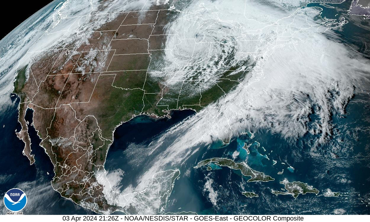
Not really wanting winter weather anymore, but you have to admit, this is impressive:
-
Significant Miller B Nor'easter watch, Apr 3rd-4th
wx_observer replied to Typhoon Tip's topic in New England
Sounds about right...so bring it home. We really don't need school cancelling / power outage level snow in April. -
Significant Miller B Nor'easter watch, Apr 3rd-4th
wx_observer replied to Typhoon Tip's topic in New England
Ice pellets here in central MA, around 800' elevation. -
Significant Miller B Nor'easter watch, Apr 3rd-4th
wx_observer replied to Typhoon Tip's topic in New England
Yikes, don't send it this way. The .25 inches of ice we got a week ago did enough damage here... -
Significant Miller B Nor'easter watch, Apr 3rd-4th
wx_observer replied to Typhoon Tip's topic in New England
Maybe in January or February? The garden is calling....I'm about ready for 60F with sun for a several day stretch now.